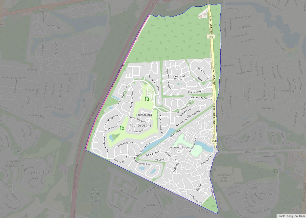
Map of Linden city, New Jersey

Map of Linden city, New Jersey

Linden is a city in southeastern Union County, in the U.S. state of New Jersey. It is part of the New York Metropolitan Area, located about 13 miles (21 km) southwest of Manhattan and bordering Staten Island, a borough of New York City, across the Arthur Kill. As of the 2020 United States census, the city’s … Read more

Map of Lincroft CDP

Map of Lincroft CDP

Lincroft is an unincorporated community and census-designated place (CDP) within Middletown Township, in Monmouth County, in the U.S. state of New Jersey. As of the 2020 United States Census, the CDP had a population of 7,060, teflecting a 15.1% increase from the 6,135 residents enumerated at the 2010 U.S. Census, in turn a decline of … Read more

Map of Lopatcong Overlook CDP

Map of Lopatcong Overlook CDP

Lopatcong Overlook is an unincorporated community and census-designated place (CDP) located within Lopatcong Township, in Warren County, New Jersey, United States, that was created as part of the 2010 United States Census. As of the 2010 Census, Lopatcong Overlook’s population was 734. Lopatcong Overlook CDP overview: Name: Lopatcong Overlook CDP LSAD Code: 57 LSAD Description: … Read more

Map of Longport borough

Map of Longport borough

Longport is a borough situated on the Jersey Shore on Absecon Island, within Atlantic County, in the U.S. state of New Jersey, on the Atlantic Ocean shoreline. As of the 2020 United States census, the borough’s population was 893, a decrease of two people (−0.2%) from the 2010 census count of 895, which in turn … Read more

Map of Long Valley CDP

Map of Long Valley CDP

Long Valley is an unincorporated community and census-designated place (CDP) located within Washington Township, in Morris County, New Jersey, United States. Once known as German Valley from its foundation during the colonial era, the community was renamed in response to anti-German sentiment during World War I. As of the 2010 United States Census, the CDP’s … Read more

Map of Long Branch city

Map of Long Branch city, New Jersey

Long Branch is a beachside city in Monmouth County, in the U.S. state of New Jersey. As of the 2020 United States census, the city’s population was 31,667, an increase of 948 (+3.1%) from the 2010 census count of 30,719, which in turn reflected a decline of 621 (−2.0%) from the 31,340 counted in the … Read more

Map of Lodi borough, New Jersey

Map of Lodi borough, New Jersey

Lodi (/ˈloʊdaɪ/; LOH-dye) is a borough in Bergen County, in the U.S. state of New Jersey. As of the 2020 United States census, the borough’s population was 26,206, an increase of 2,070 (+8.6%) from the 2010 census count of 24,136, which in turn reflected an increase of 165 (+0.7%) from the 23,971 counted in the … Read more

Map of Loch Arbour village

Map of Loch Arbour village

Loch Arbour is a village situated on the Jersey Shore in Monmouth County, in the U.S. state of New Jersey. As of the 2020 United States census, the village’s population was 224, an increase of 30 (+15.5%) from the 2010 census count of 194, which had in turn reflected a decline of 86 (−30.7%) from … Read more

Map of Little Silver borough

Map of Little Silver borough

Little Silver is a borough in Monmouth County, in the U.S. state of New Jersey. As of the 2020 United States census, the borough’s population was 6,131, an increase of 181 (+3.0%) from the 2010 census count of 5,950, which in turn reflected a drop of 220 (−3.6%) from the 6,170 counted in the 2000 … Read more

Map of Little Ferry borough

Map of Little Ferry borough

Little Ferry is a borough in Bergen County, in the U.S. state of New Jersey. As of the 2020 United States census, the borough’s population was 10,987, an increase of 361 (+3.4%) from the 2010 census count of 10,626, which in turn reflected a decline of 174 (−1.6%) from the 10,800 counted in the 2000 … Read more

Map of Linwood city, New Jersey

Map of Linwood city, New Jersey

Linwood is a city in Atlantic County, in the U.S. state of New Jersey. As of the 2020 United States census, the city’s population was 6,971, a decrease of 121 (−1.7%) from the 2010 census count of 7,092, which in turn reflected a decline of 80 (−1.1%) from the 7,172 counted in the 2000 census. … Read more

Map of Lindenwold borough

Map of Lindenwold borough

Lindenwold is a borough in Camden County, in the U.S. state of New Jersey. As of the 2020 United States census, the borough’s population was 21,641, an increase of 4,028 (+22.9%) from the 2010 census count of 17,613, which in turn reflected an increase of 199 (+1.1%) from the 17,414 counted in the 2000 census. … Read more