Little Ferry is a borough in Bergen County, in the U.S. state of New Jersey. As of the 2020 United States census, the borough’s population was 10,987, an increase of 361 (+3.4%) from the 2010 census count of 10,626, which in turn reflected a decline of 174 (−1.6%) from the 10,800 counted in the 2000 census.
| Name: | Little Ferry borough |
|---|---|
| LSAD Code: | 21 |
| LSAD Description: | borough (suffix) |
| State: | New Jersey |
| County: | Bergen County |
| Incorporated: | September 18, 1894 |
| Elevation: | 3 ft (0.9 m) |
| Total Area: | 1.67 sq mi (4.32 km²) |
| Land Area: | 1.48 sq mi (3.83 km²) |
| Water Area: | 0.19 sq mi (0.50 km²) 11.44% |
| Total Population: | 10,987 |
| Population Density: | 7,438.7/sq mi (2,872.1/km²) |
| ZIP code: | 07643 |
| Area code: | 201 |
| FIPS code: | 3440680 |
| GNISfeature ID: | 0885281 |
| Website: | www.littleferrynj.org |
Online Interactive Map
Click on ![]() to view map in "full screen" mode.
to view map in "full screen" mode.
Little Ferry location map. Where is Little Ferry borough?


History
Little Ferry was formed by an act of the New Jersey Legislature on September 18, 1894, from portions of Lodi Township and New Barbadoes Township, based on the results of a referendum held two days earlier. The borough was formed during the “Boroughitis” phenomenon then sweeping through Bergen County, in which 26 boroughs were formed in the county in 1894 alone.
During the colonial era, the borough was the site of an important ferry crossing between the region’s towns at Bergen and Hackensack, which was operated by rope on the site starting in 1659, continuing until 1826 when it was replaced by a bridge on the Bergen Turnpike.
Gethsemane Cemetery, an African burial ground, was opened in 1860 and was used for interments until 1924. The site was added to the National Register of Historic Places in 1994.
In the earlier 20th nearby Fort Lee on the Hudson Palisades was home to many film studios of America’s first motion picture industry. On July 9, 1937, a major fire broke out in a 20th Century-Fox film storage facility in Little Ferry. Flammable nitrate film had previously contributed to several fires in film industry laboratories, studios and vaults, although the precise causes were often unknown; in the Little Ferry fire, temperatures of 100 °F (38 °C) and insufficient venting were the proximate causes.
Rosie’s Diner (formerly the Farmland Diner) was used in the 1970s for the filming of Bounty paper towel commercials featuring Nancy Walker as Rosie the Waitress.
New Jersey Monthly magazine ranked Little Ferry 35th in its 2008 rankings of the “Best Places To Live” in New Jersey.
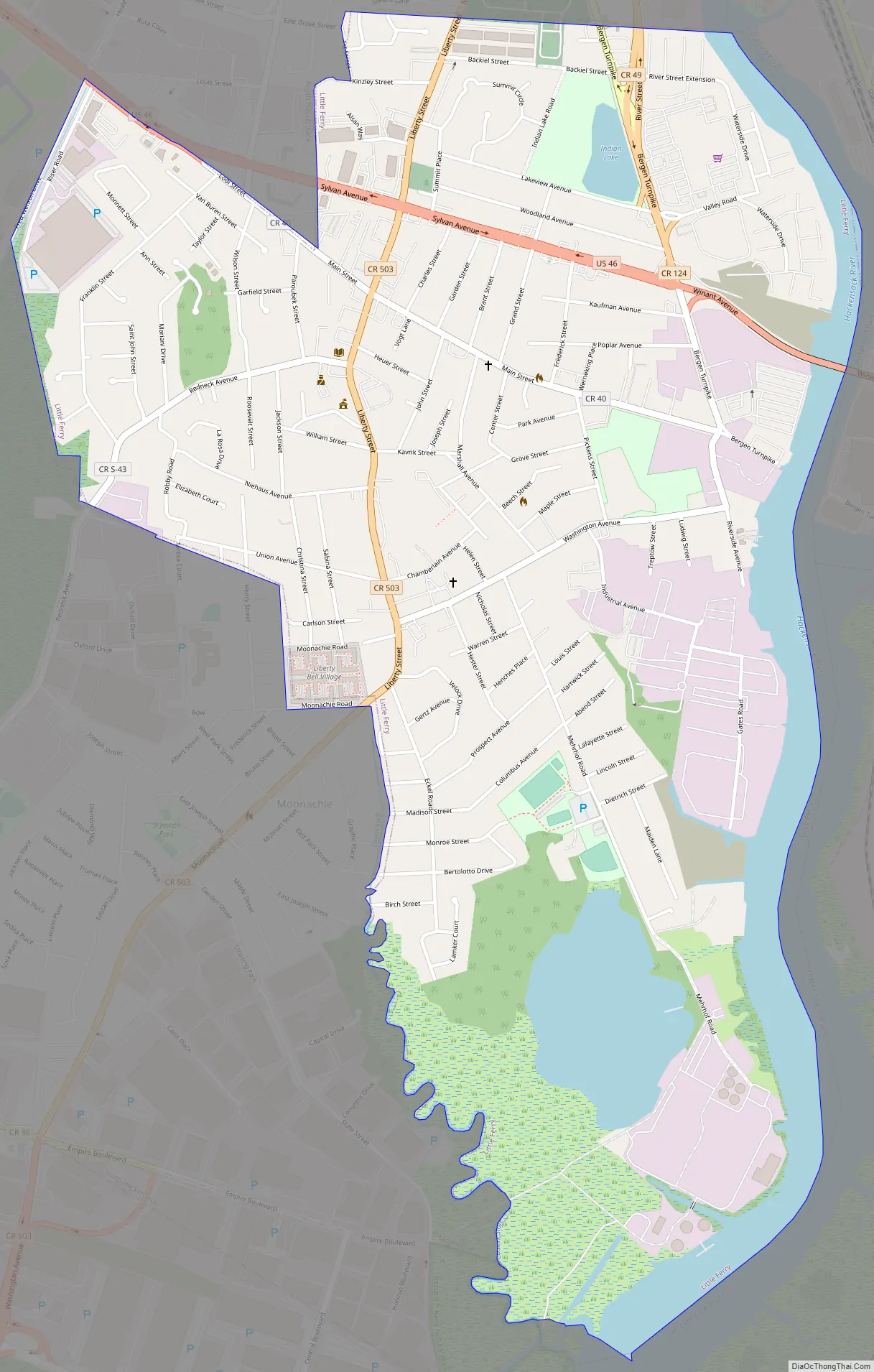
Little Ferry Road Map
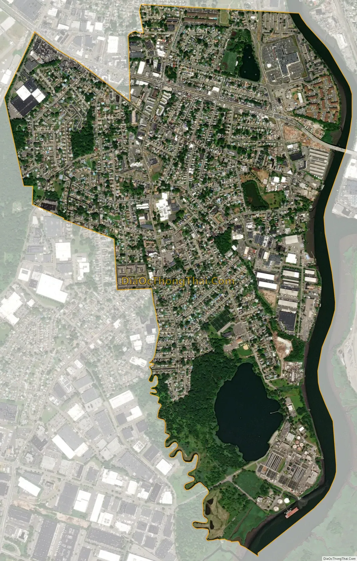
Little Ferry city Satellite Map
Geography
According to the United States Census Bureau, the borough had a total area of 1.67 square miles (4.32 km), including 1.48 square miles (3.83 km) of land and 0.19 square miles (0.50 km) of water (11.44%).
The borough borders the Bergen County municipalities of Hackensack, Moonachie, Ridgefield, Ridgefield Park, South Hackensack and Teterboro.
The borough lies near the confluence of the Hackensack River and Overpeck Creek in the New Jersey Meadowlands.
See also
Map of New Jersey State and its subdivision: Map of other states:- Alabama
- Alaska
- Arizona
- Arkansas
- California
- Colorado
- Connecticut
- Delaware
- District of Columbia
- Florida
- Georgia
- Hawaii
- Idaho
- Illinois
- Indiana
- Iowa
- Kansas
- Kentucky
- Louisiana
- Maine
- Maryland
- Massachusetts
- Michigan
- Minnesota
- Mississippi
- Missouri
- Montana
- Nebraska
- Nevada
- New Hampshire
- New Jersey
- New Mexico
- New York
- North Carolina
- North Dakota
- Ohio
- Oklahoma
- Oregon
- Pennsylvania
- Rhode Island
- South Carolina
- South Dakota
- Tennessee
- Texas
- Utah
- Vermont
- Virginia
- Washington
- West Virginia
- Wisconsin
- Wyoming


