Linwood is a city in Atlantic County, in the U.S. state of New Jersey. As of the 2020 United States census, the city’s population was 6,971, a decrease of 121 (−1.7%) from the 2010 census count of 7,092, which in turn reflected a decline of 80 (−1.1%) from the 7,172 counted in the 2000 census.
Linwood was originally incorporated as a borough by an act of the New Jersey Legislature on February 20, 1889, from portions of Egg Harbor Township, based on the results of a referendum held the previous day. Linwood was reincorporated as a city on April 27, 1931. The area had been called Leedsville until 1880, when a post office was being established. The United States Postal Service insisted that the name had to be changed as it conflicted with an existing post office elsewhere in the state. Among the names proposed and considered by local residents were “Brinola”, “Geneva”, “Pearville” and “Viola”, with “Linwood” ultimately chosen.
Geographically, the city, and all of Atlantic County, is part of the South Jersey region of the state and of the Atlantic City–Hammonton metropolitan statistical area, which in turn is included in the Philadelphia–Reading–Camden combined statistical area and the Delaware Valley.
| Name: | Linwood city |
|---|---|
| LSAD Code: | 25 |
| LSAD Description: | city (suffix) |
| State: | New Jersey |
| County: | Atlantic County |
| Incorporated: | February 20, 1889 (as borough) |
| Elevation: | 30 ft (9 m) |
| Total Area: | 4.21 sq mi (10.91 km²) |
| Land Area: | 3.81 sq mi (9.87 km²) |
| Water Area: | 0.40 sq mi (1.04 km²) 9.55% |
| Total Population: | 6,971 |
| Population Density: | 1,829.2/sq mi (706.3/km²) |
| ZIP code: | 08221 |
| Area code: | 609 |
| FIPS code: | 3440530 |
| GNISfeature ID: | 0885280 |
| Website: | www.linwoodcity.org |
Online Interactive Map
Click on ![]() to view map in "full screen" mode.
to view map in "full screen" mode.
Linwood location map. Where is Linwood city?


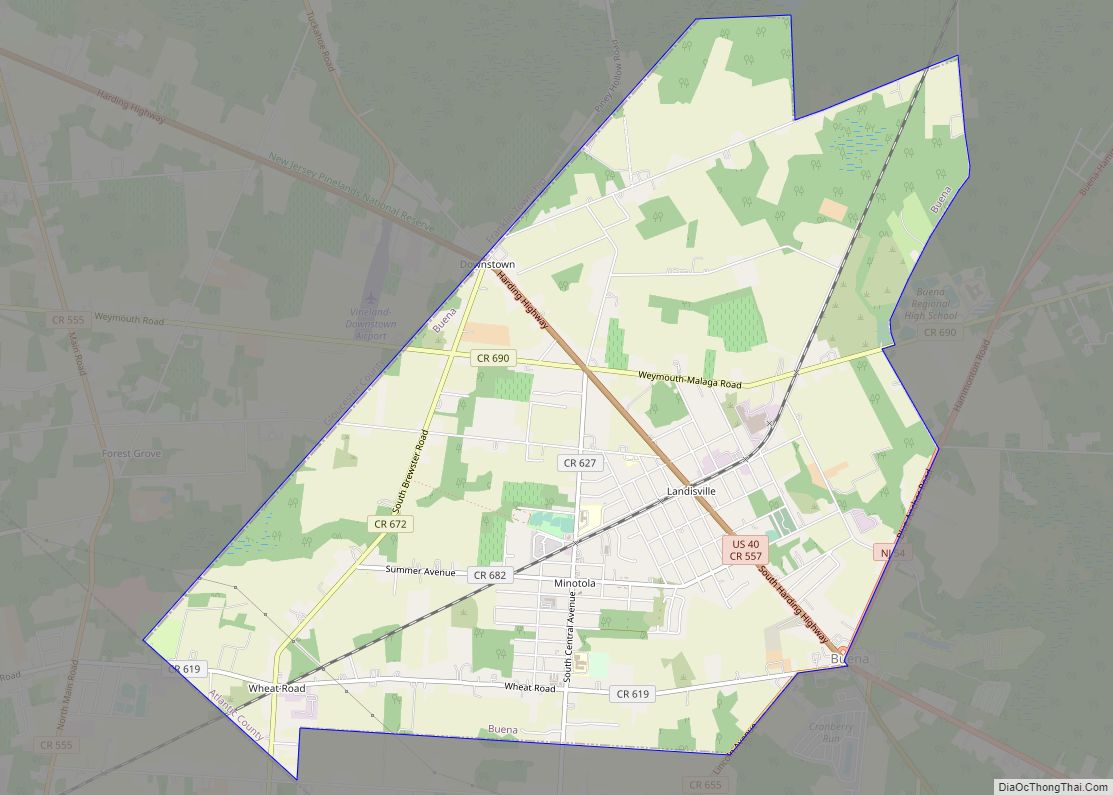
Linwood Road Map
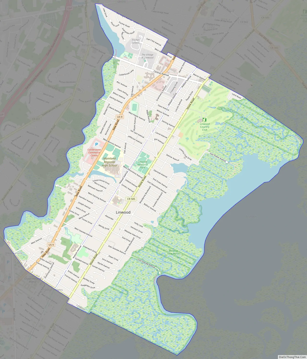
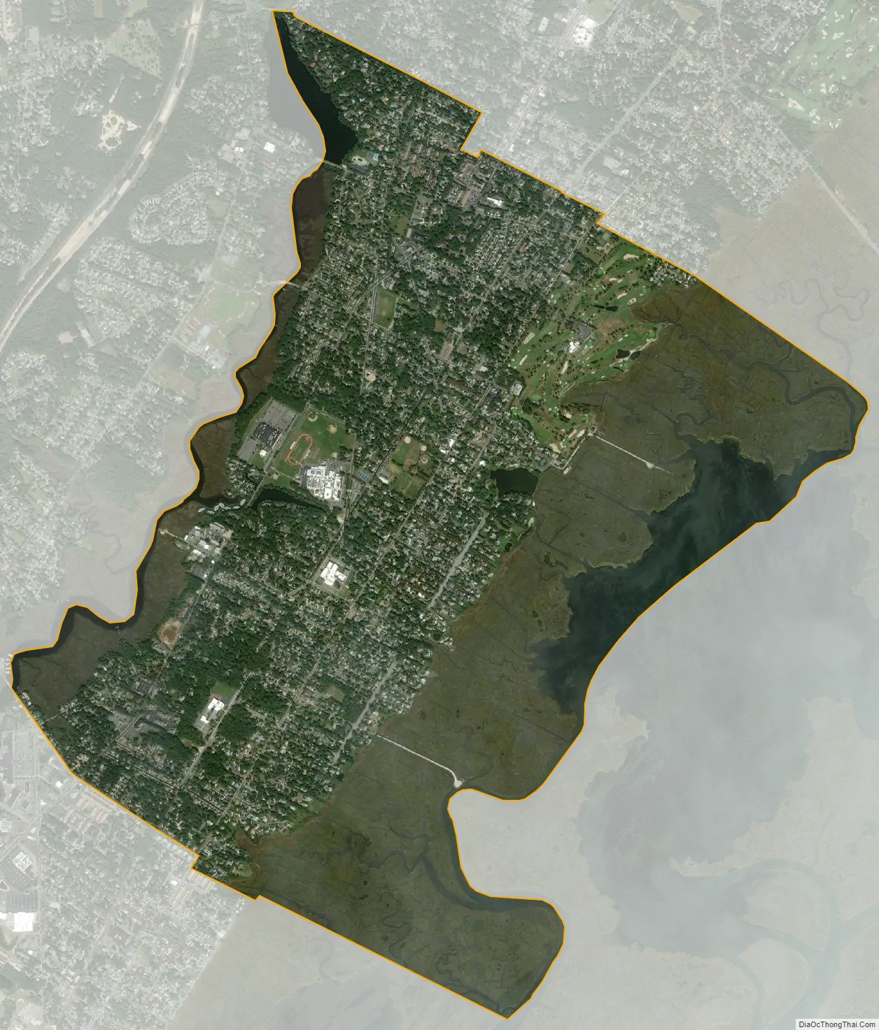
Linwood city Satellite Map
Geography
According to the United States Census Bureau, the city had a total area of 4.21 square miles (10.91 km), including 3.81 square miles (9.87 km) of land and 0.40 square miles (1.04 km) of water (9.55%).
The city is located about 9 miles (14 km) west of Atlantic City. It borders the municipalities of Egg Harbor Township, Northfield and Somers Point.
Unincorporated communities, localities and place names located partially or completely within the city include Bellhaven and Seaview.
See also
Map of New Jersey State and its subdivision: Map of other states:- Alabama
- Alaska
- Arizona
- Arkansas
- California
- Colorado
- Connecticut
- Delaware
- District of Columbia
- Florida
- Georgia
- Hawaii
- Idaho
- Illinois
- Indiana
- Iowa
- Kansas
- Kentucky
- Louisiana
- Maine
- Maryland
- Massachusetts
- Michigan
- Minnesota
- Mississippi
- Missouri
- Montana
- Nebraska
- Nevada
- New Hampshire
- New Jersey
- New Mexico
- New York
- North Carolina
- North Dakota
- Ohio
- Oklahoma
- Oregon
- Pennsylvania
- Rhode Island
- South Carolina
- South Dakota
- Tennessee
- Texas
- Utah
- Vermont
- Virginia
- Washington
- West Virginia
- Wisconsin
- Wyoming