Long Branch is a beachside city in Monmouth County, in the U.S. state of New Jersey. As of the 2020 United States census, the city’s population was 31,667, an increase of 948 (+3.1%) from the 2010 census count of 30,719, which in turn reflected a decline of 621 (−2.0%) from the 31,340 counted in the 2000 census. As of the 2020 census, it was the 6th-most-populous municipality in Monmouth County and had the 74th-highest population of any municipality in New Jersey.
Long Branch was formed on April 11, 1867, as the Long Branch Commission, from portions of Ocean Township. Long Branch was incorporated as a city by an act of the New Jersey Legislature on April 8, 1903, based on the results of a referendum, replacing the Long Branch Commission.
| Name: | Long Branch city |
|---|---|
| LSAD Code: | 25 |
| LSAD Description: | city (suffix) |
| State: | New Jersey |
| County: | Monmouth County |
| Incorporated: | April 11, 1867 (as Long Branch Commission) |
| Elevation: | 23 ft (7 m) |
| Total Area: | 6.29 sq mi (16.28 km²) |
| Land Area: | 5.12 sq mi (13.27 km²) |
| Water Area: | 1.16 sq mi (3.01 km²) 18.49% |
| Total Population: | 31,667 |
| Population Density: | 6,180.1/sq mi (2,386.1/km²) |
| ZIP code: | 07740 |
| Area code: | 732/848 |
| FIPS code: | 3441310 |
| GNISfeature ID: | 0885285 |
| Website: | www.visitlongbranch.com |
Online Interactive Map
Click on ![]() to view map in "full screen" mode.
to view map in "full screen" mode.
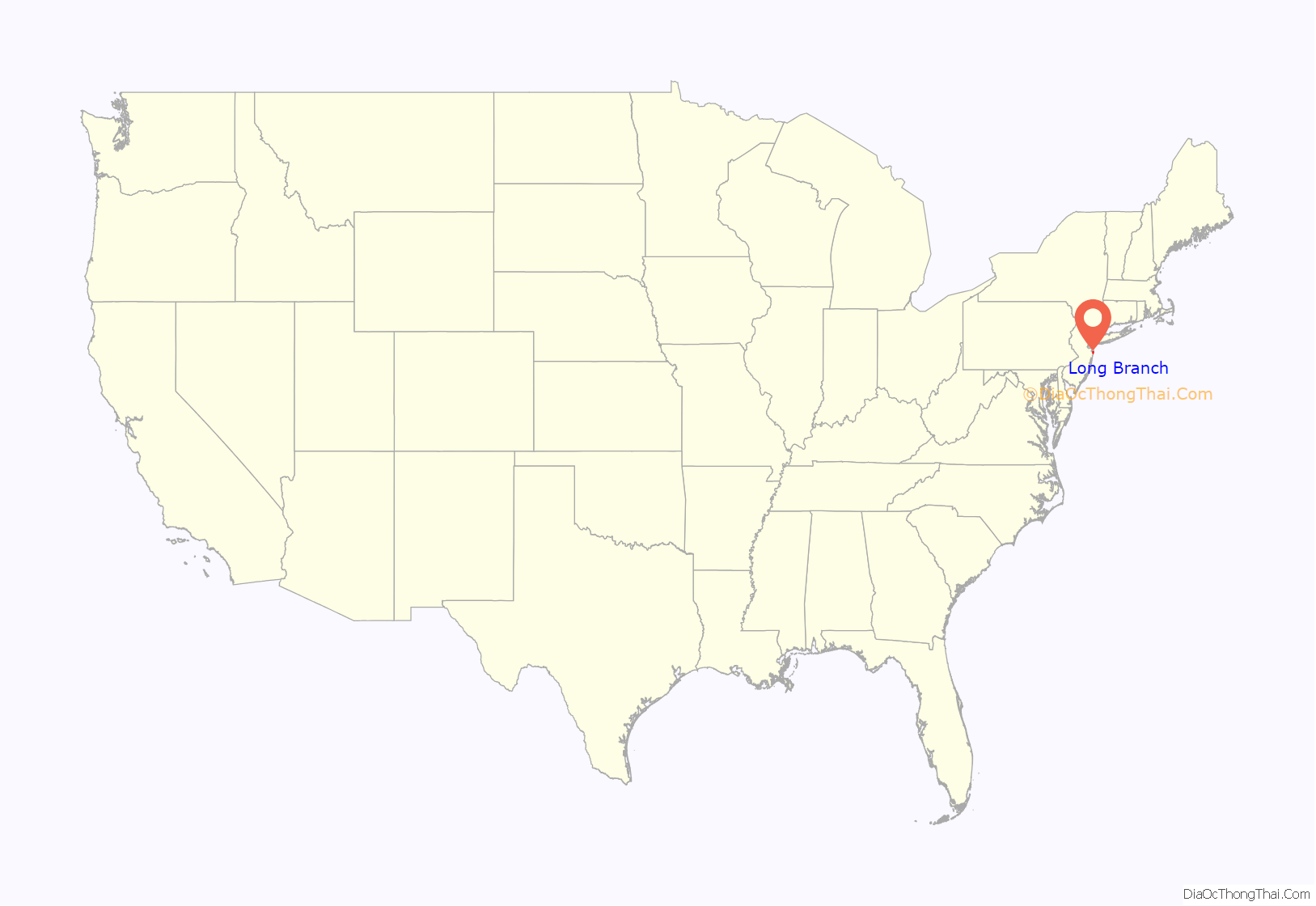
Long Branch location map. Where is Long Branch city?

History
Long Branch emerged as a beach resort town in the late 18th century, named for its location along a branch of the South Shrewsbury River. In the 19th century, theatrical performers of the day often gathered and performed there. It was visited by presidents Chester A. Arthur, James A. Garfield, Ulysses S. Grant, Benjamin Harrison, Rutherford B. Hayes, William McKinley, Woodrow Wilson, and Donald Trump. Seven Presidents Park, a park near the beach, is named in honor of the visits of the first seven of these presidents. The Church of the Presidents, where these same seven presidents worshiped, is the only structure left in Long Branch associated with them.
President Grant and his family summered at their beachfront cottage in Long Branch the first year of his presidency in 1869 and for most of the rest of Grant’s life. During this time, Long Branch came to be called the “summer capital”. President James A. Garfield was brought to Long Branch in the hope that the fresh air and quiet might aid his recovery after being shot on July 2, 1881, an incident that left the assassin’s bullet lodged in his spine. He died here on September 19, 1881, exactly two months before his 50th birthday. The Garfield Tea House, constructed from railroad ties that had been laid to carry Garfield’s train, is in Elberon.
The famous Long Branch Saloon of the American Old West, located in Dodge City, Kansas, was given its name by its first owner, William Harris, who had moved west from Long Branch, New Jersey, his hometown.
Originally a resort town with a few hotels and large estates and many farms in the early 20th century, Long Branch grew in population. Italian, Irish and Jewish immigrants settled in during this period. During the 1930s, the city used government policies to enforce racial segregation against Blacks at local beaches, assigning all black applicants for beach passes to a single, segregated beach.
By the 1950s, Long Branch like many other towns had developed new residential spots and housing to make room for the growing population. Many of the former farms of Long Branch were transformed into residential suburbs. Many of the estates and a few old historic resorts (with the addition of many new ones) still remain.
In the early 20th century, Long Branch lost much of its activity as a theater spot. In addition, the opening of the Garden State Parkway in the mid-1950s allowed shore visitors to access points further south, which added to Long Branch’s decline. The civil unrest of the 1960s caused riots in neighboring Asbury Park, and many fled the shore cities for the suburban towns west of the beach. Decades later, the older, more dilapidated parts of the resort town were condemned and redeveloped, in part by using eminent domain legislation.
Long Branch still continues to be a popular resort area. Many people from New York City travel or settle into the area to escape the crowded city and enjoy Long Branch’s beaches.
Hurricane Sandy
On October 29, 2012, Long Branch was one of many shore communities that were devastated by Hurricane Sandy. Although Sandy’s winds were powerful, Long Branch’s position between Long Beach Island and Sea Bright gave Long Branch a much larger wall of security because it could not be engulfed by surrounding waters. Despite this mainland advantage, there were still several instances of flooding in Long Branch during the storm. Many residents went without electricity for as long as two weeks. The boardwalk was destroyed; the city began rebuilding it in 2015, and it reopened in April 2016, making it the last boardwalk damaged by Sandy to be rebuilt.
Long Branch Road Map

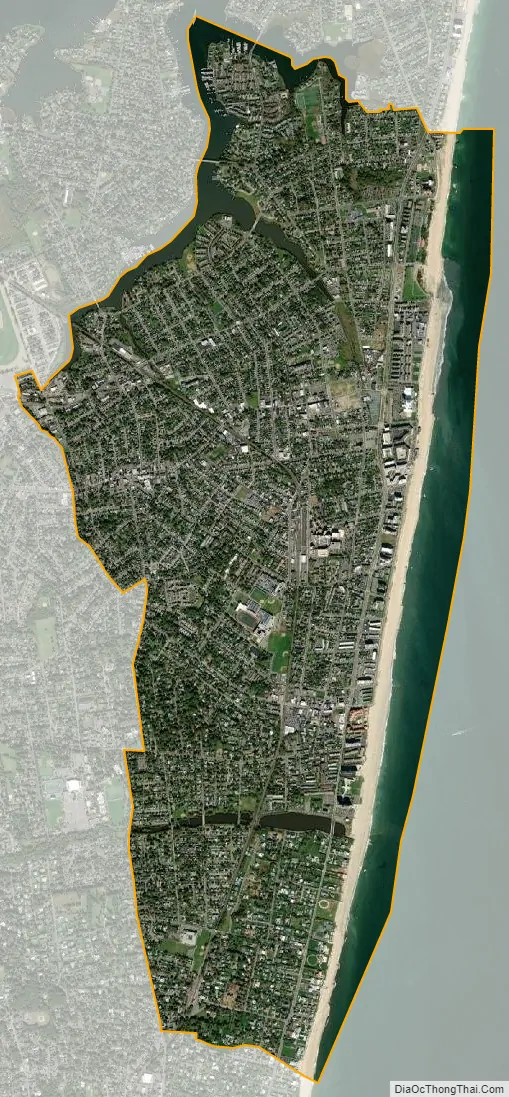
Long Branch city Satellite Map
Geography
Long Branch takes its name from the “long branch” or south branch of the Shrewsbury River.
According to the U.S. Census Bureau, the city had a total area of 6.29 square miles (16.28 km), including 5.12 square miles (13.27 km) of land and 1.16 square miles (3.01 km) of water (18.49%).
The city borders the Monmouth County communities of Deal, Monmouth Beach, Ocean Township, Oceanport and West Long Branch.
Neighborhoods
There are several distinct neighborhoods and areas in the City of Long Branch, each with its own character. Unincorporated communities, localities and place names located partially or completely within the city include Branchport, East Long Branch, Elberon (served as ZIP Code 07740), Hollywood, Kensington Park, North Long Branch, Pleasure Bay and West End. Other areas include North End (once known as “Atlanticville”), Beachfront North and South (including Pier Village, adjacent to the site of the former Long Branch Pier at the foot of Laird Street), Downtown and Uptown. As the city’s redevelopment initiatives continue to expand, the lower Broadway area (a portion of the city’s Downtown) will become an Arts District.
In years past, Long Branch was a major destination for beachgoers, along with Asbury Park, and enjoyed an upscale connotation with tourists. Long Branch is home to Seven Presidents Oceanfront Park, named for the United States presidents who visited the fashionable resort town, including Ulysses S. Grant, Chester A. Arthur, Rutherford Hayes, Benjamin Harrison, William McKinley, Woodrow Wilson and James Garfield.
Long Branch’s fame as the Nation’s First Seaside Resort waned in the years following World War II. The defining moment marking the end of this era occurred on June 8, 1987, when the largest fire in the history of the city destroyed the landmark amusement pier and adjoining Haunted Mansion, “Kid’s World” Amusement Park and other businesses.
Climate
According to the Köppen climate classification system, Long Branch has a humid subtropical climate (Cfa). Cfa climates are characterized by all months having an average temperature above 32.0 °F (0.0 °C), at least four months with an average temperature at or above 50.0 °F (10.0 °C), at least one month with an average temperature at or above 71.6 °F (22.0 °C) and no significant precipitation difference between seasons. Although most summer days are slightly humid with a cooling afternoon sea breeze in Long Branch, episodes of heat and high humidity can occur with heat index values above 104 °F (40 °C). Since 1981, the highest air temperature was 100.6 °F (38.1 °C) on August 9, 2001, and the highest daily average mean dew point was 77.7 °F (25.4 °C) on August 13, 2016, and July 19, 2019. July is the peak in thunderstorm activity and the average wettest month is August. Since 1981, the wettest calendar day was 5.82 inches (148 mm) on August 27, 2011. During the winter months, the average annual extreme minimum air temperature is 3.9 °F (−15.6 °C). Since 1981, the coldest air temperature was −5.9 °F (−21.1 °C) on January 22, 1984. Episodes of extreme cold and wind can occur with wind chill values below −6 °F (−21 °C). The average seasonal (November–April) snowfall total is 18 to 24 inches (46 to 61 cm) and the average snowiest month is February which corresponds with the annual peak in nor’easter activity.
Ecology
According to the A. W. Kuchler U.S. potential natural vegetation types, Long Branch would have a dominant vegetation type of Appalachian oak (104) with a dominant vegetation form of Eastern Hardwood Forest (25). The plant hardiness zone is 7a with an average annual extreme minimum air temperature of 3.9 °F (−15.6 °C). The average date of first spring leaf-out is March 23 and fall color typically peaks in early-November.
See also
Map of New Jersey State and its subdivision: Map of other states:- Alabama
- Alaska
- Arizona
- Arkansas
- California
- Colorado
- Connecticut
- Delaware
- District of Columbia
- Florida
- Georgia
- Hawaii
- Idaho
- Illinois
- Indiana
- Iowa
- Kansas
- Kentucky
- Louisiana
- Maine
- Maryland
- Massachusetts
- Michigan
- Minnesota
- Mississippi
- Missouri
- Montana
- Nebraska
- Nevada
- New Hampshire
- New Jersey
- New Mexico
- New York
- North Carolina
- North Dakota
- Ohio
- Oklahoma
- Oregon
- Pennsylvania
- Rhode Island
- South Carolina
- South Dakota
- Tennessee
- Texas
- Utah
- Vermont
- Virginia
- Washington
- West Virginia
- Wisconsin
- Wyoming


