Map of Brielle borough
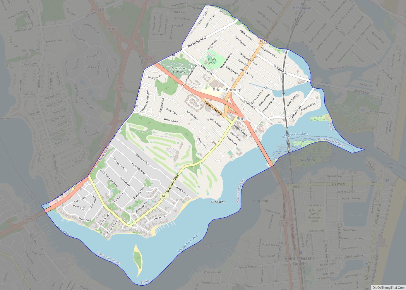
Brielle is a borough located in southern Monmouth County, in the U.S. state of New Jersey, along the Manasquan River. As of the 2020 United States census, the borough’s population was 4,982, its highest decennial count ever and an increase of 208 (+4.4%) from the 2010 census count of 4,774, which in turn reflected a ... Read more
Map of Brielle borough
Map of Buena borough, New Jersey
Buena (/ˈbjuːnə/ BEW-nə) is a borough in Atlantic County, in the U.S. state of New Jersey. The borough, and all of Atlantic County, is part of South Jersey and the Atlantic City–Hammonton metropolitan statistical area, which in turn is included in the Philadelphia–Reading–Camden combined statistical area and the Delaware Valley. As of the 2020 United ... Read more
Map of Buena borough, New Jersey
Map of Budd Lake CDP
Budd Lake is an unincorporated community and census-designated place (CDP) located within Mount Olive Township, in Morris County, New Jersey, United States. As of the 2020 United States census, the CDP’s population was 9,784, its highest decennial census count ever and an increase of 816 (+9.1%) from the 8,968 enumerated at the 2010 census, which ... Read more
Map of Budd Lake CDP
Map of Brownville CDP, New Jersey
Brownville is an unincorporated community and census-designated place (CDP) located within Old Bridge Township, in Middlesex County, New Jersey, United States. As of the 2010 United States Census, the CDP’s population was 2,383. Brownville CDP overview: Name: Brownville CDP LSAD Code: 57 LSAD Description: CDP (suffix) State: New Jersey County: Middlesex County Elevation: 66 ft (20 m) ... Read more
Map of Brownville CDP, New Jersey
Map of Cape May Point borough
Cape May Point is a borough located at the tip of the Cape May Peninsula in Cape May County, in the U.S. state of New Jersey. The borough, and all of Cape May County, is part of the Ocean City metropolitan statistical area, and is part of the Philadelphia–Wilmington–Camden, PA-NJ-DE–MD combined statistical area, also known ... Read more
Map of Cape May Point borough
Map of Cape May Court House CDP
Cape May Court House is an unincorporated community and census-designated place (CDP) located within Middle Township in Cape May County, in the U.S. state of New Jersey. It is part of the Ocean City metropolitan statistical area. As of the 2020 United States Census, the CDP’s population was 5,573, reflecting a 4.4% increase from the ... Read more
Map of Cape May Court House CDP
Map of Camden city, New Jersey
Camden is a city in and the county seat of Camden County, in the U.S. state of New Jersey. Camden is part of the Delaware Valley (Philadelphia metropolitan area) and is located directly across the Delaware River from Philadelphia, the nation’s sixth most populous city. At the 2020 United States census, Camden was the 14th-most ... Read more
Map of Camden city, New Jersey
Map of Califon borough
Califon is a borough in Hunterdon County, in the U.S. state of New Jersey. As of the 2020 United States census, the borough’s population was 1,005, a decrease of 71 (−6.6%) from the 2010 census count of 1,076, which in turn reflected an increase of 21 (+2.0%) from the 1,055 counted in the 2000 census. ... Read more
Map of Califon borough
Map of Caldwell borough, New Jersey
Caldwell is a borough located in northwestern Essex County, in the U.S. state of New Jersey, about 16 miles (26 km) west of New York City and 6 miles (9.7 km) north-west of Newark, the state’s most populous city. As of the 2020 United States census, the borough’s population was 9,027, an increase of 1,205 (+15.4%) from ... Read more
Map of Caldwell borough, New Jersey
Map of Byram Center CDP
Byram Center is an unincorporated community and census-designated place (CDP) located in Byram Township, in Sussex County, New Jersey, United States. As of the 2010 United States Census, the CDP’s population was 90. Byram Center CDP overview: Name: Byram Center CDP LSAD Code: 57 LSAD Description: CDP (suffix) State: New Jersey County: Sussex County Elevation: ... Read more
Map of Byram Center CDP
Map of Buttzville CDP
Buttzville is an unincorporated community and census-designated place (CDP) located within White Township in Warren County, New Jersey, United States, that was created as part of the 2010 United States Census. As of the 2010 Census, the CDP’s population was 146. Buttzville CDP overview: Name: Buttzville CDP LSAD Code: 57 LSAD Description: CDP (suffix) State: ... Read more
Map of Buttzville CDP
Map of Butler borough, New Jersey
Butler is a borough in Morris County, New Jersey, United States. As of the 2020 United States census, the borough’s population was 8,047, an increase of 508 (+6.7%) from the 2010 census count of 7,539, which in turn reflected an increase of 119 (+1.6%) from the 7,420 counted in the 2000 census. Butler was incorporated ... Read more
Map of Butler borough, New Jersey