Caldwell is a borough located in northwestern Essex County, in the U.S. state of New Jersey, about 16 miles (26 km) west of New York City and 6 miles (9.7 km) north-west of Newark, the state’s most populous city. As of the 2020 United States census, the borough’s population was 9,027, an increase of 1,205 (+15.4%) from the 2010 census count of 7,822, which in turn reflected an increase of 238 (+3.1%) from the 7,584 counted in the 2000 census.
Caldwell was incorporated as a borough by an act of the New Jersey Legislature on February 10, 1892, from portions of Caldwell Township (now Fairfield Township), based on the results of a referendum held on the previous day. In 1981, the borough’s name was changed to the “Township of the Borough of Caldwell”, as one of seven Essex County municipalities to pass a referendum to become a township, joining four municipalities that had already made the change, of what would ultimately be more than a dozen Essex County municipalities to reclassify themselves as townships in order take advantage of federal revenue sharing policies that allocated townships a greater share of government aid to municipalities on a per capita basis. Effective January 26, 1995, it again became a borough.
Grover Cleveland, the 22nd and 24th President of the United States, and the only president to serve two non-consecutive terms, was born in Caldwell on March 18, 1837. His father, Rev. Richard Falley Cleveland, was pastor of the First Presbyterian Church. The Grover Cleveland birthplace—the church’s former manse—is now a museum and is open to the public.
Though today the Caldwell area is considered to be a suburb of both Newark and New York City, the area originally developed as its own individual, self-contained community and economy rather than as urban sprawl from a larger city. When it was formed, miles of woods separated downtown Caldwell from Newark or any of its developing suburbs.
New Jersey Monthly magazine ranked Caldwell as its third-best place to live in its 2010 rankings of the “Best Places To Live” in New Jersey.
| Name: | Caldwell borough |
|---|---|
| LSAD Code: | 21 |
| LSAD Description: | borough (suffix) |
| State: | New Jersey |
| County: | Essex County |
| Incorporated: | February 10, 1892 |
| Elevation: | 397 ft (121 m) |
| Total Area: | 1.18 sq mi (3.05 km²) |
| Land Area: | 1.18 sq mi (3.05 km²) |
| Water Area: | 0.00 sq mi (0.00 km²) 0.08% |
| Total Population: | 9,027 |
| Population Density: | 7,663.0/sq mi (2,958.7/km²) |
| Area code: | 973 |
| FIPS code: | 3409250 |
| GNISfeature ID: | 2381010 |
| Website: | www.caldwell-nj.com |
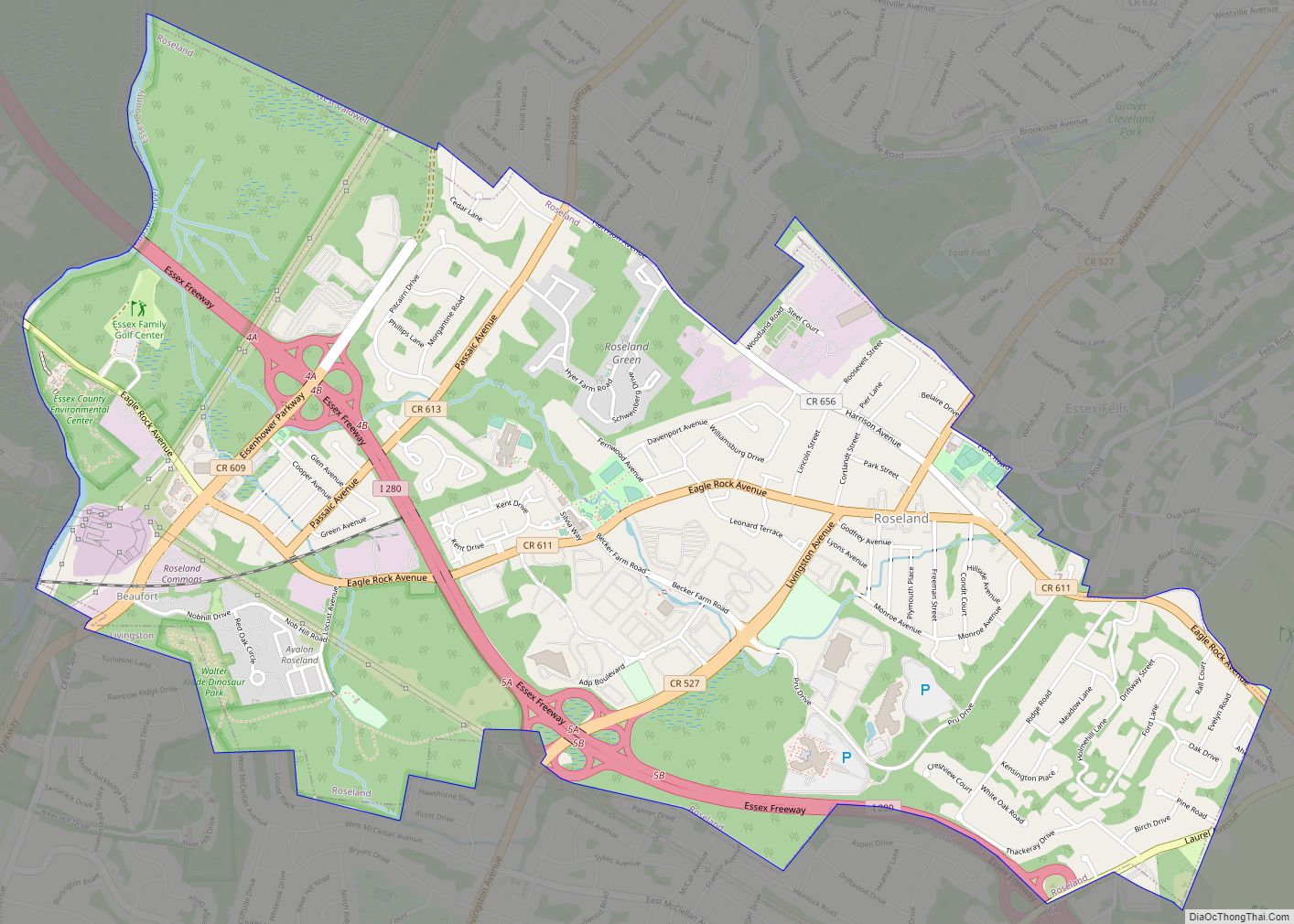
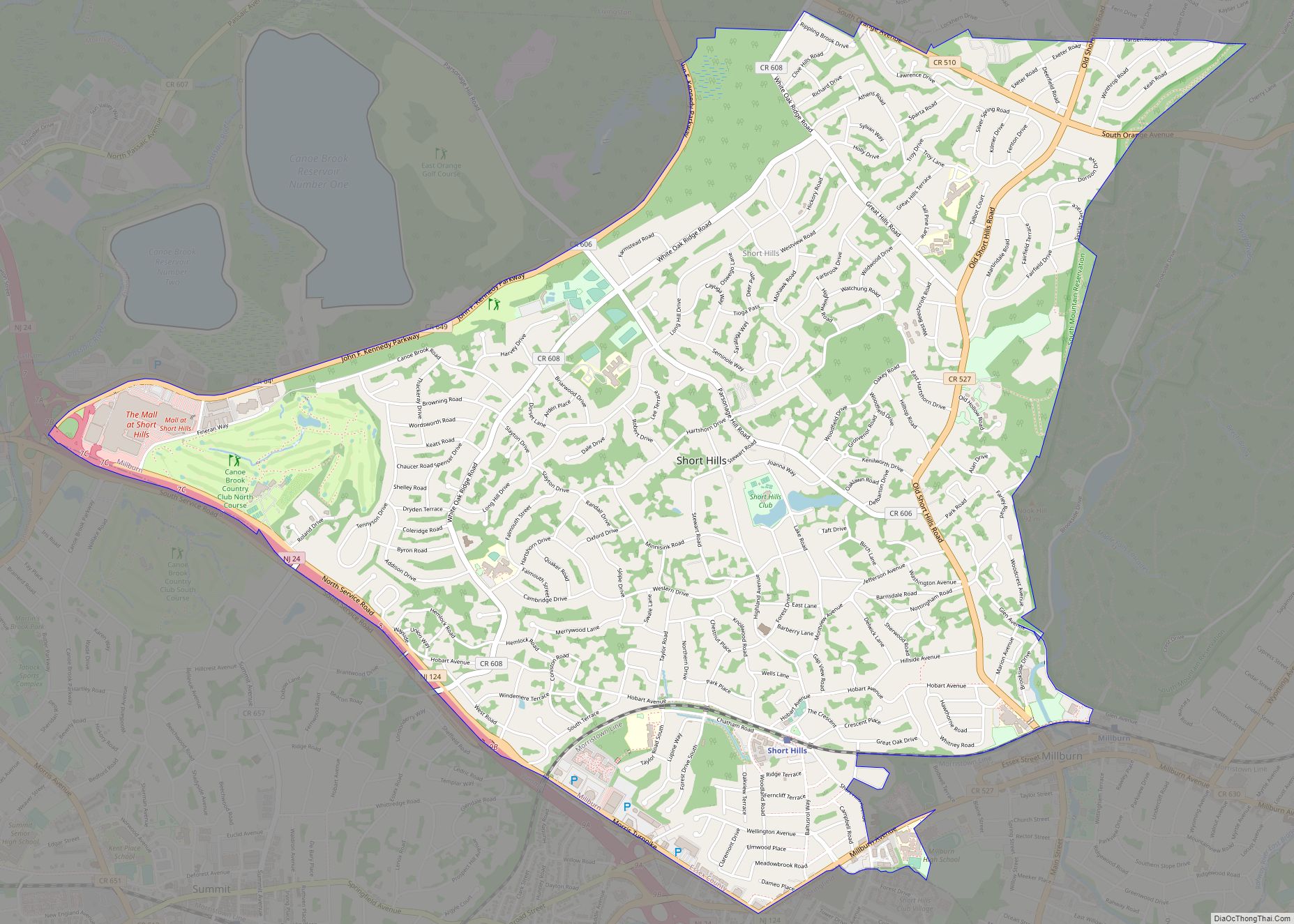
Online Interactive Map
Click on ![]() to view map in "full screen" mode.
to view map in "full screen" mode.
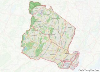
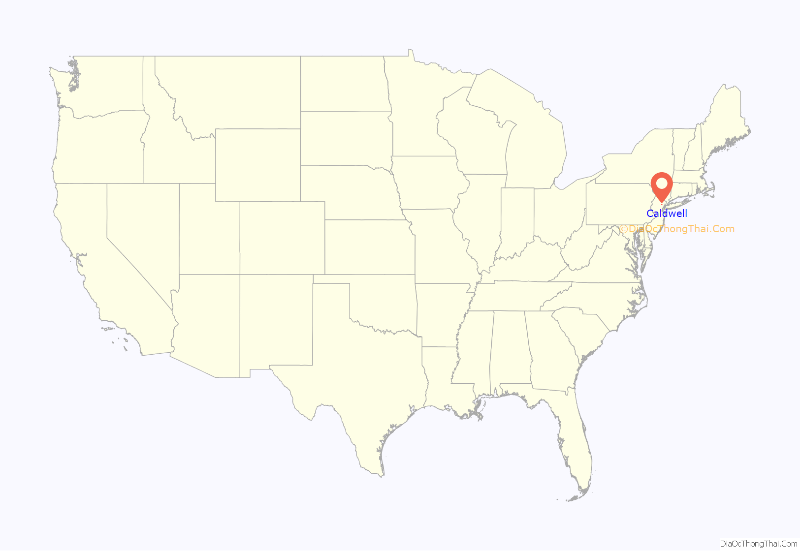
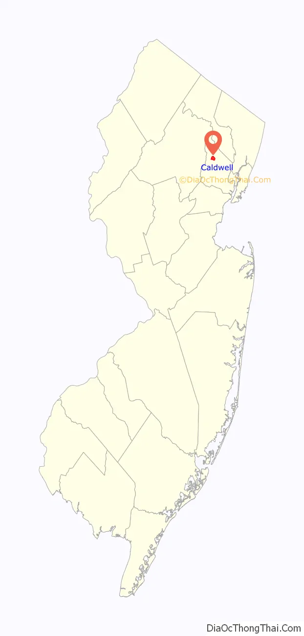
Caldwell location map. Where is Caldwell borough?
History
In 1702, settlers purchased a 14,000 acres (57 km) Horseneck Tract from the Lenni Lenape Native Americans for goods equal to $325 (equivalent to $5,761.5 in 2021). This purchase encompassed much of western Essex County, from the First Mountain to the Passaic River at Pine Brook. Caldwell is located in the center of the Horseneck Tract. Settlement began about 1740 by Thomas Gould and Saunders Sanders.
The Horseneck Tract consisted of modern-day Caldwell, West Caldwell, North Caldwell, Fairfield, Verona, Cedar Grove, Essex Fells, Roseland, and portions of Livingston and West Orange. This land was part of the larger purchase and had been referred to as the Horse Neck Tract until February 17, 1787, when the town congregation voted to change the name to Caldwell, in honor of the Reverend James Caldwell who pushed for their organization’s creation.
Caldwell Township contained what is today the towns of West Caldwell and Caldwell. Soon after, the area of Caldwell Township just to the east of Caldwell Borough between Caldwell Borough and Montclair (present-day Verona and Cedar Grove) decided to follow Caldwell’s lead and incorporated itself as its own borough, Verona. Some of the already developed eastern neighborhoods of Caldwell Township chose to become part of Montclair, as it was a rapidly developing suburb of Newark and Paterson. At around the same time, the area north of Caldwell Borough became its own town, North Caldwell. The wooded area directly to the south of downtown Caldwell Borough became Essex Fells. Meanwhile, the farmland to the south of the western portion of Caldwell township attempted to become its own municipality known as South Caldwell. This failed, as much of developed sections of that area lied on its southernmost and easternmost borders, along the expanding Newark suburbs of Livingston and West Orange respectively. Those areas were engulfed by those two towns once they became incorporated municipalities of several small villages and developments.
This left only the most rural farmland south of Caldwell Borough and Essex Fells to become its own township, Roseland. At this point, all that remained of the original Caldwell Township was 6,600 acres of rural farmland and meadows in the northwesternmost part of Essex County. In 1963, Caldwell Township changed its name to Fairfield in order to avoid being confused with Caldwell Borough.
Immediately following the separation of the original Caldwell, the western part of Caldwell Borough generally remained less developed than downtown Caldwell Borough and contained several farms and a large area of undeveloped swampland known as Hatfield Swamp. However, two individual settlements, known as Franklin and Westville, soon formed in the western part of Caldwell Borough. As development increased and population grew in the western part of Caldwell, the town’s more rural western population and more urban east often could not reconcile their differences. This led to the areas of Franklin and Westville consolidating into their own township known as West Caldwell in 1904, leaving only the one square mile of original downtown Horseneck development as the borough of Caldwell. Lewis G. Lockward was elected the first mayor of Caldwell. In 1929, an attempt to consolidate the three Caldwells into a single municipality was rejected by voters.
This borough was one of the filming locations for the Columbia Pictures 1994 comedy film North.
Historical facts
- George Washington and his staff made their way through the community during the Revolution. They stopped for lunch at the old stone house of Saunders Sanders (located near present-day Brookside Avenue), one of the two people to settle the original area.
- Marquis de Lafayette visited in 1824, featuring a celebration party at the Crane Tavern.
- About 1816, Elias B. Caldwell and family, Presbyterians, helped found Liberia, a nation for free blacks, and the town of Caldwell, Liberia.
- During the 1928 Presidential campaign, Herbert Hoover visited the Grover Cleveland Birthplace with his wife.
- Grover Cleveland lived the first four years of his life in Caldwell.
- In October 1897, a severe fire ripped through a large portion of Bloomfield Avenue, destroying buildings in its wake. These buildings were replaced, in part, by the Hasler Building, opposite the Presbyterian Church. This became Caldwell’s first brick building.
- In, 1908 the Caldwell Public Library opened. It is one of 20 remaining Carnegie libraries in New Jersey. In 2022, Preservation New Jersey listed the library on its list of the state’s ten most endangered historic properties.
- In 1914, during a Fourth of July fireworks celebration, a bomb fell, injuring 20 people. Local churches raised funds to defray the medical bills of the injured.
- In 1968, Caldwell’s ornate historic bronze dolphin handle cannon was stolen off the town green. The cannon had been given to the borough by Marquis de Lafayette, who was a friend of Caldwell. A poorly cast rusting iron replica cannon was constructed and was placed at the site.
- On July 14, 1974, the landmark Park Theatre was destroyed by fire.
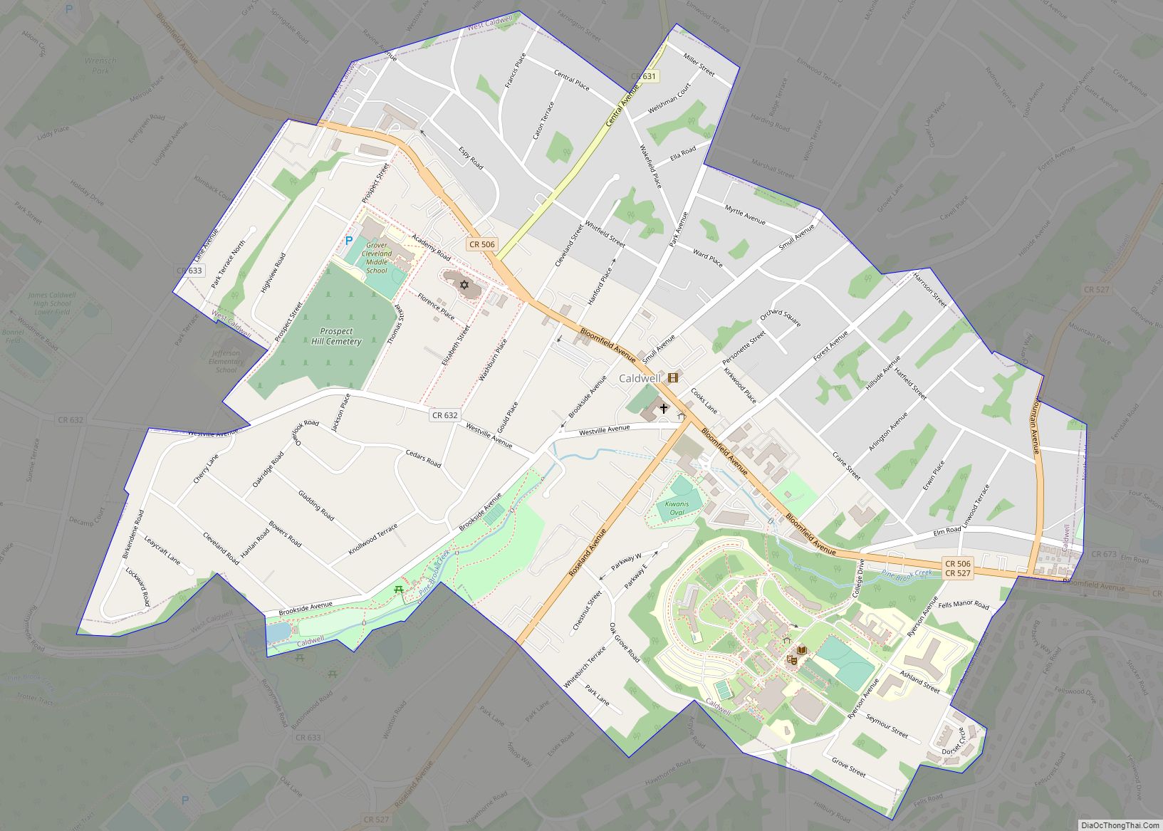
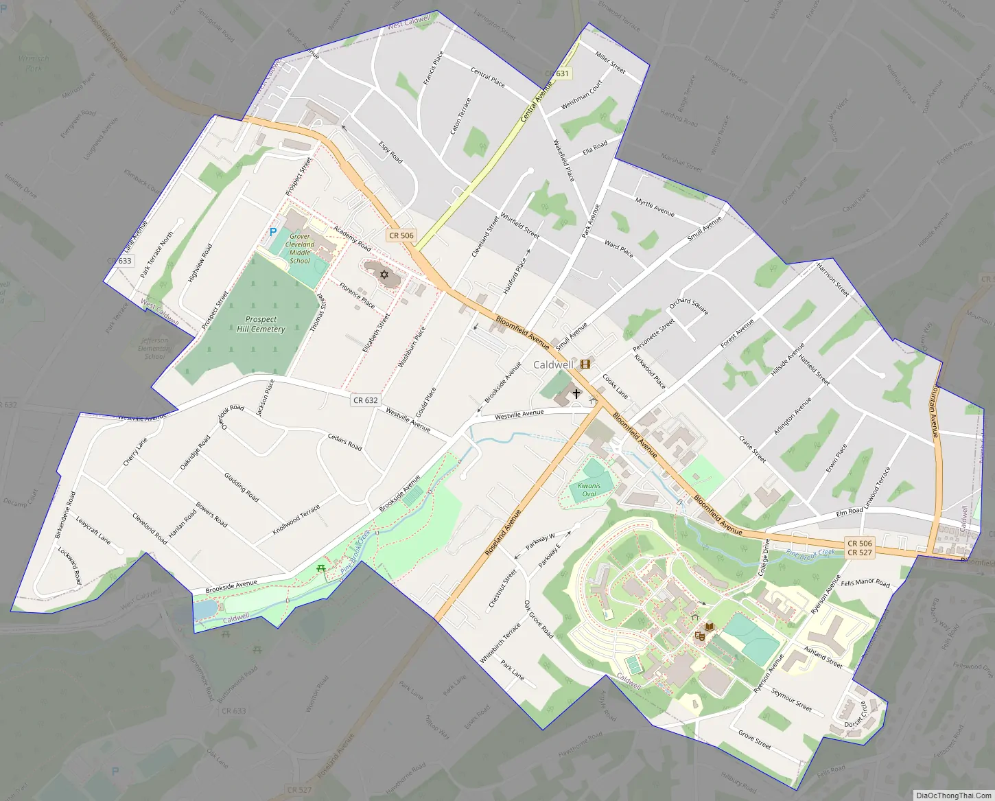
Caldwell Road Map
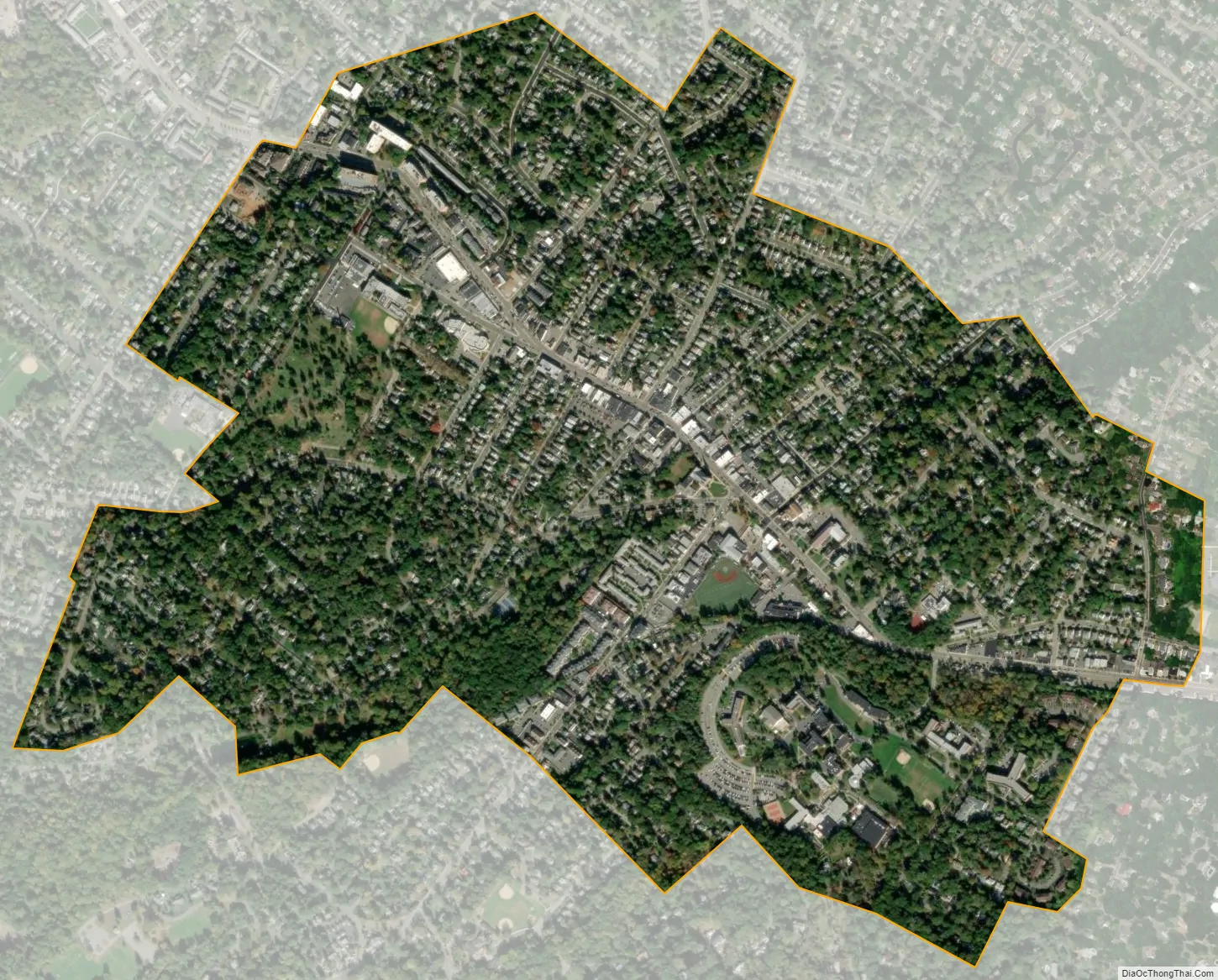
Caldwell city Satellite Map
Geography
According to the United States Census Bureau, the borough had a total area of 1.18 square miles (3.05 km), including 1.18 square miles (3.05 km) of land and <0.01 square miles (<0.01 km) of water (0.08%).
Caldwell is part of “The Caldwells”, the group of three Essex County municipalities which all have the word Caldwell in their name. Together with North Caldwell and West Caldwell, these communities are named after the Reverend James Caldwell, a Patriot who played an active role supporting the Continental Army during the American Revolutionary War, most notably his actions at the Battle of Springfield, where he gave the soldiers pages from hymn books to use as wadding for their rifle bullets. While each community has its own independent government, and the three municipalities have no shared governance (other than Essex County), the term is often used to refer to the area, including on highway exit signs. Signage for Exit 47B and 52 on Interstate 80 refer to “The Caldwells” as a destination. Fairfield Township was known as Caldwell Township until it abandoned its original name in 1963 in an effort to avoid confusion of mail distribution in the various Caldwells.
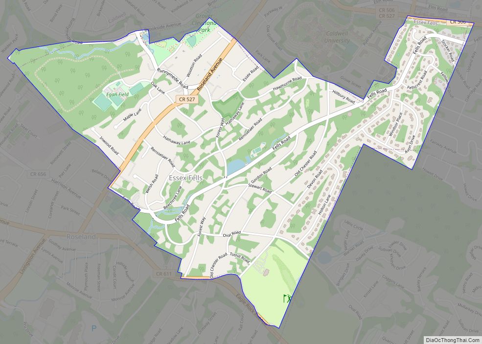
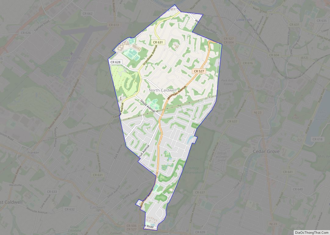
The borough borders the Essex County municipalities of Essex Fells, North Caldwell and West Caldwell, New Jersey.
See also
Map of New Jersey State and its subdivision: Map of other states:- Alabama
- Alaska
- Arizona
- Arkansas
- California
- Colorado
- Connecticut
- Delaware
- District of Columbia
- Florida
- Georgia
- Hawaii
- Idaho
- Illinois
- Indiana
- Iowa
- Kansas
- Kentucky
- Louisiana
- Maine
- Maryland
- Massachusetts
- Michigan
- Minnesota
- Mississippi
- Missouri
- Montana
- Nebraska
- Nevada
- New Hampshire
- New Jersey
- New Mexico
- New York
- North Carolina
- North Dakota
- Ohio
- Oklahoma
- Oregon
- Pennsylvania
- Rhode Island
- South Carolina
- South Dakota
- Tennessee
- Texas
- Utah
- Vermont
- Virginia
- Washington
- West Virginia
- Wisconsin
- Wyoming