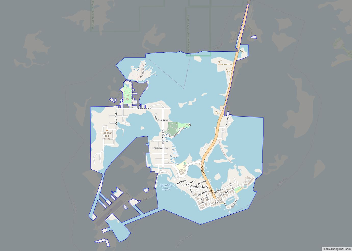
Map of Cedar Grove CDP, Florida
Cedar Grove is an unincorporated area and census-designated place in Bay County, Florida, United States. It was formerly an incorporated town, but it was dissolved in 2008 after a vote by residents. The town had 90 days from October 3, 2008, to implement the dissolution ordinance and hand over all operations to organs of the ... Read more
Map of Cedar Grove CDP, Florida
Map of Celebration CDP
Celebration is a master-planned community (MPC) and census-designated place (CDP) in Osceola County, Florida, United States. A suburb of Orlando, Celebration is located near Walt Disney World Resort and was originally developed by The Walt Disney Company. Its population was recorded as 11,178 in the 2020 census. After founding Celebration, Disney followed its plans to ... Read more
Map of Celebration CDP
Map of Charleston Park CDP
Charleston Park is an unincorporated community and census-designated place (CDP) in Lee County, Florida, United States. The population was 235 at the 2020 census, up from 218 at the 2010 census. It is part of the Cape Coral-Fort Myers, Florida Metropolitan Statistical Area. Charleston Park CDP overview: Name: Charleston Park CDP LSAD Code: 57 LSAD ... Read more
Map of Charleston Park CDP
Map of Century town, Florida
Century is a town in Escambia County, Florida, United States. Per the 2020 census, the population was 1,713. It is part of the Pensacola–Ferry Pass–Brent Metropolitan Statistical Area. Century town overview: Name: Century town LSAD Code: 43 LSAD Description: town (suffix) State: Florida County: Escambia County Elevation: 85 ft (26 m) Total Area: 3.34 sq mi (8.64 km²) Land Area: ... Read more
Map of Century town, Florida
Map of Center Hill city
Center Hill is a city in Sumter County, Florida, United States. The population was 988 at the 2010 census. According to the U.S Census estimates of 2018, the city had a population of 1,409. Center Hill city overview: Name: Center Hill city LSAD Code: 25 LSAD Description: city (suffix) State: Florida County: Sumter County Elevation: ... Read more
Map of Center Hill city
Map of Chattahoochee city
Chattahoochee is a city in Gadsden County, Florida, United States. Its history dates to the Spanish era. The population was 3,652 as of the 2010 census, up from 3,287 at the 2000 census. It is part of the Tallahassee, Florida Metropolitan Statistical Area. Chattahoochee sits on the banks of the Apalachicola River, and is separated ... Read more
Map of Chattahoochee city
Map of Charlotte Park CDP
Charlotte Park is a census-designated place (CDP) in Charlotte County, Florida, United States. The population was 2,667 at the 2020 census. It is part of the Sarasota-Bradenton-Punta Gorda Combined Statistical Area. Charlotte Park CDP overview: Name: Charlotte Park CDP LSAD Code: 57 LSAD Description: CDP (suffix) State: Florida County: Charlotte County Elevation: 3 ft (1 m) Total ... Read more
Map of Charlotte Park CDP
Map of Charlotte Harbor CDP
Charlotte Harbor is a census-designated place (CDP) in Charlotte County, Florida, United States. The name Charlotte Harbor also refers to Charlotte Harbor (estuary) and Charlotte Harbor Preserve State Park, a 42,000-acre (17,000 ha) preserve with 70 miles (110 km) of shoreline along Charlotte Harbor in Charlotte County. The population of Charlotte Harbor was 3,710 at the 2010 ... Read more
Map of Charlotte Harbor CDP
Map of Chipley city
Chipley is a city in and the county seat of Washington County, Florida, United States, located between Tallahassee and Pensacola. Its population was 3,605 in the 2010 U.S. Census. The area is served by Chipley High School. Originally called “Orange”, the city was renamed Chipley in 1882 for William Dudley Chipley, president of the Pensacola ... Read more
Map of Chipley city
Map of Chiefland city
Chiefland is a city in Levy County, Florida, United States. The population was 2,316 at the 2020 census. Chiefland calls itself the “Gem of the Suwannee Valley” and was incorporated in 1929. Chiefland city overview: Name: Chiefland city LSAD Code: 25 LSAD Description: city (suffix) State: Florida County: Levy County Elevation: 33 ft (10 m) Total Area: ... Read more
Map of Chiefland city
Map of Cheval CDP
Cheval is a census-designated place in Hillsborough County, Florida, United States. The population was 10,702 at the 2010 census, up from 7,602 at the 2000 census. Cheval CDP overview: Name: Cheval CDP LSAD Code: 57 LSAD Description: CDP (suffix) State: Florida County: Hillsborough County Elevation: 59 ft (18 m) Total Area: 6.79 sq mi (17.58 km²) Land Area: 5.95 sq mi (15.41 km²) ... Read more
Map of Cheval CDP
Map of Chuluota CDP
Chuluota (/tʃuːliˈoʊtə/ choo-lee-OH-tə) is a census-designated place and an unincorporated area in Seminole County, Florida, United States. The population was 2,524 at the 2020 Census. It is part of the Orlando–Kissimmee Metropolitan Statistical Area. Chuluota CDP overview: Name: Chuluota CDP LSAD Code: 57 LSAD Description: CDP (suffix) State: Florida County: Seminole County Elevation: 39 ft (12 m) ... Read more
Map of Chuluota CDP