Chipley is a city in and the county seat of Washington County, Florida, United States, located between Tallahassee and Pensacola. Its population was 3,605 in the 2010 U.S. Census. The area is served by Chipley High School.
Originally called “Orange”, the city was renamed Chipley in 1882 for William Dudley Chipley, president of the Pensacola and Atlantic Railroad and Florida state senator from 1895 to 1897.
During the cold snap of January 1985, a temperature of 2 degrees was recorded at one of the town’s golf courses, making it the second-coldest Florida temperature ever recorded and the lowest January reading for the state.
| Name: | Chipley city |
|---|---|
| LSAD Code: | 25 |
| LSAD Description: | city (suffix) |
| State: | Florida |
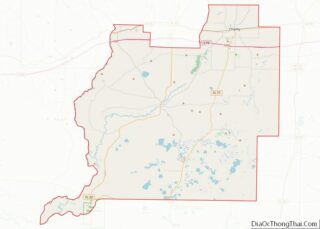
| County: | Washington County |
| Founded: | 1882 |
| Elevation: | 119 ft (36 m) |
| Total Area: | 4.25 sq mi (10.99 km²) |
| Land Area: | 4.25 sq mi (10.99 km²) |
| Water Area: | 0.00 sq mi (0.00 km²) |
| Total Population: | 3,660 |
| Population Density: | 862.19/sq mi (332.92/km²) |
| ZIP code: | 32428 |
| Area code: | 850 |
| FIPS code: | 1211975 |
| GNISfeature ID: | 0280398 |
| Website: | http://www.cityofchipley.com |
Online Interactive Map
Click on ![]() to view map in "full screen" mode.
to view map in "full screen" mode.
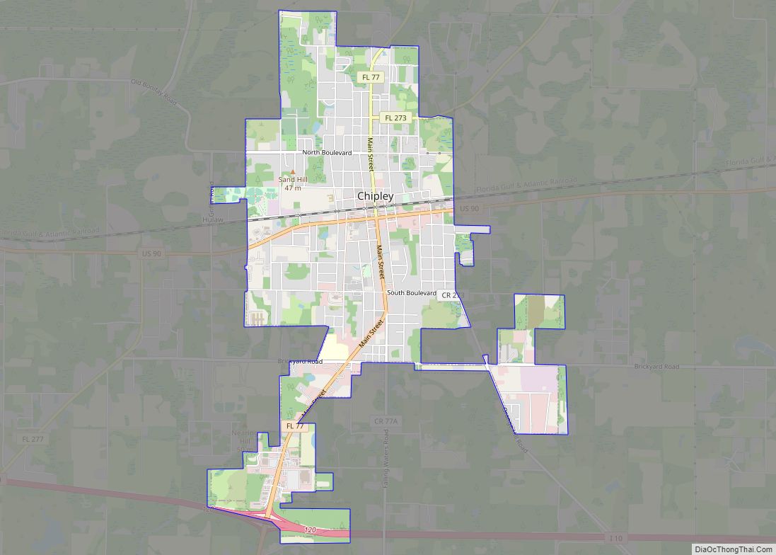
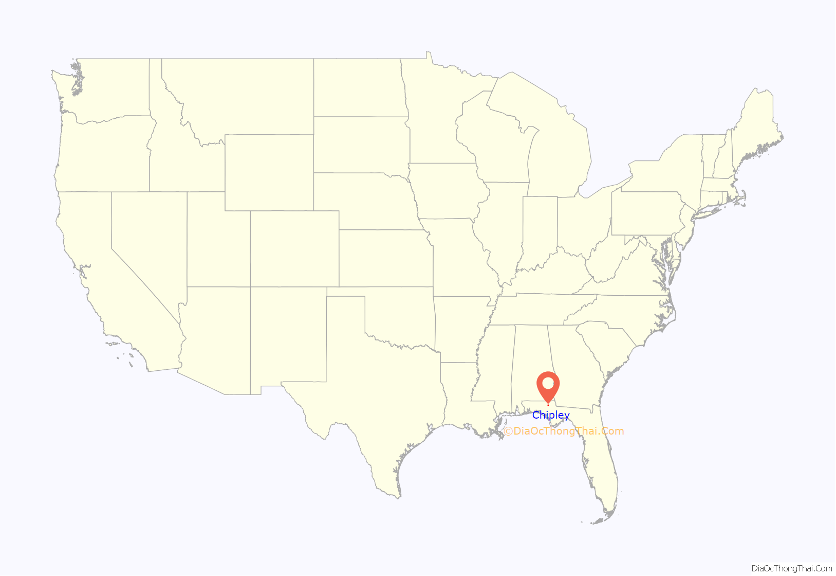
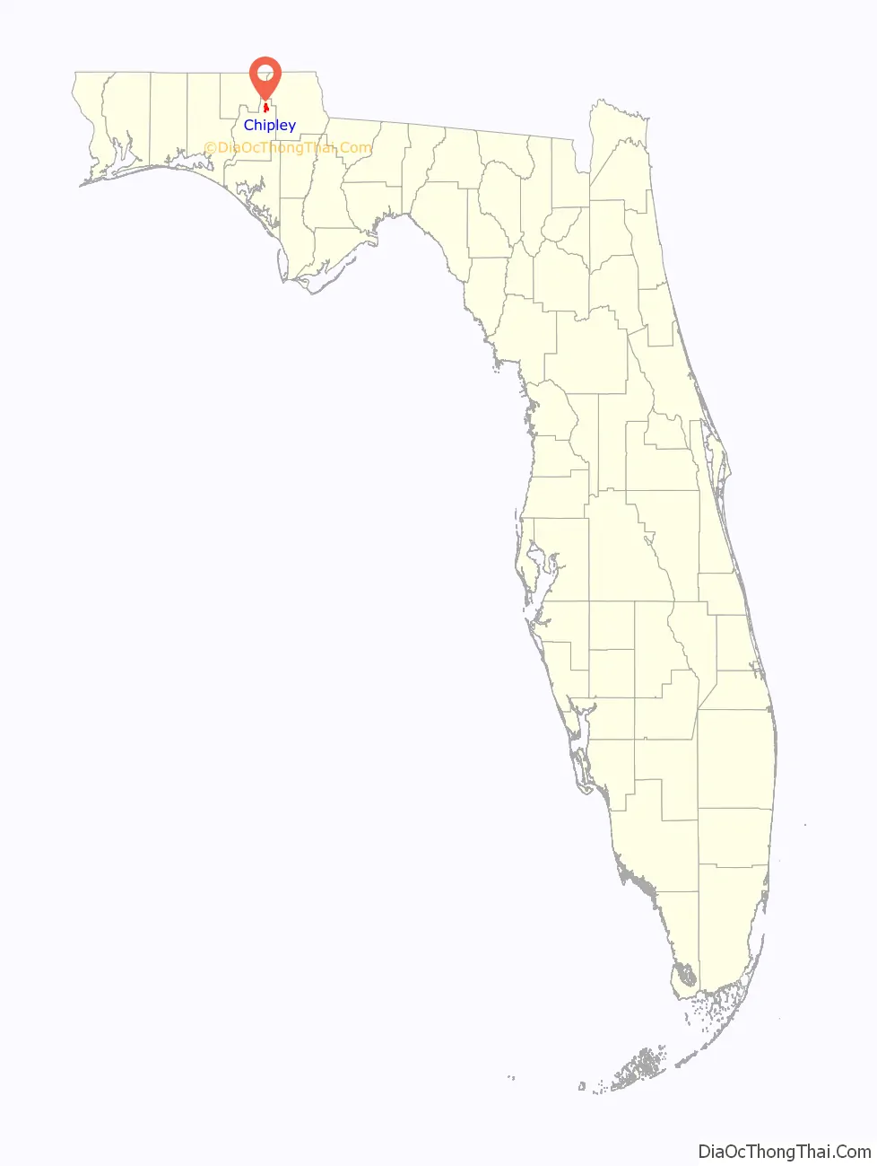
Chipley location map. Where is Chipley city?
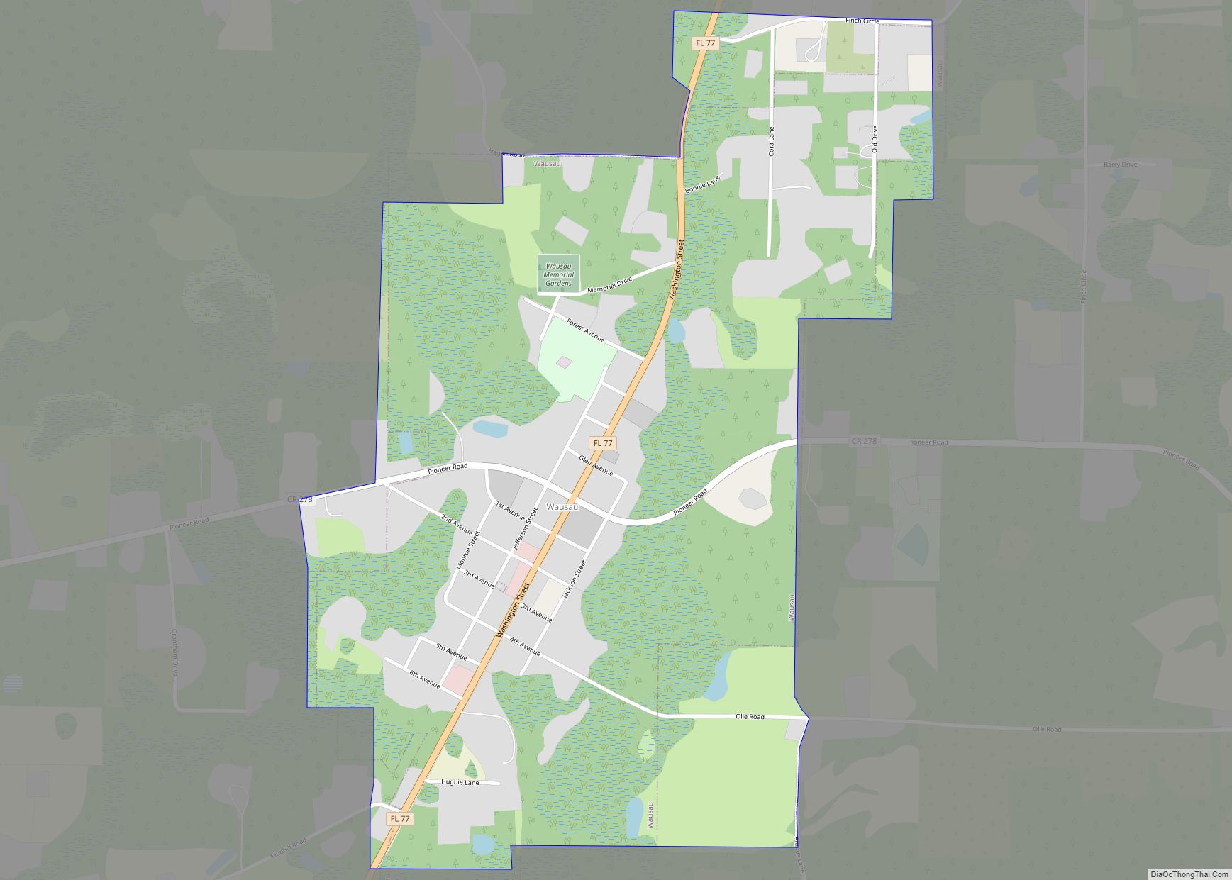
Chipley Road Map
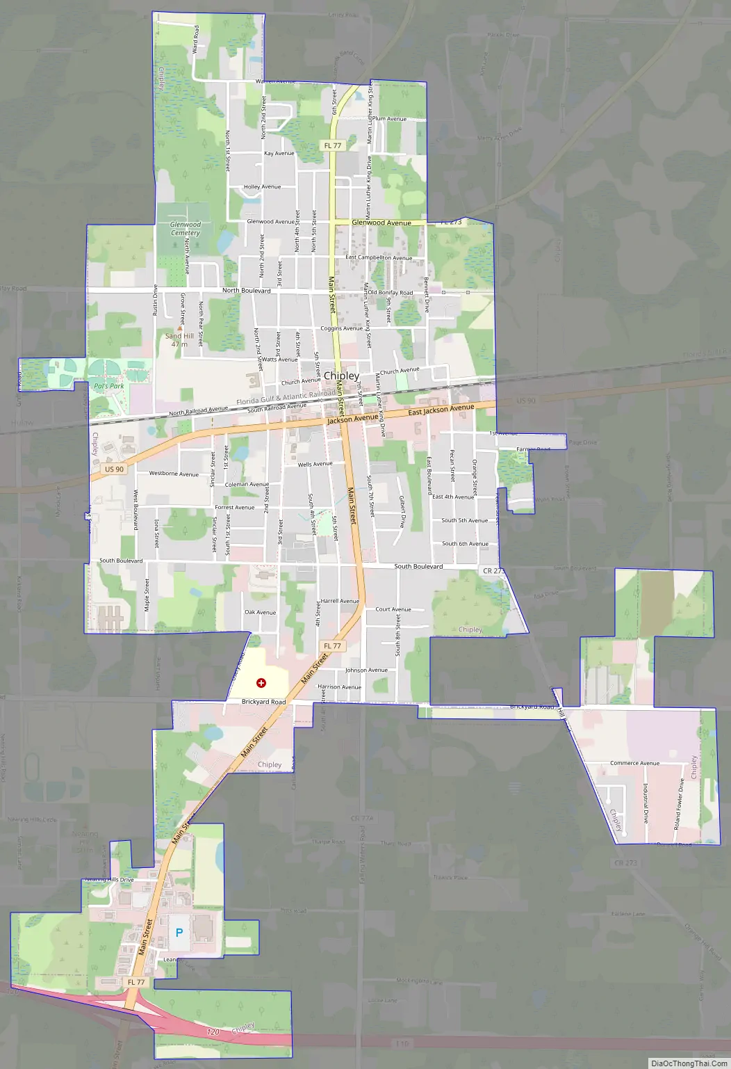
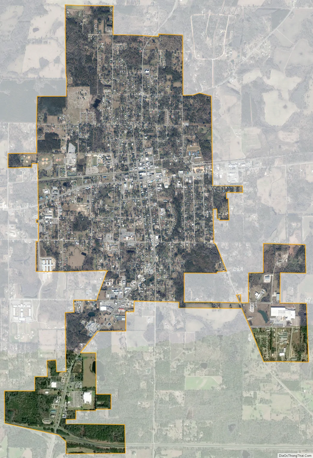
Chipley city Satellite Map
Geography
Chipley is located at 30°46′45″N 85°32′21″W / 30.779225°N 85.539087°W / 30.779225; -85.539087.
The city is located in the Florida Panhandle along Interstate 10 and U.S. Route 90. U.S. Route 90 runs through the downtown area from west to east as Jackson Avenue, and leads east 10 mi (16 km) to Cottondale and west 9 mi (14 km) to Bonifay. Interstate 10 runs from west to east south of the city, with access from exit 120 (Florida State Road 77). I-10 leads east 86 mi (138 km) to Tallahassee, the state capital, and west 116 mi (187 km) to Pensacola. FL-77 is the main north–south route through the city, and leads north 12 mi (19 km) to Graceville and south 47 mi (76 km) to Panama City.
According to the United States Census Bureau, the city has an area of 4.1 square miles (11 km), all land.
Climate
See also
Map of Florida State and its subdivision:- Alachua
- Baker
- Bay
- Bradford
- Brevard
- Broward
- Calhoun
- Charlotte
- Citrus
- Clay
- Collier
- Columbia
- Desoto
- Dixie
- Duval
- Escambia
- Flagler
- Franklin
- Gadsden
- Gilchrist
- Glades
- Gulf
- Hamilton
- Hardee
- Hendry
- Hernando
- Highlands
- Hillsborough
- Holmes
- Indian River
- Jackson
- Jefferson
- Lafayette
- Lake
- Lee
- Leon
- Levy
- Liberty
- Madison
- Manatee
- Marion
- Martin
- Miami-Dade
- Monroe
- Nassau
- Okaloosa
- Okeechobee
- Orange
- Osceola
- Palm Beach
- Pasco
- Pinellas
- Polk
- Putnam
- Saint Johns
- Saint Lucie
- Santa Rosa
- Sarasota
- Seminole
- Sumter
- Suwannee
- Taylor
- Union
- Volusia
- Wakulla
- Walton
- Washington
- Alabama
- Alaska
- Arizona
- Arkansas
- California
- Colorado
- Connecticut
- Delaware
- District of Columbia
- Florida
- Georgia
- Hawaii
- Idaho
- Illinois
- Indiana
- Iowa
- Kansas
- Kentucky
- Louisiana
- Maine
- Maryland
- Massachusetts
- Michigan
- Minnesota
- Mississippi
- Missouri
- Montana
- Nebraska
- Nevada
- New Hampshire
- New Jersey
- New Mexico
- New York
- North Carolina
- North Dakota
- Ohio
- Oklahoma
- Oregon
- Pennsylvania
- Rhode Island
- South Carolina
- South Dakota
- Tennessee
- Texas
- Utah
- Vermont
- Virginia
- Washington
- West Virginia
- Wisconsin
- Wyoming