Map of Avon town, Indiana
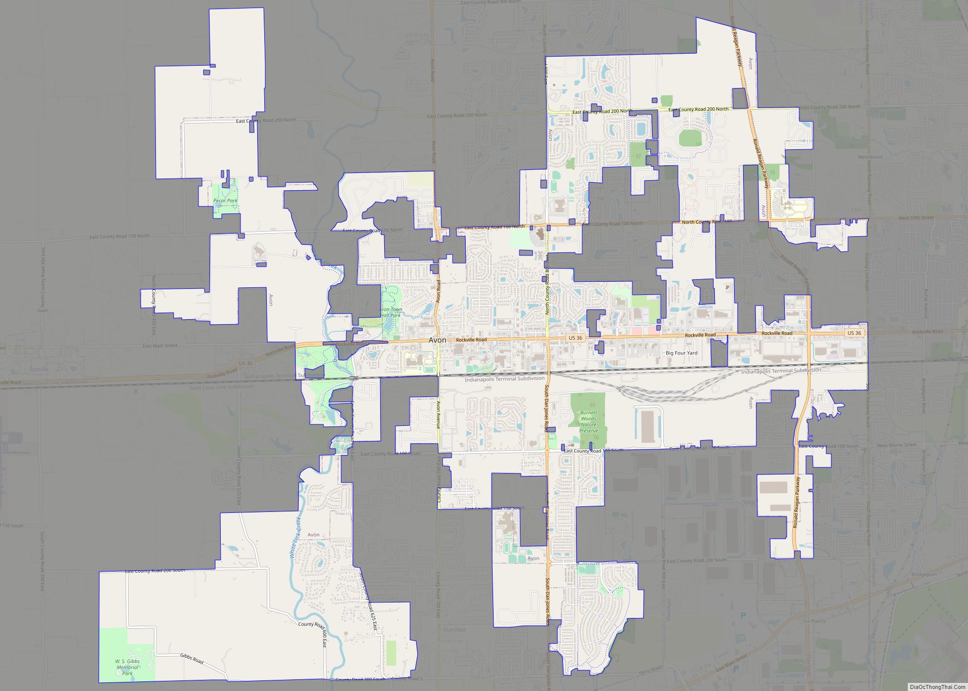
Avon is a town in Washington Township, Hendricks County, Indiana, United States. The population was 21,474 at the 2020 census. It is part of the Indianapolis metropolitan area. Avon town overview: Name: Avon town LSAD Code: 43 LSAD Description: town (suffix) State: Indiana County: Hendricks County Elevation: 833 ft (254 m) Total Area: 19.41 sq mi (50.26 km²) Land Area: ... Read more
Map of Avon town, Indiana
Map of Avoca CDP, Indiana
Avoca is an unincorporated community and census-designated place in Marshall Township, Lawrence County, Indiana, United States. As of the 2010 census the population was 583. Avoca CDP overview: Name: Avoca CDP LSAD Code: 57 LSAD Description: CDP (suffix) State: Indiana County: Lawrence County Elevation: 623 ft (190 m) Total Area: 2.10 sq mi (5.43 km²) Land Area: 2.10 sq mi (5.43 km²) Water ... Read more
Map of Avoca CDP, Indiana
Map of Avilla town, Indiana
Avilla is a town in Allen Township, Noble County, in the U.S. state of Indiana. The population was 2,401 at the 2010 census. Avilla town overview: Name: Avilla town LSAD Code: 43 LSAD Description: town (suffix) State: Indiana County: Noble County Elevation: 968 ft (295 m) Total Area: 1.71 sq mi (4.42 km²) Land Area: 1.71 sq mi (4.42 km²) Water Area: 0.00 sq mi ... Read more
Map of Avilla town, Indiana
Map of Bargersville town
Bargersville is a town in White River and Union townships, Johnson County, Indiana, United States. The population was 9,560 at the 2020 census. Bargersville town overview: Name: Bargersville town LSAD Code: 43 LSAD Description: town (suffix) State: Indiana County: Johnson County Elevation: 820 ft (250 m) Total Area: 18.73 sq mi (48.50 km²) Land Area: 18.71 sq mi (48.46 km²) Water Area: 0.02 sq mi ... Read more
Map of Bargersville town
Map of Bainbridge town, Indiana
Bainbridge is a town in Monroe Township, Putnam County, in the U.S. state of Indiana. The population was 746 at the 2010 census. Bainbridge town overview: Name: Bainbridge town LSAD Code: 43 LSAD Description: town (suffix) State: Indiana County: Putnam County Elevation: 932 ft (284 m) Total Area: 0.40 sq mi (1.04 km²) Land Area: 0.40 sq mi (1.04 km²) Water Area: 0.00 sq mi ... Read more
Map of Bainbridge town, Indiana
Map of Bass Lake CDP, Indiana
Bass Lake is a census-designated place (CDP) in California and North Bend Townships, Starke County, in the U.S. state of Indiana. The population was 1,195 at the 2010 census. Covering over 1,300 surface acres, Bass Lake is the third-largest natural lake in Indiana. Bass Lake CDP overview: Name: Bass Lake CDP LSAD Code: 57 LSAD ... Read more
Map of Bass Lake CDP, Indiana
Map of Bedford city, Indiana
Bedford is a city in Shawswick Township and the county seat of Lawrence County, Indiana, United States. In the 2020 census, the population was 13,792. That is up from 13,413 in 2010. Bedford is the principal city of the Bedford, IN Micropolitan Statistical Area, which comprises all of Lawrence County. Bedford city overview: Name: Bedford ... Read more
Map of Bedford city, Indiana
Map of Battle Ground town, Indiana
Battle Ground is a town in Tippecanoe Township, Tippecanoe County in the U.S. state of Indiana. The population was 1,334 at the 2010 census. It is near the site of the Battle of Tippecanoe. Battle Ground is part of the Lafayette, Indiana, Metropolitan Statistical Area. Battle Ground town overview: Name: Battle Ground town LSAD Code: ... Read more
Map of Battle Ground town, Indiana
Map of Batesville city, Indiana
Batesville is a city in Franklin and Ripley counties in the U.S. state of Indiana. The population was 6,520 at the 2010 census, making it the largest community in both counties but is not the county seat of either. The Batesville Casket Company is headquartered here. Medical technology company Hillrom has a substantial presence in ... Read more
Map of Batesville city, Indiana
Map of Bethany town, Indiana
Bethany is a town in Clay Township, Morgan County, in the U.S. state of Indiana. The population was 95 at the 2020 census. Bethany town overview: Name: Bethany town LSAD Code: 43 LSAD Description: town (suffix) State: Indiana County: Morgan County Elevation: 656 ft (200 m) Total Area: 0.10 sq mi (0.25 km²) Land Area: 0.10 sq mi (0.25 km²) Water Area: 0.00 sq mi ... Read more
Map of Bethany town, Indiana
Map of Berne city
Berne (English: [bɜːn]) is a city within Monroe and Wabash townships, Adams County, Indiana, United States, located 35 miles (56 km) south of Fort Wayne. The population was 4,173 at the 2020 Census. Berne is widely known for its Swiss heritage, architecture and culture, and for its status as the “Furniture Capital of Indiana.” In 2021 ... Read more
Map of Berne city
Map of Beech Grove city, Indiana
Beech Grove is a city in Marion County, Indiana, United States. As of the 2020 census, the city’s population is 14,717. The city is located within the Indianapolis metropolitan area. Beech Grove is designated an “excluded city” under Indiana law, as it is not part of the consolidated government of Indianapolis and Marion County. Beech ... Read more
Map of Beech Grove city, Indiana