Battle Ground is a town in Tippecanoe Township, Tippecanoe County in the U.S. state of Indiana. The population was 1,334 at the 2010 census. It is near the site of the Battle of Tippecanoe.
Battle Ground is part of the Lafayette, Indiana, Metropolitan Statistical Area.
| Name: | Battle Ground town |
|---|---|
| LSAD Code: | 43 |
| LSAD Description: | town (suffix) |
| State: | Indiana |
| County: | Tippecanoe County |
| Founded: | 1867 |
| Elevation: | 587 ft (179 m) |
| Land Area: | 1.02 sq mi (2.64 km²) |
| Water Area: | 0.00 sq mi (0.00 km²) |
| Population Density: | 1,801.96/sq mi (695.82/km²) |
| ZIP code: | 47920 |
| Area code: | 765 |
| FIPS code: | 1803718 |
| GNISfeature ID: | 430580 |
| Website: | www.battleground.in.gov |
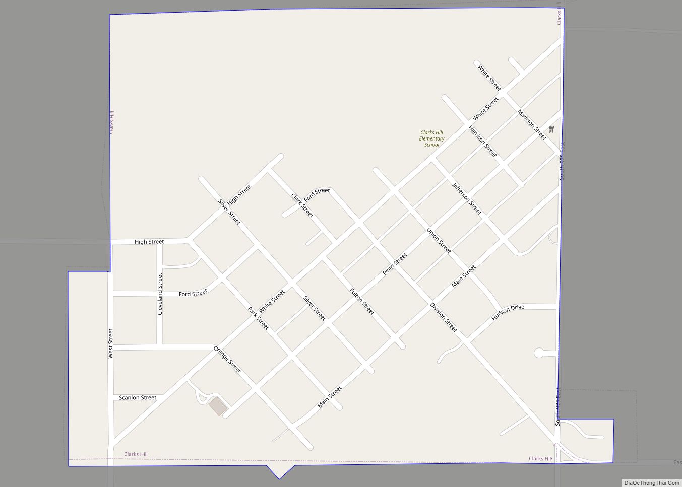
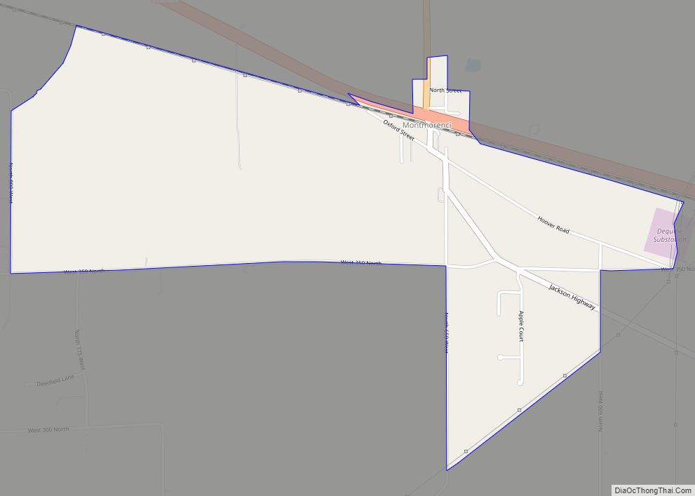
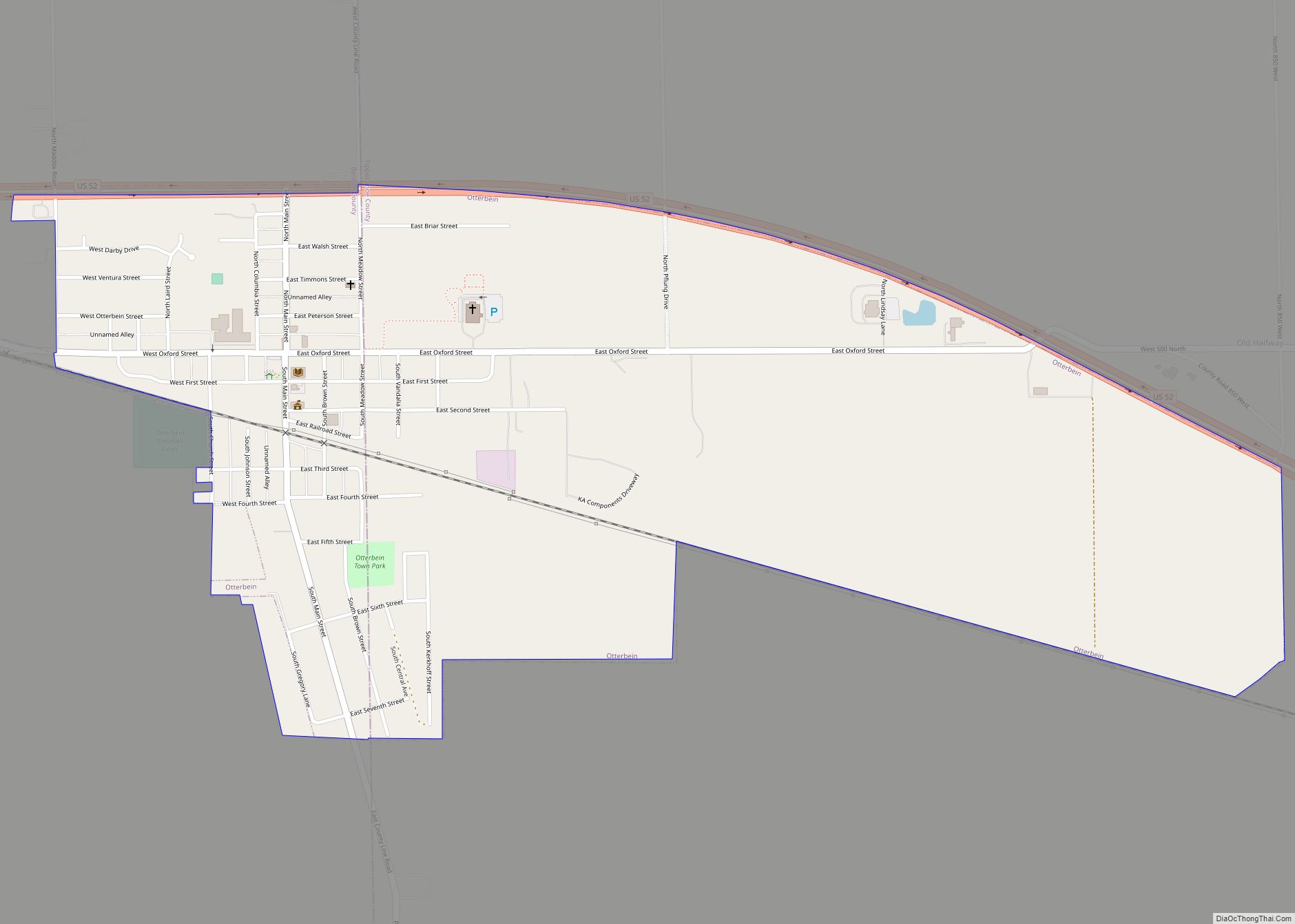
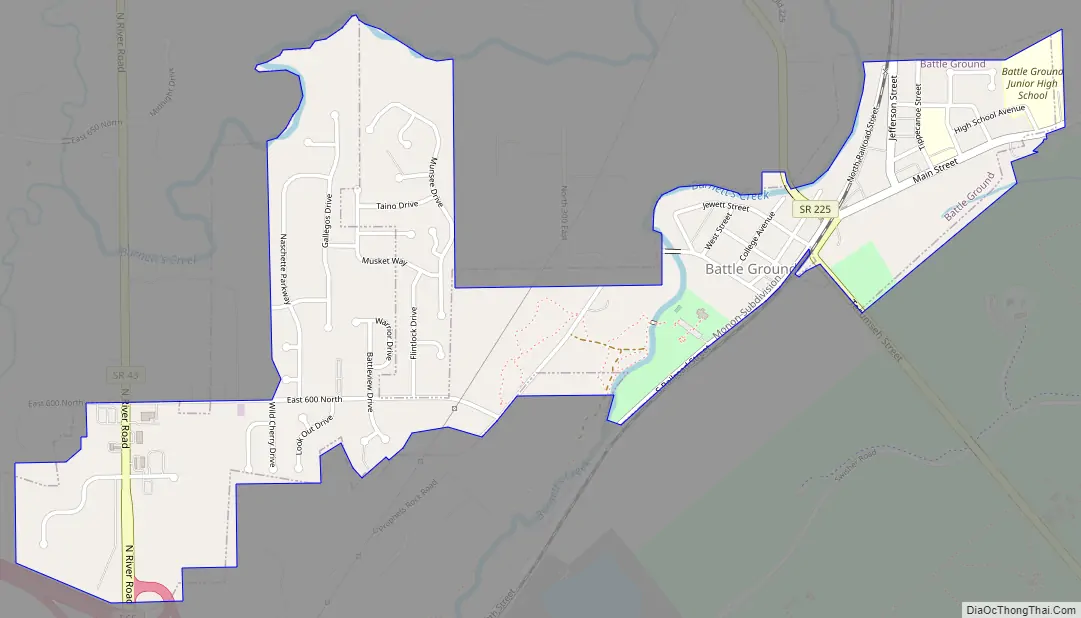
Online Interactive Map
Click on ![]() to view map in "full screen" mode.
to view map in "full screen" mode.
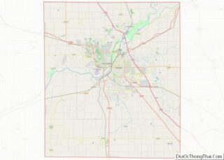
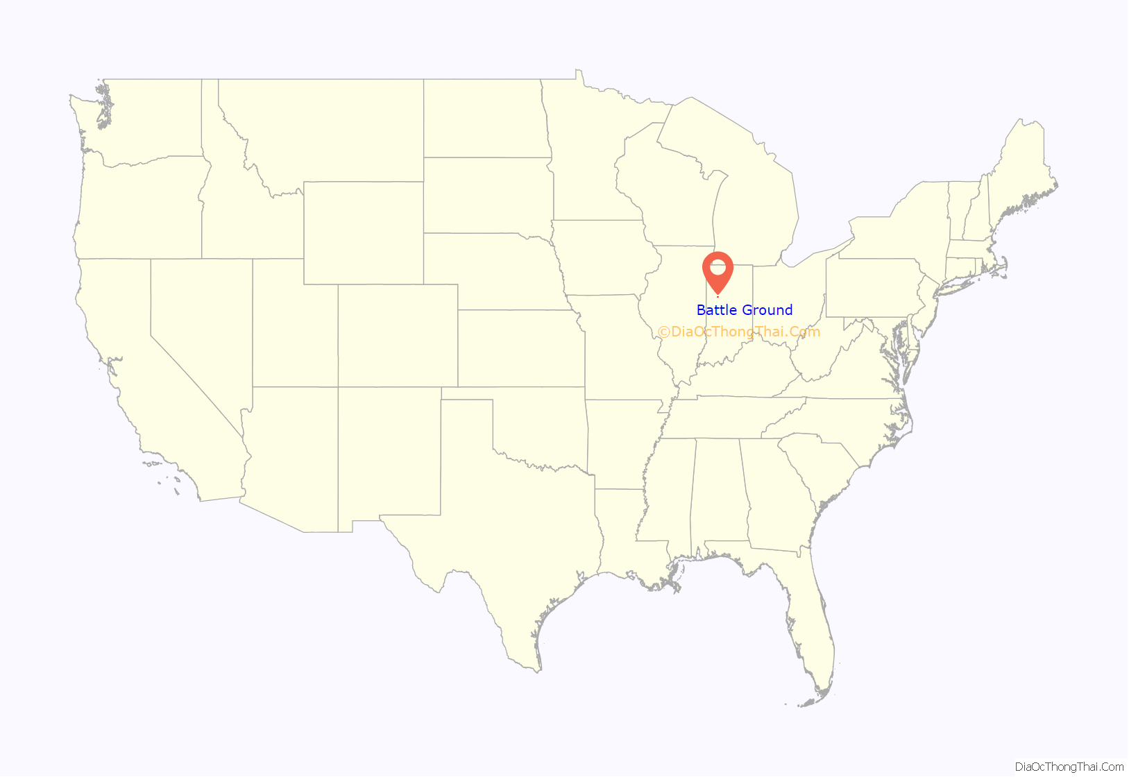
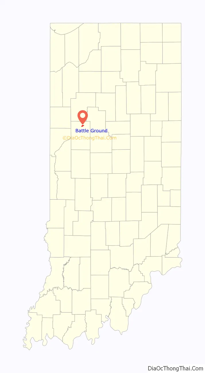
Battle Ground location map. Where is Battle Ground town?
History
In the late summer and the fall of 1811, William Henry Harrison, the governor of the Indiana Territory, organized a military expedition against the increasing resistance of the federation of Native American tribes being formed by the Shawnee brothers and chiefs, Tecumseh and Tenskwatawa, who was also known as the Prophet. With their community of Prophetstown as his objective, General Harrison marched from Vincennes, Indiana, at the head of a small army of about 1,000 men.
General Harrison met with representatives of the Prophet on November 6, 1811, when he arrived at Prophetstown. He presented demands in the name of his government. Harrison was to meet with the Prophet and his council the next day about the demands of the government. Harrison set up his encampment on a ridge about a mile northwest of Prophet’s Town.
Fearing a surprise attack by the Prophet’s forces, General Harrison placed his troops in battle formation, instructed his men to sleep fully clothed, and assigned a large detail of men for sentinel duty. On the morning of November 7, 1811, after 4:00, the camp was attacked by the Prophet.
After a fierce battle, Harrison and his army defeated the Prophet’s Indian confederation at the Battle of Tippecanoe. The defeat all but ended the Indian wars in the Midwest, especially as Tecumseh was killed at the Battle of the Thames in Canada in 1813.
Battle Ground was consolidated in 1867 with the Town of Harrisonville. The governments of both towns decided to name the consolidation Battle Ground. The Town of Battle Ground was named for the Battle of Tippecanoe, and the Town of Harrisonville was named after Harrison, the commander of the American forces of the Battle of Tippecanoe.
The Tippecanoe Battlefield monument was erected in 1908 and dedicated to the men who served and were killed in the Battle of Tippecanoe. The battlefield has been designated a National Historic Landmark and includes a museum and recreation area. The Battle of Tippecanoe Outdoor Drama premiered at a nearby amphitheater in Battle Ground in 1989 and played for two summers.
The post office at Battle Ground has been in operation since 1835.
Battle Ground Historic District was listed on the National Register of Historic Places in 1985.
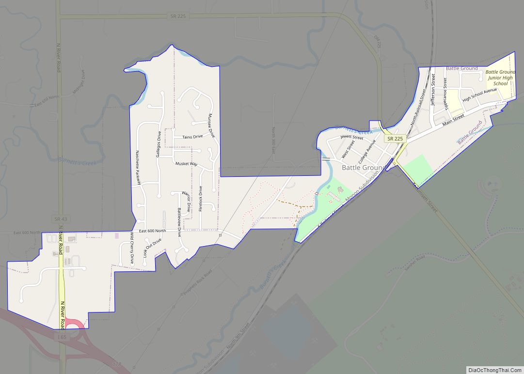
Battle Ground Road Map
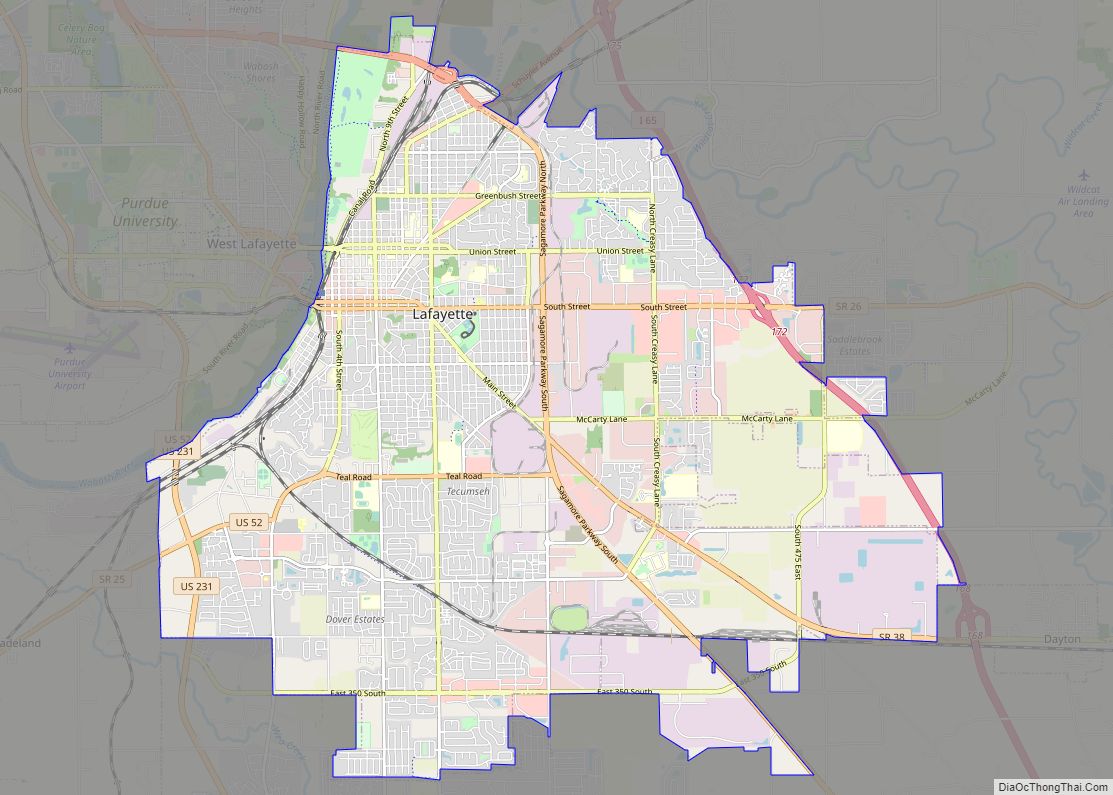
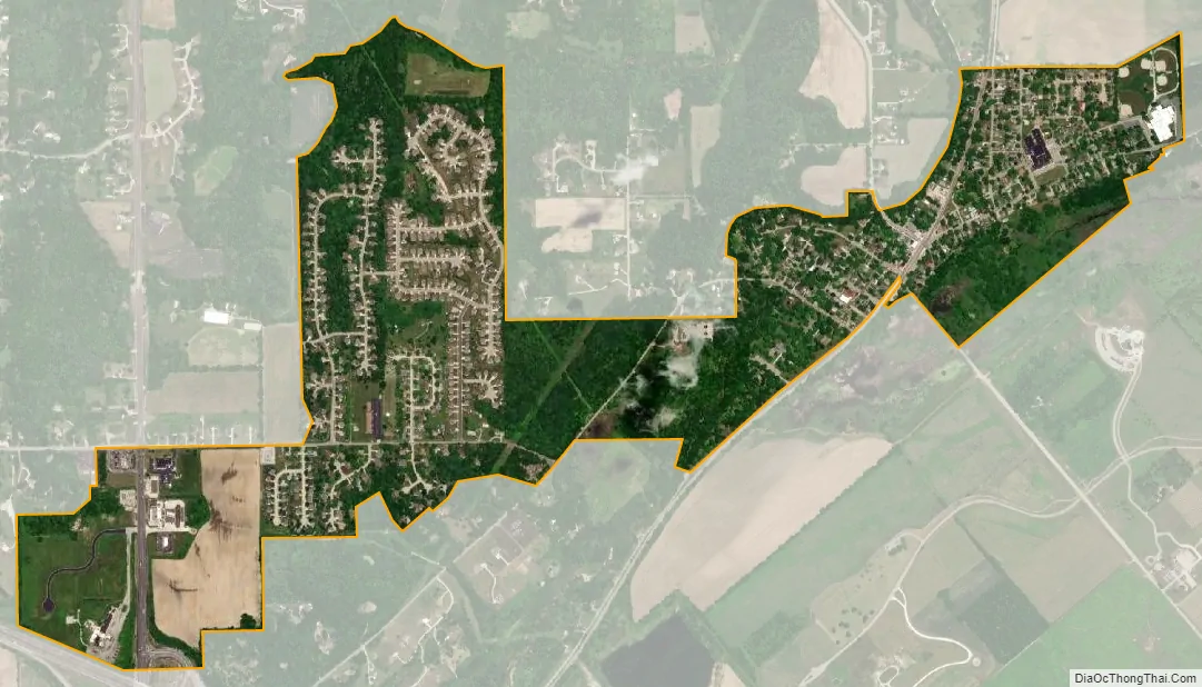
Battle Ground city Satellite Map
Geography
Battle Ground is located at 40°30′36″N 86°50′18″W / 40.51000°N 86.83833°W / 40.51000; -86.83833 (40.510110, −86.838220) in Tippecanoe Township, one and a quarter miles northwest of the Wabash River. Its elevation is approximately 585 feet. The small Harrison Creek begins near Battle Ground and flows east, while Burnett Creek skirts the town’s western edge and flows southwest.
According to the 2010 census, Battle Ground has a total area of 0.86 square miles (2.23 km), all land.
See also
Map of Indiana State and its subdivision:- Adams
- Allen
- Bartholomew
- Benton
- Blackford
- Boone
- Brown
- Carroll
- Cass
- Clark
- Clay
- Clinton
- Crawford
- Daviess
- De Kalb
- Dearborn
- Decatur
- Delaware
- Dubois
- Elkhart
- Fayette
- Floyd
- Fountain
- Franklin
- Fulton
- Gibson
- Grant
- Greene
- Hamilton
- Hancock
- Harrison
- Hendricks
- Henry
- Howard
- Huntington
- Jackson
- Jasper
- Jay
- Jefferson
- Jennings
- Johnson
- Knox
- Kosciusko
- LaGrange
- Lake
- Lake Michigan
- LaPorte
- Lawrence
- Madison
- Marion
- Marshall
- Martin
- Miami
- Monroe
- Montgomery
- Morgan
- Newton
- Noble
- Ohio
- Orange
- Owen
- Parke
- Perry
- Pike
- Porter
- Posey
- Pulaski
- Putnam
- Randolph
- Ripley
- Rush
- Saint Joseph
- Scott
- Shelby
- Spencer
- Starke
- Steuben
- Sullivan
- Switzerland
- Tippecanoe
- Tipton
- Union
- Vanderburgh
- Vermillion
- Vigo
- Wabash
- Warren
- Warrick
- Washington
- Wayne
- Wells
- White
- Whitley
- Alabama
- Alaska
- Arizona
- Arkansas
- California
- Colorado
- Connecticut
- Delaware
- District of Columbia
- Florida
- Georgia
- Hawaii
- Idaho
- Illinois
- Indiana
- Iowa
- Kansas
- Kentucky
- Louisiana
- Maine
- Maryland
- Massachusetts
- Michigan
- Minnesota
- Mississippi
- Missouri
- Montana
- Nebraska
- Nevada
- New Hampshire
- New Jersey
- New Mexico
- New York
- North Carolina
- North Dakota
- Ohio
- Oklahoma
- Oregon
- Pennsylvania
- Rhode Island
- South Carolina
- South Dakota
- Tennessee
- Texas
- Utah
- Vermont
- Virginia
- Washington
- West Virginia
- Wisconsin
- Wyoming