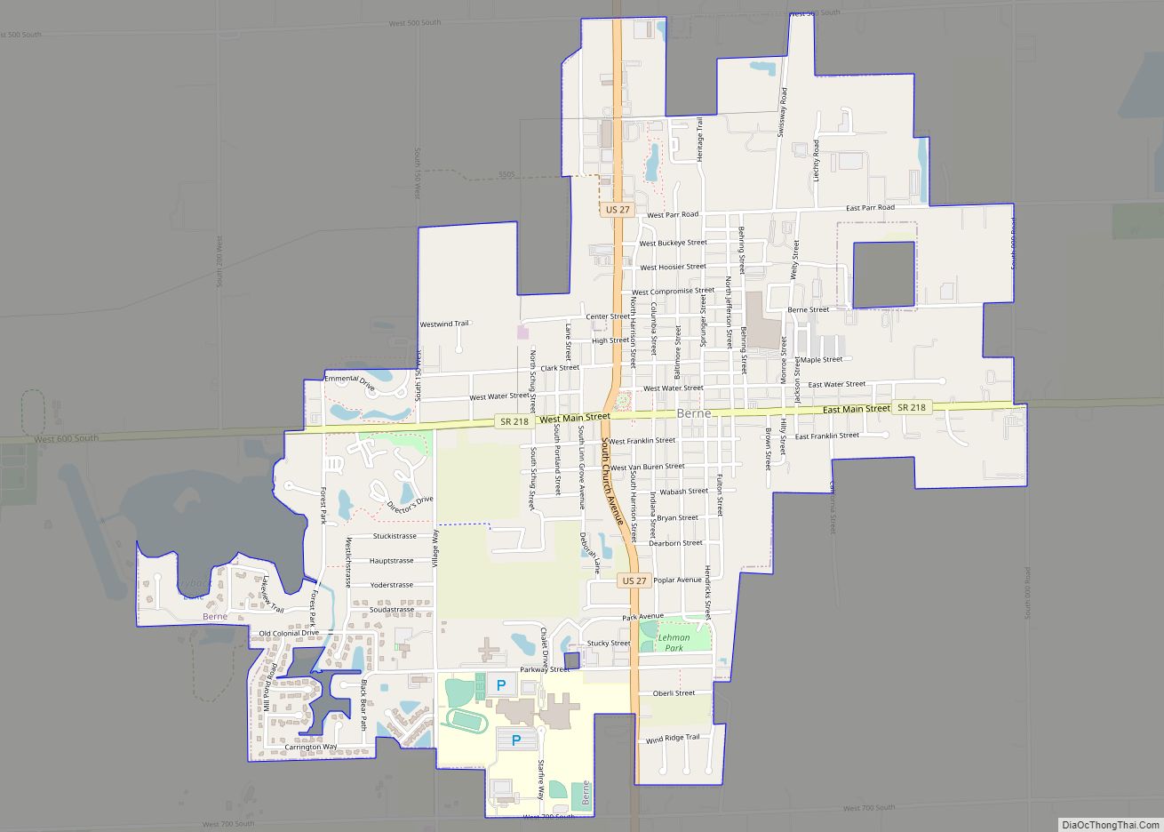
Berne (English: [bɜːn]) is a city within Monroe and Wabash townships, Adams County, Indiana, United States, located 35 miles (56 km) south of Fort Wayne. The population was 4,173 at the 2020 Census. Berne is widely known for its Swiss heritage, architecture and culture, and for its status as the “Furniture Capital of Indiana.” In 2021 Berne was rated the “Safest Small City in Indiana.” Bloomberg Businessweek rated Berne the 2nd “Best Place to Raise Your Kids” in Indiana in 2011.
Berne and the surrounding area have also become known for their large Amish population (the 5th largest Amish community in the USA), who speak Bernese German (a Swiss German dialect), as opposed to Pennsylvania Dutch.
| Name: | Berne city |
|---|---|
| LSAD Code: | 25 |
| LSAD Description: | city (suffix) |
| State: | Indiana |
| County: | Adams County |
| Founded: | 1852 |
| Elevation: | 843 ft (257 m) |
| Total Area: | 2.33 sq mi (6.03 km²) |
| Land Area: | 2.31 sq mi (5.99 km²) |
| Water Area: | 0.01 sq mi (0.04 km²) |
| Total Population: | 4,173 |
| Population Density: | 1,804.15/sq mi (696.69/km²) |
| ZIP code: | 46711, 46769 |
| Area code: | 260 |
| FIPS code: | 1804888 |
| Website: | www.cityofberne.com |
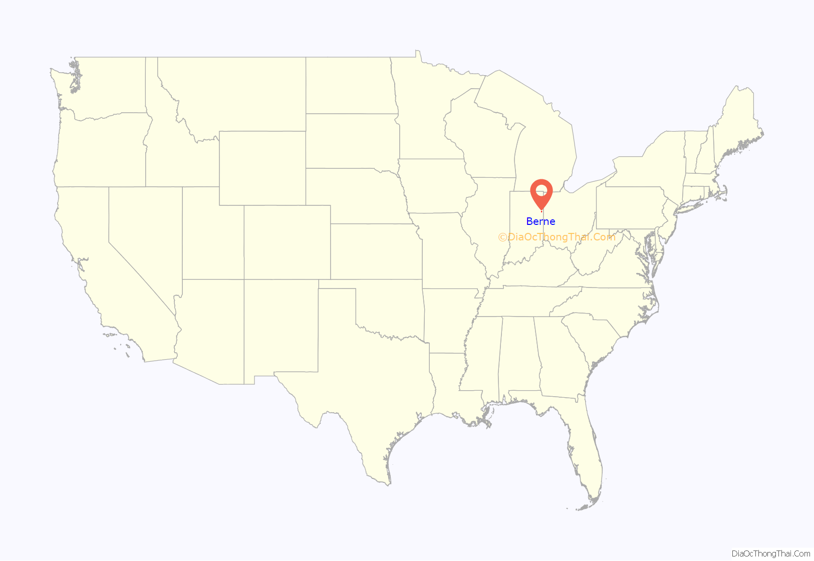
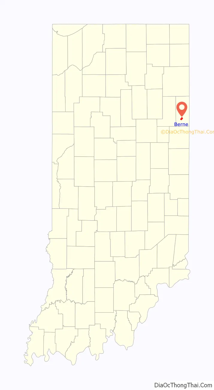
Online Interactive Map
Click on ![]() to view map in "full screen" mode.
to view map in "full screen" mode.
Berne location map. Where is Berne city?
History
Berne was settled in 1852 by Mennonite immigrants who came directly from Switzerland (Münsterberg, in the Jura Mountains near Moutier) and named the community after their homeland’s capital. They began the chore of preparing for farming by clearing the land. However, farm markets were severely limited because of treacherous mud roads and distant trade centers. The advent of the railroad was soon to be the answer to the immigrants’ prayers.
When the Grand Rapids and Indiana Railroad laid plans to construct a rail line through Adams County, two farmers, John Hilty and Abraham Lehman, offered a proposition; they would donate land to the railroad in exchange for the building of a rail depot in the small community. The deed indicates that Abraham Lehman and Christian Leichty were the parties who donated the land for the depot. The railroad companies agreed, and Hilty and Lehman (as recorded on the original plat map of Berne on file at the Adams County, Indiana, records office) quickly platted ten building lots in anticipation of what was to come – more settlers. The lots were located in Wabash Township along an east to west road later named Main Street. On Christmas Day, 1871, the first train arrived at the local depot. This historical event marked the beginning of Berne, which was officially recorded as a community soon after. A post office was established in Berne in 1872.
A steady stream of Swiss and German people came into the area from that train, as did English-speaking migrants, some of whom became successful businessmen in the new community. They contributed immensely in the growth of Berne. After the population of the town exceeded 2,500, on a petition of two-thirds of the residents, the town decided to become a city in 1887. By 1895 the community was the second largest city in the county with an entrepreneurial business spirit and community activities revolving around many different church and social groups.
The General Conference of the Mennonite Church has been held in Berne four times – the first in 1884, the last in 1947. The First Mennonite Church in Berne is the largest of its kind in North America, and previously had the largest congregation. It is affiliated with the Lancaster Mennonite Conference.
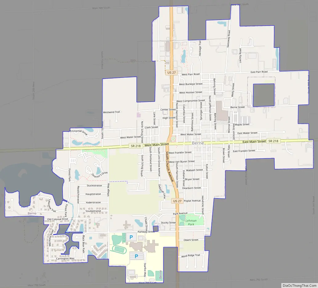
Berne Road Map
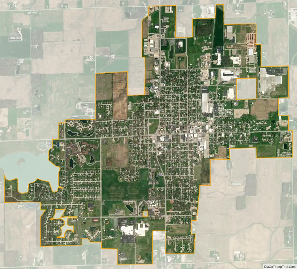
Berne city Satellite Map
Geography
Berne is located in northeastern Indiana at 40°39′29″N 84°57′15″W / 40.65806°N 84.95417°W / 40.65806; -84.95417 (40.658146, -84.954256).
According to the 2010 census, Berne has a total area of 2.08 square miles (5.39 km), all land.
Teays River
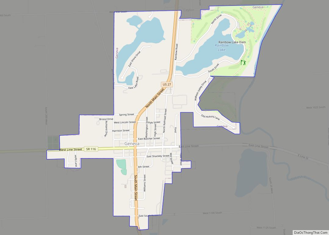
An ancient pre-glacial river known as the “Teays River” (about the size of the Ohio River) with its headwaters near present-day Blowing Rock, North Carolina, used to pass through Virginia, West Virginia and Ohio and run just east of Berne (with its western edge passing near the intersection of 000 Road with State Road 218) before flowing southwest through the present town of Geneva into Jay County. It then continued its course across Indiana into Illinois, draining most of the east-central United States. The glaciers of the last Ice Age (the Pleistocene) bisected the Teays River Valley and buried it underneath at least 400 feet of glacial drift (the largest remaining piece is the Kanawha River of West Virginia). Although the river does not flow anymore, the underground Teays River Valley still contains significant water deposits, making Berne and Geneva very water-rich areas. In fact, wells just to the east of Berne provide the much larger city of Decatur (c.10 miles north) with a large proportion of its water supply. The current locations of many wetland areas – such as Limberlost Swamp Nature Preserve, Loblolly Marsh Nature Preserve, Limberlost Park and Rainbow Bend Park lie over the old Teays River Valley.
See also
Map of Indiana State and its subdivision:- Adams
- Allen
- Bartholomew
- Benton
- Blackford
- Boone
- Brown
- Carroll
- Cass
- Clark
- Clay
- Clinton
- Crawford
- Daviess
- De Kalb
- Dearborn
- Decatur
- Delaware
- Dubois
- Elkhart
- Fayette
- Floyd
- Fountain
- Franklin
- Fulton
- Gibson
- Grant
- Greene
- Hamilton
- Hancock
- Harrison
- Hendricks
- Henry
- Howard
- Huntington
- Jackson
- Jasper
- Jay
- Jefferson
- Jennings
- Johnson
- Knox
- Kosciusko
- LaGrange
- Lake
- Lake Michigan
- LaPorte
- Lawrence
- Madison
- Marion
- Marshall
- Martin
- Miami
- Monroe
- Montgomery
- Morgan
- Newton
- Noble
- Ohio
- Orange
- Owen
- Parke
- Perry
- Pike
- Porter
- Posey
- Pulaski
- Putnam
- Randolph
- Ripley
- Rush
- Saint Joseph
- Scott
- Shelby
- Spencer
- Starke
- Steuben
- Sullivan
- Switzerland
- Tippecanoe
- Tipton
- Union
- Vanderburgh
- Vermillion
- Vigo
- Wabash
- Warren
- Warrick
- Washington
- Wayne
- Wells
- White
- Whitley
- Alabama
- Alaska
- Arizona
- Arkansas
- California
- Colorado
- Connecticut
- Delaware
- District of Columbia
- Florida
- Georgia
- Hawaii
- Idaho
- Illinois
- Indiana
- Iowa
- Kansas
- Kentucky
- Louisiana
- Maine
- Maryland
- Massachusetts
- Michigan
- Minnesota
- Mississippi
- Missouri
- Montana
- Nebraska
- Nevada
- New Hampshire
- New Jersey
- New Mexico
- New York
- North Carolina
- North Dakota
- Ohio
- Oklahoma
- Oregon
- Pennsylvania
- Rhode Island
- South Carolina
- South Dakota
- Tennessee
- Texas
- Utah
- Vermont
- Virginia
- Washington
- West Virginia
- Wisconsin
- Wyoming