Map of Angola city, Indiana
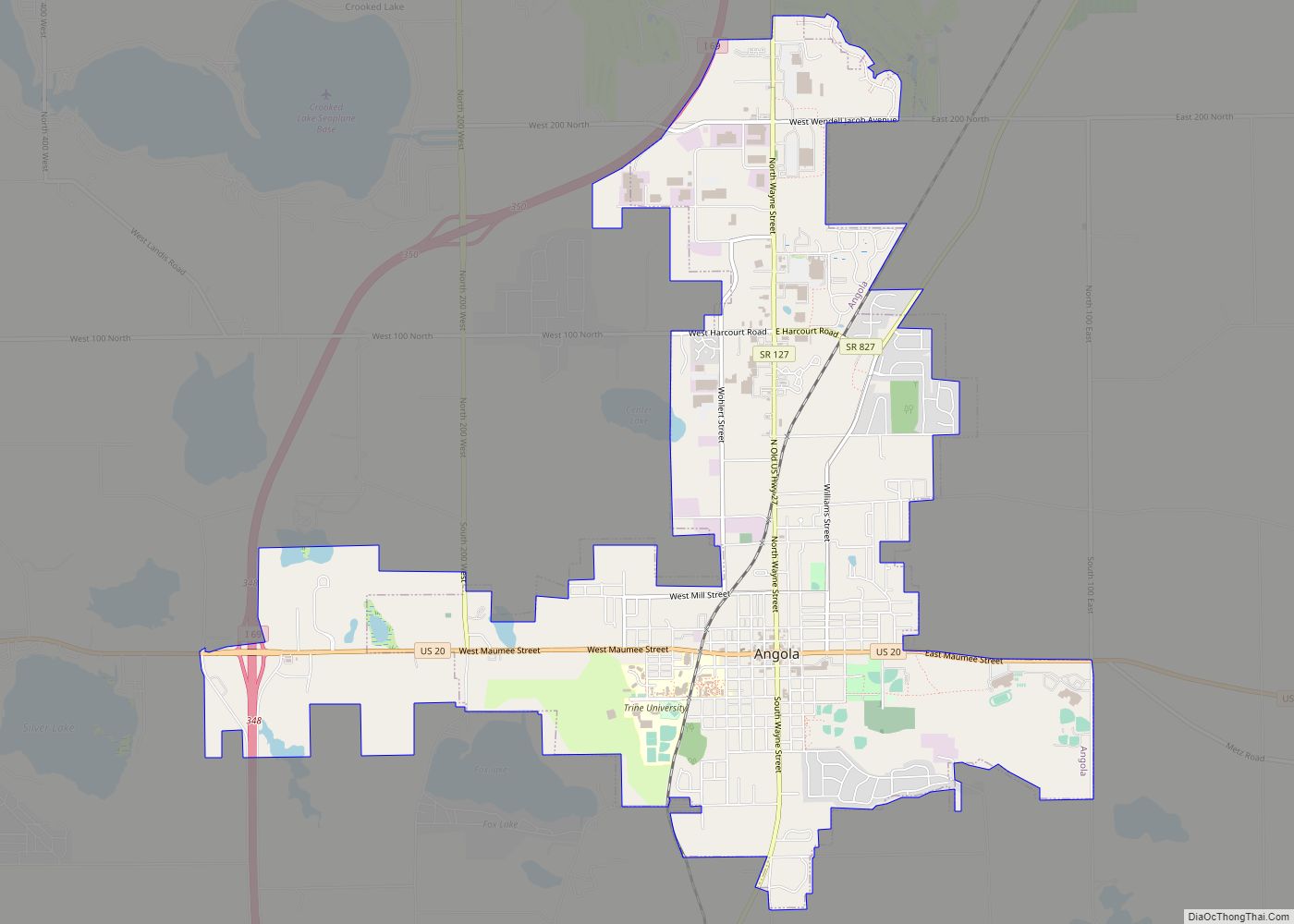
Angola is a city in Pleasant Township, Steuben County, Indiana, United States. The population was 8,612 at the 2010 census. The city is the county seat of Steuben County. Angola was founded by Thomas Gale and Cornelius Gilmore on June 28, 1838, and is home to Trine University. The town is served by I-69 and ... Read more
Map of Angola city, Indiana
Map of Andrews town, Indiana
Andrews is a town in Dallas Township, Huntington County, Indiana, United States. The population was 1,048 at the 2020 census. Andrews town overview: Name: Andrews town LSAD Code: 43 LSAD Description: town (suffix) State: Indiana County: Huntington County Elevation: 712 ft (217 m) Total Area: 0.64 sq mi (1.66 km²) Land Area: 0.63 sq mi (1.64 km²) Water Area: 0.01 sq mi (0.02 km²) Total Population: ... Read more
Map of Andrews town, Indiana
Map of Anderson city, Indiana
Anderson is a city in Madison County, Indiana, United States. Named after Chief William Anderson, it is the county seat of Madison County. The city is the headquarters of the Church of God (Anderson) and home of Anderson University, which is affiliated with the Church of God. Highlights of the city include the historic Paramount ... Read more
Map of Anderson city, Indiana
Map of Arlington CDP, Indiana
Arlington is an unincorporated community in Posey Township, in the northwestern part of Rush County, Indiana, United States. It lies just south of the B&O Railroad, on U.S. Route 52, 8 miles west of Rushville. The elevation is 922 feet (281 m). Arlington CDP overview: Name: Arlington CDP LSAD Code: 57 LSAD Description: CDP (suffix) State: ... Read more
Map of Arlington CDP, Indiana
Map of Argos town
Argos is a town in Green and Walnut townships, Marshall County, Indiana, United States. The population was 1,777 at the 2020 census. Argos town overview: Name: Argos town LSAD Code: 43 LSAD Description: town (suffix) State: Indiana County: Marshall County Elevation: 728 ft (222 m) Total Area: 1.30 sq mi (3.36 km²) Land Area: 1.29 sq mi (3.33 km²) Water Area: 0.01 sq mi (0.03 km²) ... Read more
Map of Argos town
Map of Arcadia town, Indiana
Arcadia is a town in Jackson Township, Hamilton County, Indiana, United States. The population was 1,666 at the 2010 census. Arcadia town overview: Name: Arcadia town LSAD Code: 43 LSAD Description: town (suffix) State: Indiana County: Hamilton County Elevation: 860 ft (262 m) Total Area: 0.55 sq mi (1.43 km²) Land Area: 0.55 sq mi (1.43 km²) Water Area: 0.00 sq mi (0.00 km²) Total Population: ... Read more
Map of Arcadia town, Indiana
Map of Attica city, Indiana
Attica is a city in Logan Township, Fountain County, Indiana, United States. Attica city overview: Name: Attica city LSAD Code: 25 LSAD Description: city (suffix) State: Indiana County: Fountain County Elevation: 545 ft (166 m) Total Area: 1.80 sq mi (4.67 km²) Land Area: 1.80 sq mi (4.67 km²) Water Area: 0.00 sq mi (0.00 km²) Total Population: 3,036 Population Density: 1,682.93/sq mi (649.85/km²) ZIP code: 47918 ... Read more
Map of Attica city, Indiana
Map of Atlanta town, Indiana
Atlanta town overview: Name: Atlanta town LSAD Code: 43 LSAD Description: town (suffix) State: Indiana County: Hamilton County FIPS code: 1802602 Online Interactive Map Atlanta online map. Source: Basemap layers from Google Map, Open Street Map (OSM), Arcgisonline, Wmflabs. Boundary Data from Database of Global Administrative Areas. Atlanta location map. Where is Atlanta town? Atlanta ... Read more
Map of Atlanta town, Indiana
Map of Ashley town, Indiana
Ashley is a town in Indiana located on the border of Smithfield Township, DeKalb County and Steuben Township, Steuben County. The population was 983 at the 2010 census. Ashley town overview: Name: Ashley town LSAD Code: 43 LSAD Description: town (suffix) State: Indiana County: DeKalb County, Steuben County Elevation: 1,001 ft (305 m) Total Area: 1.90 sq mi (4.93 km²) ... Read more
Map of Ashley town, Indiana
Map of Austin city, Indiana
Austin is a city in Jennings Township, Scott County, in the U.S. state of Indiana. The population was 4,272 at the 2000 census, at which time it was a town; Austin became a city on January 1, 2008. The population was 4,295 at the 2010 census. Austin city overview: Name: Austin city LSAD Code: 25 ... Read more
Map of Austin city, Indiana
Map of Aurora city, Indiana
Aurora is a city in Center Township, Dearborn County, Indiana, United States. The population was 3,750 at the 2010 census. Aurora city overview: Name: Aurora city LSAD Code: 25 LSAD Description: city (suffix) State: Indiana County: Dearborn County Incorporated: 1848 Elevation: 486 ft (148 m) Total Area: 3.54 sq mi (9.16 km²) Land Area: 3.29 sq mi (8.53 km²) Water Area: 0.24 sq mi (0.63 km²) ... Read more
Map of Aurora city, Indiana
Map of Auburn city, Indiana
Auburn is a city in DeKalb County, Indiana, United States. The population was 13,820 at the 2020 census. Founded in 1836 by Wesley Park (1811–1868), the city is the county seat of DeKalb County. Auburn is also known as Home of the Classics. Auburn city overview: Name: Auburn city LSAD Code: 25 LSAD Description: city ... Read more
Map of Auburn city, Indiana