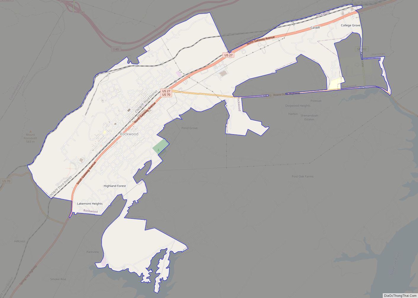
Map of Rives town, Tennessee

Map of Rives town, Tennessee

Rives is a town in Obion County, Tennessee. The population was 326 at the 2010 census. It is part of the Union City, TN–KY Micropolitan Statistical Area. Rives town overview: Name: Rives town LSAD Code: 43 LSAD Description: town (suffix) State: Tennessee County: Obion County Elevation: 299 ft (91 m) Total Area: 0.34 sq mi (0.89 km²) Land Area: 0.34 sq mi … Read more

Map of Saltillo town, Tennessee

Map of Saltillo town, Tennessee

Saltillo is a town in Hardin County, Tennessee, United States. The population was 420 at the 2020 census. Saltillo is located on the left bank of the Tennessee River, about 12 miles north of Savannah. Saltillo town overview: Name: Saltillo town LSAD Code: 43 LSAD Description: town (suffix) State: Tennessee County: Hardin County Elevation: 413 ft … Read more

Map of Sale Creek CDP

Map of Sale Creek CDP

Sale Creek is an unincorporated community and census-designated place (CDP) in northern Hamilton County, Tennessee, United States. It is located along U.S. Route 27 between Chattanooga and Dayton, Tennessee. Sale Creek’s population was 2,901 as of the 2020 census. Sale Creek is home to Sale Creek Middle/High School. A local curiosity, the reportedly “haunted” Shipley … Read more

Map of Rutledge town, Tennessee

Map of Rutledge town, Tennessee

Rutledge is a city in and the county seat of Grainger County, Tennessee. The city is part of both the Knoxville metropolitan area and the Morristown metropolitan area. As of the 2020 census, the city had a total population of 1,321. Rutledge town overview: Name: Rutledge town LSAD Code: 43 LSAD Description: town (suffix) State: … Read more

Map of Sevierville city

Map of Sevierville city

Sevierville (/səˈvɪərvɪl/ sə-VEER-vil) is a city in and the county seat of Sevier County, Tennessee, located in eastern Tennessee. The population was 17,889 at the 2020 United States Census. Sevierville city overview: Name: Sevierville city LSAD Code: 25 LSAD Description: city (suffix) State: Tennessee County: Sevier County Founded: 1795 Incorporated: 1901 Elevation: 903 ft (275 m) Total … Read more

Map of Selmer town

Map of Selmer town

Selmer is a town in and the county seat of McNairy County, Tennessee, in the southwestern part of the state. The population was 4,396 at the 2010 census and estimated at 4,400 at the 2018 census. It is named after Selma, Alabama. Buford Pusser served as the sheriff of McNairy County from 1964 to 1970. … Read more

Map of Scotts Hill town

Map of Scotts Hill town

Scotts Hill is a town in Decatur and Henderson counties in the U.S. state of Tennessee. The population was 984 at the 2010 census. The community was named after Micajah Scott, a pioneer settler and the first merchant to settle in the town. The name “Scotts Hill” is derived from the location of Scott’s store, … Read more

Map of Savannah city, Tennessee

Map of Savannah city, Tennessee

Savannah is a city in and the county seat of Hardin County, Tennessee, United States. The population was 7,213 at the 2020 census. Savannah is located along the east side of the Tennessee River. Savannah hosted the NAIA college football national championship game from 1996 to 2007, and is home to several places of historical … Read more

Map of Saulsbury town

Map of Saulsbury town

Saulsbury is a town in rural Hardeman County, Tennessee. It is located along State Highway 57 in southwest Hardeman County. The population was 99 at the 2000 census and 81 at the 2010 census showing a decrease of 18. Saulsbury is the least-populated incorporated municipality in Tennessee. Saulsbury town overview: Name: Saulsbury town LSAD Code: … Read more

Map of Sardis town, Tennessee

Map of Sardis town, Tennessee

Sardis is a town in Henderson County, Tennessee, United States. The population was 381 at the 2010 census. The community was named after a Methodist church grounds near the site. Sardis town overview: Name: Sardis town LSAD Code: 43 LSAD Description: town (suffix) State: Tennessee County: Henderson County Elevation: 515 ft (157 m) Total Area: 2.50 sq mi (6.47 km²) … Read more

Map of Samburg town

Map of Samburg town

Samburg is a town in Obion County, Tennessee, United States. The population was 210 at the 2020 census. Samburg is located on the eastern shores of Reelfoot Lake. On the night of December 10 and morning of December 11, 2021 a devastating tornado destroyed much of the town. Samburg town overview: Name: Samburg town LSAD … Read more

Map of Smithville city, Tennessee

Map of Smithville city, Tennessee

Smithville is a city in DeKalb County, Tennessee, United States. The population was 5,004 at the 2020 census, up from 3,994 at the 2010 census. It is the county seat of DeKalb County. Smithville is home to the Smithville Fiddler’s Jamboree, which it has hosted annually since 1972. Smithville city overview: Name: Smithville city LSAD … Read more