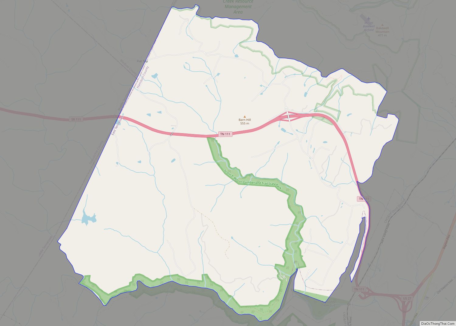
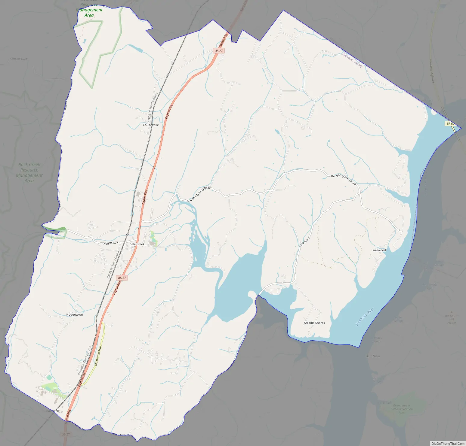
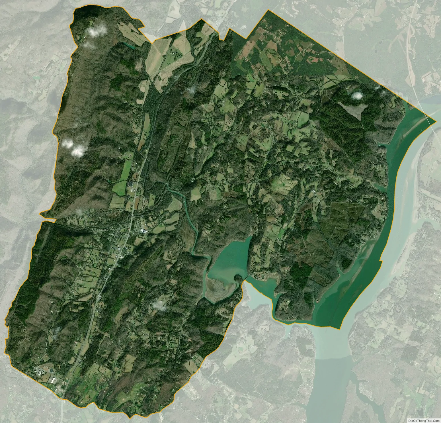
Sale Creek is an unincorporated community and census-designated place (CDP) in northern Hamilton County, Tennessee, United States. It is located along U.S. Route 27 between Chattanooga and Dayton, Tennessee.
Sale Creek’s population was 2,901 as of the 2020 census. Sale Creek is home to Sale Creek Middle/High School. A local curiosity, the reportedly “haunted” Shipley Hollow Road, is in Sale Creek.
| Name: | Sale Creek CDP |
|---|---|
| LSAD Code: | 57 |
| LSAD Description: | CDP (suffix) |
| State: | Tennessee |
| County: | Hamilton County |
| Elevation: | 725 ft (221 m) |
| Total Area: | 32.72 sq mi (84.74 km²) |
| Land Area: | 30.14 sq mi (78.06 km²) |
| Water Area: | 2.58 sq mi (6.68 km²) |
| Total Population: | 3,021 |
| Population Density: | 100.23/sq mi (38.70/km²) |
| ZIP code: | 37373 |
| Area code: | 423 |
| FIPS code: | 4766220 |
| GNISfeature ID: | 1300533 |
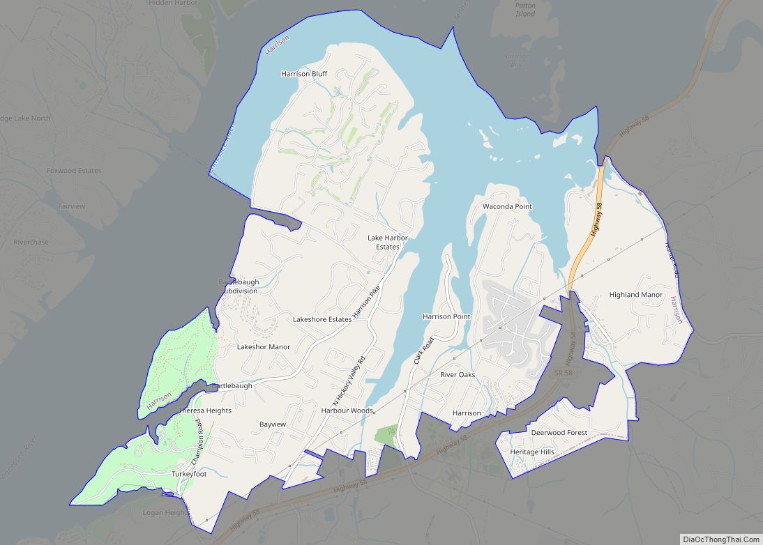
Online Interactive Map
Click on ![]() to view map in "full screen" mode.
to view map in "full screen" mode.
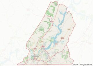
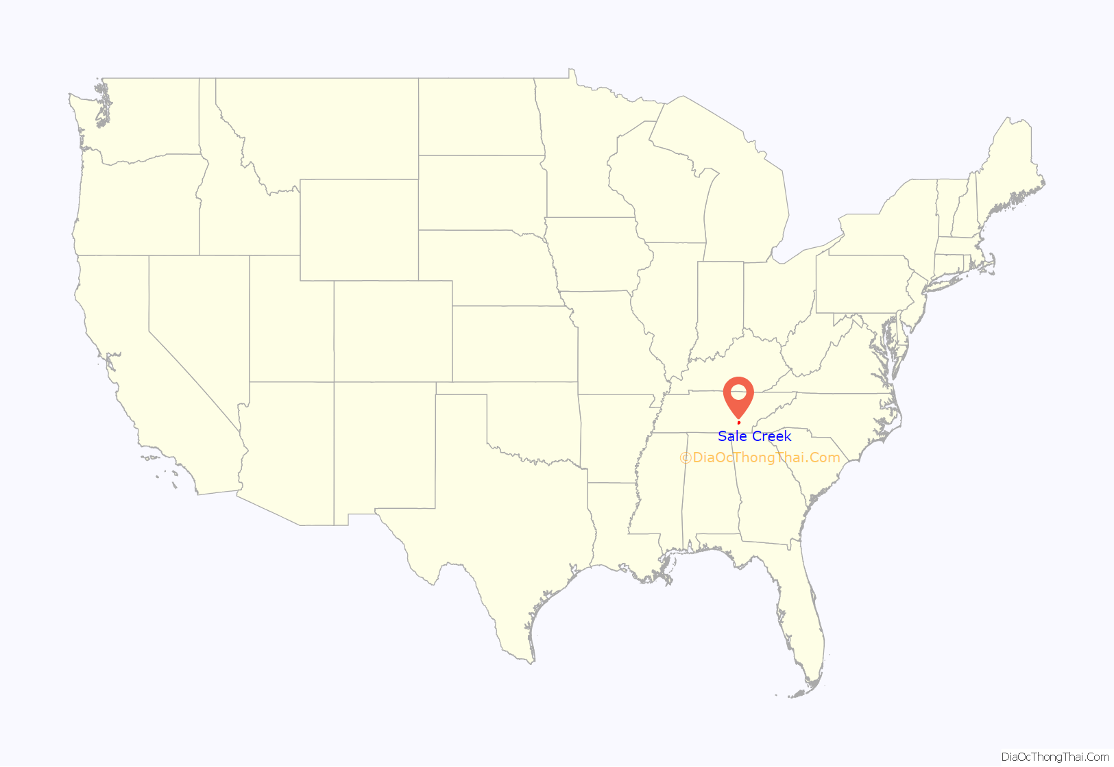
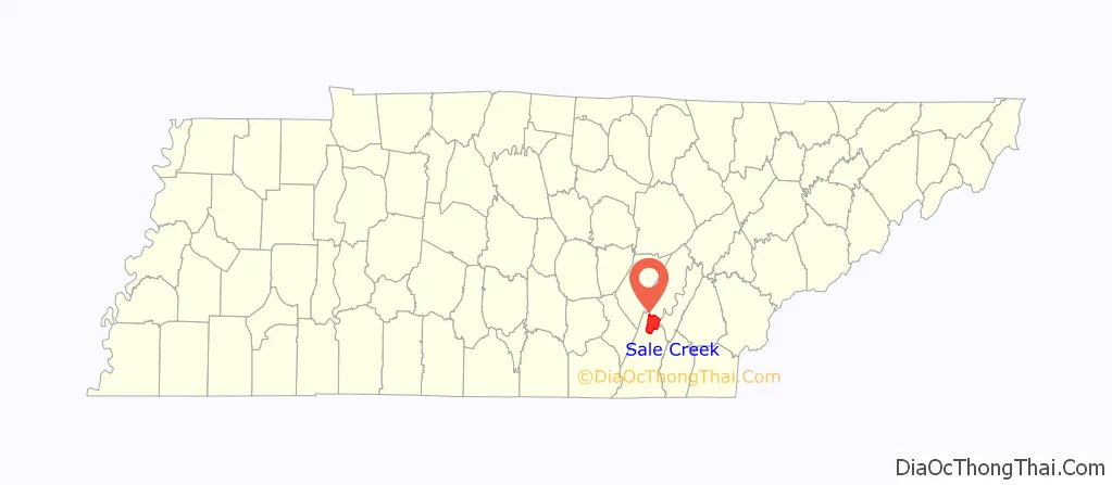
Sale Creek location map. Where is Sale Creek CDP?
History
The community takes its name from the creek which runs through it. The creek got its name from the auction held along its banks consisting of the goods and arms taken from the eleven towns of the militant Cherokee in the region before they were burned during the raid of Evan Shelby’s troops in 1779 during the Cherokee–American wars.
The area was occupied by the 6th Tennessee Infantry US from September to December 1863 during the Civil War.
Sale Creek Road Map
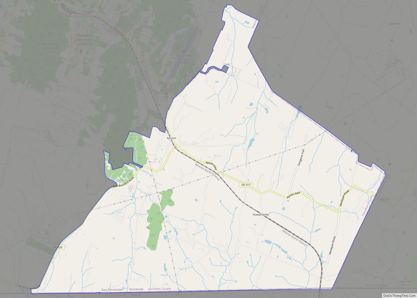
Sale Creek city Satellite Map
See also
Map of Tennessee State and its subdivision:- Anderson
- Bedford
- Benton
- Bledsoe
- Blount
- Bradley
- Campbell
- Cannon
- Carroll
- Carter
- Cheatham
- Chester
- Claiborne
- Clay
- Cocke
- Coffee
- Crockett
- Cumberland
- Davidson
- Decatur
- DeKalb
- Dickson
- Dyer
- Fayette
- Fentress
- Franklin
- Gibson
- Giles
- Grainger
- Greene
- Grundy
- Hamblen
- Hamilton
- Hancock
- Hardeman
- Hardin
- Hawkins
- Haywood
- Henderson
- Henry
- Hickman
- Houston
- Humphreys
- Jackson
- Jefferson
- Johnson
- Knox
- Lake
- Lauderdale
- Lawrence
- Lewis
- Lincoln
- Loudon
- Macon
- Madison
- Marion
- Marshall
- Maury
- McMinn
- McNairy
- Meigs
- Monroe
- Montgomery
- Moore
- Morgan
- Obion
- Overton
- Perry
- Pickett
- Polk
- Putnam
- Rhea
- Roane
- Robertson
- Rutherford
- Scott
- Sequatchie
- Sevier
- Shelby
- Smith
- Stewart
- Sullivan
- Sumner
- Tipton
- Trousdale
- Unicoi
- Union
- Van Buren
- Warren
- Washington
- Wayne
- Weakley
- White
- Williamson
- Wilson
- Alabama
- Alaska
- Arizona
- Arkansas
- California
- Colorado
- Connecticut
- Delaware
- District of Columbia
- Florida
- Georgia
- Hawaii
- Idaho
- Illinois
- Indiana
- Iowa
- Kansas
- Kentucky
- Louisiana
- Maine
- Maryland
- Massachusetts
- Michigan
- Minnesota
- Mississippi
- Missouri
- Montana
- Nebraska
- Nevada
- New Hampshire
- New Jersey
- New Mexico
- New York
- North Carolina
- North Dakota
- Ohio
- Oklahoma
- Oregon
- Pennsylvania
- Rhode Island
- South Carolina
- South Dakota
- Tennessee
- Texas
- Utah
- Vermont
- Virginia
- Washington
- West Virginia
- Wisconsin
- Wyoming