Savannah is a city in and the county seat of Hardin County, Tennessee, United States. The population was 7,213 at the 2020 census. Savannah is located along the east side of the Tennessee River.
Savannah hosted the NAIA college football national championship game from 1996 to 2007, and is home to several places of historical significance, including the Cherry Family Mansion.
| Name: | Savannah city |
|---|---|
| LSAD Code: | 25 |
| LSAD Description: | city (suffix) |
| State: | Tennessee |
| County: | Hardin County |
| Incorporated: | 1833 |
| Elevation: | 443 ft (135 m) |
| Total Area: | 6.82 sq mi (17.67 km²) |
| Land Area: | 6.82 sq mi (17.67 km²) |
| Water Area: | 0.00 sq mi (0.00 km²) |
| Total Population: | 7,213 |
| Population Density: | 1,057.47/sq mi (408.27/km²) |
| ZIP code: | 38372 |
| Area code: | 731 |
| FIPS code: | 4766720 |
| GNISfeature ID: | 1300820 |
| Website: | www.cityofsavannah.org |
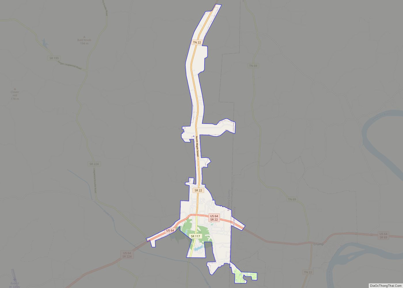
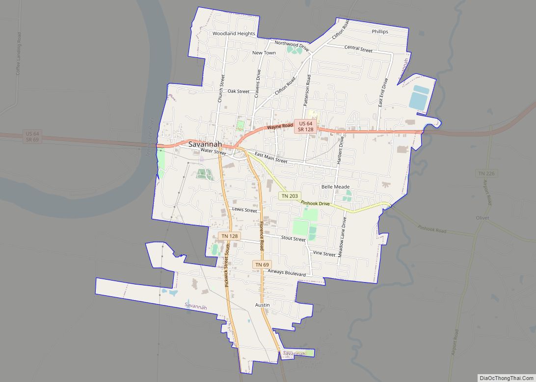
Online Interactive Map
Click on ![]() to view map in "full screen" mode.
to view map in "full screen" mode.
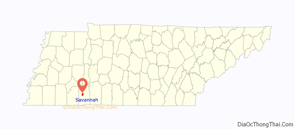
Savannah location map. Where is Savannah city?

History
The city’s original name was “Rudd’s Ferry”, named for James Rudd, an early settler who established a ferry at the site in the early 1820s. Rudd’s Ferry was later purchased by a wealthy landowner, David Robinson. The city was renamed “Savannah” after Savannah, Georgia, the hometown of Rudd’s wife, Elizabeth.
Battle of Shiloh
Hardin County was the site of the 1862 Battle of Shiloh (also known as the “Battle of Pittsburg Landing”) during the Civil War. The battleground site is 10 miles (16 km) southwest of the city of Savannah. Union General Ulysses S. Grant commandeered the Cherry Mansion just off the city square for use as a headquarters during the battle.
Pickwick Landing State Park
Pickwick Landing State Park is 12 miles (19 km) south of Savannah. Originally a steamboat stop, the Tennessee Valley Authority bought the site in the 1930s during the Great Depression and constructed a dam and Pickwick Lake so electricity could be generated. In 1969, Tennessee bought 681 acres (276 ha) from the TVA and made it a state park.
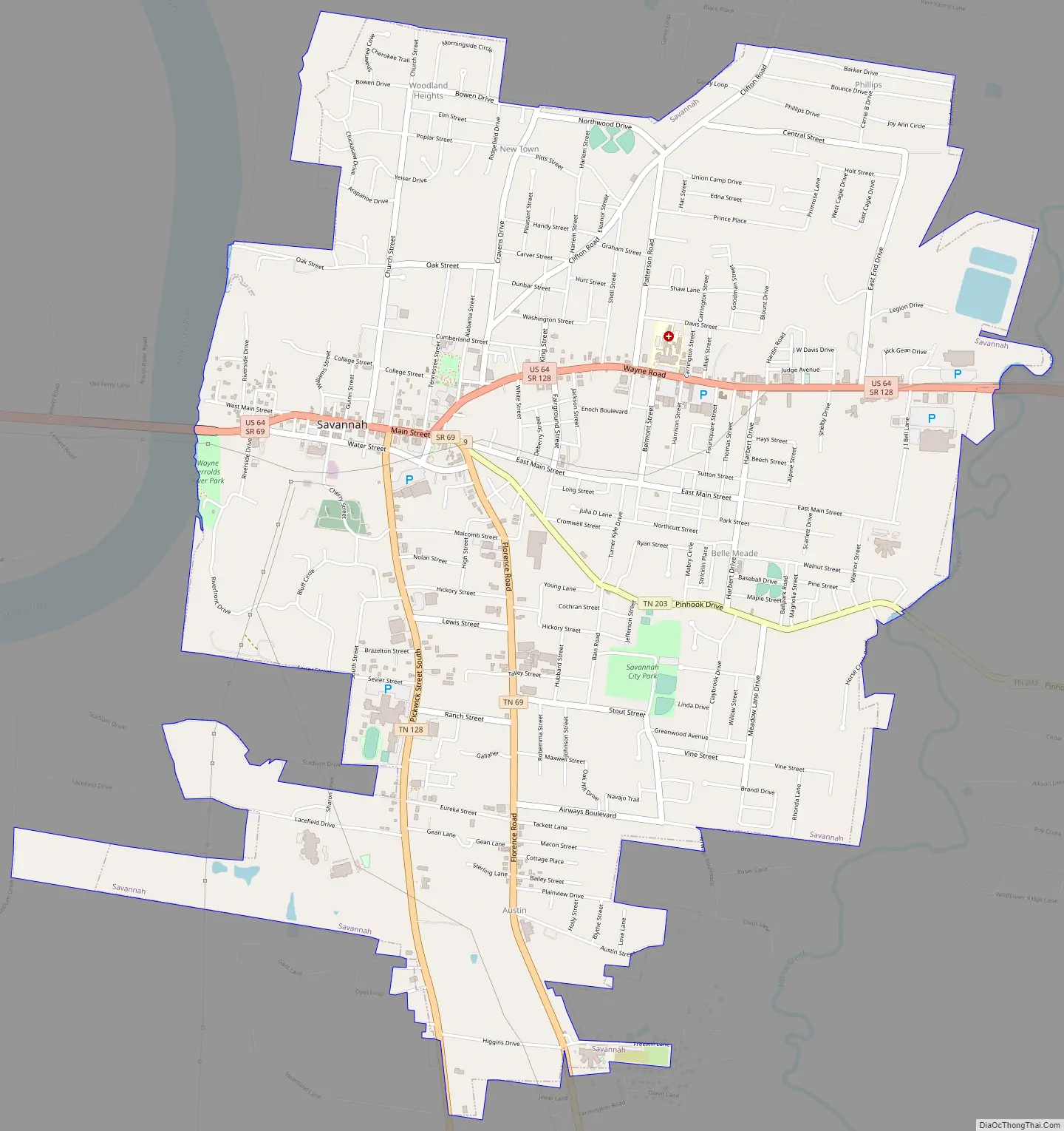
Savannah Road Map
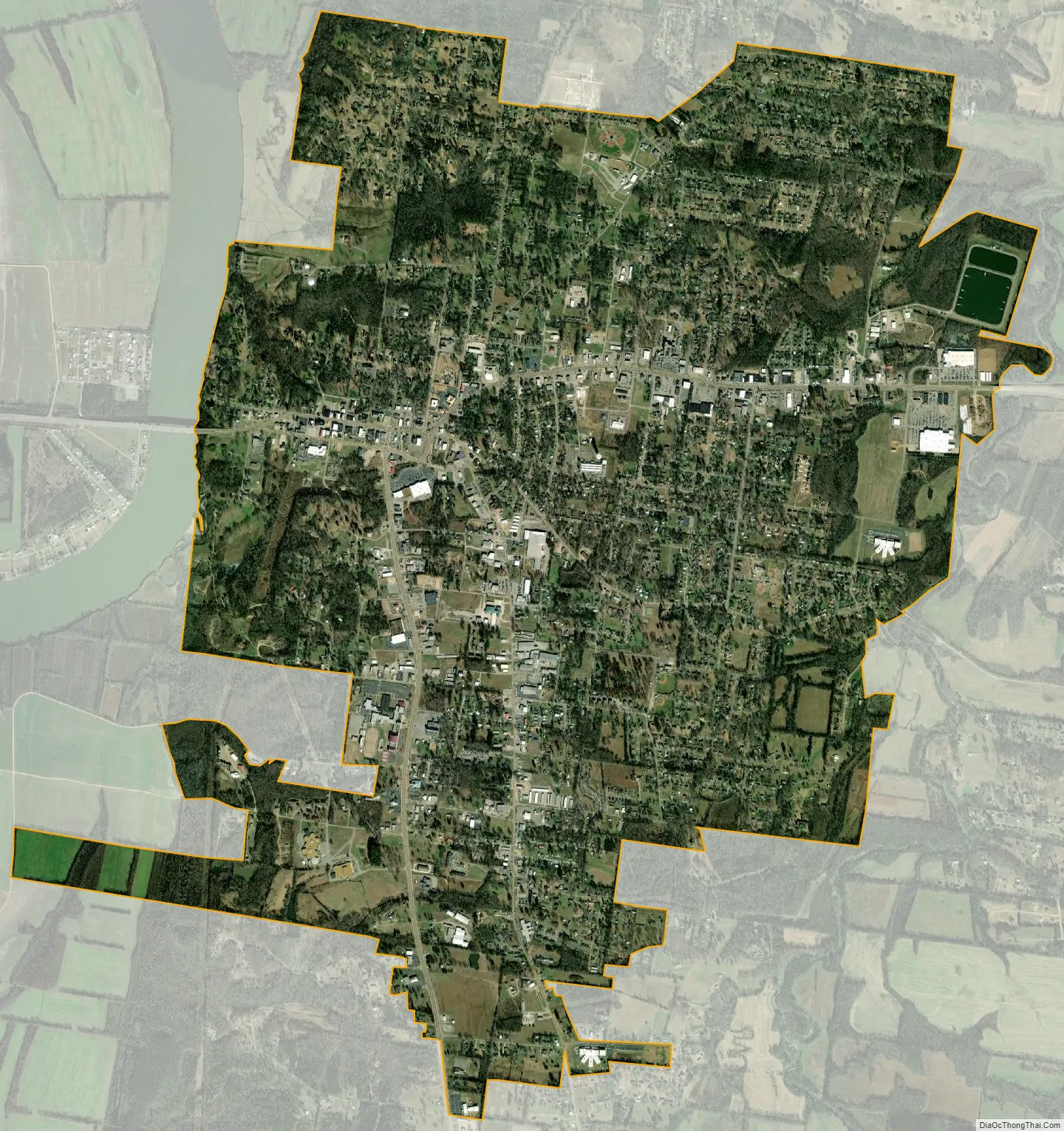
Savannah city Satellite Map
Geography
Savannah is located just west of the center of Hardin County at 35°13′25″N 88°14′13″W / 35.22361°N 88.23694°W / 35.22361; -88.23694 (35.223674, -88.237011), on the east bank of the Tennessee River. U.S. Route 64 passes through the center of town on Bridge Avenue, Main Street, and Wayne Road. US 64 leads east 30 miles (48 km) to Waynesboro and west 21 miles (34 km) to Selmer. Tennessee State Route 69 leads southeast 26 miles (42 km) to the Alabama border. Florence, Alabama, is 49 miles (79 km) southeast of Savannah via SR 69 and Alabama State Route 20.
According to the United States Census Bureau, Savannah has a total area of 6.5 square miles (16.9 km), all of it recorded as land.
Climate
See also
Map of Tennessee State and its subdivision:- Anderson
- Bedford
- Benton
- Bledsoe
- Blount
- Bradley
- Campbell
- Cannon
- Carroll
- Carter
- Cheatham
- Chester
- Claiborne
- Clay
- Cocke
- Coffee
- Crockett
- Cumberland
- Davidson
- Decatur
- DeKalb
- Dickson
- Dyer
- Fayette
- Fentress
- Franklin
- Gibson
- Giles
- Grainger
- Greene
- Grundy
- Hamblen
- Hamilton
- Hancock
- Hardeman
- Hardin
- Hawkins
- Haywood
- Henderson
- Henry
- Hickman
- Houston
- Humphreys
- Jackson
- Jefferson
- Johnson
- Knox
- Lake
- Lauderdale
- Lawrence
- Lewis
- Lincoln
- Loudon
- Macon
- Madison
- Marion
- Marshall
- Maury
- McMinn
- McNairy
- Meigs
- Monroe
- Montgomery
- Moore
- Morgan
- Obion
- Overton
- Perry
- Pickett
- Polk
- Putnam
- Rhea
- Roane
- Robertson
- Rutherford
- Scott
- Sequatchie
- Sevier
- Shelby
- Smith
- Stewart
- Sullivan
- Sumner
- Tipton
- Trousdale
- Unicoi
- Union
- Van Buren
- Warren
- Washington
- Wayne
- Weakley
- White
- Williamson
- Wilson
- Alabama
- Alaska
- Arizona
- Arkansas
- California
- Colorado
- Connecticut
- Delaware
- District of Columbia
- Florida
- Georgia
- Hawaii
- Idaho
- Illinois
- Indiana
- Iowa
- Kansas
- Kentucky
- Louisiana
- Maine
- Maryland
- Massachusetts
- Michigan
- Minnesota
- Mississippi
- Missouri
- Montana
- Nebraska
- Nevada
- New Hampshire
- New Jersey
- New Mexico
- New York
- North Carolina
- North Dakota
- Ohio
- Oklahoma
- Oregon
- Pennsylvania
- Rhode Island
- South Carolina
- South Dakota
- Tennessee
- Texas
- Utah
- Vermont
- Virginia
- Washington
- West Virginia
- Wisconsin
- Wyoming