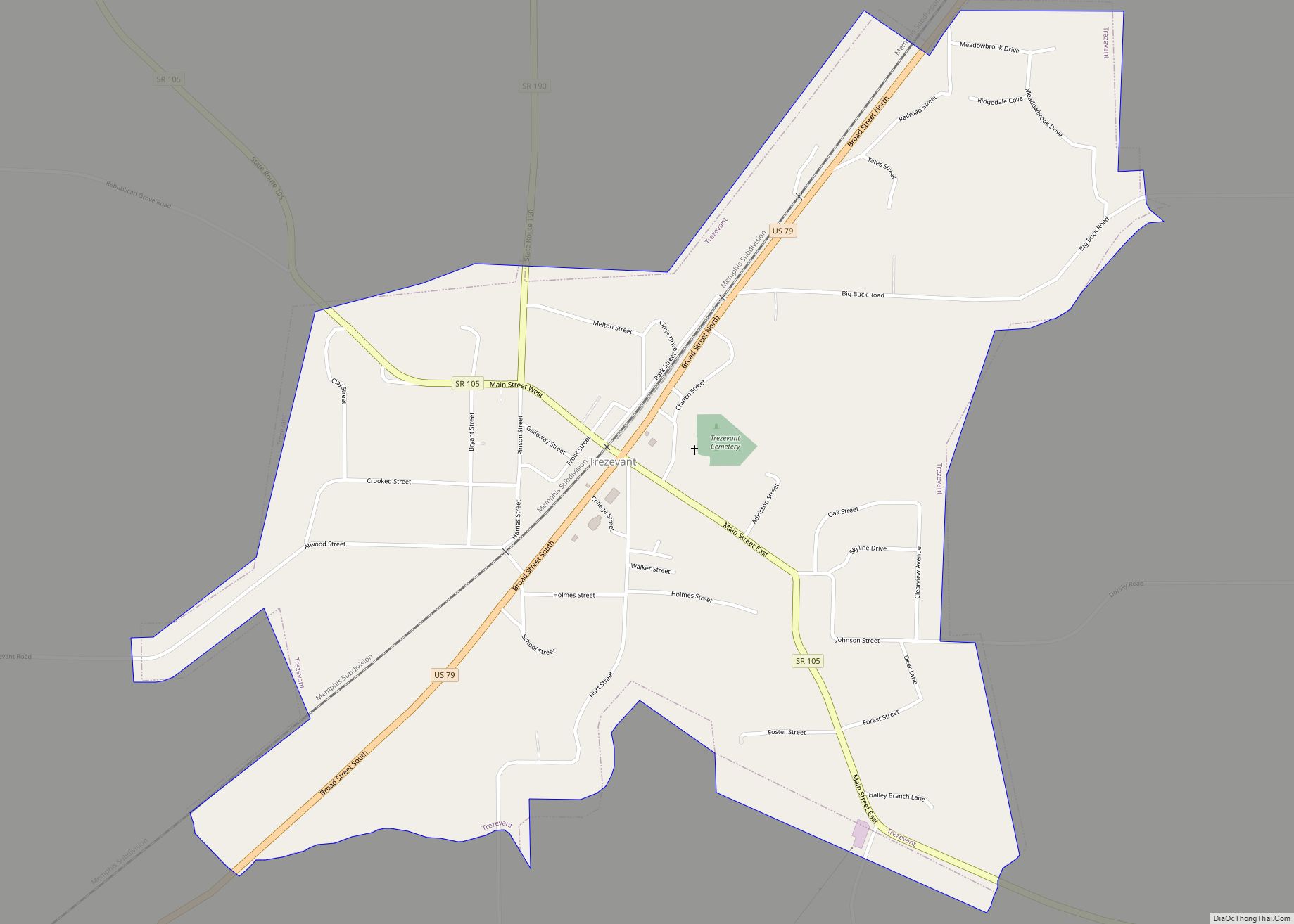
Map of Troy town, Tennessee

Map of Troy town, Tennessee

Troy is a town in Obion County, Tennessee, United States. The population was 1,423 at the 2020 census. It is part of the Union City, TN–KY Micropolitan Statistical Area. Troy town overview: Name: Troy town LSAD Code: 43 LSAD Description: town (suffix) State: Tennessee County: Obion County Founded: 1825 Incorporated: 1901 Elevation: 377 ft (115 m) Total … Read more

Map of Wartburg city

Map of Wartburg city

Wartburg is a city in Morgan County, Tennessee, United States. The population was 918 at the 2010 census. It is the county seat of Morgan County. Wartburg city overview: Name: Wartburg city LSAD Code: 25 LSAD Description: city (suffix) State: Tennessee County: Morgan County Incorporated: 1968 Elevation: 1,312 ft (400 m) Total Area: 1.13 sq mi (2.92 km²) Land Area: … Read more

Map of Walterhill CDP

Map of Walterhill CDP

Walterhill, also known as Walter Hill, is a census-designated place (CDP) in Rutherford County, Tennessee. The population was 401 at the 2010 census. Walterhill is the site of the 34-acre (140,000 m) Walterhill Floodplain State Natural Area, established to support a rare plant species found in the Stones River floodplain, the Stones River bladderpod (Paysonia stonensis). … Read more

Map of Walnut Hill CDP, Tennessee

Map of Walnut Hill CDP, Tennessee

Walnut Hill is a census-designated place (CDP) in Sullivan County, Tennessee, United States. The population was 2,394 at the 2010 census. It is part of the Kingsport–Bristol (TN)–Bristol (VA) Metropolitan Statistical Area, which is a component of the Johnson City–Kingsport–Bristol, TN-VA Combined Statistical Area – commonly known as the “Tri-Cities” region. Walnut Hill CDP overview: … Read more

Map of Walnut Grove CDP, Tennessee

Map of Walnut Grove CDP, Tennessee

Walnut Grove is a census-designated place in Sumner County, Tennessee, United States. Its population was 864 as of the 2010 census. The community incorporated as a town in 1998. It disincorporated on July 1, 2001, after the law under which it had incorporated was ruled unconstitutional. Walnut Grove CDP overview: Name: Walnut Grove CDP LSAD … Read more

Map of Walland CDP

Map of Walland CDP

Walland is an unincorporated community and census-designated place (CDP) in Blount County, Tennessee, in the Southeastern United States. Its population was 259 as of the 2010 census. Walland is the site of a post office and is the place name associated with zip code 37886, which covers an area beyond the Walland community. Walland CDP … Read more

Map of Walden town, Tennessee

Map of Walden town, Tennessee

Walden is a town located in Hamilton County, Tennessee, United States. The population was 1,981 at the 2020 census and up from 1,898 at the 2010 census. It is part of the Chattanooga, Tennessee–Georgia Metropolitan Statistical Area. Walden, along with the community of Fairmount are located within the town of Signal Mountain‘s zip code, 37377. … Read more

Map of Vonore town

Map of Vonore town

Vonore is a town in Monroe County, which is located on the southeast border of the U.S. state of Tennessee. The population was 1,574 as of the 2020 census. The city hall, library, community center, police department, and fire department are located on Church Street. Vonore town overview: Name: Vonore town LSAD Code: 43 LSAD … Read more

Map of Viola town, Tennessee

Map of Viola town, Tennessee

Viola is a town in Warren County, Tennessee, United States. The population was 129 at the 2000 census and 131 at the 2010 census. Viola town overview: Name: Viola town LSAD Code: 43 LSAD Description: town (suffix) State: Tennessee County: Warren County Incorporated: 1901 Elevation: 1,001 ft (305 m) Total Area: 0.49 sq mi (1.26 km²) Land Area: 0.49 sq mi (1.26 km²) … Read more

Map of Vanleer town

Map of Vanleer town

Vanleer is a town in Dickson County, Tennessee, United States. The population was estimated to be 422 in 2019, up from 395 at the 2010 census. The town is approximately 49 miles northwest of Nashville and is located within the city’s greater metropolitan area. The town is named for Anthony Wayne Van Leer, onetime operator … Read more

Map of Unionville CDP, Tennessee

Map of Unionville CDP, Tennessee

Unionville is an unincorporated community and census-designated place (CDP) in Bedford County, Tennessee, United States. Its population was 1,368 as of the 2010 census. Unionville has a post office with ZIP code 37180. Unionville CDP overview: Name: Unionville CDP LSAD Code: 57 LSAD Description: CDP (suffix) State: Tennessee County: Bedford County Elevation: 722 ft (220 m) Total … Read more

Map of Wartrace town

Map of Wartrace town

Wartrace is a town in Bedford County, Tennessee, United States. The population was 548 at the 2000 census and 651 at the 2010 census. It is located northeast of Shelbyville. The downtown area is listed on the National Register of Historic Places as the Wartrace Historic District. Wartrace is a hub of the Tennessee Walking … Read more