Walden is a town located in Hamilton County, Tennessee, United States. The population was 1,981 at the 2020 census and up from 1,898 at the 2010 census. It is part of the Chattanooga, Tennessee–Georgia Metropolitan Statistical Area.
Walden, along with the community of Fairmount are located within the town of Signal Mountain‘s zip code, 37377.
| Name: | Walden town |
|---|---|
| LSAD Code: | 43 |
| LSAD Description: | town (suffix) |
| State: | Tennessee |
| County: | Hamilton County |
| Incorporated: | 1975 |
| Elevation: | 1,900 ft (600 m) |
| Total Area: | 3.53 sq mi (9.15 km²) |
| Land Area: | 3.53 sq mi (9.15 km²) |
| Water Area: | 0.00 sq mi (0.00 km²) |
| Total Population: | 1,981 |
| Population Density: | 560.71/sq mi (216.52/km²) |
| Area code: | 423 |
| FIPS code: | 4777540 |
| GNISfeature ID: | 1304322 |
| Website: | waldentn.gov |
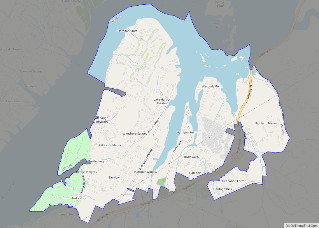
Online Interactive Map
Click on ![]() to view map in "full screen" mode.
to view map in "full screen" mode.
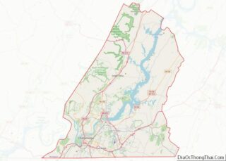
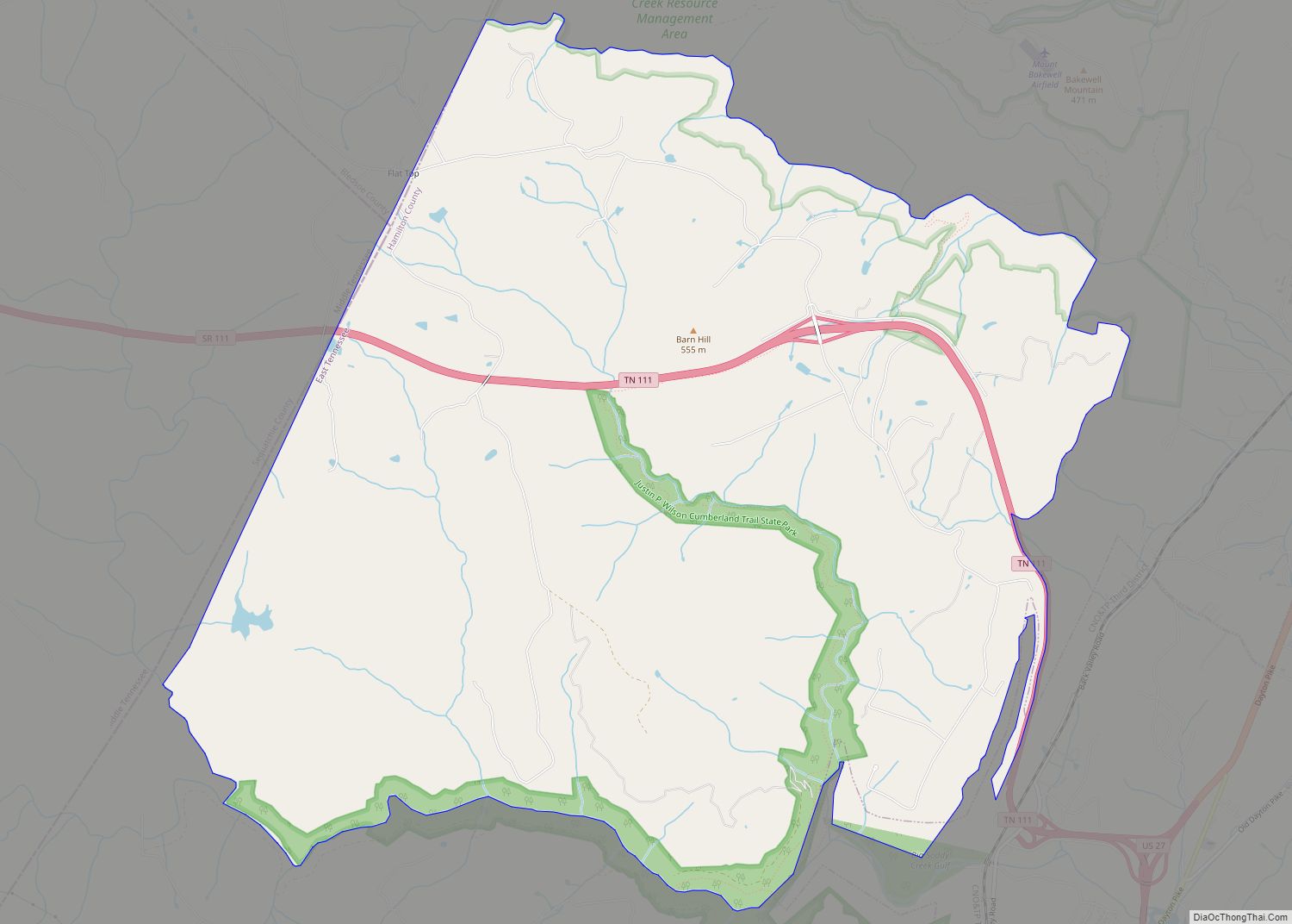
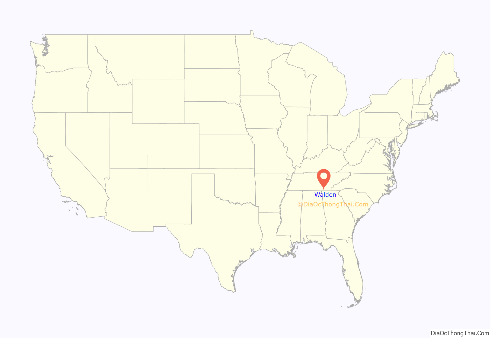
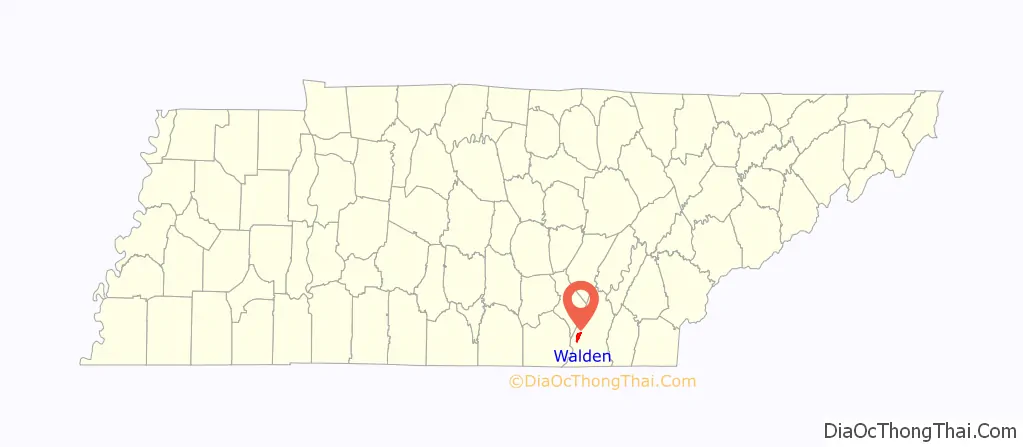
Walden location map. Where is Walden town?
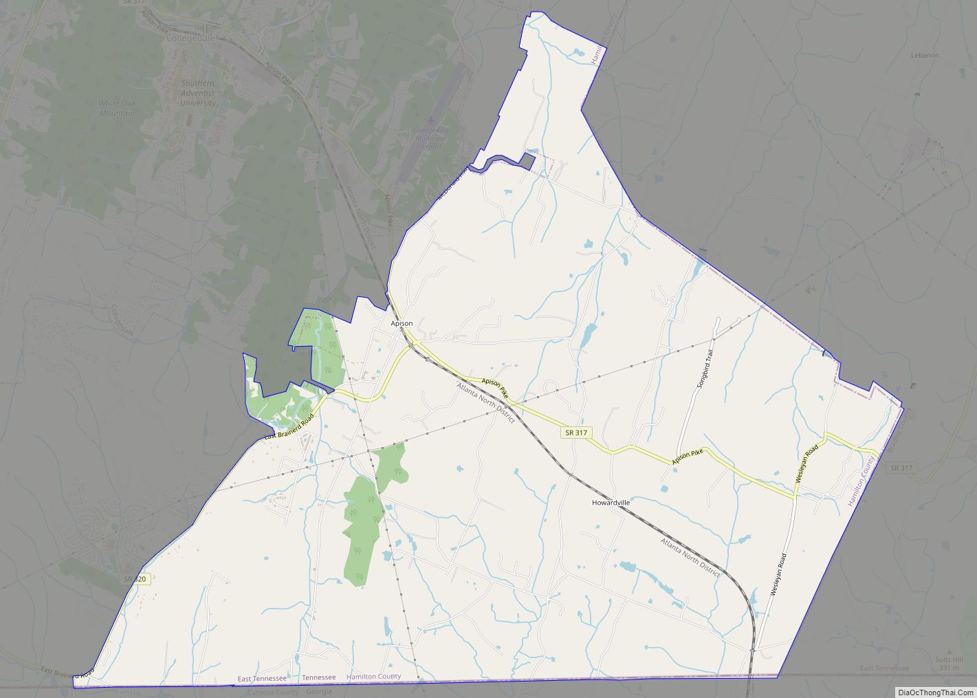
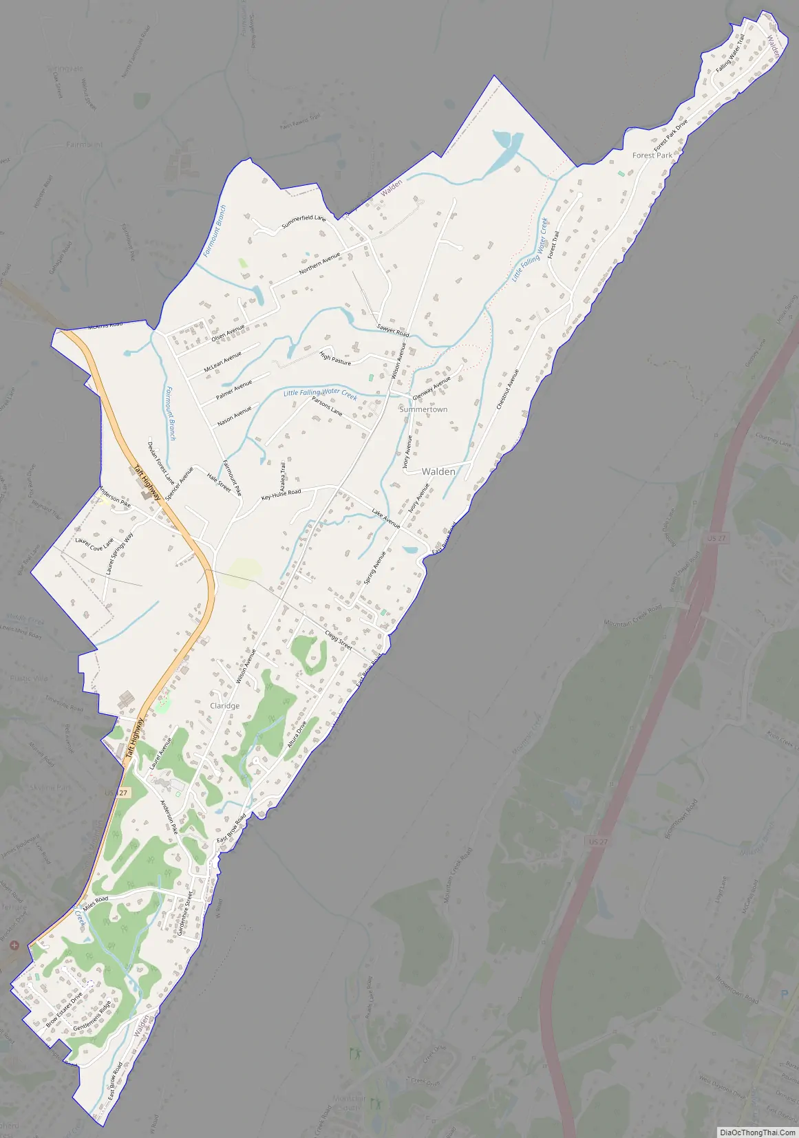
Walden Road Map
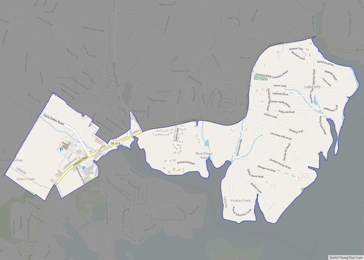
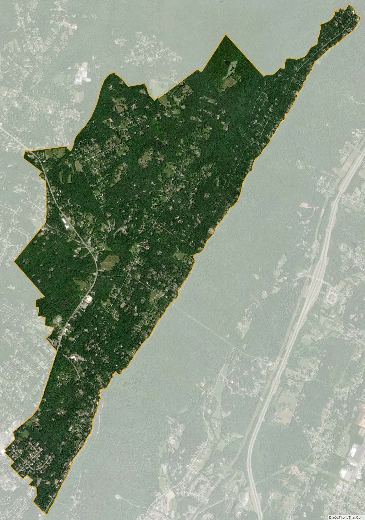
Walden city Satellite Map
Geography
Walden is located at 35°9′40″N 85°18′44″W / 35.16111°N 85.31222°W / 35.16111; -85.31222 (35.161154, -85.312116). The town is situated atop Walden’s Ridge, a section of the Cumberland Plateau.
According to the United States Census Bureau, the town has a total area of 3.6 square miles (9.3 km), all of it land.
See also
Map of Tennessee State and its subdivision:- Anderson
- Bedford
- Benton
- Bledsoe
- Blount
- Bradley
- Campbell
- Cannon
- Carroll
- Carter
- Cheatham
- Chester
- Claiborne
- Clay
- Cocke
- Coffee
- Crockett
- Cumberland
- Davidson
- Decatur
- DeKalb
- Dickson
- Dyer
- Fayette
- Fentress
- Franklin
- Gibson
- Giles
- Grainger
- Greene
- Grundy
- Hamblen
- Hamilton
- Hancock
- Hardeman
- Hardin
- Hawkins
- Haywood
- Henderson
- Henry
- Hickman
- Houston
- Humphreys
- Jackson
- Jefferson
- Johnson
- Knox
- Lake
- Lauderdale
- Lawrence
- Lewis
- Lincoln
- Loudon
- Macon
- Madison
- Marion
- Marshall
- Maury
- McMinn
- McNairy
- Meigs
- Monroe
- Montgomery
- Moore
- Morgan
- Obion
- Overton
- Perry
- Pickett
- Polk
- Putnam
- Rhea
- Roane
- Robertson
- Rutherford
- Scott
- Sequatchie
- Sevier
- Shelby
- Smith
- Stewart
- Sullivan
- Sumner
- Tipton
- Trousdale
- Unicoi
- Union
- Van Buren
- Warren
- Washington
- Wayne
- Weakley
- White
- Williamson
- Wilson
- Alabama
- Alaska
- Arizona
- Arkansas
- California
- Colorado
- Connecticut
- Delaware
- District of Columbia
- Florida
- Georgia
- Hawaii
- Idaho
- Illinois
- Indiana
- Iowa
- Kansas
- Kentucky
- Louisiana
- Maine
- Maryland
- Massachusetts
- Michigan
- Minnesota
- Mississippi
- Missouri
- Montana
- Nebraska
- Nevada
- New Hampshire
- New Jersey
- New Mexico
- New York
- North Carolina
- North Dakota
- Ohio
- Oklahoma
- Oregon
- Pennsylvania
- Rhode Island
- South Carolina
- South Dakota
- Tennessee
- Texas
- Utah
- Vermont
- Virginia
- Washington
- West Virginia
- Wisconsin
- Wyoming