Wartburg is a city in Morgan County, Tennessee, United States. The population was 918 at the 2010 census. It is the county seat of Morgan County.
| Name: | Wartburg city |
|---|---|
| LSAD Code: | 25 |
| LSAD Description: | city (suffix) |
| State: | Tennessee |
| County: | Morgan County |
| Incorporated: | 1968 |
| Elevation: | 1,312 ft (400 m) |
| Total Area: | 1.13 sq mi (2.92 km²) |
| Land Area: | 1.13 sq mi (2.92 km²) |
| Water Area: | 0.00 sq mi (0.00 km²) |
| Total Population: | 848 |
| Population Density: | 752.44/sq mi (290.50/km²) |
| ZIP code: | 37887 |
| Area code: | 423 |
| FIPS code: | 4778100 |
| GNISfeature ID: | 2405678 |
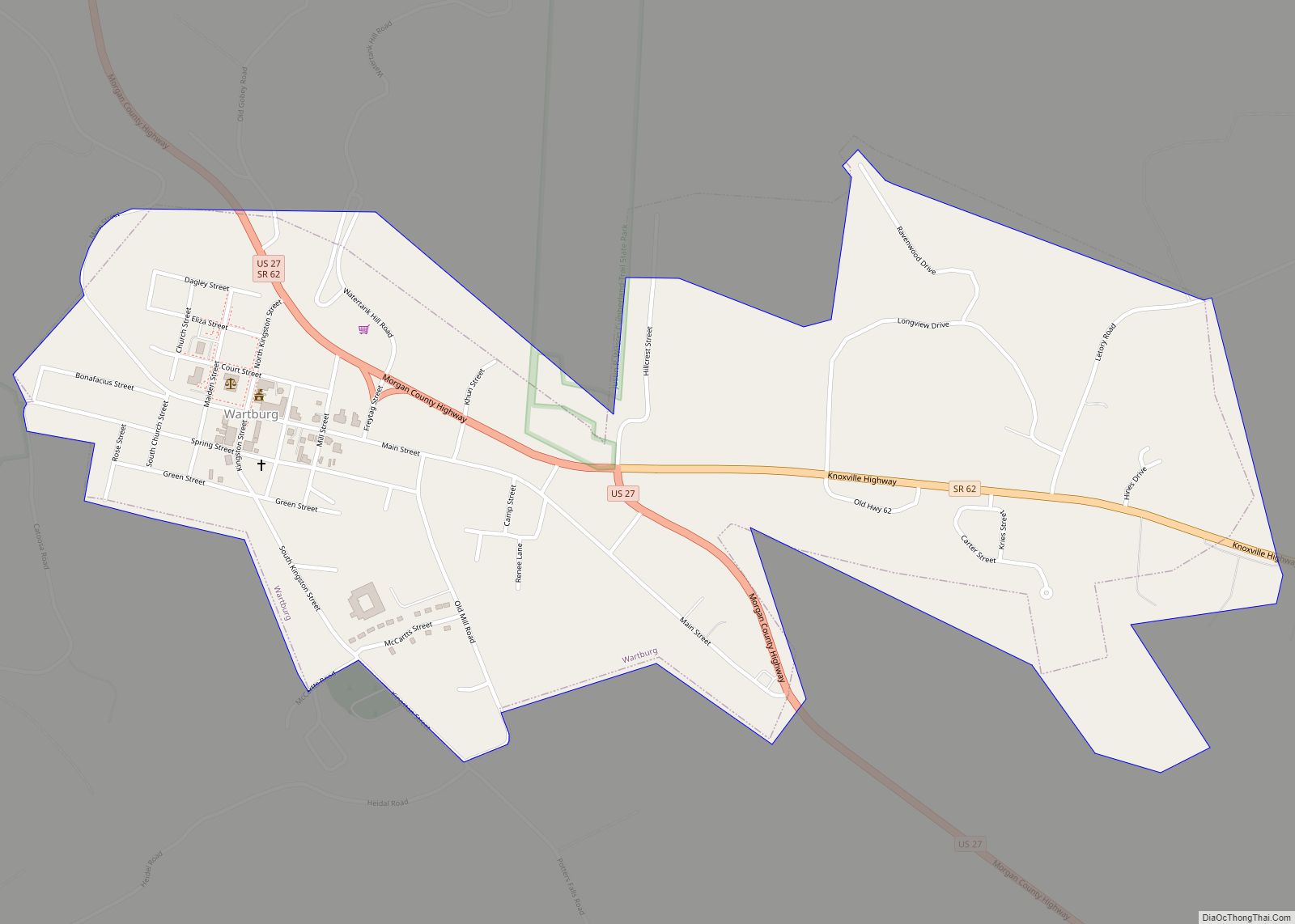
Online Interactive Map
Click on ![]() to view map in "full screen" mode.
to view map in "full screen" mode.
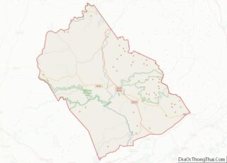
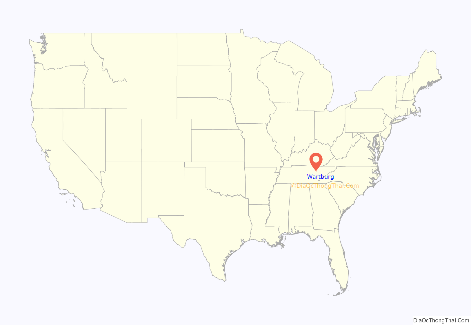
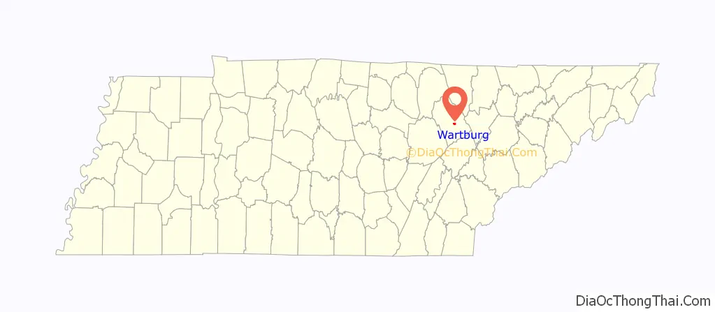
Wartburg location map. Where is Wartburg city?
History
In 1805, the Cherokee ceded what is now Morgan County to the United States by signing the Third Treaty of Tellico. The first settlers arrived in the area shortly thereafter.
Wartburg was founded in the mid-1840s by George Gerding, a land speculator who bought up large tracts of land in what is now Morgan County and organized the East Tennessee Colonization Company with plans to establish a series of German colonies in the Cumberland region. German and Swiss immigrants, seeking to escape poor economic conditions in their home counties, arrived at the site by traveling from New Orleans up the Mississippi and Cumberland rivers to Nashville, and then by ox cart to the Cumberland Plateau. The first of these settlers arrived in the area in 1845, and new groups of immigrants would continue trickling in until 1855.
The new settlement, which had already been platted by East Tennessee Colonization Company agent Friedrich Guenther, was named after Wartburg Castle in Germany. The first six streets were initially named for European cities, but the names were changed within a few years to Rose, Church, Maidenland (now Maiden), Kingston, Mill, and Cumberland. As most immigrants lived on farms outside the town, Wartburg grew slowly. By 1850, the town consisted of Gerding’s house and store, a church and school building, a doctor’s office, and a few small houses. Early residents included a number of professionals trained in Europe, including architect Carl Rothe, musician Gustav Knabe, painter George Dury, and physicians Rudolf Knaffl and F. A. Sienknecht.
While Morgan County was generally pro-Union during the Civil War, Wartburg was bitterly divided over the secession issue. Gerding, the city’s founder, supported the Confederacy. John Wilken, a prominent Lutheran pastor in the city, supported the Union. F.A. Sienknecht supported the Union, though two of his sons fought for the Confederacy. On January 2, 1862, a Confederate cavalry unit under Colonel J.W. White clashed with the Union Home Guard near Wartburg. In late March 1862, Confederate General Kirby Smith reported that all Confederate citizens had been expelled from the Wartburg area. In June 1863, Union General William P. Sanders marched through Wartburg and captured 104 Confederate soldiers in the vicinity.
In 1870, Morgan County elected to move its county seat from the now-defunct town of Montgomery, which had a population of just 50 residents and had been economically overshadowed by Wartburg. A new courthouse, consisting of a simple frame structure, was completed in 1871. The current Richardsonian Romanesque-style courthouse was built in 1904.
By the early 20th century, Wartburg had grown modestly, reporting a population of about 500 in 1920. At this time, the city included a bank, school, newspaper, four general stores, a clothing store, a hardware store, and a billiard hall. In 1968, Wartburg voted to incorporate, and elected Roy McNeal as its mayor.
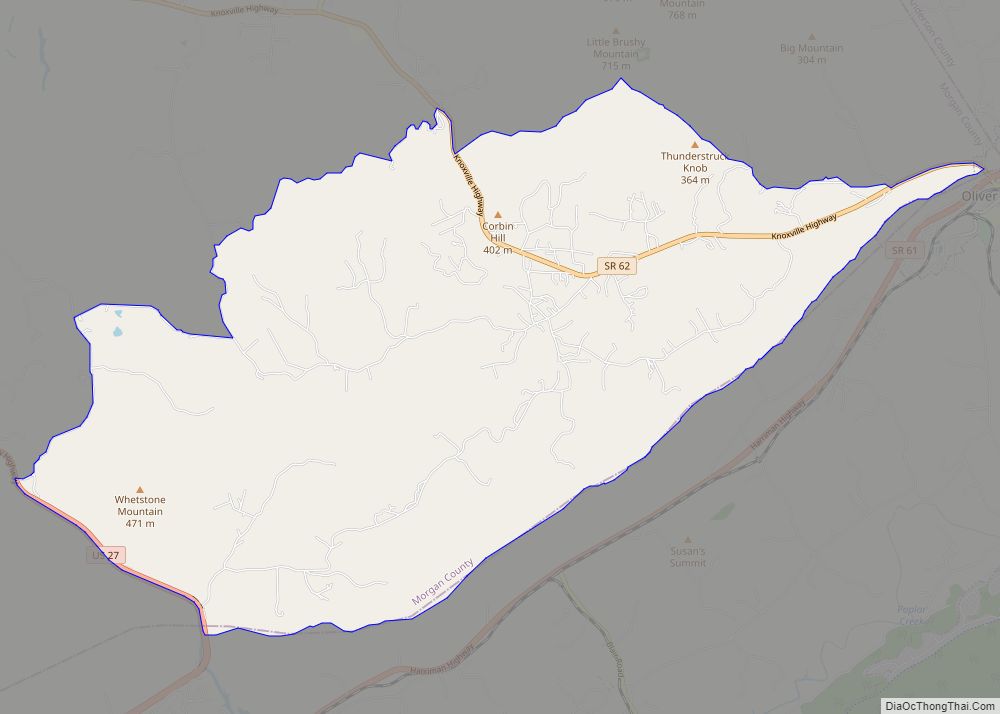
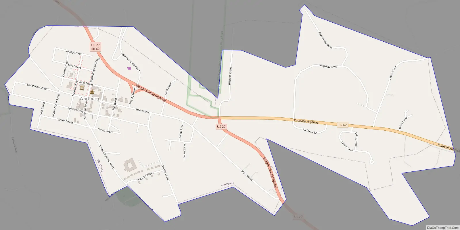
Wartburg Road Map
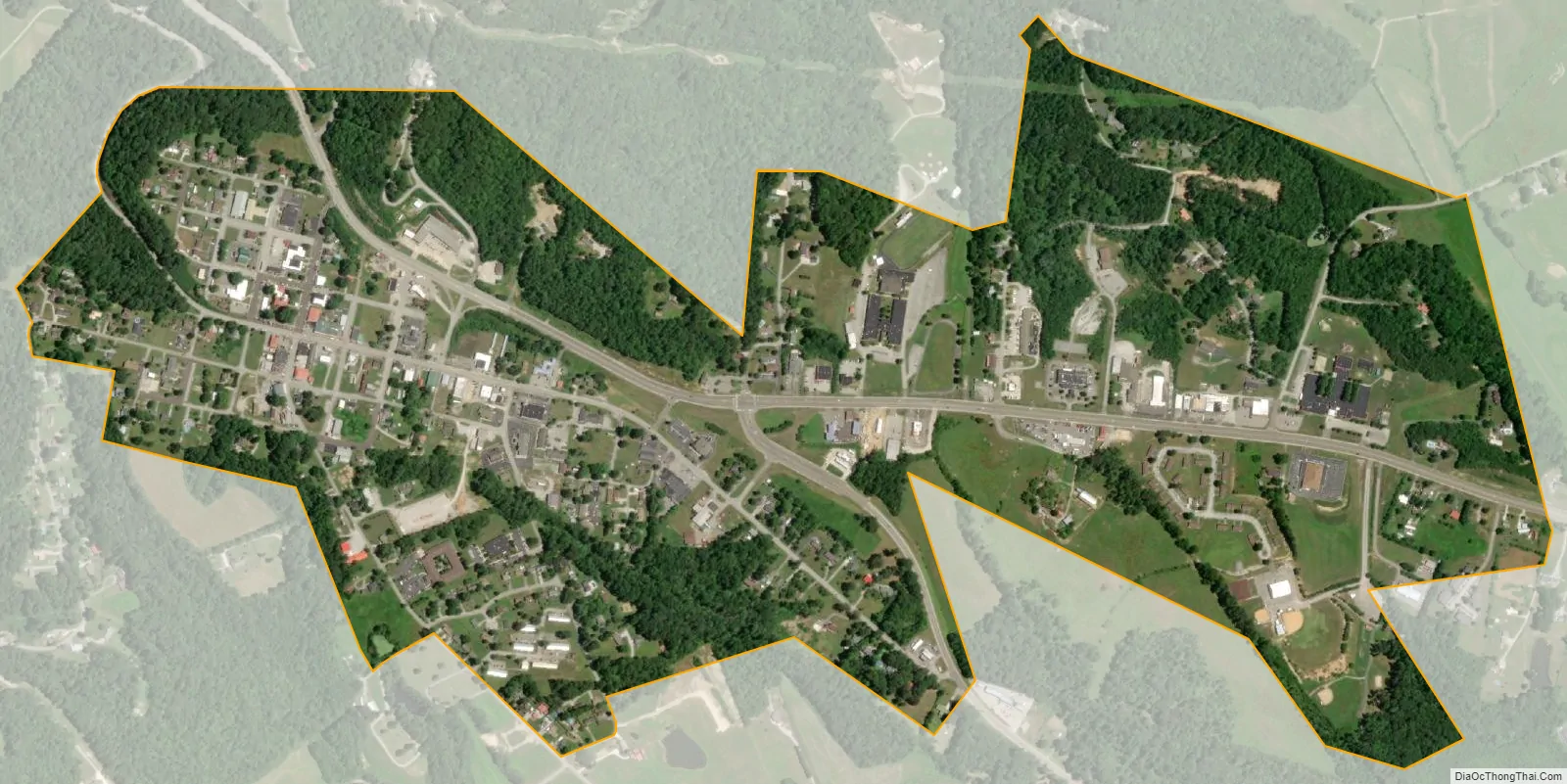
Wartburg city Satellite Map
Geography
Wartburg is situated amidst the Crab Orchard Mountains, a sub-range of the Cumberland Mountains, near the eastern edge of the Cumberland Plateau. Bird Mountain dominates the area east of Wartburg, rising from its base at the edge of the city and stretching for some 10 miles (16 km) to its 3,142-foot (958 m) summit at Frozen Head State Park. The Emory River, its source near the summit of Bird, flows westwardly along the mountain’s northern base, passing just north of Wartburg, and turning south before dropping off the plateau and emptying into the Watts Bar Lake impoundment of the Tennessee River. The Obed River flows eastwardly from Cumberland County through a scenic gorge before emptying into the Emory just west of Wartburg.
Wartburg is situated around the junction of U.S. Route 27, which connects the city to Kentucky to the north and Harriman and Interstate 40 to the south, and State Route 62, which connects Wartburg to Oak Ridge to the east and the rural areas of Morgan County and Fentress County to the west.
According to the United States Census Bureau, the city has a total area of 1.0 square mile (2.6 km), all of it land.
See also
Map of Tennessee State and its subdivision:- Anderson
- Bedford
- Benton
- Bledsoe
- Blount
- Bradley
- Campbell
- Cannon
- Carroll
- Carter
- Cheatham
- Chester
- Claiborne
- Clay
- Cocke
- Coffee
- Crockett
- Cumberland
- Davidson
- Decatur
- DeKalb
- Dickson
- Dyer
- Fayette
- Fentress
- Franklin
- Gibson
- Giles
- Grainger
- Greene
- Grundy
- Hamblen
- Hamilton
- Hancock
- Hardeman
- Hardin
- Hawkins
- Haywood
- Henderson
- Henry
- Hickman
- Houston
- Humphreys
- Jackson
- Jefferson
- Johnson
- Knox
- Lake
- Lauderdale
- Lawrence
- Lewis
- Lincoln
- Loudon
- Macon
- Madison
- Marion
- Marshall
- Maury
- McMinn
- McNairy
- Meigs
- Monroe
- Montgomery
- Moore
- Morgan
- Obion
- Overton
- Perry
- Pickett
- Polk
- Putnam
- Rhea
- Roane
- Robertson
- Rutherford
- Scott
- Sequatchie
- Sevier
- Shelby
- Smith
- Stewart
- Sullivan
- Sumner
- Tipton
- Trousdale
- Unicoi
- Union
- Van Buren
- Warren
- Washington
- Wayne
- Weakley
- White
- Williamson
- Wilson
- Alabama
- Alaska
- Arizona
- Arkansas
- California
- Colorado
- Connecticut
- Delaware
- District of Columbia
- Florida
- Georgia
- Hawaii
- Idaho
- Illinois
- Indiana
- Iowa
- Kansas
- Kentucky
- Louisiana
- Maine
- Maryland
- Massachusetts
- Michigan
- Minnesota
- Mississippi
- Missouri
- Montana
- Nebraska
- Nevada
- New Hampshire
- New Jersey
- New Mexico
- New York
- North Carolina
- North Dakota
- Ohio
- Oklahoma
- Oregon
- Pennsylvania
- Rhode Island
- South Carolina
- South Dakota
- Tennessee
- Texas
- Utah
- Vermont
- Virginia
- Washington
- West Virginia
- Wisconsin
- Wyoming