Map of Clarkrange CDP

Map of Clarkrange CDP

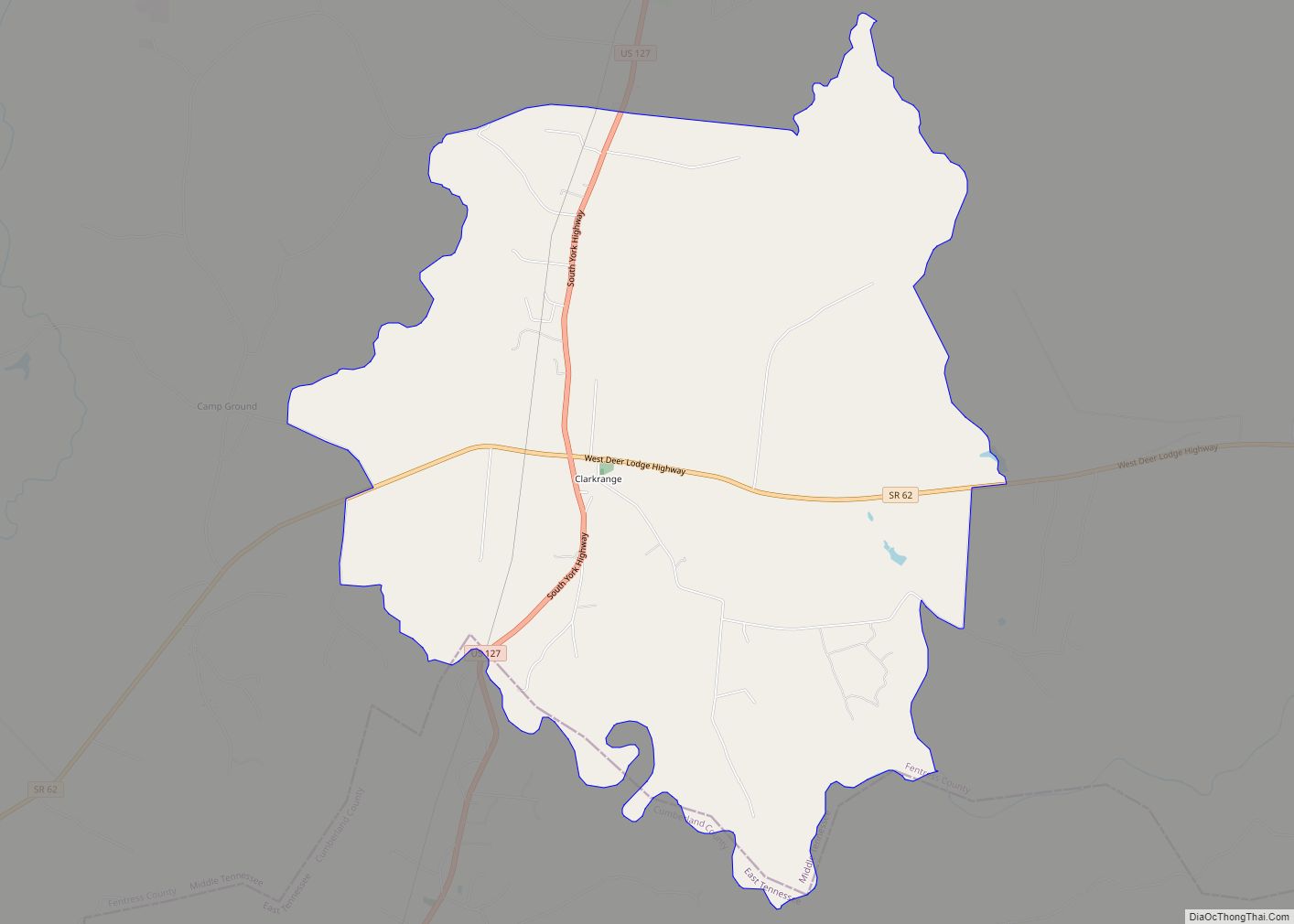
Clarkrange is an unincorporated community and census-designated place (CDP) in Fentress County, Tennessee, United States. It is concentrated around the intersection of U.S. Route 127 and Tennessee State Route 62, in Tennessee’s western Cumberland Plateau region. The 2010 census reported the population of Clarkrange as 575. The community has a post office, established in 1885, … Read more

Map of Church Hill city, Tennessee

Map of Church Hill city, Tennessee

Church Hill is a city in Hawkins County, Tennessee, United States. The population was 6,998 at the 2020 census and 6,737 at the 2010 census. It is part of the Kingsport–Bristol (TN)–Bristol (VA) Metropolitan Statistical Area, which is a component of the Johnson City–Kingsport–Bristol, TN-VA Combined Statistical Area – commonly known as the “Tri-Cities” region. … Read more

Map of Christiana CDP, Tennessee

Map of Christiana CDP, Tennessee

Christiana CDP overview: Name: Christiana CDP LSAD Code: 57 LSAD Description: CDP (suffix) State: Tennessee FIPS code: 4714860 Online Interactive Map Christiana online map. Source: Basemap layers from Google Map, Open Street Map (OSM), Arcgisonline, Wmflabs. Boundary Data from Database of Global Administrative Areas. Christiana location map. Where is Christiana CDP? Christiana Road Map Christiana … Read more

Map of Chesterfield CDP, Tennessee

Map of Chesterfield CDP, Tennessee

Chesterfield is a census-designated place and unincorporated community in Henderson County, Tennessee, United States. Its population was 469 as of the 2010 census. Chesterfield CDP overview: Name: Chesterfield CDP LSAD Code: 57 LSAD Description: CDP (suffix) State: Tennessee County: Henderson County Elevation: 404 ft (123 m) Total Area: 7.70 sq mi (19.93 km²) Land Area: 7.68 sq mi (19.90 km²) Water Area: 0.01 sq mi … Read more

Map of Charlotte town, Tennessee

Map of Charlotte town, Tennessee

Charlotte is a town in Dickson County, Tennessee, United States. The population was 1,656 at the 2020 census. It is the county seat of Dickson County. This town is part of the Nashville metropolitan area. Charlotte town overview: Name: Charlotte town LSAD Code: 43 LSAD Description: town (suffix) State: Tennessee County: Dickson County Founded: 1808 … Read more

Map of Charleston city, Tennessee

Map of Charleston city, Tennessee

Charleston is a city in Bradley County, Tennessee, United States. The population was 664 at the 2020 census. It is included in the Cleveland Metropolitan Statistical Area. Charleston city overview: Name: Charleston city LSAD Code: 25 LSAD Description: city (suffix) State: Tennessee County: Bradley County Incorporated: November 11, 1956 Elevation: 725 ft (221 m) Total Area: 1.07 sq mi … Read more

Map of Colonial Heights CDP

Map of Colonial Heights CDP, Tennessee

Colonial Heights is a census-designated place (CDP) in Sullivan County, Tennessee, United States. It is surrounded by the city of Kingsport. The population was 3,055 at the 2020 census down from 6,934 at the 2010 census, due to annexation by the city of Kingsport. It is part of the Kingsport–Bristol (TN)–Bristol (VA) Metropolitan Statistical Area, … Read more

Map of Collinwood city

Map of Collinwood city

Collinwood is a city in Wayne County, Tennessee, United States. The population was 982 at the 2010 census, down from 1,024 in 2000. Collinwood city overview: Name: Collinwood city LSAD Code: 25 LSAD Description: city (suffix) State: Tennessee County: Wayne County Elevation: 1,060 ft (323 m) Total Area: 2.78 sq mi (7.20 km²) Land Area: 2.78 sq mi (7.20 km²) Water Area: 0.00 sq mi … Read more

Map of Collierville town, Tennessee

Map of Collierville town, Tennessee

Collierville is a town in Shelby County, Tennessee, United States, and a suburb located in the Memphis metropolitan area. With a population of 51,324 in the 2020 census, Collierville is the third largest municipality in the county after Memphis and Bartlett. It is home to the Carriage Crossing shopping mall and is served by Collierville … Read more

Map of Collegedale city

Map of Collegedale city

Collegedale is a city in Hamilton County, Tennessee, United States. The population was 11,109 at the 2020 census. Collegedale is a suburb of Chattanooga and is part of the Chattanooga, TN–GA Metropolitan Statistical Area. Collegedale is home to Southern Adventist University. The median household income is one of the highest in Hamilton County. It has … Read more

Map of Coalmont city, Tennessee

Map of Coalmont city, Tennessee

Coalmont is a city in Grundy County, Tennessee, United States. Established in 1904, the city has an area of 6 square miles. The population was 841 at the 2010 census. Coalmont city overview: Name: Coalmont city LSAD Code: 25 LSAD Description: city (suffix) State: Tennessee County: Grundy County Elevation: 1,883 ft (574 m) Total Area: 6.19 sq mi (16.04 km²) … Read more

Map of Coalfield CDP

Map of Coalfield CDP

Coalfield is an unincorporated community and census-designated place (CDP) in Morgan County, Tennessee, United States. As of the 2010 census, the population of the CDP was 2,463, making Coalfield the most populous settlement in all of Morgan County. The community does have its own post office, with the ZIP code 37719. Coalfield CDP overview: Name: … Read more