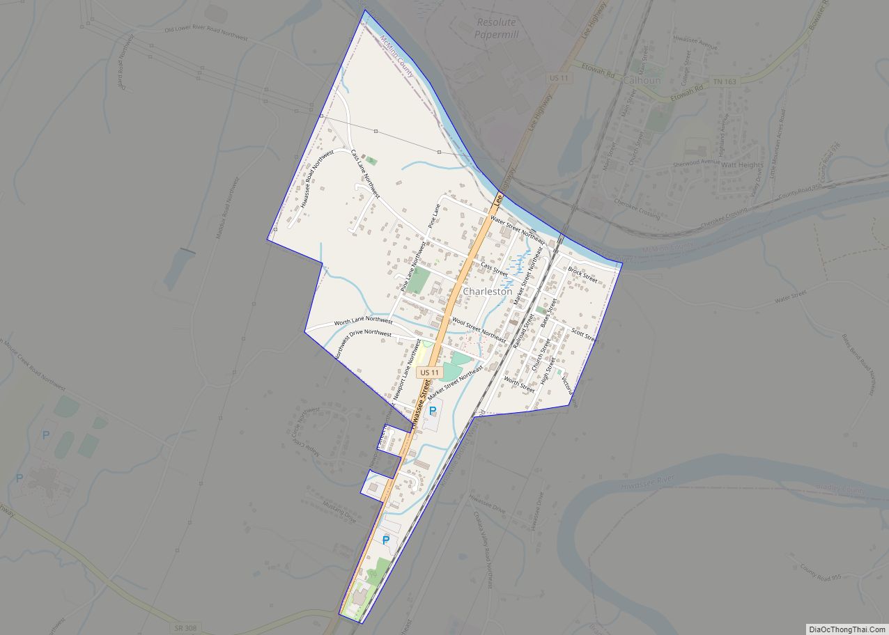
Charleston is a city in Bradley County, Tennessee, United States. The population was 664 at the 2020 census. It is included in the Cleveland Metropolitan Statistical Area.
| Name: | Charleston city |
|---|---|
| LSAD Code: | 25 |
| LSAD Description: | city (suffix) |
| State: | Tennessee |
| County: | Bradley County |
| Incorporated: | November 11, 1956 |
| Elevation: | 725 ft (221 m) |
| Total Area: | 1.07 sq mi (2.78 km²) |
| Land Area: | 1.04 sq mi (2.69 km²) |
| Water Area: | 0.04 sq mi (0.09 km²) |
| Total Population: | 664 |
| Population Density: | 639.69/sq mi (247.04/km²) |
| ZIP code: | 37310 |
| Area code: | 423 |
| FIPS code: | 4713020 |
| GNISfeature ID: | 1305866 |
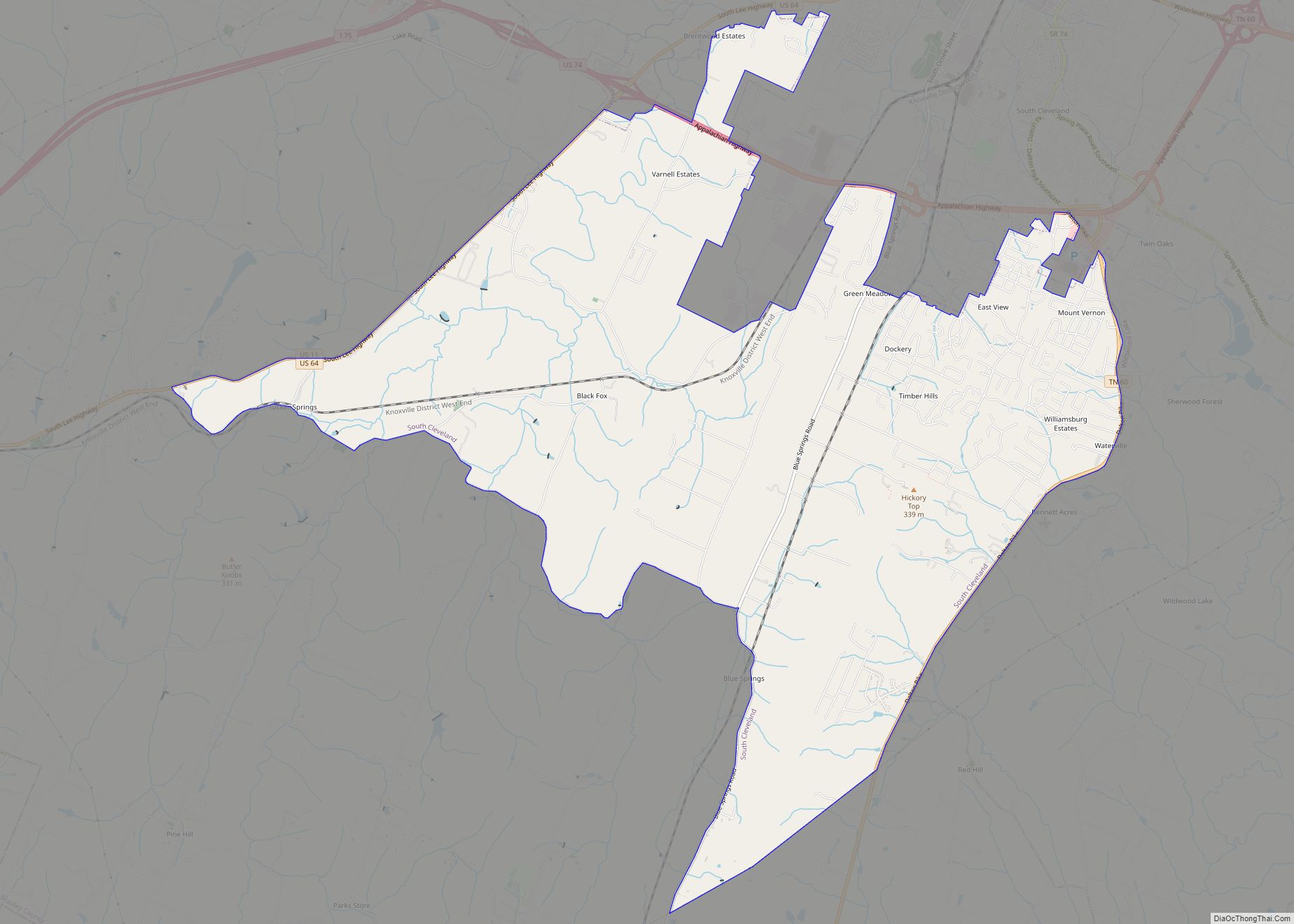
Online Interactive Map
Click on ![]() to view map in "full screen" mode.
to view map in "full screen" mode.
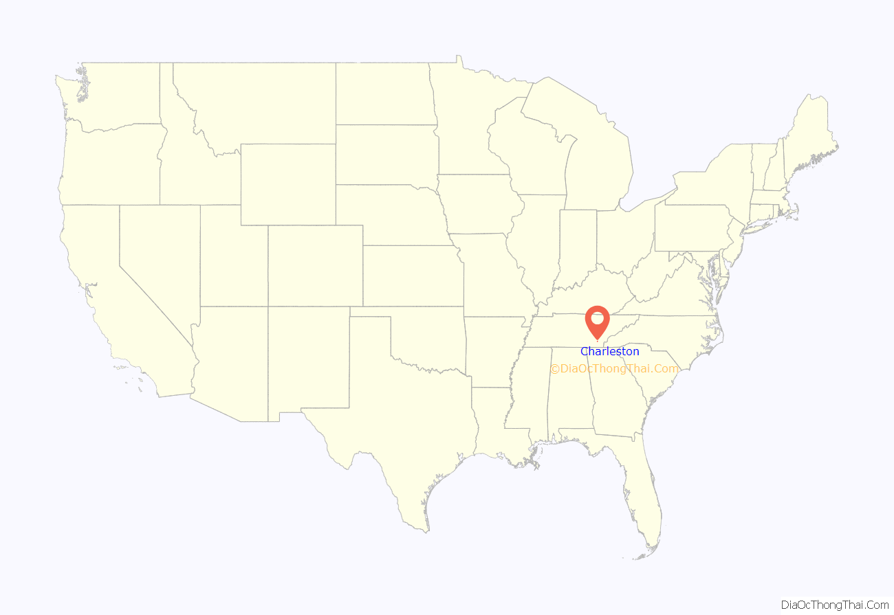
Charleston location map. Where is Charleston city?
History
The land now occupied by Charleston and Bradley County was home to the Cherokee long before European settlers arrived. What is now Charleston began around 1808 when Major John Walker Sr., a part-Cherokee grandson of Nancy Ward, established a ferry across the Hiwassee River between present-day Charleston and Calhoun. As a result, the community was initially known as “Walker’s Ferry.” The Hiwassee Purchase of 1819 resulted in the cession of Cherokee lands between the Hiwassee and Little Tennessee rivers to the Federal Government, and as a result, the Hiwassee River became the boundary between the Cherokee Nation and the United States, where it remained until the Cherokee removal in 1838. In 1821, the Cherokee Agency— the official liaison between the U.S. government and the Cherokee Nation— was moved to the location of present-day Charleston. The agent to the Cherokees was first Colonel Return J. Meigs Sr., who had served in the American Revolutionary War, and later Joseph McMinn, who served as Governor of Tennessee from 1815 to 1821. Lewis Ross, the brother of Chief John Ross, constructed a home nearby in 1820, and established a trading post and store in the city the following year. Between 1832 and the Cherokee removal in 1838, the Red Clay Council Grounds in southern Bradley County, now a state park by the same name, served as the final eastern capitol of the Cherokee Nation.
In the 1820s and 1830s, many white settlers began to move into the area anticipating a future forced removal of the Cherokee by the Federal Government. At times, these settlers came into conflict with the Cherokee, who resisted settlers who tried to take over their territory. After the passage of the Indian Removal Act of 1830, Fort Cass was constructed in Charleston as the headquarters of the Cherokee removal, which was initiated by the Treaty of New Echota in December 1835. During the summer of 1838, thousands of Cherokees from various locations were held in internment camps at the fort under the supervision of federal troops before starting their journey westward, which became known as the Trail of Tears. Several other internment camps were located in the valleys between Charleston and present-day Cleveland, Tennessee over a distance of 12 miles (19 km), including one at nearby Rattlesnake Springs.
During the Civil War the Henegar House, the oldest remaining brick structure in Bradley County, was used as headquarters by both Union and Confederate generals including William T. Sherman, Oliver O. Howard, Marcus J. Wright, and Samuel Bolivar Buckner. The Charleston Cumberland Presbyterian Church building was used as a hospital by Confederate Forces in 1863. The railroad bridge over the Hiwassee River in Charleston was destroyed as part of the East Tennessee bridge burnings in November 1861.
Charleston was incorporated on November 11, 1956. Several areas in and around Charleston were used as the primary filming locations for the 1960 Elia Kazan film Wild River. The city’s business district served as the fictional Garthville in the film.
Charleston was the first city in Tennessee to elect a black mayor and the first city to appoint a black police chief.
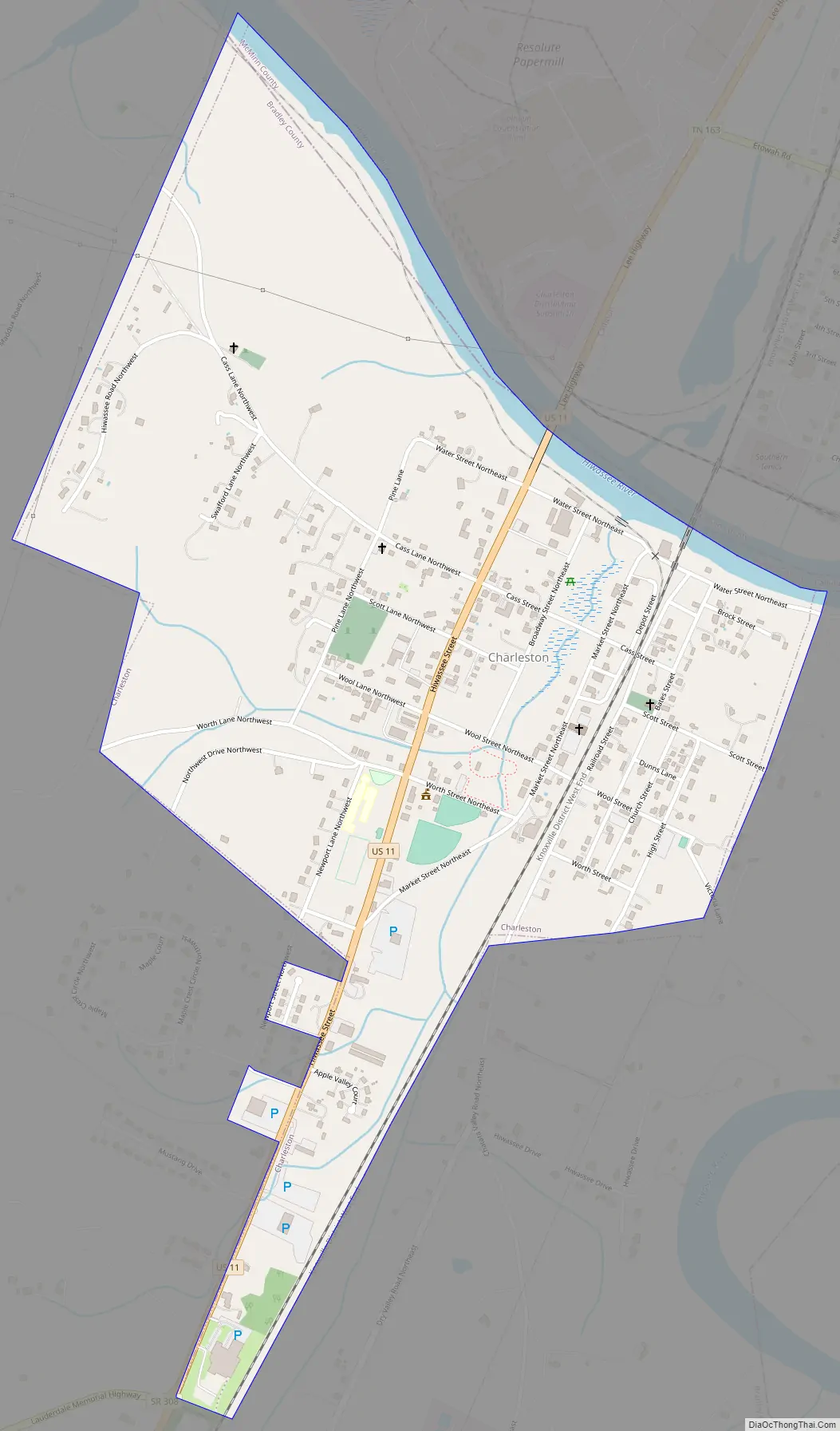
Charleston Road Map
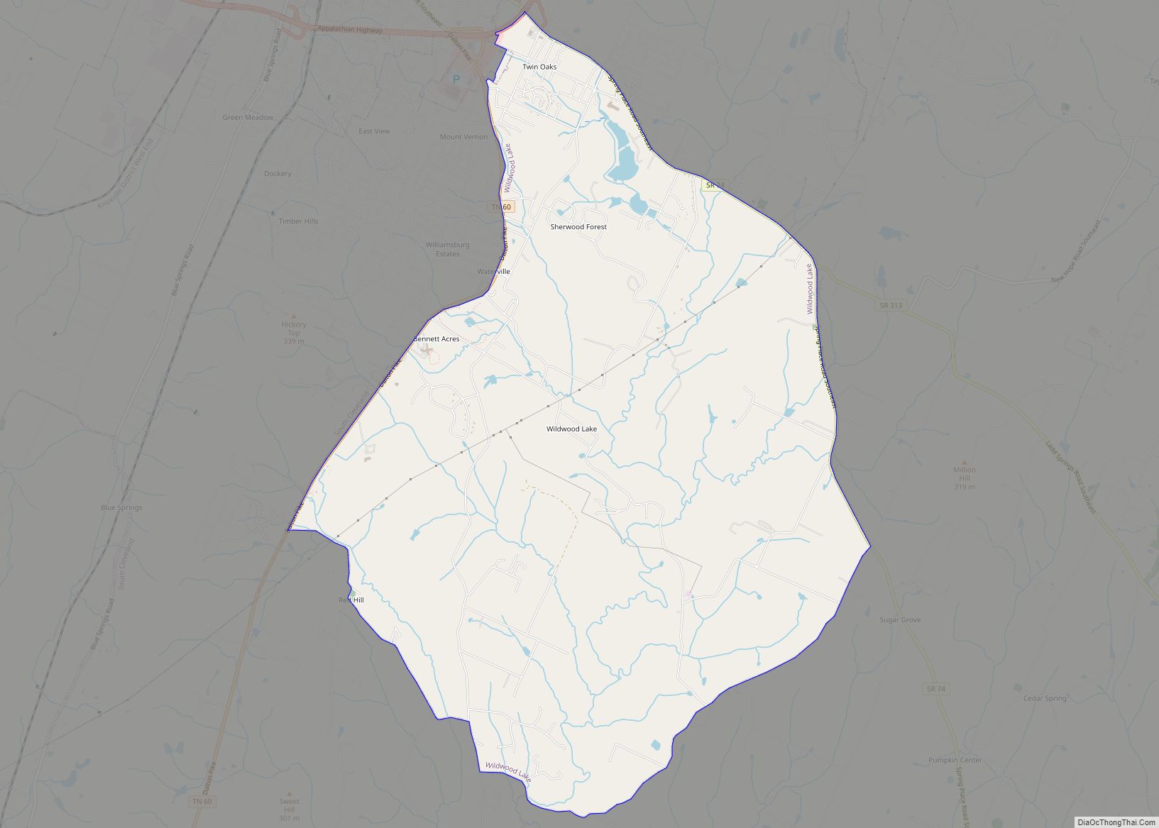
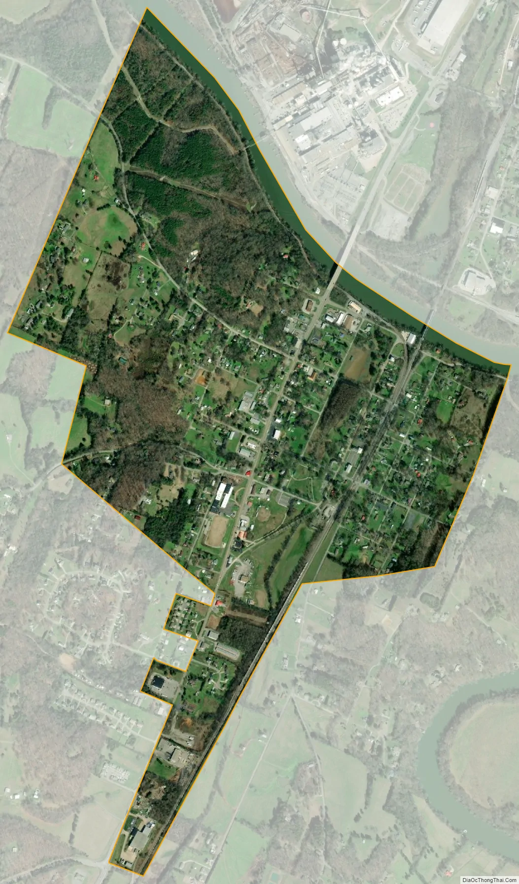
Charleston city Satellite Map
Geography
Charleston is situated along the south bank of the Hiwassee River, which flows down out of the Blue Ridge Mountains several miles to the east and empties into the Chickamauga Lake impoundment of the Tennessee River several miles to the west. The river forms the boundary between Bradley County and McMinn County. Calhoun, Charleston’s sister city, is situated on the north bank of the Hiwassee, on the McMinn County side.
Charleston is traversed by U.S. Route 11, which enters the city from Calhoun to the north and exits the city en route to Cleveland to the south. Interstate 75, which roughly parallels U.S. 11 in the area, runs about 2 miles (3.2 km) west of Charleston, and is connected to the city by State Route 308.
According to the United States Census Bureau, the city has a total area of 1.0 square mile (2.6 km), of which 0.1 square miles (0.26 km), or 5.77%, is water.
See also
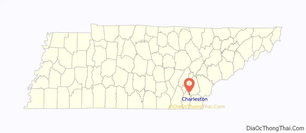
Map of Tennessee State and its subdivision:- Anderson
- Bedford
- Benton
- Bledsoe
- Blount
- Bradley
- Campbell
- Cannon
- Carroll
- Carter
- Cheatham
- Chester
- Claiborne
- Clay
- Cocke
- Coffee
- Crockett
- Cumberland
- Davidson
- Decatur
- DeKalb
- Dickson
- Dyer
- Fayette
- Fentress
- Franklin
- Gibson
- Giles
- Grainger
- Greene
- Grundy
- Hamblen
- Hamilton
- Hancock
- Hardeman
- Hardin
- Hawkins
- Haywood
- Henderson
- Henry
- Hickman
- Houston
- Humphreys
- Jackson
- Jefferson
- Johnson
- Knox
- Lake
- Lauderdale
- Lawrence
- Lewis
- Lincoln
- Loudon
- Macon
- Madison
- Marion
- Marshall
- Maury
- McMinn
- McNairy
- Meigs
- Monroe
- Montgomery
- Moore
- Morgan
- Obion
- Overton
- Perry
- Pickett
- Polk
- Putnam
- Rhea
- Roane
- Robertson
- Rutherford
- Scott
- Sequatchie
- Sevier
- Shelby
- Smith
- Stewart
- Sullivan
- Sumner
- Tipton
- Trousdale
- Unicoi
- Union
- Van Buren
- Warren
- Washington
- Wayne
- Weakley
- White
- Williamson
- Wilson
- Alabama
- Alaska
- Arizona
- Arkansas
- California
- Colorado
- Connecticut
- Delaware
- District of Columbia
- Florida
- Georgia
- Hawaii
- Idaho
- Illinois
- Indiana
- Iowa
- Kansas
- Kentucky
- Louisiana
- Maine
- Maryland
- Massachusetts
- Michigan
- Minnesota
- Mississippi
- Missouri
- Montana
- Nebraska
- Nevada
- New Hampshire
- New Jersey
- New Mexico
- New York
- North Carolina
- North Dakota
- Ohio
- Oklahoma
- Oregon
- Pennsylvania
- Rhode Island
- South Carolina
- South Dakota
- Tennessee
- Texas
- Utah
- Vermont
- Virginia
- Washington
- West Virginia
- Wisconsin
- Wyoming