Cookeville is the county seat and largest city of Putnam County, Tennessee, United States. As of the 2020 United States census, its population was reported to be 34,842. It is recognized as one of the country’s micropolitan areas, or smaller cities which function as significant regional economic hubs. Of the twenty micropolitan areas in Tennessee, Cookeville is the largest. The Cookeville micropolitan area’s 2010 Census population was 106,042. The U.S. Census Bureau ranked the Cookeville micropolitan area as the 7th largest-gaining micropolitan area in the country between 2018 and 2019, with a one-year gain of 1,796 and a 2019 population of 114,272. The city is a college town, home to Tennessee Tech.
| Name: | Cookeville city |
|---|---|
| LSAD Code: | 25 |
| LSAD Description: | city (suffix) |
| State: | Tennessee |
| County: | Putnam County |
| Founded: | 1854 |
| Incorporated: | 1903 |
| Elevation: | 1,089 ft (332 m) |
| Land Area: | 35.77 sq mi (92.64 km²) |
| Water Area: | 0.18 sq mi (0.46 km²) |
| Population Density: | 974.06/sq mi (376.08/km²) |
| Area code: | 931 |
| FIPS code: | 4716920 |
| GNISfeature ID: | 2404122 |
| Website: | cookeville-tn.gov |
Online Interactive Map
Click on ![]() to view map in "full screen" mode.
to view map in "full screen" mode.
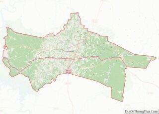
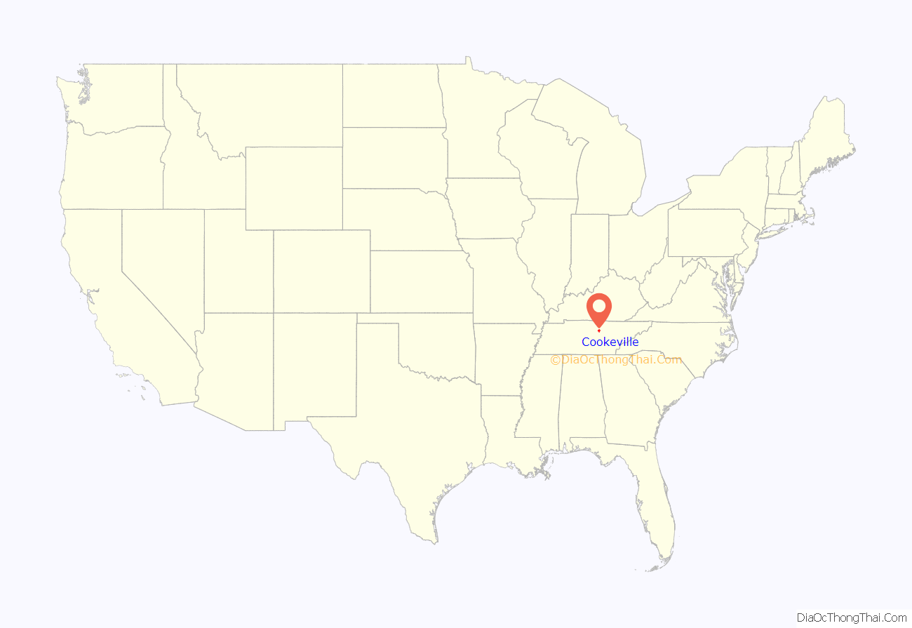
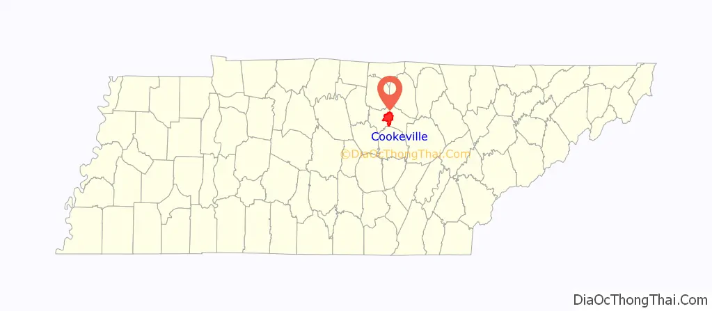
Cookeville location map. Where is Cookeville city?
History
Early years and establishment
Previous to its settlement era, the area of Cookeville was dominated by the Cherokee Native American tribe through the Paleo-Indian to the early European colonization periods of history. The Cherokee would use the region as communal hunting grounds. Claims to the land by the Cherokee in the Cumberland Plateau would cease following the signing of the third rendition of the Treaty of Tellico in October 1805. The area surrounding Cookeville and Putnam County was first reported to be settled by Virginia and North Carolina longhunters around the late 1700s to early 1800s, most of whom were of English and Scotch-Irish descent. Settlers arrived by Avery’s Trace, which was known as the Walton Road in the area of what is present-day Cookeville. Putnam County was not established until 1842, when it was formed from portions of White, Overton, Jackson, Smith, and DeKalb counties after the population increased sufficiently, straining those counties’ abilities to support services to the isolated residents. Entering the 19th century, the area was dominated economically with the rise of agriculture, logging, and timber production. Putnam County re-established itself in 1854, with the establishment of a county seat required by new Tennessee state law. In the same year, land purchased by Charles Crook would become the area where the new county seat would be established since it has access to a natural springs able to support a town. The city was named Cookeville for Richard Fielding Cooke, an early pioneer who came to Tennessee in 1810 and settled in the area. Cooke was twice elected to the state senate, and was influential in establishing Putnam County in 1854.
Antebellum and Civil War era
The largely rugged landscape of the Cookeville area made it unsuitable for large-scale farming operations compared to most of the larger Middle Tennessee region. Despite this, several farming institutions operated in the region, some using African slave laborers. Following Tennessee’s secession from the United States in 1861, residents of the Cookeville area were conflicted on siding in the American Civil War. Most residents opposed secession and wished to remain with the Union. Cookeville residents enrolled to assist in both the armies of the Confederacy and the Union. Several aggressions occurred during the Civil War, including the burning of the Putnam County Courthouse in Cookeville’s city square, the slaying of 20 and capture of 40 Confederate soldiers by Union Army Colonel Henry McConnell, and the Battle of Dug Hill.
Economic and cultural growth in Cookeville stagnated as a result of political divide amongst residents’s viewpoints on the Civil War, causing animosities amongst neighbors and families. The tides would turn by the late 1800s, following the completion of the city’s first hotel, the Isbell in 1886, and the Nashville and Knoxville Railroad four years later.
20th century
The investment made by railroad companies would place Cookeville on a path of massive economic and industrial development with the Nashville and Knoxville railroad, which became the Tennessee Central Railroad. With this new growth, Cookeville would officially incorporate into a chartered city in 1903. Two years later, the city would establish the Cookeville Light and Water Department, when electricity was first distributed in the city. In 1909, the Tennessee Central Railroad would construct the Cookeville Depot in the city’s West Side District, providing passenger rail service until 1955.
In 1909, local religious leaders with the aid of the Tennessee state government would establish the University of Dixie, a private university deeded to the community. However, the institution would be seized by the state government in 1915 following decline in enrollment and financial support. The state government would re-establish it into Tennessee Polytechnic Institute, a public institute of technology focused on education in science, technology, engineering, and mathematics. The university would establish Cookeville as a regional education hub and a college town, increasing its population and post-secondary education enrollment. In 1965, it would be renamed Tennessee Technological University.
With the advancement rail access, Cookeville began to industrialize with the rise of textile manufacturing, coal mining, and the rapid expansion of the established timber production industry. The dominance of the railroad declined by the beginnings of the Great Depression. By 1930, U.S. Route 70, the first modern highway in Cookeville, would be completed by the Tennessee Department of Highways, prompting further expansion of Cookeville’s industrial and commercial markets. The large-scale Center Hill Dam project by the United States Army Corps of Engineers would provide employment opportunities to Cookeville residents, and after its completion, provided advanced electricity production for industrial development, flood control of the nearby Caney Fork River, and recreational sites with the design of Edgar Evins and Burgess Falls state parks.
Other infrastructure additions to the city would be beneficial to the city’s growth, including a water treatment plant in 1946, the Cookeville General Hospital in 1950, and a wastewater treatment plant in 1952.
During the Jim Crow era of the 1950s, John’s Place was one business where white and black locals often socialized despite their differences. John’s Place was originally opened as Ed’s Place in 1949, and later known as McClellan’s Cafe, and finally as John’s Place starting since 1957, the establishment at 11 Gibson Ave. off of West Spring Street was a grocery store and restaurant. John’s Place is known for its southern cuisine – fried chicken, catfish, meatloaf, and corn bread, as well as beer. Throughout the segregation of the 1960s, the only place you could interact interracially was at John’s Place, and many locals encountered their first African American at the restaurant. John’s Place was listed on the National Register of Historic Places in 2011.
By 1966, the Interstate 40 corridor was completed south of the city center, prompting annexation of several of the freeway’s interchanges for commercial development. After its end of passenger rail use in 1955, the Cookeville Depot fell into disrepair. A group of local residents and preservationists would work for the saving of the depot from demolition. After the lengthy demanding from residents, the Cookeville city government would purchase the Cookeville Depot. The citizens group responsible for its preservation restored the facility and reopened it into a museum in 1985, the year it was listed on the National Register of Historic Places.
By the 1970 census, the population of Cookeville would increase by more than 80% compared to the 1960 census, showcasing its rise from a predominately rural town into a larger hub city with increased enrollment at Tennessee Technological University and Interstate 40 positioning the city for increased employment opportunities.
The city’s establishment as the economic hub of the Upper Cumberland region strengthened with the construction and completion of Tennessee State Route 111, also known as Appalachian Development Highway System Corridor J. Corridor J, which went through the engineering phase in 1978, and completed in the late 1980s, provides expressway-grade access to Cookeville for neighboring communities in Overton and White counties.
Throughout the 1990s, the Cookeville Public Works and Engineering Department constructed several collector streets that aided with commercial development along the northern side of the I-40 corridor in the city.
Modern day
With the dawn of the 21st century, Cookeville embarked on one of its recorded largest expansions of its city limits, when it would annex over 10 square miles of previously unincorporated Putnam County between 2000 and 2009. In 2007, city officials approved the purchase of over 400 acres for a regional industrial park known as the Highlands Business Park. Cookeville General Hospital, then recently renamed the Cookeville Regional Medical Center, completed a major renovation and expansion project as a result of the city and surrounding region’s extensive population growth one year later.
During the March 2020 tornado outbreak, an EF-4 tornado touched down west of Cookeville damaging several of the city’s western outskirt neighborhoods, killing 19 people, injuring 87, and causing more than $100 million in damages. As a result of the tornado, Tennessee Tech closed for two days, encouraging students volunteers to assist first responders in rescue and clean-up. The tornado’s estimated maximum wind speed of 175 mph along its nearly nine-mile path was recorded as the strongest storm of the outbreak.
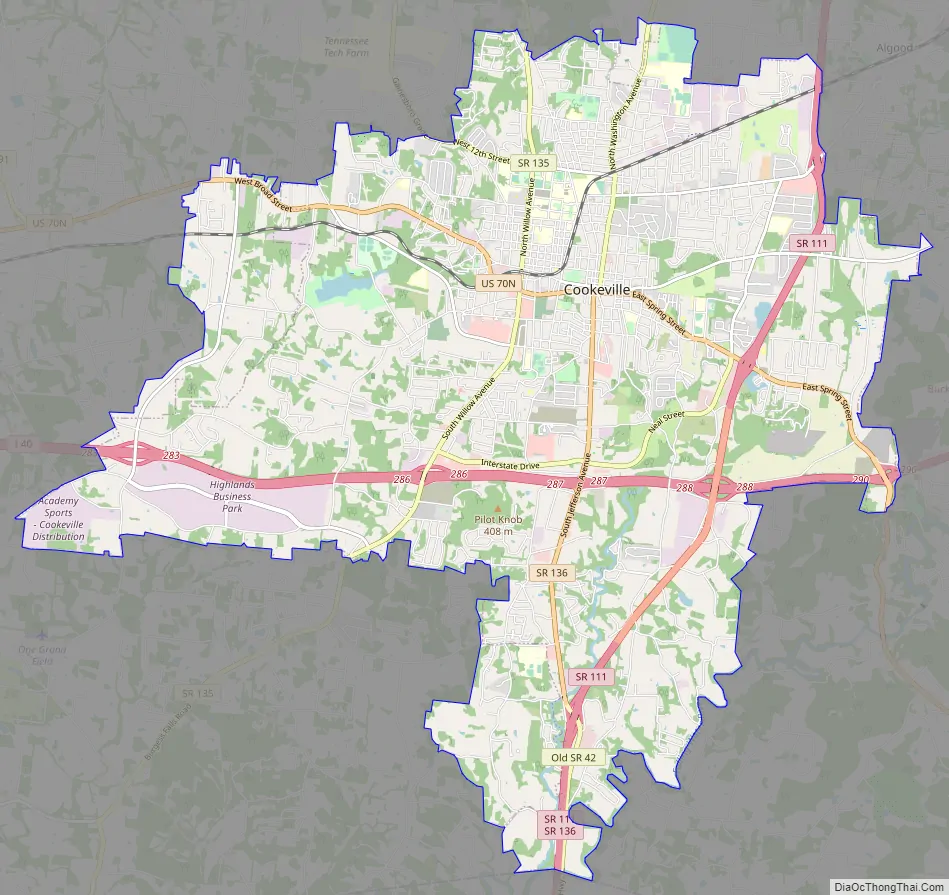
Cookeville Road Map
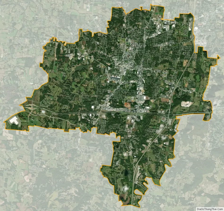
Cookeville city Satellite Map
Geography
According to the United States Census Bureau, the city has a total area of 22.0 square miles (57 km), of which 21.9 square miles (57 km) is land and 0.2 square miles (0.52 km) (0.77%) is water.
Located on the Highland Rim, Cookeville’s elevation (1100 ft AMSL) is a few hundred feet higher than either Nashville or Knoxville. As a result, temperatures and humidity levels are generally slightly lower in Cookeville than in either the Nashville Basin or in the Tennessee Valley.
Cookeville is situated in the Upper Cumberland region of Tennessee near the crossroads of I-40, SR 136, and US 70N-SR 24. The city is located 79 miles east of Nashville and 101 miles west of Knoxville.
Three man-made lakes maintained by the Corps of Engineers are located near Cookeville, created to help flood control in the narrow valleys of the Cumberland Plateau: Center Hill Lake, Cordell Hull Lake, and Dale Hollow Lake. Two smaller man-made lakes, City Lake and Burgess Falls Lake, lie along the Falling Water River, which flows through the southeastern part of the county. Cane Creek Lake, created by an earthen dam built by the Civilian Conservation Corps, lies in the western part of the city.
Climate
Cookeville has a humid subtropical climate (Köppen climate classification: Cfa) with relatively high temperatures and evenly distributed precipitation through the year. Summers are typically hot and humid and winters are mild and cool. The highest temperature recorded in Cookeville since 1896 is 105 °F (41 °C) on June 29, 2012, and the lowest temperature recorded is −22 °F (−30 °C) on January 21, 1985. Average annual precipitation is 56.1 in (1,420 mm), with the highest recorded precipitation at 6.06 in (154 mm) on September 29, 1964. Average annual snowfall is 8.0 in (200 mm) with the highest recorded snowfall at 15.2 in (39 cm) on November 3, 1966.
See also
Map of Tennessee State and its subdivision:- Anderson
- Bedford
- Benton
- Bledsoe
- Blount
- Bradley
- Campbell
- Cannon
- Carroll
- Carter
- Cheatham
- Chester
- Claiborne
- Clay
- Cocke
- Coffee
- Crockett
- Cumberland
- Davidson
- Decatur
- DeKalb
- Dickson
- Dyer
- Fayette
- Fentress
- Franklin
- Gibson
- Giles
- Grainger
- Greene
- Grundy
- Hamblen
- Hamilton
- Hancock
- Hardeman
- Hardin
- Hawkins
- Haywood
- Henderson
- Henry
- Hickman
- Houston
- Humphreys
- Jackson
- Jefferson
- Johnson
- Knox
- Lake
- Lauderdale
- Lawrence
- Lewis
- Lincoln
- Loudon
- Macon
- Madison
- Marion
- Marshall
- Maury
- McMinn
- McNairy
- Meigs
- Monroe
- Montgomery
- Moore
- Morgan
- Obion
- Overton
- Perry
- Pickett
- Polk
- Putnam
- Rhea
- Roane
- Robertson
- Rutherford
- Scott
- Sequatchie
- Sevier
- Shelby
- Smith
- Stewart
- Sullivan
- Sumner
- Tipton
- Trousdale
- Unicoi
- Union
- Van Buren
- Warren
- Washington
- Wayne
- Weakley
- White
- Williamson
- Wilson
- Alabama
- Alaska
- Arizona
- Arkansas
- California
- Colorado
- Connecticut
- Delaware
- District of Columbia
- Florida
- Georgia
- Hawaii
- Idaho
- Illinois
- Indiana
- Iowa
- Kansas
- Kentucky
- Louisiana
- Maine
- Maryland
- Massachusetts
- Michigan
- Minnesota
- Mississippi
- Missouri
- Montana
- Nebraska
- Nevada
- New Hampshire
- New Jersey
- New Mexico
- New York
- North Carolina
- North Dakota
- Ohio
- Oklahoma
- Oregon
- Pennsylvania
- Rhode Island
- South Carolina
- South Dakota
- Tennessee
- Texas
- Utah
- Vermont
- Virginia
- Washington
- West Virginia
- Wisconsin
- Wyoming