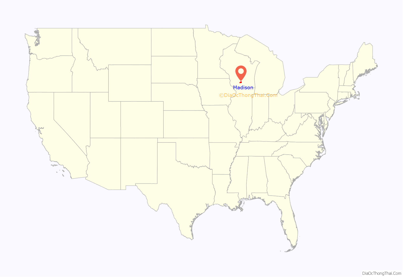
Madison is the county seat of Dane County and the capital city of the U.S. state of Wisconsin. As of the 2020 census the population was 269,840, making it the second-largest city in Wisconsin by population, after Milwaukee, and the 80th-largest in the U.S. The city forms the core of the Madison Metropolitan Area which includes Dane County and neighboring Iowa, Green, and Columbia counties for a population of 680,796. Madison is also the principal city of the Madison-Janesville-Beloit Combined Statistical Area which as of 2020 had a population of 910,246. Madison is named for American Founding Father and President James Madison.
Located on an isthmus and lands surrounding five lakes—Lake Mendota, Lake Monona, Lake Wingra, Lake Kegonsa and Lake Waubesa—the city is home to the University of Wisconsin–Madison, the Wisconsin State Capitol, the Overture Center for the Arts, and the Henry Vilas Zoo. Madison is home to an extensive network of parks and bike trails; it has the most parks and playgrounds per capita of any of the 100 largest U.S. cities and is one of five communities to have received a “Platinum Bicycle Friendly Community” rating from the League of American Bicyclists. Madison is also home to nine National Historic Landmarks, including several buildings designed by architect Frank Lloyd Wright, such as his 1937 Jacobs I House, which is a UNESCO World Heritage Site.
Residents of Madison are known as Madisonians. Madison has long been a center for progressive political activity, protests, and demonstrations, and contemporary Madison is considered the most politically liberal city in Wisconsin. The presence of the University of Wisconsin–Madison (the largest employer in the state) as well as other educational institutions has a significant impact on the economy, culture, and demographics of Madison.
As of 2021, Madison is the fastest-growing city in Wisconsin. Madison’s economy features a large and growing technology sector, and the Madison area is home to the headquarters of Epic Systems, American Family Insurance, Exact Sciences, Promega, American Girl, Sub-Zero, Lands’ End, Spectrum Brands, a regional office for Google, and the University Research Park, as well as many biotechnology and health systems startups. Madison is a popular visitor destination, with tourism generating over $1 billion for Dane County’s economy in 2018. A booming population combined with a lack in the quantity of housing due to restrictive zoning density regulations have contributed to rising housing costs in many Madison neighborhoods, with a 23% increase in median rent between 2014 and 2019.
| Name: | Madison city |
|---|---|
| LSAD Code: | 25 |
| LSAD Description: | city (suffix) |
| State: | Wisconsin |
| County: | Dane County |
| Founded: | 1836 |
| Incorporated: | 1856 |
| Elevation: | 873 ft (266 m) |
| Land Area: | 79.57 sq mi (206.09 km²) |
| Water Area: | 21.96 sq mi (56.88 km²) |
| Population Density: | 3,391.23/sq mi (1,309.33/km²) |
| Area code: | 608 |
| FIPS code: | 5548000 |
| GNISfeature ID: | 1581834 |
| Website: | cityofmadison.com |
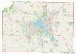
If you’re in need of a map of Madison Wisconsin, then check out our comprehensive map collection. They feature major highways, roads, places of interest, parks, and things to do. Five major lakes stand out which include Lake Mendota, Lake Monona, Lake Waubesa, Lake Wingra, and Lake Kegonsa. Together, their combined area spans 29 square miles, which is close to 3/10 the size of the City of Madison.
Madison is the capital of Wisconsin with a population of 233,000 people. This makes it the 2nd biggest city in Wisconsin, larger than Green Bay, but smaller than Milwaukee. Let’s start exploring Madison, WI with our interactive map.
Online Interactive Map
Click on ![]() to view map in "full screen" mode.
to view map in "full screen" mode.
Madison is home to many historical, cultural, and recreational attractions, including museums, parks, theaters, and the Wisconsin State Capitol. With the help of Google Maps and the road network it provides, you can find your way to and around Madison, Wisconsin, whether you’re a local or a tourist.
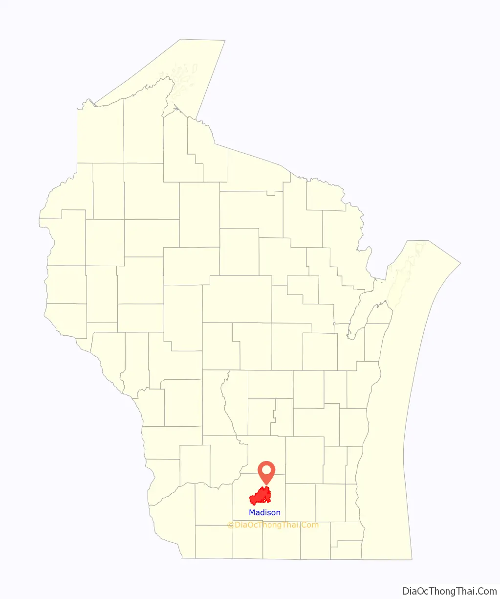
Madison location map. Where is Madison city?
History
Native Americans
Before Europeans, humans inhabited the area in and around Madison for about 12,000 years. The Ho-Chunk called the region Taychopera (Ta-ko-per-ah), meaning “land of the four lakes” (Mendota, Monona, Waubesa, and Kegonsa). Effigy mounds, which had been constructed for ceremonial and burial purposes over 1,000 years earlier, dotted the rich prairies around the lakes.
Founding
Madison’s modern origins begin in 1829, when former federal judge James Duane Doty purchased over a thousand acres (4 km) of swamp and forest land on the isthmus between Lakes Mendota and Monona, with the intention of building a city in the Four Lakes region. He purchased 1,261 acres for $1,500. When the Wisconsin Territory was created in 1836 the territorial legislature convened in Belmont, Wisconsin. One of the legislature’s tasks was to select a permanent location for the territory’s capital. Doty lobbied aggressively for Madison as the new capital, offering buffalo robes to the freezing legislators and choice lots in Madison at discount prices to undecided voters. He had James Slaughter plat two cities in the area, Madison and “The City of Four Lakes”, near present-day Middleton.
Doty named his city Madison for James Madison, the fourth President of the U.S. who had died on June 28, 1836, and he named the streets for the other 38 signers of the U.S. Constitution. Although the city existed only on paper, the territorial legislature voted on November 28, 1836 in favor of Madison as its capital, largely because of its location halfway between the new and growing cities around Milwaukee in the east and the long established strategic post of Prairie du Chien in the west, and between the highly populated lead mining regions in the southwest and Wisconsin’s oldest city, Green Bay, in the northeast.
Expansion
The cornerstone for the Wisconsin capitol was laid in 1837, and the legislature first met there in 1838. On October 9, 1839, Kintzing Prichett registered the plat of Madison at the registrar’s office of the then-territorial Dane County. Madison was incorporated as a village in 1846, with a population of 626. When Wisconsin became a state in 1848, Madison remained the capital, and the following year it became the site of the University of Wisconsin (now University of Wisconsin–Madison). The Milwaukee & Mississippi Railroad (a predecessor of the Milwaukee Road) connected to Madison in 1854. Madison incorporated as a city in 1856, with a population of 6,863, leaving the unincorporated remainder as a separate Town of Madison. The original capitol was replaced in 1863 and the second capitol burned in 1904. The current capitol was built between 1906 and 1917.
During the Civil War, Madison served as a center of the Union Army in Wisconsin. The intersection of Milwaukee, East Washington, Winnebago, and North Streets is known as Union Corners, because a tavern there was the last stop for Union soldiers before heading to fight the Confederates. Camp Randall, on the west side of Madison, was built and used as a training camp, a military hospital, and a prison camp for captured Confederate soldiers. After the war ended, the Camp Randall site was absorbed into the University of Wisconsin and Camp Randall Stadium was built there in 1917. In 2004 the last vestige of active military training on the site was removed when the stadium renovation replaced a firing range used for ROTC training.
1960s and 1970s
In the 1960s and 1970s, the Madison counterculture was centered in the neighborhood of Mifflin and Bassett streets, referred to as “Miffland”. The area contained many three-story apartments where students and counterculture youth lived, painted murals, and operated the co-operative grocery store, the Mifflin Street Co-op. Residents of the neighborhood often came into conflict with authorities, particularly during the administration of Republican mayor Bill Dyke. Dyke was viewed by students as a direct antagonist in efforts to protest the Vietnam War because of his efforts to suppress local protests. The annual Mifflin Street Block Party became a focal point for protest, although by the late 1970s it had become a mainstream community party.
During the late 1960s and early 1970s, thousands of students and other citizens took part in anti-Vietnam War marches and demonstrations, with more violent incidents drawing national attention to the city and UW campus. These include:
- the 1967 student protest of Dow Chemical Company, with 74 injured;
- the 1969 strike to secure greater representation and rights for African-American students and faculty, which resulted in the involvement of the Wisconsin Army National Guard;
- the 1970 fire that caused damage to the Army ROTC headquarters housed in the University of Wisconsin Armory and Gymnasium, also known as the Red Gym; and
- the 1970 late-summer predawn ANFO bombing of the Army Mathematics Research Center in Sterling Hall, killing a postdoctoral researcher, Robert Fassnacht. (See Sterling Hall bombing)
These protests were the subject of the 1979 documentary The War at Home. David Maraniss’s 2004 book, They Marched into Sunlight, incorporated the 1967 Dow protests into a larger Vietnam War narrative. Tom Bates wrote the book Rads on the subject (ISBN 0-06-092428-4). Bates wrote that Dyke’s attempt to suppress the annual Mifflin Street Block Party “would take three days, require hundreds of officers on overtime pay, and engulf the student community from the nearby Southeast Dorms to Langdon Street’s fraternity row. Tear gas hung like heavy fog across the Isthmus.” In the fracas, student activist Paul Soglin, then a city alderman, was arrested twice and taken to jail. Soglin was later elected mayor of Madison, serving several times.
21st century
In early 2011, Madison was the site for large protests against a bill proposed by Governor Scott Walker that abolished almost all collective bargaining for public worker unions. The protests at the capitol ranged in size from 10,000 to over 100,000 people and lasted for several months.
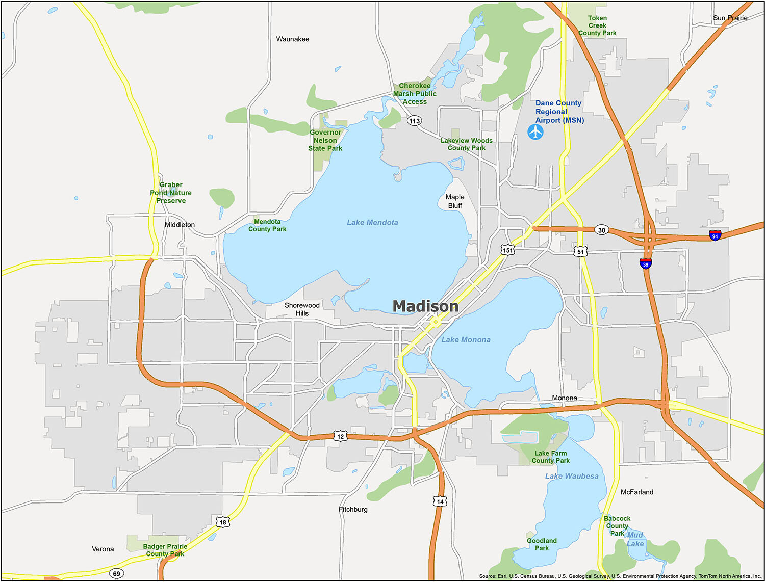
Madison Road Map
Visiting Madison, Wisconsin can be a truly memorable experience. Whether you’re looking for a family-friendly getaway or an adventurous vacation, there’s something for everyone. If you plan on traveling outside the city, then a Wisconsin road map can help you find all the interstates and highways in the state. This map includes I-39, I-94, state highways and major roads to help you get to where you need to go.
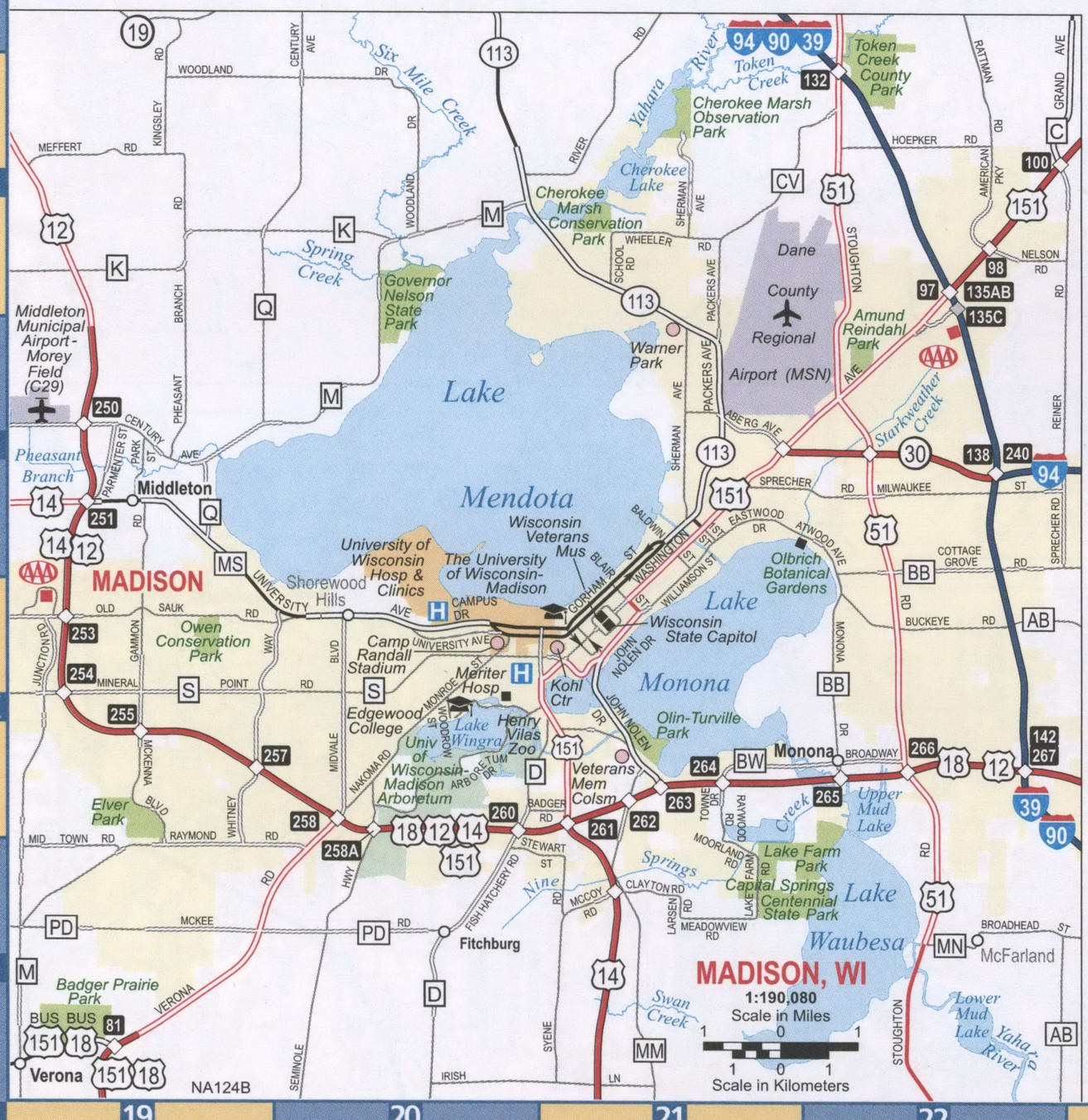
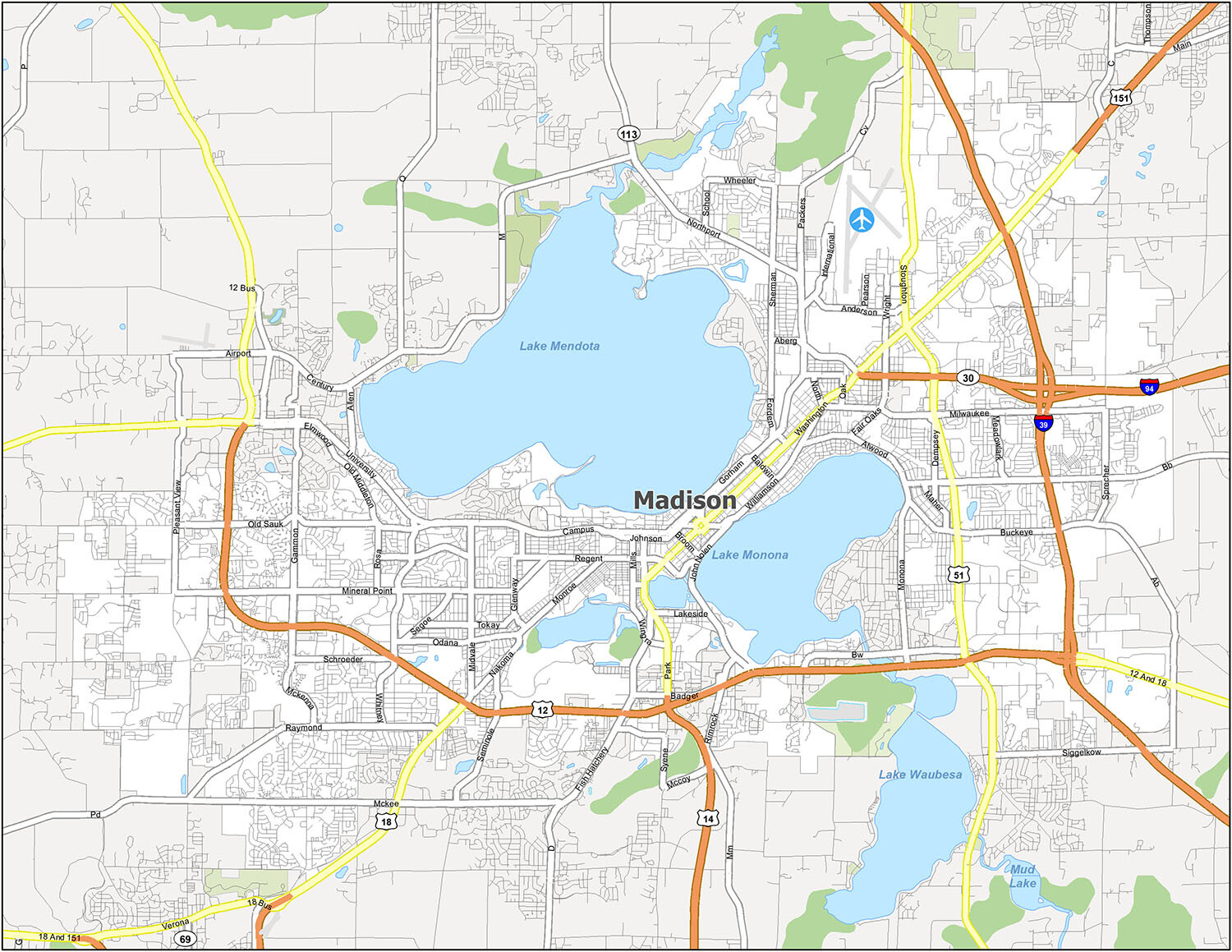
Discover Madison, Wisconsin with this reference map. Perfect for planning your next vacation, this map shows populated areas, parks, lakes and more. Explore the city and find the reference information you need. Airports, villages, cities and lakes are all included in this Madison, Wisconsin map.
Airports: Dane County Regional Airport (MSN)
Villages: Maple Bluff, McFarland, Shorewood Hills, Waunakee
Cities: Fitchburg, Madison, Middleton, Monona, Sun Prairie, Verona
Lakes: Mud Lake, Lake Mendota, Lake Monona, Lake Waubesa
10 things to do in Madison city
If you’re looking for a great place to visit in Madison, Wisconsin, you won’t be disappointed. From the amazing attractions to the great universities and gardens, you’ll find something to do and explore. Whether you’re a student, a tourist, or an avid explorer, Madison is the perfect place to spend a day or two.
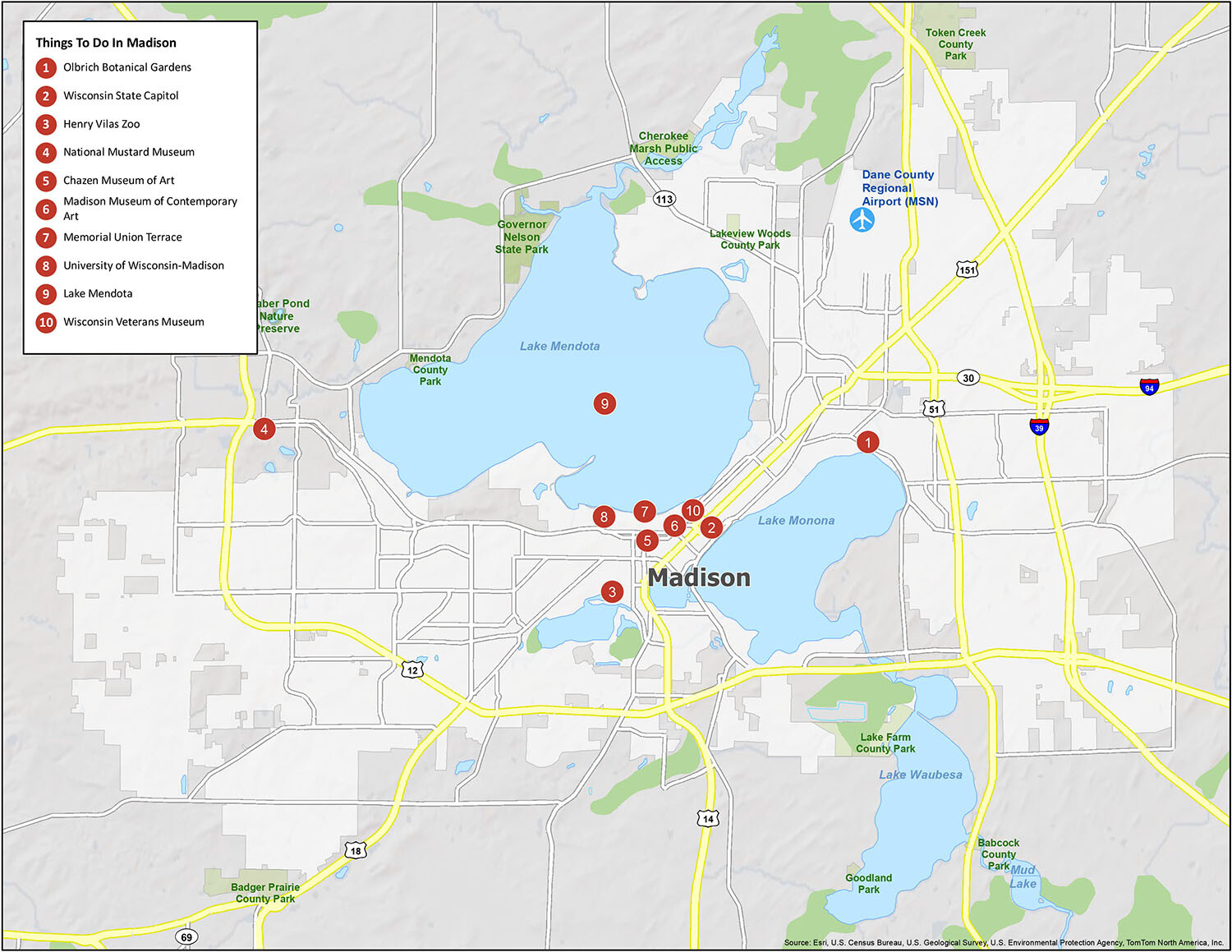
Discover the wonders of Madison, Wisconsin by exploring all of the important features it has to offer. From the Olbrich Botanical Gardens to the Wisconsin State Capitol and the Henry Vilas Zoo, there is something for everyone. Visit the National Mustard Museum, the Chazen Museum of Art, and the Madison Museum of Contemporary Art. Take a stroll down the Memorial Union Terrace, explore the University of Wisconsin-Madison, and go for a swim in Lake Mendota. Don’t forget to check out the Wisconsin Veterans Museum, too!
No matter what brings you to Madison, Wisconsin, you’re sure to find something to do and explore. With its amazing attractions, universities, gardens, the zoo, and more, Madison is a great place to spend a day or two.
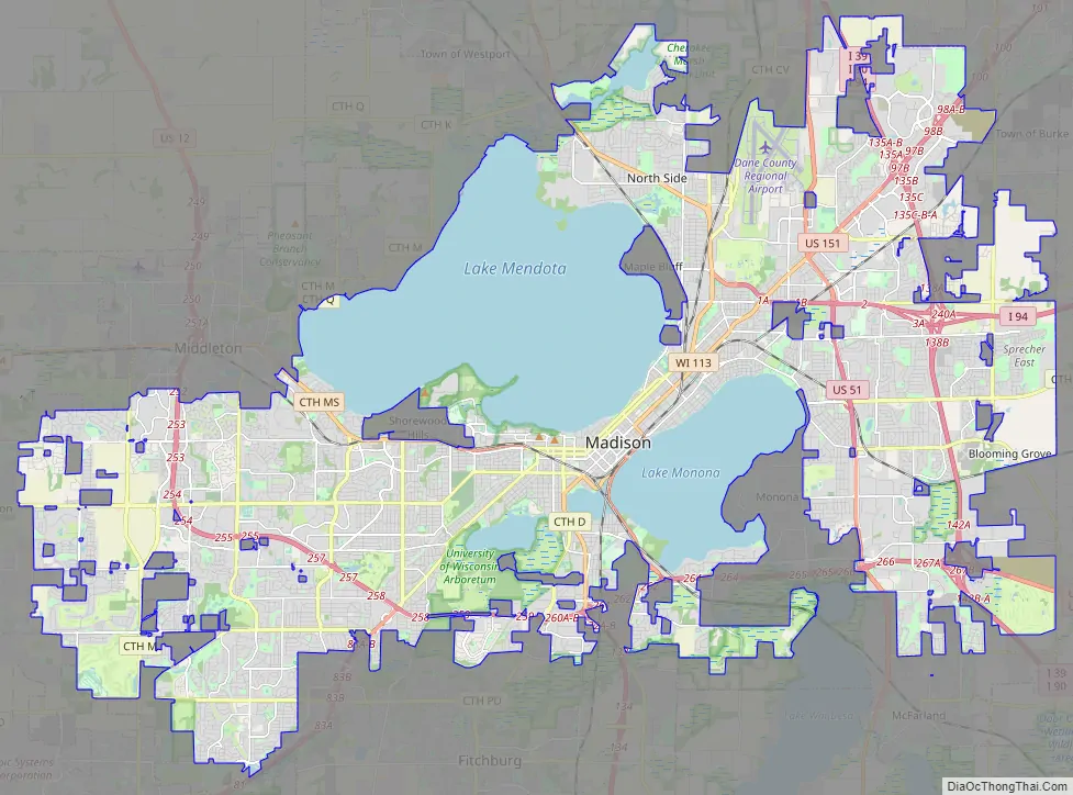
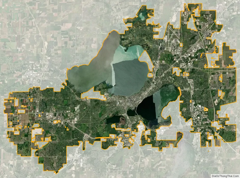
Madison city Satellite Map
Geography
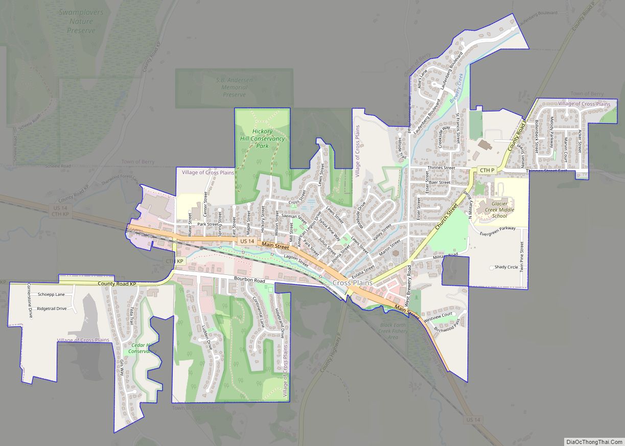
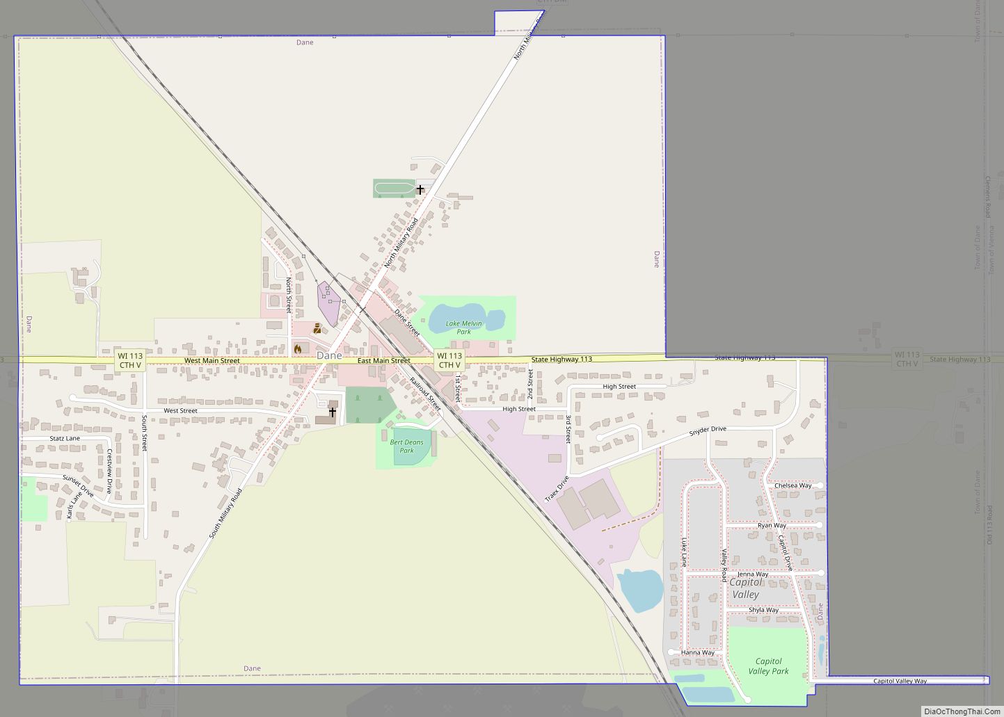
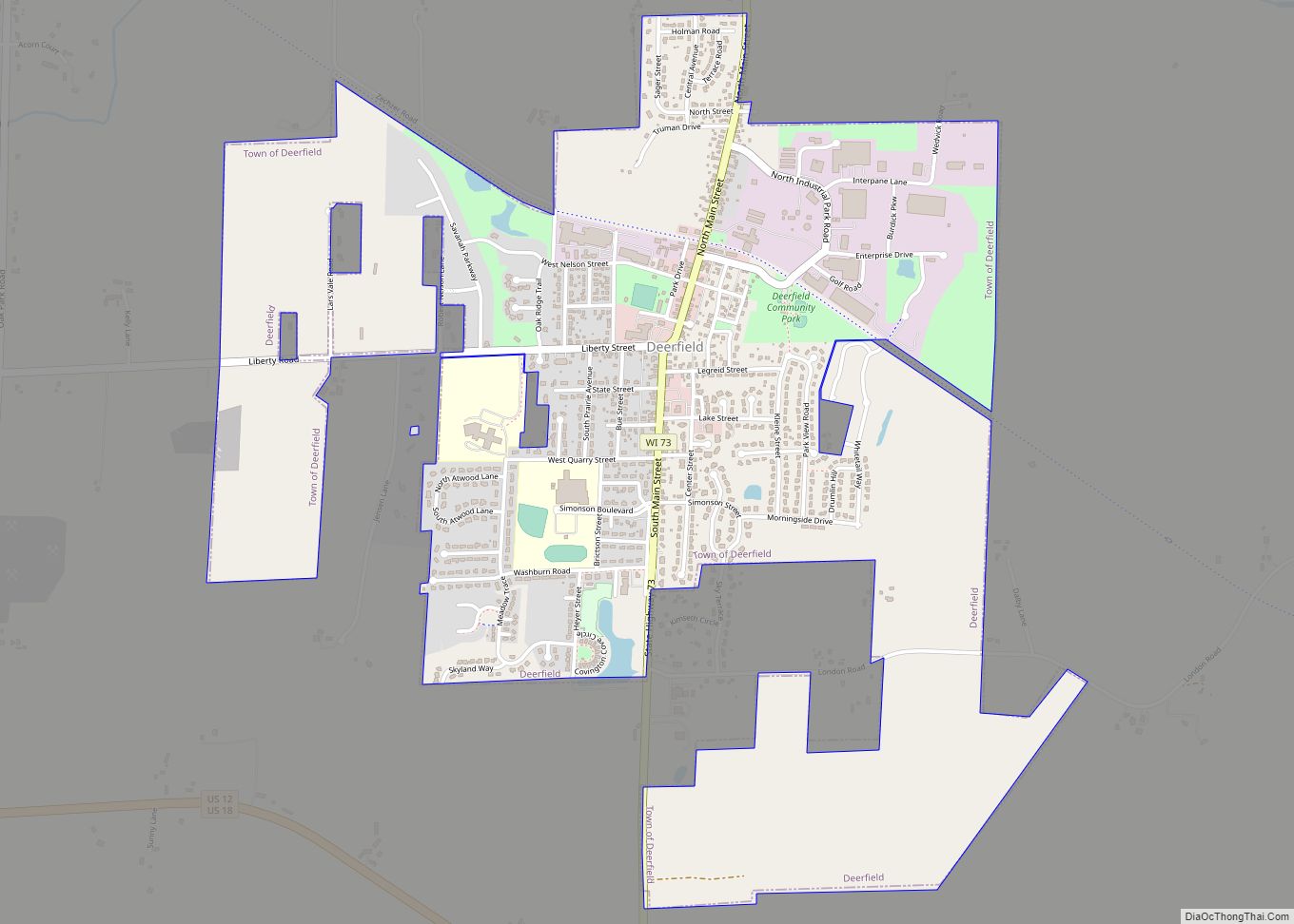
Madison is located in the center of Dane County in south-central Wisconsin, 77 miles (124 km) west of Milwaukee and 122 miles (196 km) northwest of Chicago. The city completely surrounds the city of Monona, and the villages of Maple Bluff and Shorewood Hills. Madison shares borders with its largest suburb, Sun Prairie, and three other suburbs, Middleton, McFarland, and Fitchburg. Other suburbs include the city of Verona and the villages of Cottage Grove, DeForest, and Waunakee as well as Mount Horeb, Oregon, Stoughton, and Cross Plains.
According to the United States Census Bureau, the city has a total area of 94.03 square miles (243.54 km), of which 76.79 square miles (198.89 km) is land and 17.24 square miles (44.65 km) is water.
The city is sometimes described as The City of Four Lakes, comprising the four successive lakes of the Yahara River: Lake Mendota (“Fourth Lake”), Lake Monona (“Third Lake”), Lake Waubesa (“Second Lake”) and Lake Kegonsa (“First Lake”), although Waubesa and Kegonsa are not actually in Madison, but just south of it. A fifth smaller lake, Lake Wingra, is within the city as well; it is connected to the Yahara River chain by Wingra Creek. The Yahara flows into the Rock River, which flows into the Mississippi River. Downtown Madison is located on an isthmus between Lakes Mendota and Monona. The city’s trademark of “Lake, City, Lake” reflects this geography. The city’s lowest elevation is the intersection of Regas Road and Corporate Drive on the east side, at 836.9 ft (255.1 m). The highest elevation is located along Pleasant View Road on the far west side of the city, atop a portion of a terminal moraine of the Green Bay Lobe of the Wisconsin glaciation, at 1,190 ft (360 m).
Neighborhoods
Local identity varies throughout Madison, with over 120 officially recognized neighborhood associations, such as the east side Williamson-Marquette Neighborhood. Historically, the north, east, and south sides were blue collar while the west side was white collar, and to a certain extent this remains true. Students dominate on the University of Wisconsin campus and to the east into downtown, while to its south and in Shorewood Hills on its west, faculty have been a major presence since those neighborhoods were originally developed. The turning point in Madison’s development was the university’s 1954 decision to develop its experimental farm on the western edge of town; since then, the city has grown substantially along suburban lines.
Major commercial areas
The Hilldale area comprises the Hill Farms neighborhood, Sunset Village Neighborhood, and part of the suburb of Shorewood Hills. The area has long winding streets, and according to a planning document issued by the neighborhood association, a “suburban-like feel”. The area is also a commercial district, and contains Hilldale Shopping Center, an outdoor shopping center containing restaurants, a movie theater, and national retail chains.
The Capitol Square Area is Madison’s central business district. It is home to high rise apartments, restaurants, and shopping outlets. It contains several museums and is home to the Wisconsin State Capitol building and the Monona Terrace. The capitol square holds a number of public events for the city of Madison including the Dane County Farmers’ Market, Concerts on the Square, Taste of Madison and Art Fair on the Square. The area’s nightlife is served by several bars and live music venues.
State Street, which links the University of Wisconsin campus with the Capitol Square, is lined with restaurants, espresso cafes, and shops. Only pedestrians, buses, emergency vehicles, delivery vehicles, and bikes are allowed on State Street. State Street is home to much of the nightlife of the University of Wisconsin–Madison, as it is the location of a number of bars and performance venues ranging from comedy clubs to multiple large theaters, including the Overture Center, which features local ballets and Broadway touring casts. State street is also home to Freakfest, the annual Halloween party in Madison. A newer event on State Street is the Madison Night Market that occurs four nights during the year.
The Park Street Area is located in the south of Madison, and contains multiple official neighborhoods, including the Burr Oaks Neighborhood Association and Greenbush. It has been described as the “racially and economically diverse area of Madison”. Park Street is home to ethnic restaurants and specialty grocery stores, as well as retail. Residential areas to the sides of Park Street tend to have smaller houses or condos, and a higher density of houses.
The Dudgeon-Monroe neighborhood neighbors downtown Madison. It is located around Monroe Street, a commercial area which has local shops, coffee houses, dining and galleries. It is home to a neighborhood jazz fest and Wingra Park, where people can rent paddle boats and canoes at the boathouse on Lake Wingra.
The Marquette neighborhood sits on the near east side of Madison. Willy (Williamson) Street contains locally owned shops, restaurants, and entertainment establishments, as well as art galleries, and the Willy Street Co-op. The houses in the Marquette neighborhood fall into two separate historic districts, Third Lake Ridge Historic District and Marquette Bungalow Historic District. The area is also the location of festivals like the Waterfront Festival (June), La Fete de Marquette (July), Orton Park Festival (August), and Willy Street Fair (September). The Willy Street neighborhood is a hub for Madison’s bohemian culture. Houses lining the street are often painted colorfully, and the area has several murals.
Climate
Madison, along with the rest of the state, has a humid continental climate (Köppen: Dfa), characterized by variable weather patterns and a large seasonal temperature variance: winter temperatures can be well below freezing, with moderate to occasionally heavy snowfall and temperatures reaching 0 °F or −17.8 °C on 17 mornings annually; high temperatures in summer average in the lower 80s °F (27–28 °C), reaching 90 °F or 32.2 °C on an average 12 afternoons per year, with lower humidity levels than winter but higher than spring. Summer accounts for a greater proportion of annual rainfall, but winter still sees significant precipitation.
See also
Map of Wisconsin State and its subdivision:- Adams
- Ashland
- Barron
- Bayfield
- Brown
- Buffalo
- Burnett
- Calumet
- Chippewa
- Clark
- Columbia
- Crawford
- Dane
- Dodge
- Door
- Douglas
- Dunn
- Eau Claire
- Florence
- Fond du Lac
- Forest
- Grant
- Green
- Green Lake
- Iowa
- Iron
- Jackson
- Jefferson
- Juneau
- Kenosha
- Kewaunee
- La Crosse
- Lafayette
- Lake Michigan
- Lake Superior
- Langlade
- Lincoln
- Manitowoc
- Marathon
- Marinette
- Marquette
- Menominee
- Milwaukee
- Monroe
- Oconto
- Oneida
- Outagamie
- Ozaukee
- Pepin
- Pierce
- Polk
- Portage
- Price
- Racine
- Richland
- Rock
- Rusk
- Saint Croix
- Sauk
- Sawyer
- Shawano
- Sheboygan
- Taylor
- Trempealeau
- Vernon
- Vilas
- Walworth
- Washburn
- Washington
- Waukesha
- Waupaca
- Waushara
- Winnebago
- Wood
- Alabama
- Alaska
- Arizona
- Arkansas
- California
- Colorado
- Connecticut
- Delaware
- District of Columbia
- Florida
- Georgia
- Hawaii
- Idaho
- Illinois
- Indiana
- Iowa
- Kansas
- Kentucky
- Louisiana
- Maine
- Maryland
- Massachusetts
- Michigan
- Minnesota
- Mississippi
- Missouri
- Montana
- Nebraska
- Nevada
- New Hampshire
- New Jersey
- New Mexico
- New York
- North Carolina
- North Dakota
- Ohio
- Oklahoma
- Oregon
- Pennsylvania
- Rhode Island
- South Carolina
- South Dakota
- Tennessee
- Texas
- Utah
- Vermont
- Virginia
- Washington
- West Virginia
- Wisconsin
- Wyoming