Algoma is a city in Kewaunee County in the U.S. state of Wisconsin. The population was 3,167 at the 2010 census. Algoma is part of the Green Bay Metropolitan Statistical Area.
| Name: | Algoma city |
|---|---|
| LSAD Code: | 25 |
| LSAD Description: | city (suffix) |
| State: | Wisconsin |
| County: | Kewaunee County |
| Elevation: | 581 ft (177 m) |
| Total Area: | 2.50 sq mi (6.48 km²) |
| Land Area: | 2.46 sq mi (6.36 km²) |
| Water Area: | 0.04 sq mi (0.11 km²) |
| Total Population: | 3,167 |
| Population Density: | 1,241.04/sq mi (479.07/km²) |
| Area code: | 920 |
| FIPS code: | 5501000 |
| GNISfeature ID: | 1560759 |
| Website: | www.algomacity.org |
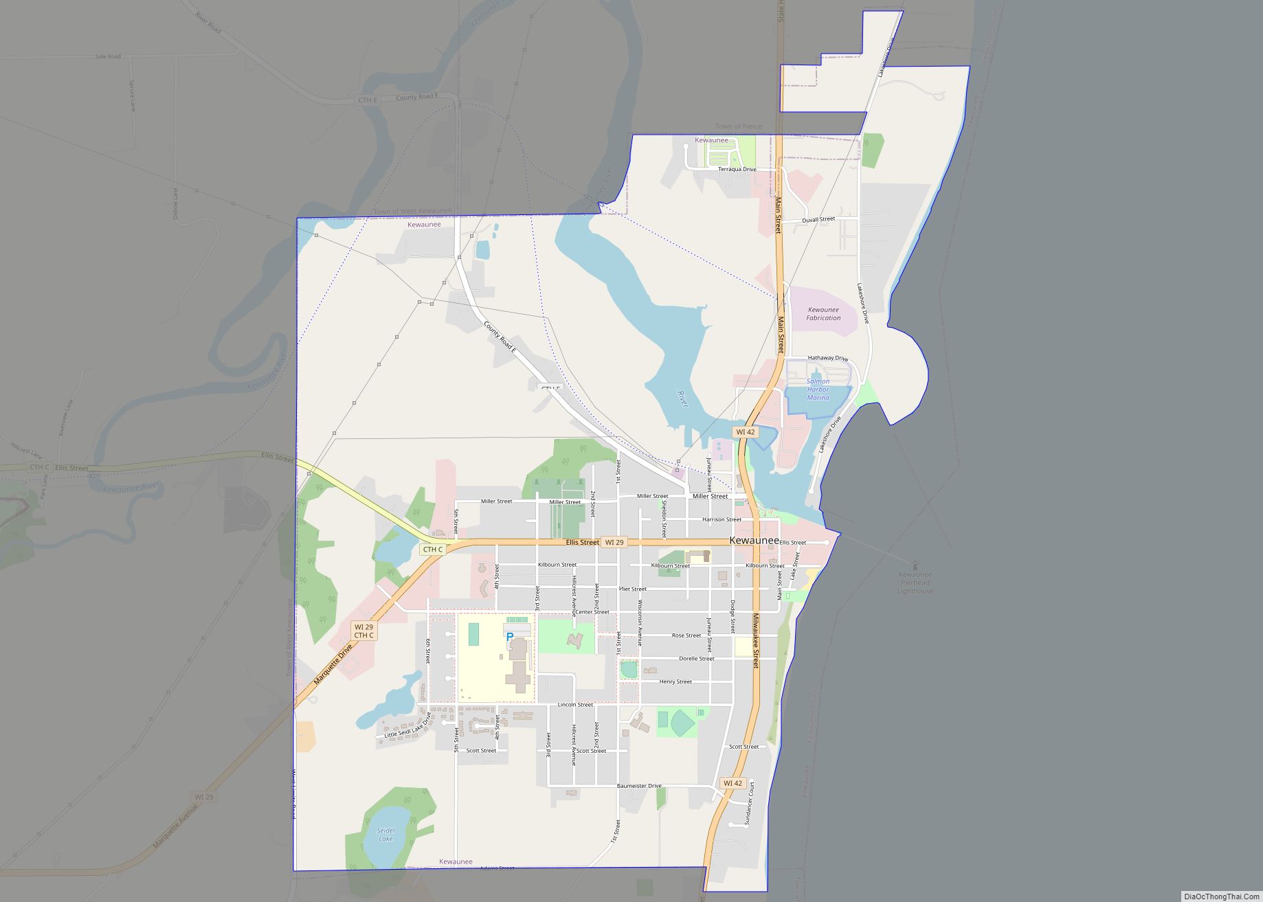
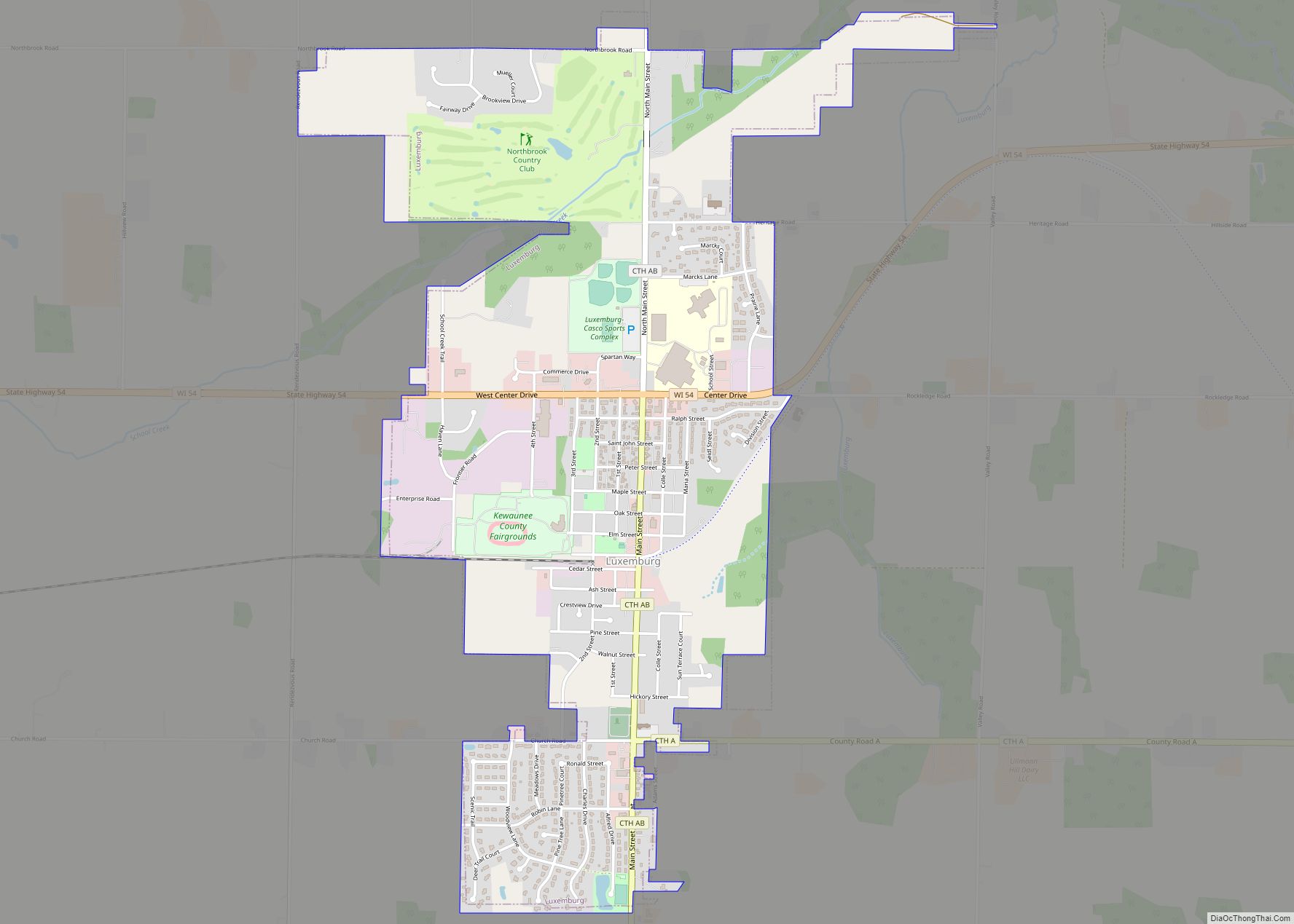
Online Interactive Map
Click on ![]() to view map in "full screen" mode.
to view map in "full screen" mode.
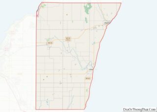
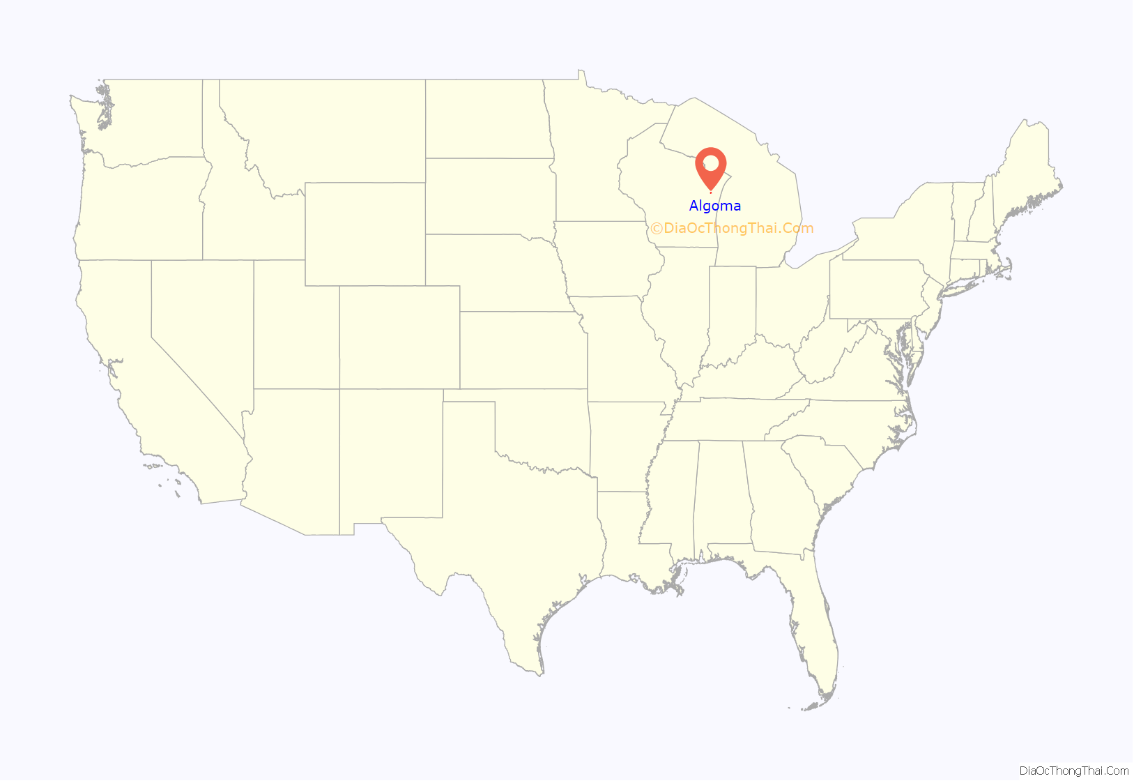
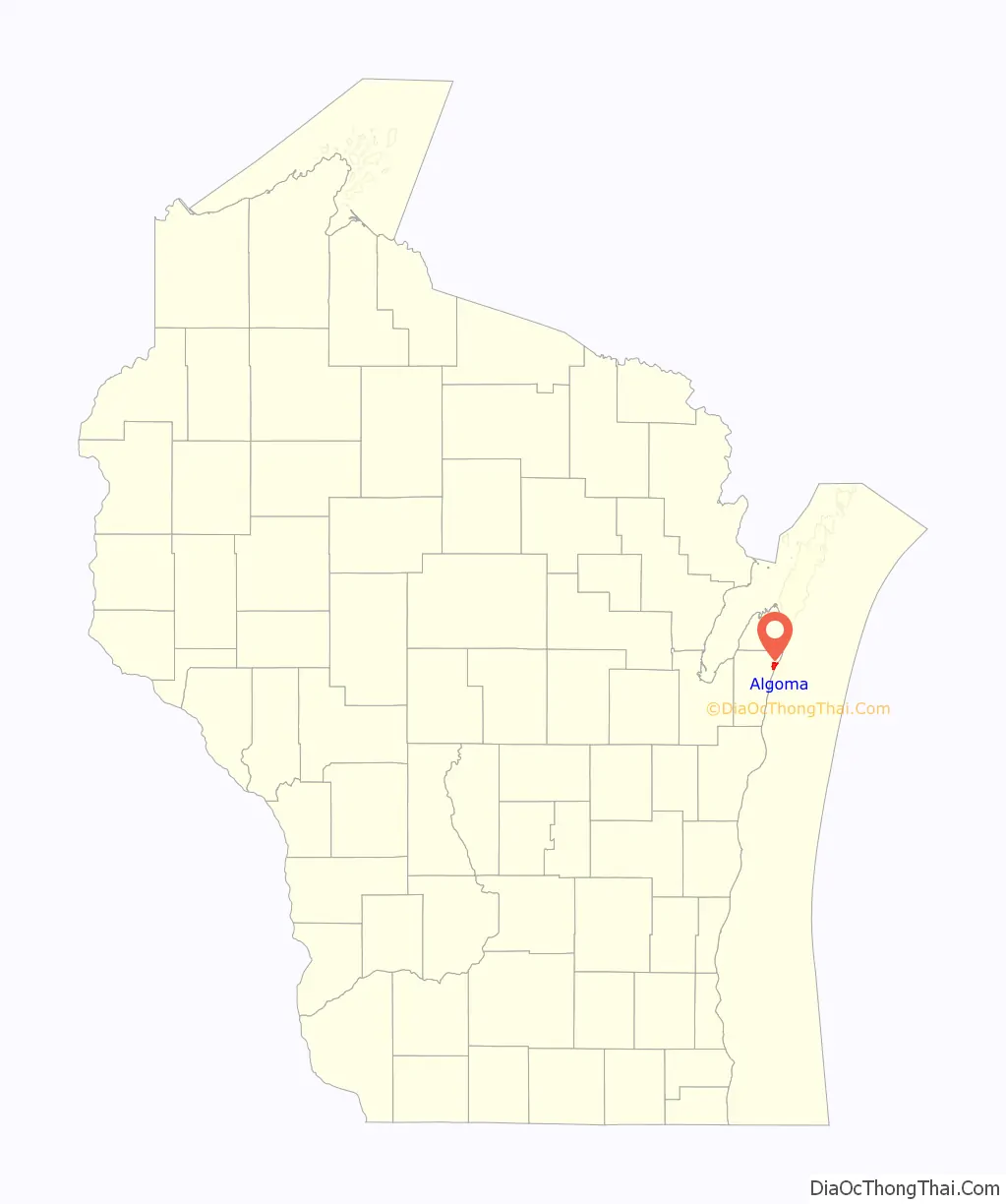
Algoma location map. Where is Algoma city?
History
The Ahnapee settlement, which eventually became known as Algoma, was founded in 1834 by Joseph McCormick of Manitowoc. In 1851, Irish and English pioneers moved to the area and called the place Wolf River. This was a loose translation from the Indian word An-Ne-Pe, meaning “land of the great gray wolf.” The wolf was a legendary animal in stories told by the local Potawatomi Indians. (This animal eventually became the mascot of the Algoma High School.) In the Menominee language, the town is known as Ākem, meaning “snowshoe”.
In the mid-19th century, immigrants from Germany, Bohemia, Scandinavia, and Belgium settled in the community. The earliest businesses consisted of a sawmill, a general store, and churches. In 1859, the name of the town was changed from Wolf to Ahnapee. The town which surrounds Algoma still bears this name.
In 1871, the town survived the Peshtigo Fire that swept from Green Bay and destroyed thousands of acres of land. Local residents were prepared to escape from the fire, but torrential rains extinguished it just before it reached Ahnapee.
Growth and development in Ahnapee was greatly advanced in 1892 with the arrival of the Ahnapee and Western Railway, which connected the coastal town with the Kewaunee Green Bay and Western Railroad at Casco Junction. The railroad would connect Algoma with the rest of the nation’s rail system for the 94 years. Several factories were built in Ahnapee as a result of the railroad’s arrival, including the Ahnapee Seating & Veneer Company. This industry would change owners and names through the years, and operated until 2017 when it closed its doors.
Ahnapee incorporated as a city on February 23, 1879. In 1897, the city was renamed Algoma, a name which may have come from an Indian term for “park of flowers.” (See also Algoma (word)) At that time the commercial fishing fleet located in Algoma was the largest on Lake Michigan. Sport fishing is still a major tourist attraction today.
In 2020, Algoma was awarded the All-America City Award for its plan to counter long-running brain drain, which included a student mentoring program, student vocational opportunities, and a community wellness and fitness center.
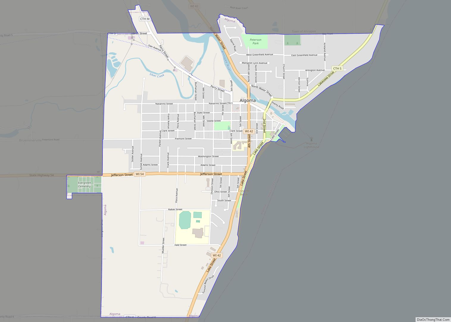
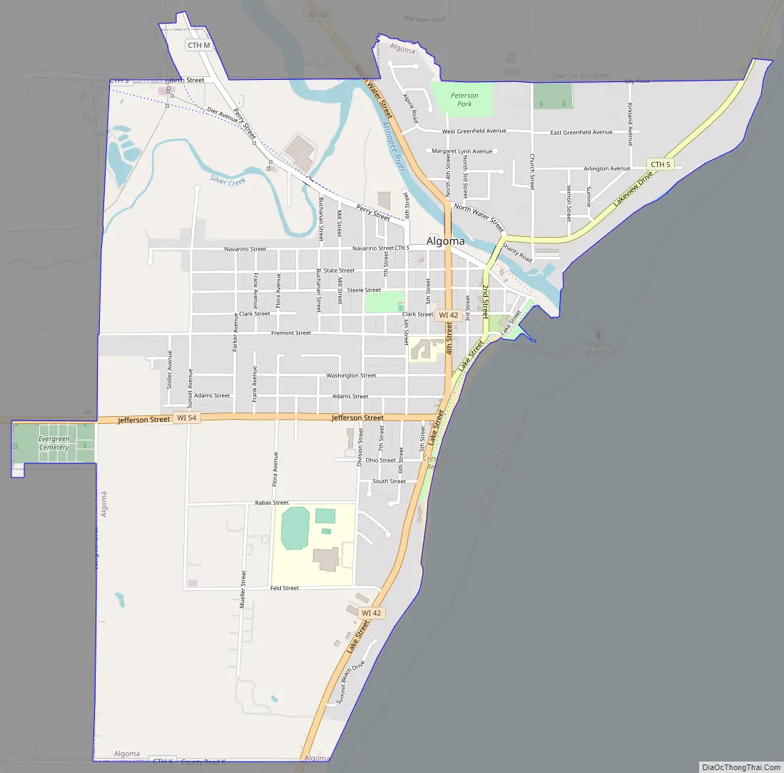
Algoma Road Map
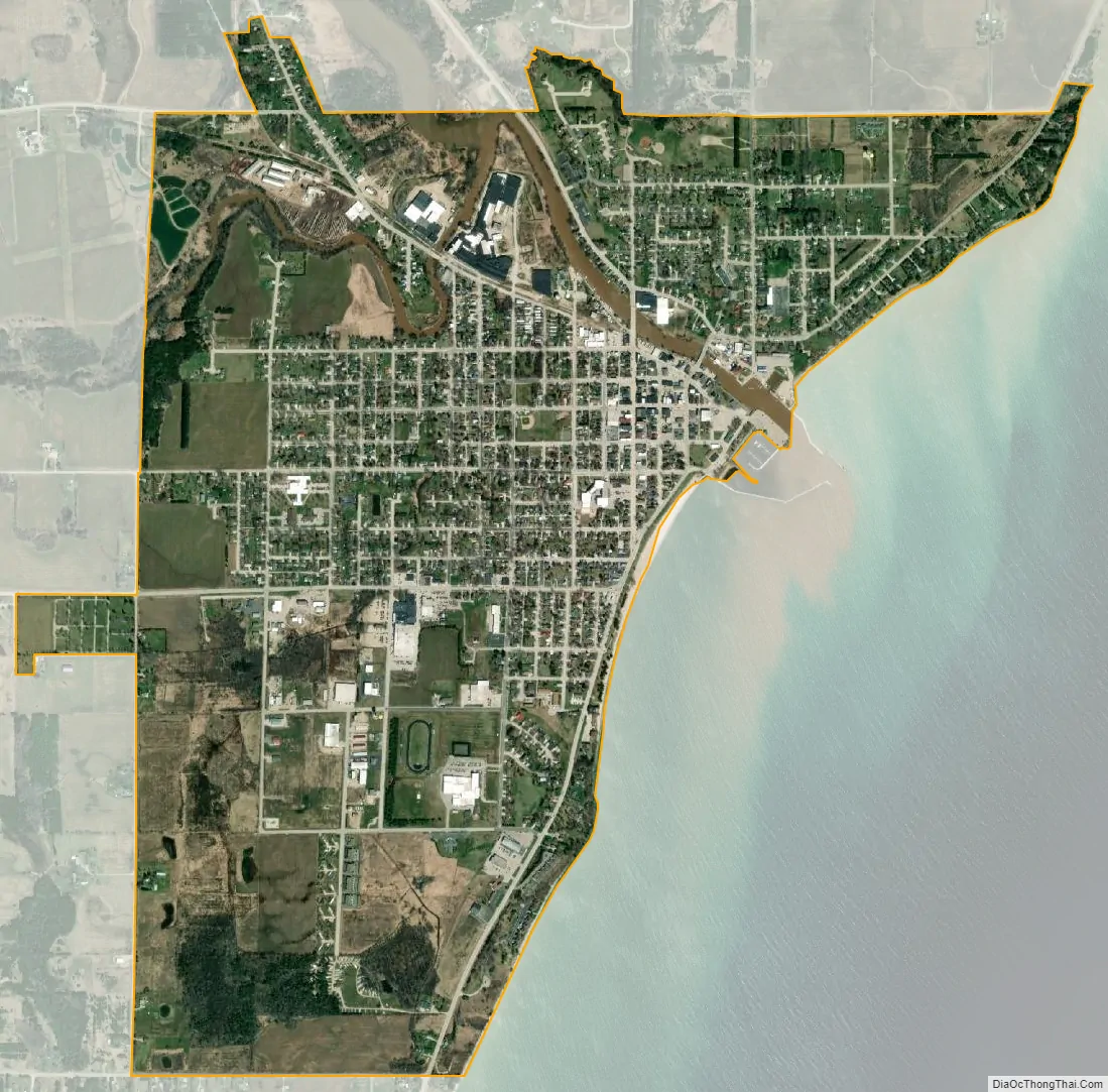
Algoma city Satellite Map
Geography
Algoma is located at 44°36′30″N 87°26′32″W / 44.608226°N 87.442342°W / 44.608226; -87.442342 (44.608226, -87.442342), along Lake Michigan at the mouth of the Ahnapee River.
According to the United States Census Bureau, the city has a total area of 2.51 square miles (6.50 km), of which, 2.47 square miles (6.40 km) is land and 0.04 square miles (0.10 km) is water.
Transportation
- WIS 42 Northbound travels to Sturgeon Bay. South it continues into Kewaunee.
- WIS 54 connects with Green Bay westbound.
- The Ahnapee State Trail, partly coinciding with the Ice Age Trail, connects Algoma with Forestville to the north. The Ice Age trail continues to Kewaunee, but the Ahnapee Trail connects Algoma to Casco.
See also
Map of Wisconsin State and its subdivision:- Adams
- Ashland
- Barron
- Bayfield
- Brown
- Buffalo
- Burnett
- Calumet
- Chippewa
- Clark
- Columbia
- Crawford
- Dane
- Dodge
- Door
- Douglas
- Dunn
- Eau Claire
- Florence
- Fond du Lac
- Forest
- Grant
- Green
- Green Lake
- Iowa
- Iron
- Jackson
- Jefferson
- Juneau
- Kenosha
- Kewaunee
- La Crosse
- Lafayette
- Lake Michigan
- Lake Superior
- Langlade
- Lincoln
- Manitowoc
- Marathon
- Marinette
- Marquette
- Menominee
- Milwaukee
- Monroe
- Oconto
- Oneida
- Outagamie
- Ozaukee
- Pepin
- Pierce
- Polk
- Portage
- Price
- Racine
- Richland
- Rock
- Rusk
- Saint Croix
- Sauk
- Sawyer
- Shawano
- Sheboygan
- Taylor
- Trempealeau
- Vernon
- Vilas
- Walworth
- Washburn
- Washington
- Waukesha
- Waupaca
- Waushara
- Winnebago
- Wood
- Alabama
- Alaska
- Arizona
- Arkansas
- California
- Colorado
- Connecticut
- Delaware
- District of Columbia
- Florida
- Georgia
- Hawaii
- Idaho
- Illinois
- Indiana
- Iowa
- Kansas
- Kentucky
- Louisiana
- Maine
- Maryland
- Massachusetts
- Michigan
- Minnesota
- Mississippi
- Missouri
- Montana
- Nebraska
- Nevada
- New Hampshire
- New Jersey
- New Mexico
- New York
- North Carolina
- North Dakota
- Ohio
- Oklahoma
- Oregon
- Pennsylvania
- Rhode Island
- South Carolina
- South Dakota
- Tennessee
- Texas
- Utah
- Vermont
- Virginia
- Washington
- West Virginia
- Wisconsin
- Wyoming