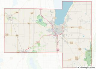
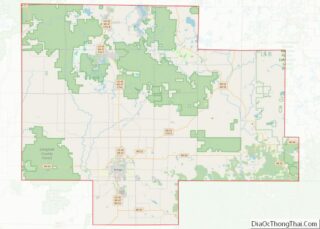
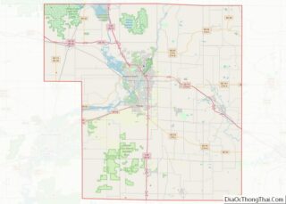
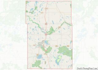
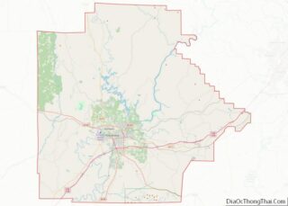
Map of Bon Homme County

Map of Bon Homme County, South Dakota

Bon Homme County (/ˈbɑːn əm/ BAHN əm; French: Comté de bon homme) is a county in the U.S. state of South Dakota. As of the 2020 census, the population was 7,003. Its county seat is Tyndall. Bon Homme County overview: Name: Bon Homme County FIPS code: 46-009 State: South Dakota Founded: April 5, 1862 Named … Read more

Map of Dewey County

Map of Dewey County, South Dakota

Dewey County is a county in the U.S. state of South Dakota. As of the 2020 census, the population was 5,239. Its county seat is Timber Lake. The county was created in 1883 and organized in 1910. It was named for William P. Dewey, Territorial surveyor-general from 1873 to 1877. Almost the entire county lies … Read more

Map of Jerauld County

Map of Jerauld County, South Dakota

Jerauld County is a county in the U.S. state of South Dakota. As of the 2020 census, the population was 1,663. Its county seat is Wessington Springs. Jerauld County overview: Name: Jerauld County FIPS code: 46-073 State: South Dakota Founded: 1883 Named for: H. J. Jerauld Seat: Wessington Springs Largest city: Wessington Springs Total Area: … Read more

Map of Perkins County

Map of Perkins County, South Dakota

Perkins County is a county in the U.S. state of South Dakota. As of the 2020 census, the population was 2,835. Its county seat is Bison. The county was established in 1908 and organized in 1909. It was named for Sturgis, South Dakota, official Henry E. Perkins. Perkins County overview: Name: Perkins County FIPS code: … Read more

Map of Bedford County

Map of Bedford County, Tennessee

Bedford County is a county located in the U.S. state of Tennessee. As of the 2020 census, the population was 50,237. Its county seat is Shelbyville. Bedford County comprises the Shelbyville, TN Micropolitan Statistical Area, which is also included in the Nashville-Davidson–Murfreesboro, TN Combined Statistical Area. Bedford County overview: Name: Bedford County FIPS code: 47-003 … Read more

Map of Cumberland County

Map of Cumberland County, Tennessee

Cumberland County is a county located in the U.S. state of Tennessee. As of the 2020 census, the population was 61,145. Its county seat is Crossville. Cumberland County comprises the Crossville, TN micropolitan statistical area. Cumberland County overview: Name: Cumberland County FIPS code: 47-035 State: Tennessee Founded: November 16, 1855 Named for: Cumberland Mountains Seat: … Read more

Map of Hancock County

Map of Hancock County, Tennessee

Hancock County is a county located in the northeastern part of the U.S. state of Tennessee. As of the 2020 census, the population was 6,662, making it the fourth-least populous county in Tennessee. Its county seat is Sneedville. Hancock County overview: Name: Hancock County FIPS code: 47-067 State: Tennessee Founded: 1844 Named for: John Hancock … Read more

Map of Lawrence County

Map of Lawrence County, Tennessee

Lawrence County is a county located in the U.S. state of Tennessee. As of the 2020 census, the population was 44,159. Its county seat and largest city is Lawrenceburg. Lawrence County comprises the Lawrenceburg, TN Micropolitan Statistical Area, which is also included in the Nashville-Davidson-Murfreesboro, TN Combined Statistical Area. Lawrence County overview: Name: Lawrence County … Read more

Map of Obion County

Map of Obion County, Tennessee

Obion County overview: Name: Obion County FIPS code: 47-131 State: Tennessee Founded: 1824 Named for: Obion River Seat: Union City Largest city: Union City Total Area: 556 sq mi (1,440 km²) Land Area: 545 sq mi (1,410 km²) Total Population: 30,787 Population Density: 58/sq mi (22/km²) Time zone: UTC−6 (Central) Summer Time Zone (DST): UTC−5 (CDT) Website: www.obioncountytn.gov Obion County location map. … Read more

Map of Sullivan County

Map of Sullivan County, Tennessee

Sullivan County is a county located in the U.S. state of Tennessee on its northeast border. As of the 2020 census, the population was 158,163. Its county seat is Blountville. Sullivan County is part of the Kingsport–Johnson City–Bristol, TN-VA Metropolitan Statistical Area, which is a component of the Kingsport–Johnson City–Bristol, TN-VA Combined Statistical Area, commonly … Read more

Map of Angelina County

Map of Angelina County, Texas

Angelina County (/ˌændʒəˈliːnə/ AN-jə-LEE-nə) is a county located in the U.S. state of Texas. It is in East Texas and its county seat is Lufkin. As of the 2020 census, the population was 86,395. The Lufkin, TX Micropolitan Statistical Area includes all of Angelina County. It was formed in 1846 from Nacogdoches County. It is … Read more

Map of Bowie County

Map of Bowie County, Texas

Bowie County (/ˈbuːi/ BOO-ee) is a county in the U.S. state of Texas. Its legal county seat is Boston, though its courthouse is located in New Boston. As of the 2020 census, the population was 92,893. Bowie County is part of the Texarkana metropolitan statistical area. The county is named for James Bowie, the legendary … Read more