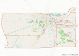
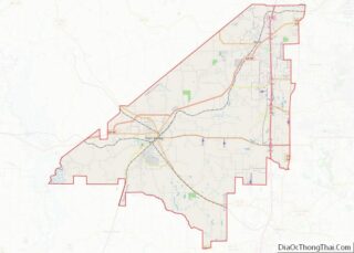
Map of Lincoln County, Oklahoma
Lincoln County is a county in eastern Central Oklahoma. As of the 2010 census, the population was 34,273. Its county seat is Chandler. Lincoln County is part of the Oklahoma City, OK Metropolitan Statistical Area. In 2010, the center of population of Oklahoma was in Lincoln County, near the town of Sparks. Lincoln County overview: ... Read more
Map of Lincoln County, Oklahoma
Map of Osage County, Oklahoma
Osage County (/ˈoʊseɪdʒ/) is the largest county by area in the U.S. state of Oklahoma. Created in 1907 when Oklahoma was admitted as a state, the county is named for and is home to the federally recognized Osage Nation. The county is coextensive with the Osage Nation Reservation, established by treaty in the 19th century ... Read more
Map of Osage County, Oklahoma
Map of Wagoner County, Oklahoma
Wagoner County is a county located in the U.S. state of Oklahoma. As of the 2020 census, the population was 80,981. Its county seat is Wagoner. Wagoner County is included in the Tulsa metropolitan statistical area. Wagoner County overview: Name: Wagoner County FIPS code: 40-145 State: Oklahoma Founded: 1907 Named for: Henry “Bigfoot” Wagoner Seat: ... Read more
Map of Wagoner County, Oklahoma
Map of Grant County, Oregon
Grant County is one of the 36 counties in the U.S. state of Oregon. As of the 2020 census, the population was 7,233, making it Oregon’s fourth-least populous county. The county seat is Canyon City. It is named for President Ulysses S. Grant, who served as an army officer in the Oregon Territory, and at ... Read more
Map of Grant County, Oregon
Map of Sherman County, Oregon
Sherman County is one of the 36 counties in the U.S. state of Oregon. As of the 2020 census, the population was 1,870, making it the second-least populous county in Oregon after nearby Wheeler. The county seat is Moro, and the largest city is Wasco. The county is named for William Tecumseh Sherman, a Union ... Read more
Map of Sherman County, Oregon
Map of Bradford County, Pennsylvania
Bradford County is a county in the Commonwealth of Pennsylvania. It is part of Northeastern Pennsylvania. As of the 2020 census, its population was 59,967. Its county seat is Towanda. The county was created on February 21, 1810, from parts of Lycoming and Luzerne Counties. Originally called Ontario County, it was reorganized and separated from ... Read more
Map of Bradford County, Pennsylvania
Map of Elk County, Pennsylvania
Elk County is a county in the Commonwealth of Pennsylvania. As of the 2020 United States census, the population was 30,990. Its county seat is Ridgway. The county was created on April 18, 1843, from parts of Jefferson, Clearfield, and McKean Counties. Elk County is named for the eastern elk (Cervus canadensis) that historically inhabited ... Read more
Map of Elk County, Pennsylvania
Map of Luzerne County, Pennsylvania
Luzerne County is a county in the Commonwealth of Pennsylvania. According to the United States Census Bureau, the county has a total area of 906 square miles (2,350 km), of which 890 square miles (2,300 km) is land and 16 square miles (41 km) is water. It is Northeastern Pennsylvania’s second-largest county by total area. As of the ... Read more
Map of Luzerne County, Pennsylvania
Map of Somerset County, Pennsylvania
Somerset County (Pennsylvania German: Somerset Kaundi) is a county in the Commonwealth of Pennsylvania. As of the 2020 census, the population was 74,129. Its county seat is Somerset. The county was created from part of Bedford County on April 17, 1795, and named after the county of Somerset in England. Somerset County comprises the Somerset, ... Read more
Map of Somerset County, Pennsylvania
Map of Washington County, Rhode Island
Washington County, known locally as South County, is a county located in the U.S. state of Rhode Island. As of the 2020 census, the population was 129,839. Rhode Island counties have no governmental functions other than as court administrative boundaries, which are part of the state government. Washington County overview: Name: Washington County FIPS code: ... Read more
Map of Washington County, Rhode Island
Map of Darlington County, South Carolina
Darlington County is a county in the U.S. state of South Carolina. As of the 2020 census, its population was 62,905. Its county seat is Darlington. Hartsville is the largest city in the county. Darlington County is home to the Darlington Raceway, which hosts the annual NASCAR Southern 500. Darlington County is also home to ... Read more
Map of Darlington County, South Carolina
Map of Lexington County, South Carolina
Lexington County is a county located in the U.S. state of South Carolina. As of the 2020 census, the population was 293,991, and the 2021 population estimate was 300,137. Its county seat and largest town is Lexington. The county was chartered in 1785 and was named in commemoration of Lexington, Massachusetts, the site of the ... Read more
Map of Lexington County, South Carolina