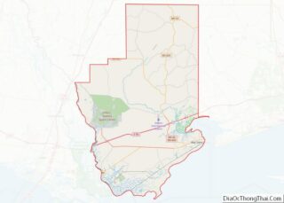
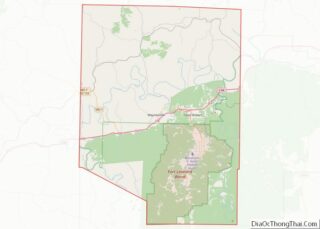
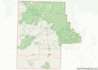
Map of Preble County

Map of Preble County, Ohio

Preble County is a county located in the U.S. state of Ohio. As of the 2020 census, the population was 40,999, down 3.0% from the 2010 census population of 42,270. Its county seat is Eaton. The county was formed on February 15, 1808, from portions of Butler and Montgomery Counties. It is named for Edward … Read more

Map of Washington County

Map of Washington County, Ohio

Washington County is a county located in the southeastern part of the U.S. state of Ohio. As of the 2020 census, the population was 59,711. Its county seat is Marietta. The county, the oldest in the state, is named for George Washington. Washington County comprises the Marietta, OH Micropolitan Statistical Area, which is also included … Read more

Map of Choctaw County

Map of Choctaw County, Oklahoma

Choctaw County is a county located in the U.S. state of Oklahoma. As of the 2010 census, the population was 15,205. Its county seat is Hugo. Formerly part of the Choctaw Nation in Indian Territory, this county was reorganized and redefined in 1907, at the time of Oklahoma statehood. According to the Encyclopedia of Oklahoma … Read more

Map of Greer County

Map of Greer County, Oklahoma

Greer County is a county located along the southwest border of the U.S. state of Oklahoma. As of the 2010 census, the population was 6,239. Its county seat is Mangum. From 1860 to 1896, the state of Texas claimed an area known as Greer County, Texas, which included present-day Greer County along with neighboring areas. … Read more

Map of Major County

Map of Major County, Oklahoma

Major County is a county in the northwestern part of the U.S. state of Oklahoma. As of the 2010 census, its population was 7,527. Its county seat is Fairview. The county was created in 1907. Located in northwestern Oklahoma, Major County is bounded by Woods and Alfalfa counties in the north, Garfield County on the … Read more

Map of Payne County

Map of Payne County, Oklahoma

Payne County is located in the U.S. state of Oklahoma. As of the 2010 census, the population was 77,350. Its county seat is Stillwater. The county was created in 1890 as part of Oklahoma Territory and is named for Capt. David L. Payne, a leader of the “Boomers”. Payne County comprises the Stillwater, OK Micropolitan … Read more

Map of Woods County

Map of Woods County, Oklahoma

Woods County is a county located in the northwestern part of the U.S. state of Oklahoma. As of the 2010 census, the population was 8,878. Its county seat is Alva. The county is named after Samuel Newitt Wood, a renowned Kansas populist. Woods County overview: Name: Woods County FIPS code: 40-151 State: Oklahoma Founded: 1893 … Read more

Map of Jackson County

Map of Jackson County, Oregon

Jackson County is one of the 36 counties in the U.S. state of Oregon. As of the 2020 census, the population was 223,259. The county seat is Medford. The county is named for Andrew Jackson, the seventh president of the United States. Jackson County comprises the Medford, OR Metropolitan Statistical Area. There are 11 incorporated … Read more

Map of Union County

Map of Union County, Oregon

Union County is one of the 36 counties in the U.S. state of Oregon. As of the 2020 census, the population was 26,196. Its county seat is La Grande. Union County comprises the La Grande, OR Micropolitan Statistical Area. It is one of the eight counties of eastern Oregon. Union County overview: Name: Union County … Read more

Map of Cambria County

Map of Cambria County, Pennsylvania

Cambria County overview: Name: Cambria County FIPS code: 42-021 State: Pennsylvania Founded: November 2, 1807 Named for: Latin name of Wales Seat: Ebensburg Largest city: Johnstown Total Area: 694 sq mi (1,800 km²) Land Area: 688 sq mi (1,780 km²) Total Population: 132,167 Population Density: 194/sq mi (75/km²) Time zone: UTC−5 (Eastern) Summer Time Zone (DST): UTC−4 (EDT) Website: www.co.cambria.pa.us Cambria County … Read more

Map of Forest County

Map of Forest County, Pennsylvania

Forest County is a county in the Commonwealth of Pennsylvania. As of the 2020 census, the population was 6,973, making it the third-least populous county in Pennsylvania. Its county seat is Tionesta. The county was created in 1848 and later organized in 1857. Forest County overview: Name: Forest County FIPS code: 42-053 State: Pennsylvania Founded: … Read more

Map of Mercer County

Map of Mercer County, Pennsylvania

Mercer County is a county in the Commonwealth of Pennsylvania. As of the 2020 census, the population was 110,652. Its county seat is Mercer, and its largest city is Hermitage. The county was created in 1800 and later organized in 1803. Mercer County is included in the Youngstown-Warren-Boardman, OH-PA Metropolitan Statistical Area. Mercer County overview: … Read more