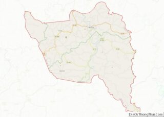
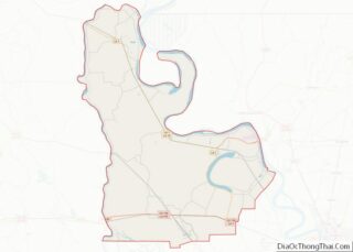
Map of Decatur County, Kansas
Decatur County (county code DC) is a county located in Northwest Kansas. As of the 2020 census, the county population was 2,764. Its county seat and most populous city is Oberlin. The county is named in honor of Commodore Stephen Decatur, Jr. Decatur County overview: Name: Decatur County FIPS code: 20-039 State: Kansas Founded: March ... Read more
Map of Decatur County, Kansas
Map of Greeley County, Kansas
Greeley County (county code: GL) is a county located in western Kansas, in the Central United States. Its county seat and largest city is Tribune. As of the 2020 census, the population was 1,284, the least populous county in Kansas. As of 2018, it is tied with Wallace County as the least densely populated county ... Read more
Map of Greeley County, Kansas
Map of Leavenworth County, Kansas
Leavenworth County (county code LV) is located in the U.S. state of Kansas and is part of the Kansas City metropolitan area. As of the 2020 census, the county population was 81,881. Its county seat and most populous city is Leavenworth. Leavenworth County overview: Name: Leavenworth County FIPS code: 20-103 State: Kansas Founded: August 25, ... Read more
Map of Leavenworth County, Kansas
Map of Ness County, Kansas
Ness County (standard abbreviation: NS) is a county located in the U.S. state of Kansas. As of the 2020 census, the county population was 2,687. The largest city and county seat is Ness City. The county was named for Corporal Noah V. Ness of the 7th Kansas Cavalry. Ness County overview: Name: Ness County FIPS ... Read more
Map of Ness County, Kansas
Map of Russell County, Kansas
Russell County overview: Name: Russell County FIPS code: 20-167 State: Kansas Founded: February 26, 1867 Named for: Avra P. Russell Seat: Russell Largest city: Russell Total Area: 899 sq mi (2,330 km²) Land Area: 886 sq mi (2,290 km²) Total Population: 6,691 Population Density: 7.4/sq mi (2.9/km²) Time zone: UTC−6 (Central) Summer Time Zone (DST): UTC−5 (CDT) Website: County Website Russell County ... Read more
Map of Russell County, Kansas
Map of Wallace County, Kansas
Wallace County overview: Name: Wallace County FIPS code: 20-199 State: Kansas Founded: 1868 Named for: W. H. L. Wallace Seat: Sharon Springs Largest city: Sharon Springs Total Area: 914 sq mi (2,370 km²) Land Area: 914 sq mi (2,370 km²) Total Population: 1,512 Population Density: 1.7/sq mi (0.7/km²) Time zone: UTC−7 (Mountain) Summer Time Zone (DST): UTC−6 (MDT) Website: WallaceCounty.net Wallace County ... Read more
Map of Wallace County, Kansas
Map of Boyle County, Kentucky
Boyle County is a county located in the central part of Kentucky. As of the 2020 census, the population was 30,614. Its county seat is Danville. The county was formed in 1842 and named for John Boyle (1774–1835), a U.S. Representative, chief justice of the Kentucky Court of Appeals , and later federal judge for ... Read more
Map of Boyle County, Kentucky
Map of Clinton County, Kentucky
Clinton County is a county located in the U.S. state of Kentucky in the Pennyrile Region along the southern border with Tennessee. As of the 2020 census, the population was 9,253. Its county seat is Albany. The county was formed in 1835 and named for DeWitt Clinton, the seventh Governor of New York. It is ... Read more
Map of Clinton County, Kentucky
Map of Grayson County, Kentucky
Grayson County is a county located in the U.S. state of Kentucky. As of the 2020 census, the population was 26,420. Its county seat is Leitchfield. The county was formed in 1810 and named for William Grayson (1740-1790), a Revolutionary War colonel and a prominent Virginia political figure. Grayson County was formerly a prohibition or ... Read more
Map of Grayson County, Kentucky
Map of Kenton County, Kentucky
Kenton County is a county located in the northern part of the Commonwealth of Kentucky. As of the 2020 census, the population was 169,064, making it the third most populous county in Kentucky (behind Jefferson County and Fayette County). Its county seats are Covington and Independence. It was, until November 24, 2010, the only county ... Read more
Map of Kenton County, Kentucky
Map of Marion County, Kentucky
Marion County is a county in the U.S. state of Kentucky. As of the 2020 census, the total population was 19,581. Its county seat is Lebanon. The county was founded in 1834 and named for Francis Marion, the American Revolutionary War hero known as the “Swamp Fox”. Marion County overview: Name: Marion County FIPS code: ... Read more
Map of Marion County, Kentucky
Map of Nicholas County, Kentucky
Nicholas County is a county located in the U.S. state of Kentucky. As of the 2020 census, the population was 7,537. Its county seat is Carlisle, which is also the only incorporated community in the county. Founded in 1799, the county is named for Col. George Nicholas, the “Father of the Kentucky Constitution.” Nicholas County ... Read more
Map of Nicholas County, Kentucky