Owsley County is a county located in the Eastern Coalfield region of the U.S. state of Kentucky. As of the 2020 census, the population was 4,051, making it the second-least populous county in Kentucky. The county seat is Booneville. The county was organized on January 23, 1843, from Clay, Estill, and Breathitt counties and named for William Owsley (1782–1862), the judge of the Kentucky Court of Appeals and Governor of Kentucky (1844–48). According to the 2010 census reports, Owsley County has the second-highest level of child poverty of any county in the United States. In terms of income per household, the county is the poorest in the nation. Between 1980 and 2014, the rate of death from cancer in the county increased by 45.6 percent, the largest such increase of any county in the United States.
| Name: | Owsley County |
|---|---|
| FIPS code: | 21-189 |
| State: | Kentucky |
| Founded: | 1843 |
| Named for: | William Owsley |
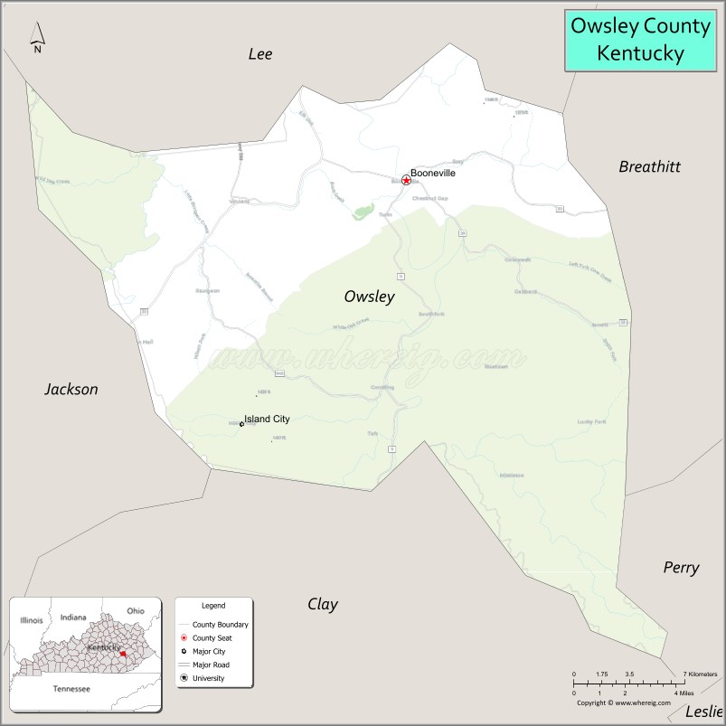
| Seat: | Booneville |
| Largest city: | Booneville |
| Total Area: | 198 sq mi (510 km²) |
| Land Area: | 197 sq mi (510 km²) |
| Total Population: | 4,051 |
| Population Density: | 20/sq mi (7.9/km²) |
| Time zone: | UTC−5 (Eastern) |
| Summer Time Zone (DST): | UTC−4 (EDT) |
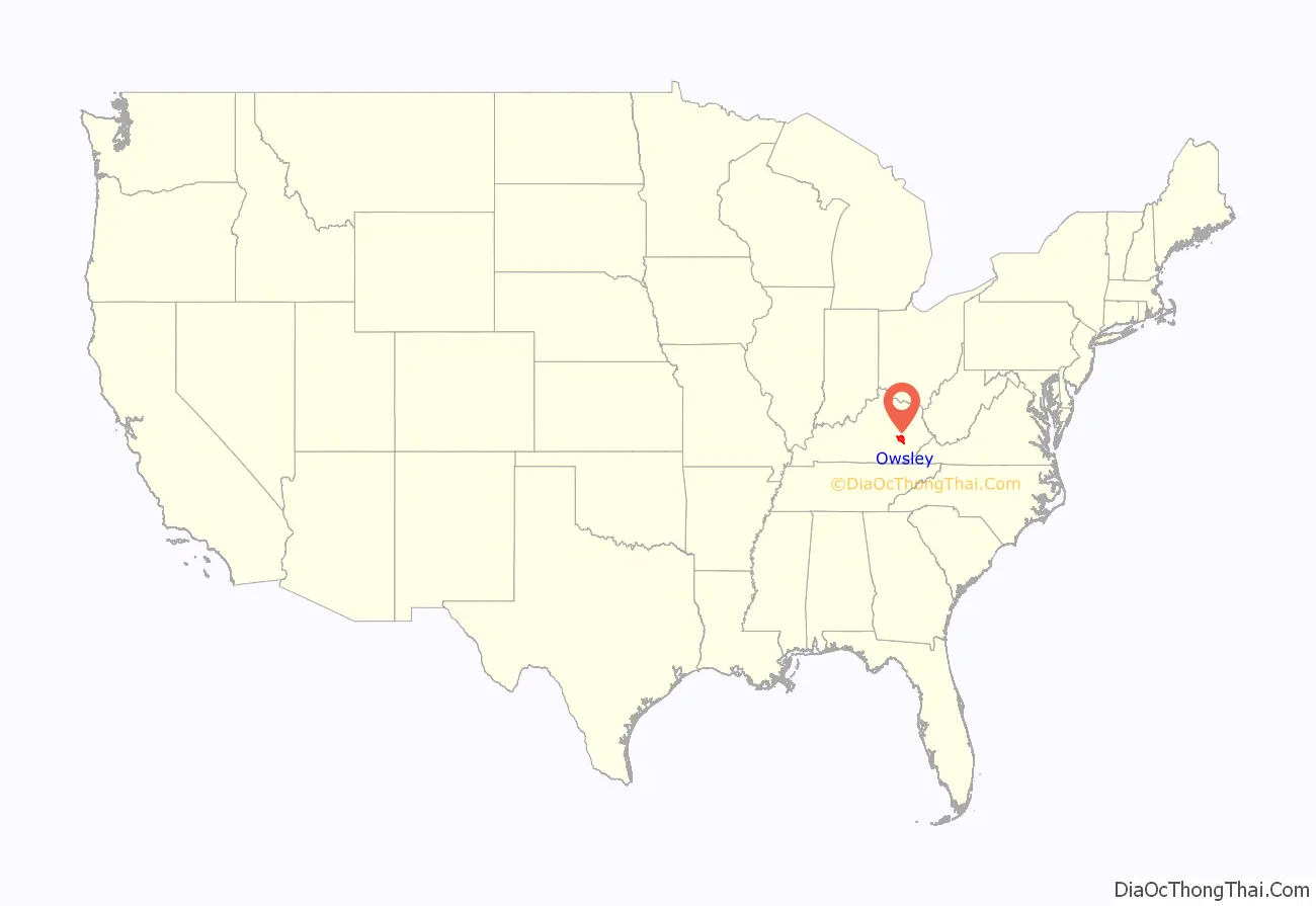
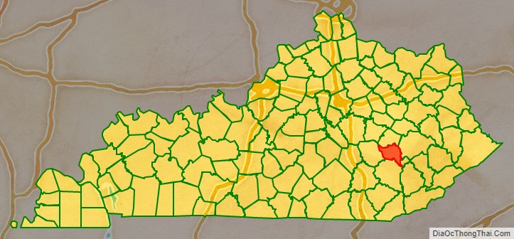
Owsley County location map. Where is Owsley County?
History
Owsley County was formed in 1843 from portions of Clay, Breathitt, and Estill Counties and was named for Governor William Owsley. Owsley County was Kentucky’s 96th county. Parts of Owsley County were used to form Jackson County in 1858 and Lee County in 1870.
The first settlers in Owsley County were John Renty Baker and John Abner. They settled there in about 1780 near the present Clay County line at Courtland. A gravestone in a cemetery on Upper Buffalo Creek reads, “Milly, wife of John Abner, died March 1846.”
John Renty Baker and his sons, all of them gunsmiths, invented and developed hand-operated machines to rifle the barrels. John Renty Baker’s father, Robert Baker, is sometimes credited with developing the firearm known as the “Kentucky Rifle”.
John Renty Baker was one of the “Longhunters”, spending more than a year at a time in the hunting and trapping in the forests of Kentucky and Tennessee. According to “The Conquest of the Old Southwest”, Baker hunted in Kentucky in 1766 with Daniel Boone’s brother-in-law, John Stewart. He lived on the Green River among the Cherokees and made trips down the Cumberland River to Spanish Natchez to sell furs.
After the death of his wife, Baker became a recluse and lived in a rock house (rockshelter) near the mouth of Buffalo Creek, where he died in 1820. He was the father of at least 21 children, who are documented.
The Baker family is the source of many stories. They were involved in one of the longest and bloodiest family feuds in U.S. history, which began in 1843 when Dr. Thomas Baker (a grandson of Julius Bob Baker) shot John Bales. Dr. Baker and Bales had both married to daughters of John White, and the couples became more intimate than was usual in the mountain country. Dr. Baker was insanely jealous of his wife and Bales. In a fit of rage, he abandoned his wife and filed for divorce, although he later withdrew it. Baker and Bales worked at a salt works in Manchester, and one day Baker called Bales to the door and shot him with his pepper box pistol. As he lay dying, Bales cursed Baker and ordered $10,000 from his estate to be used for to capture and convict him. The family feud lasted for 59 years and eventually cost more than 100 lives.
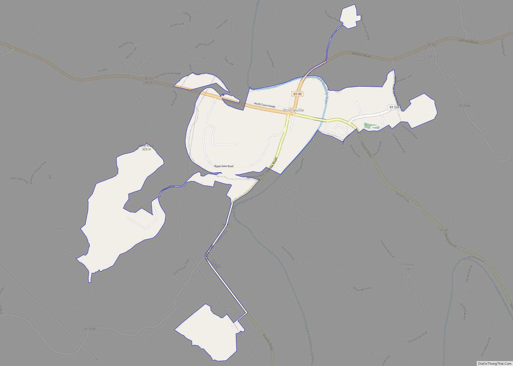
The first settler of Booneville was James Moore Sr. His home was just outside of Booneville, in front of today’s Booneville Homes apartments. Moore’s son, James Jr., built a two-room cabin across the river from his parents. This cabin still exists, though it has been enlarged and remodeled through the years. It is currently owned by Booneville’s mayor, Charles Long.
James Moores’ land included all of Booneville, extending east across the South Fork River and towards Lerose. The community was originally known as Moore’s Station, but it was renamed Booneville (for Daniel Boone) when it was incorporated in 1846. James Moore Jr. was the first postmaster. When the county was formed in 1843, Elias Moore donated the land for its seat. The post office opened in 1844. Owsley County lost part of its territory to Jackson County in 1858, and two years later lost more to Wolfe County. In 1870, Lee County was formed, and Owsley County was reduced to its present size.
The first permanent settlers of Owsley County were the Moore, Bowman, Baker, Gabbard, and Reynolds families. Most land patents came from Virginia, which Kentucky was once a part of. These were issued for military service, settlement or preemption, and for warrants from the treasury. Some families even today live on their original land grants.
Unfortunately, the court house burned to the ground January 1929, destroying all of Owsley County’s early records. Fire struck again on January 5, 1967, seriously damaging the replacement court house.
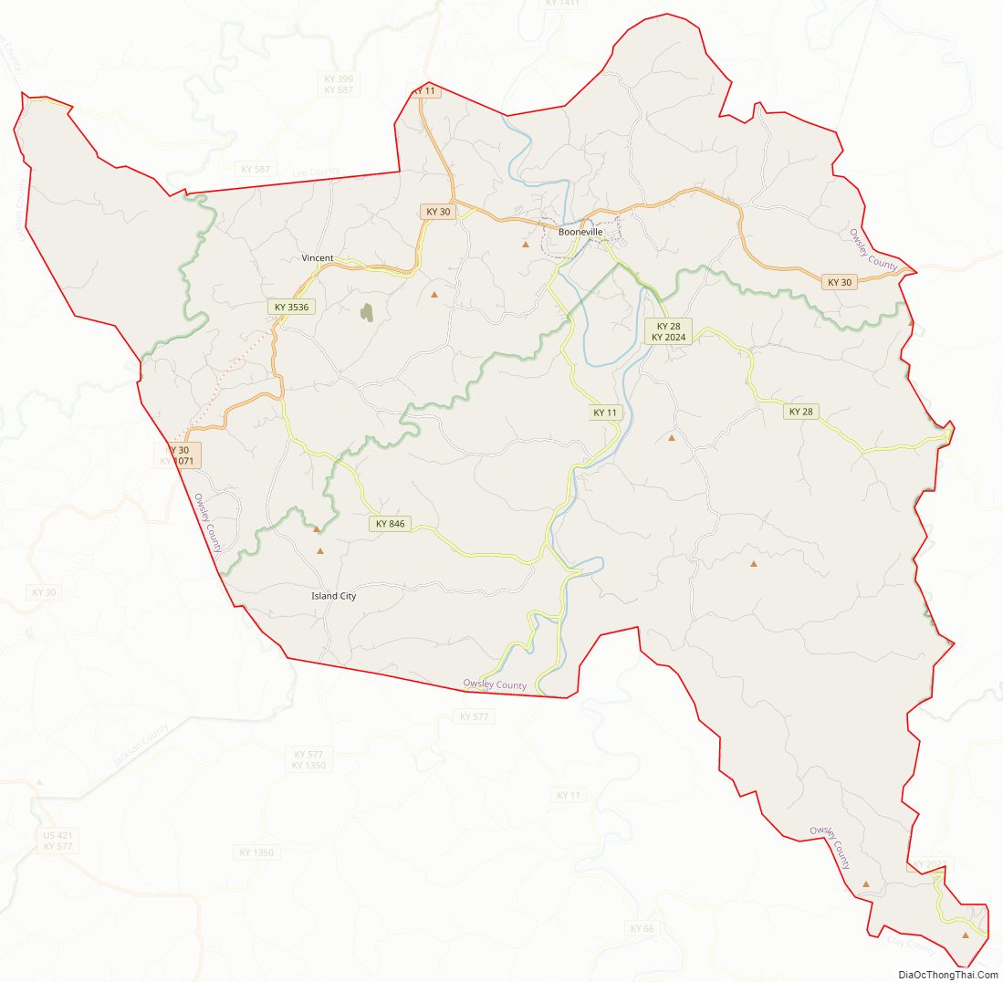
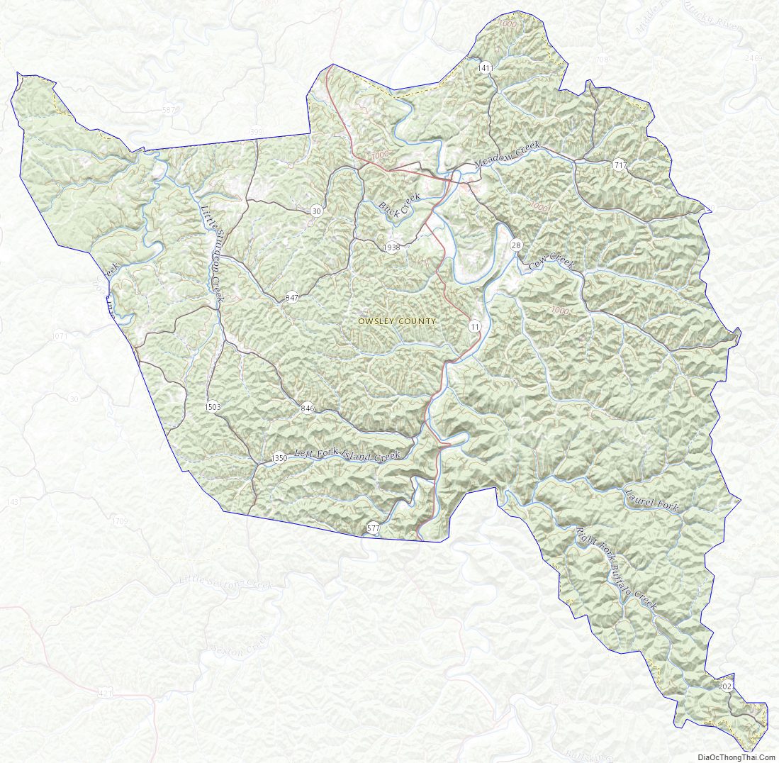
Owsley County Road Map
Geography
According to the U.S. Census Bureau, the county has a total area of 198 square miles (510 km), of which 197 square miles (510 km) is land and 0.9 square miles (2.3 km) (0.4%) is water. The South Fork of the Kentucky River passes through the county. Most of the precipitation that falls on the county ends up in this tributary of the Kentucky River. Some, however, on the northwest side of the county is in the Kentucky River watershed. Flood plains along the banks of the South of the Kentucky River and several streams provide the level land necessary for development/farming.
The county is located in the Eastern Mountain Coal Fields which is a part of the Appalachian Plateau (more precisely, the Cumberland Plateau). The elevation of the highest summit in the county is 1,730 ft (530 m) (+/- 10 ft (3 m)). It is located on the county’s extreme southern boundary with Clay County. The lowest elevation (650 ft (200 m) +/- 10 ft (3 m)) is at the point where the South Fork crosses the Owsley/Lee border on the north side of the county.
Adjacent counties
- Lee County (north)
- Breathitt County (east)
- Perry County (southeast)
- Clay County (south)
- Jackson County (west)
Major highways
- Kentucky Route 30
- Kentucky Route 11
- Kentucky Route 28
National protected area
- Daniel Boone National Forest, (the same national forest that encompasses the frequently-visited rock climbing and hiking destination known as the Red River Gorge)
Owsley County Topographic Map
Owsley County Satellite Map
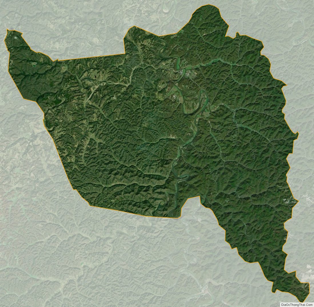
Owsley County Outline Map