Pointe Coupee Parish (/ˈpɔɪnt kəˈpiː/ or /ˈpwɑːnt kuːˈpeɪ/; French: Paroisse de la Pointe-Coupée) is a parish located in the U.S. state of Louisiana. As of the 2020 census, the population was 20,758. The parish seat is New Roads.
Pointe Coupee Parish is part of the Baton Rouge, Louisiana Metropolitan Statistical Area. In 2010, the center of population of Louisiana was located in Pointe Coupee Parish, in the city of New Roads.
| Name: | Pointe Coupee Parish |
|---|---|
| FIPS code: | 22-077 |
| State: | Louisiana |
| Founded: | 1807 |
| Named for: | French for the place of the cut-off |
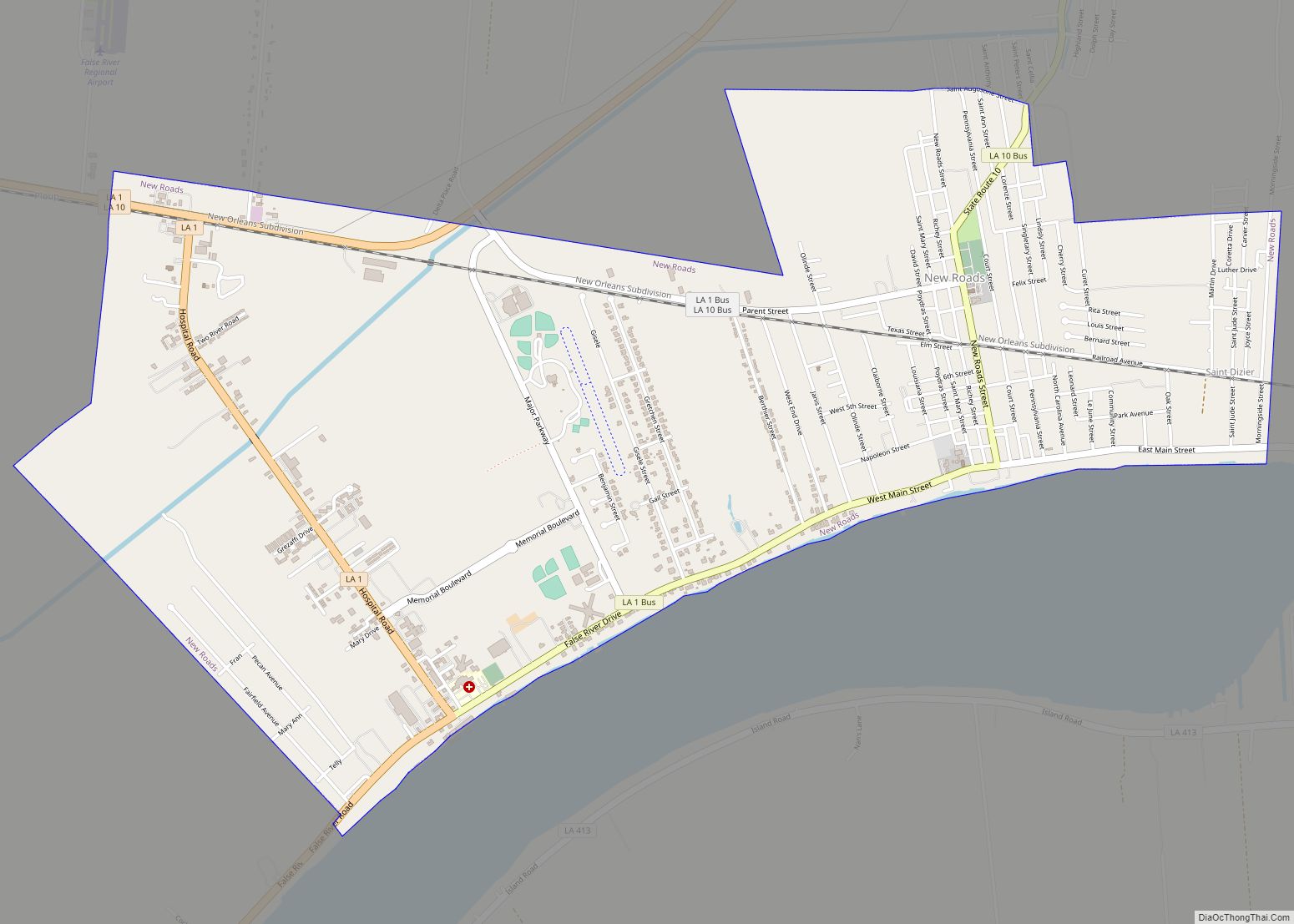
| Seat: | New Roads |
| Largest city: | New Roads |
| Total Area: | 591 sq mi (1,530 km²) |
| Land Area: | 557 sq mi (1,440 km²) |
| Total Population: | 20,758 |
| Population Density: | 35/sq mi (14/km²) |
| Time zone: | UTC−6 (Central) |
| Summer Time Zone (DST): | UTC−5 (CDT) |
| Website: | www.pcpolicejury.org |
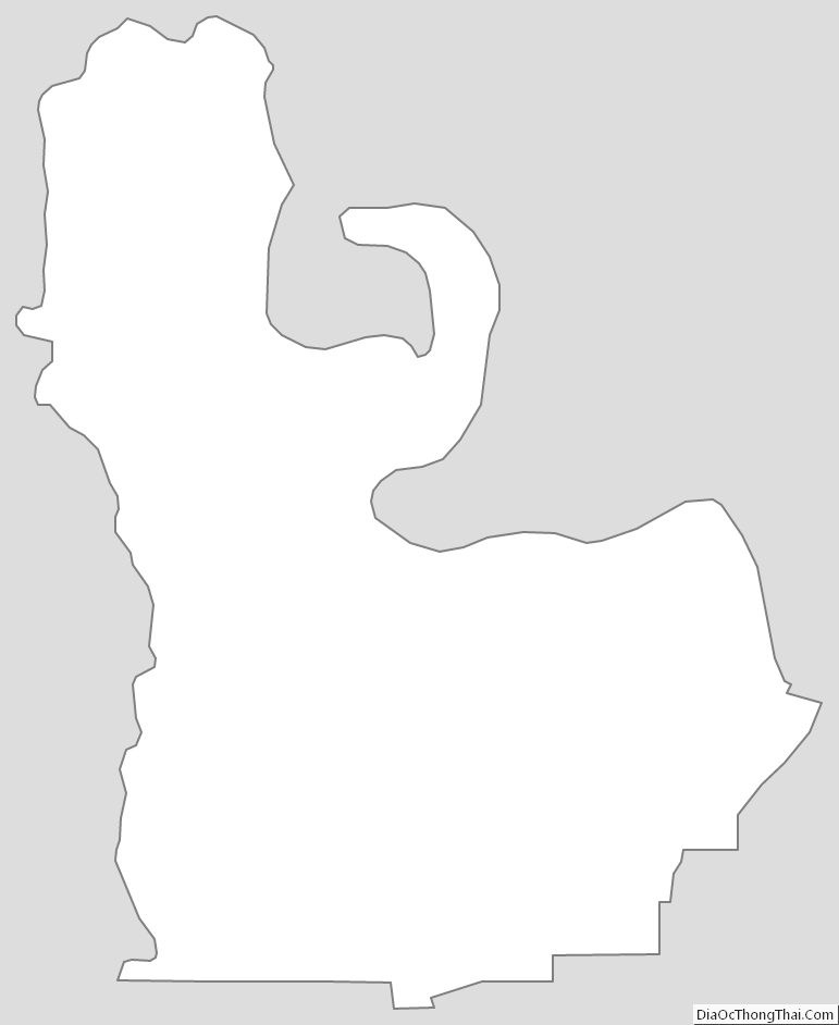
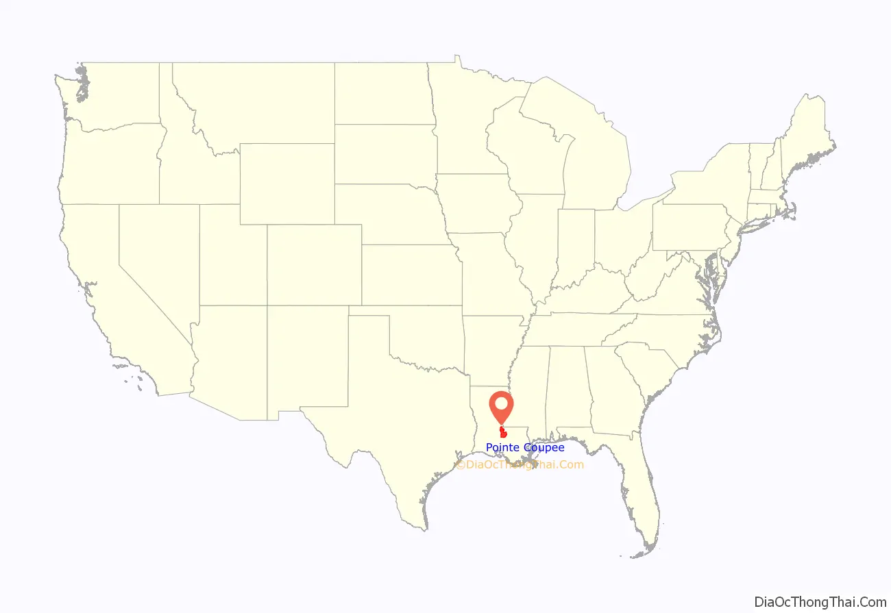
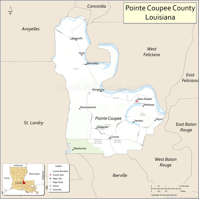
Pointe Coupee Parish location map. Where is Pointe Coupee Parish?
History
Pointe Coupee is the oldest settlement on the lower Mississippi, having been made by some wandering Canadian trappers as early as 1708. Bienville established this place as a military post, before the commencement of New Orleans. The fort was moved in 1722 to an area near the present St. Francisville Ferry landing.
After several floods, Governor Luis de Unzaga in 1772 moved the European settlement to a new post, the so-called Post Unzaga. Recently, historians Cazorla and Polo, from the Louis de Unzaga Historical Society research team, using satellite remote sensing techniques and comparative plans from the General Archive of the Indies, have managed to locate the position of the Unzaga post, which included, along with it, a parish. After the slave rebellion of 1795 this settlement was left uninhabited. Pointe Coupee Parish (originally and recently, informally pronounced pwahnt coo-pay) was organized by European Americans in 1805 as part of the Territory of Orleans (statehood for Louisiana followed in 1812). It was originally called Pointe Coupee County, and was one of the original 12 counties of the Territory of Orleans. It was renamed as Pointe Coupee Parish in 1816. The original Pointe Coupee Parish included parts of present-day Iberville and West Baton Rouge Parishes. There were minor boundary adjustments with neighboring parishes up through 1852, when its boundaries stabilized.
In 2008, Pointe Coupee was one of the communities that suffered the most damage by Hurricane Gustav.
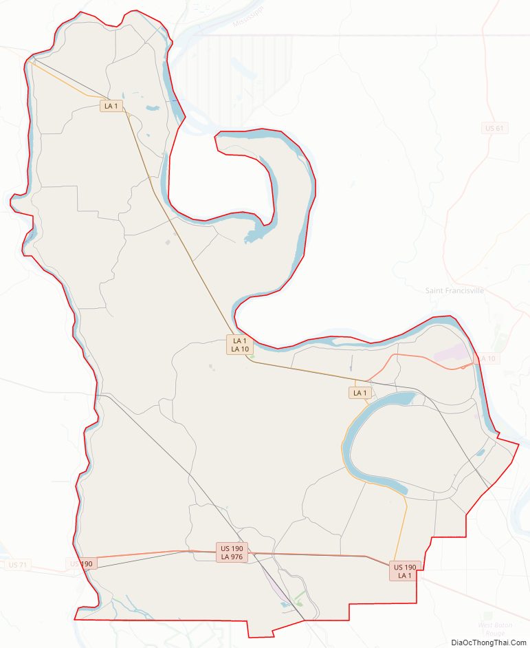
Pointe Coupee Parish Road Map
Geography
According to the U.S. Census Bureau, the parish has a total area of 591 square miles (1,530 km), of which 557 square miles (1,440 km) is land and 33 square miles (85 km) (5.6%) is water. The land consists mainly of prairies and backswamp.
Major highways
Pointe Coupee Parish has 498.98 miles of highways within its borders.
- U.S. Highway 190
- Louisiana Highway 1
- Louisiana Highway 10
- Louisiana Highway 15
- Louisiana Highway 77
- Louisiana Highway 78
- Louisiana Highway 81
- Louisiana Highway 411
- Louisiana Highway 413
- Louisiana Highway 414
- Louisiana Highway 415
- Louisiana Highway 416
- Louisiana Highway 417
- Louisiana Highway 418
- Louisiana Highway 419
- Louisiana Highway 420
- Louisiana Highway 970
- Louisiana Highway 971
- Louisiana Highway 972
- Louisiana Highway 973
- Louisiana Highway 975
- Louisiana Highway 976
- Louisiana Highway 977
- Louisiana Highway 978
- Louisiana Highway 979
- Louisiana Highway 981
- Louisiana Highway 982
- Louisiana Highway 983
- Louisiana Highway 984
- Louisiana Highway 3050
- Louisiana Highway 3091
- Louisiana Highway 3131
- Louisiana Highway 3190
Major waterways
- Atchafalaya River
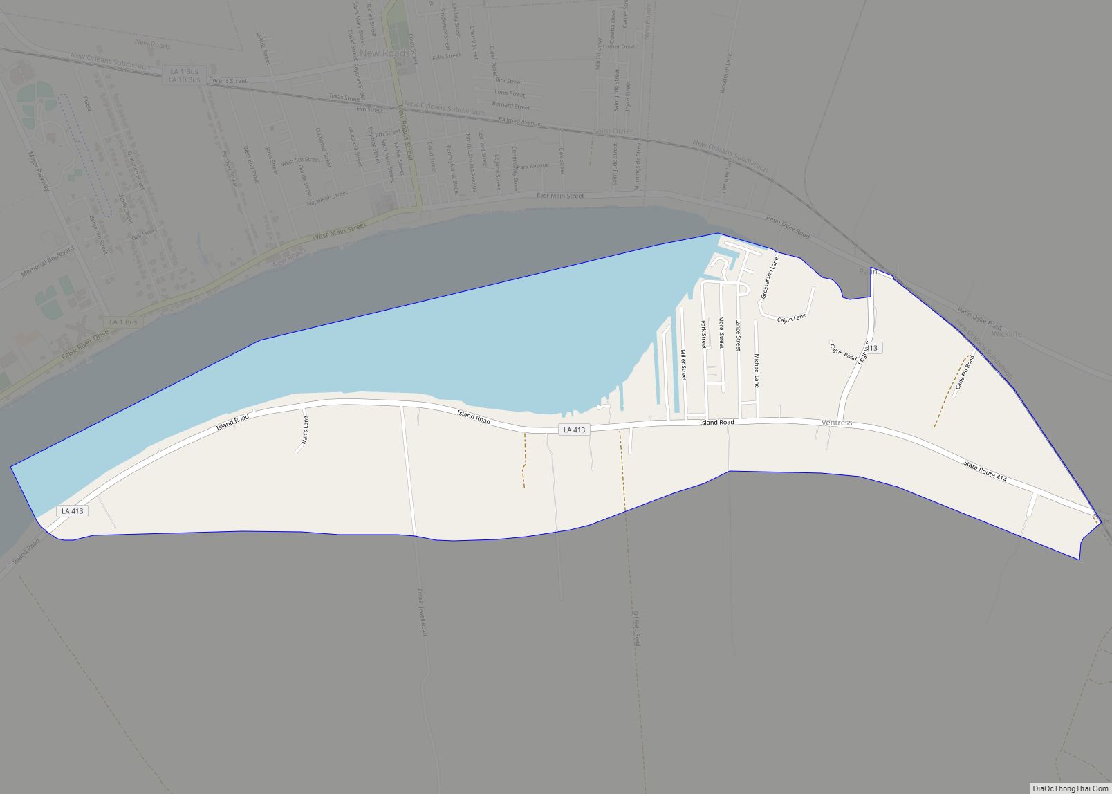
- False River
- Mississippi River
- Old River
- Raccourci Old River (not a river but an oxbow lake)
- Red River
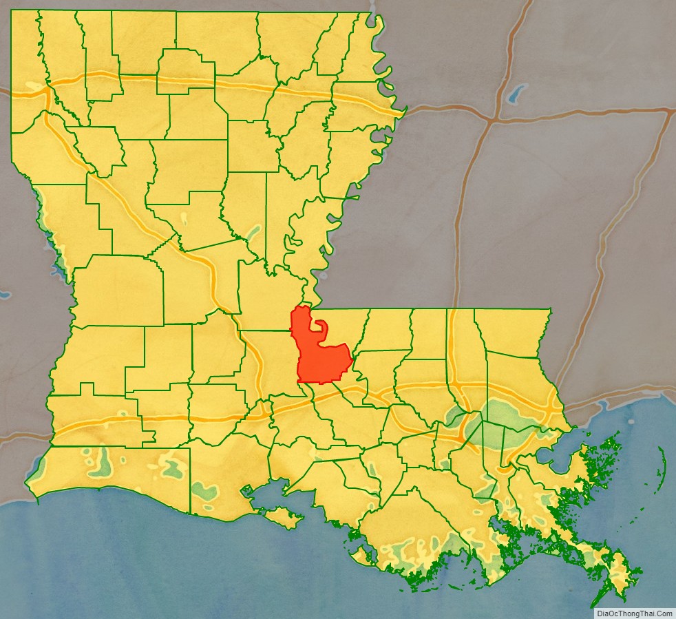
Adjacent parishes
- Concordia Parish (north)
- West Feliciana Parish (northeast)
- West Baton Rouge Parish (east)
- Iberville Parish (south)
- St. Martin Parish (southwest)
- St. Landry Parish (west)
- Avoyelles Parish (northwest)
National protected area
- Atchafalaya National Wildlife Refuge (part)
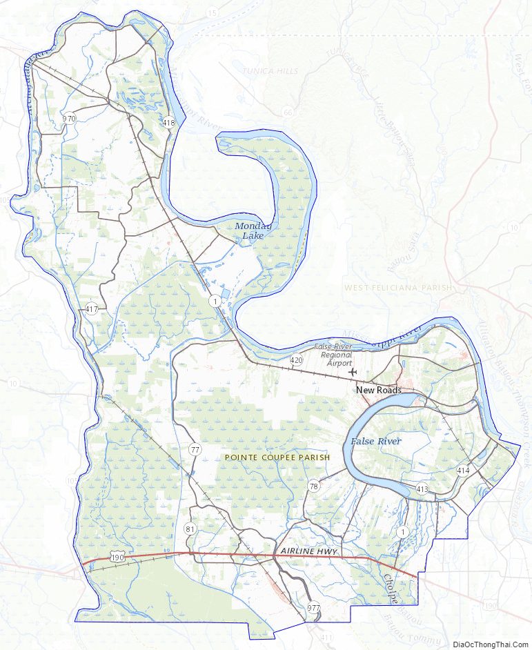
Pointe Coupee Parish Topographic Map
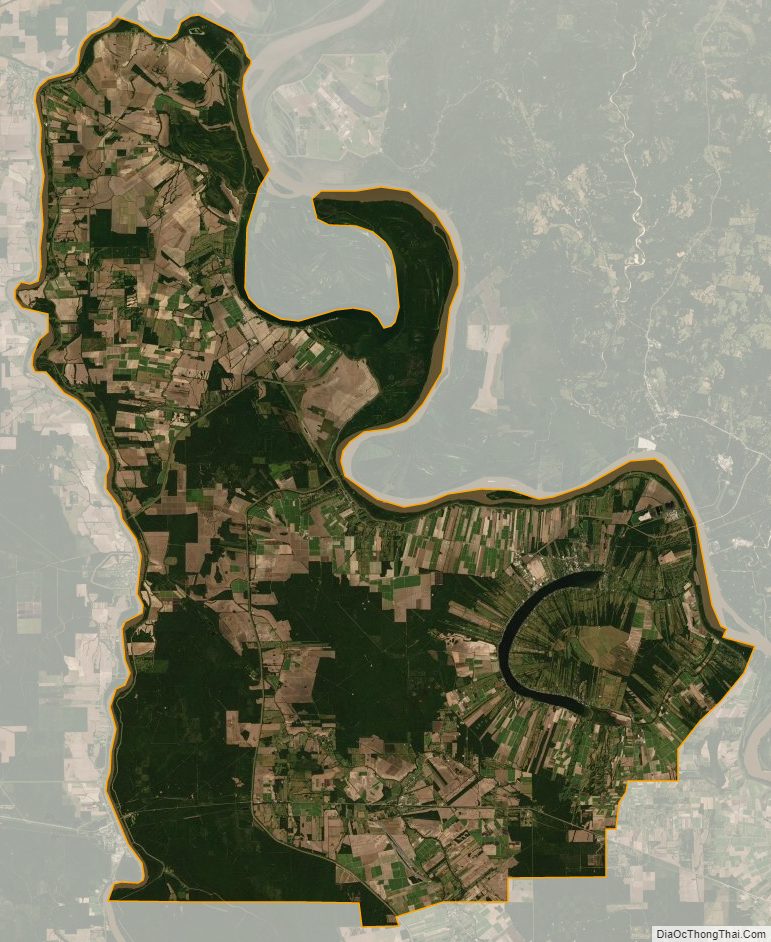
Pointe Coupee Parish Satellite Map
Pointe Coupee Parish Outline Map