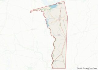
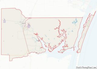
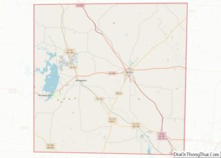
Map of Washakie County

Map of Washakie County, Wyoming

Washakie County is a county in the U.S. state of Wyoming. As of the 2020 United States Census, the population was 7,685. Its county seat is Worland. Washakie County overview: Name: Washakie County FIPS code: 56-043 State: Wyoming Founded: February 21, 1911 (authorized)1913 (organized) Named for: Chief Washakie Seat: Worland Largest city: Worland Total Area: … Read more

Map of Chilton County

Map of Chilton County, Alabama

Chilton County is a county located in the central portion of the U.S. state of Alabama. As of the 2020 census, the population was 45,014. The county seat is Clanton. Its name is in honor of William Parish Chilton, Sr. (1810–1871), a lawyer who became Chief Justice of the Alabama Supreme Court and later represented … Read more

Map of Escambia County

Map of Escambia County, Alabama

Escambia County is a county located in the south central portion of the U.S. state of Alabama. As of the 2020 census, the population was 36,757. Its county seat is Brewton. Escambia County is coextensive with the Atmore, AL Micropolitan Statistical Area; which is itself a constituent part of the larger Pensacola-Ferry Pass, FL-AL Combined … Read more

Map of Lowndes County

Map of Lowndes County, Alabama

Lowndes County is in the central part of the U.S. state of Alabama. As of the 2020 census, the county’s population was 10,311. Its county seat is Hayneville. The county is named in honor of William Lowndes, a member of the United States Congress from South Carolina. Lowndes County is part of the Montgomery, Alabama … Read more

Map of Shelby County

Map of Shelby County, Alabama

Shelby County is located in the central portion of the U.S. state of Alabama. As of the 2020 census the population was 223,024. The county seat is Columbiana. Its largest city is Alabaster. The county is named in honor of Isaac Shelby, Governor of Kentucky from 1792 to 1796 and again from 1812 to 1816. … Read more

Map of Fairbanks North Star Borough

Map of Fairbanks North Star Borough, Alaska

The Fairbanks North Star Borough is a borough located in the state of Alaska. As of the 2020 census, the population was 95,665, down from 97,581 in 2010. The borough seat is Fairbanks. The borough’s land area is slightly smaller than that of the state of New Jersey. Fairbanks North Star Borough comprises the Fairbanks, … Read more

Map of Wade Hampton Census Area

Map of Kusilvak Census Area, Alaska

Kusilvak Census Area, formerly known as Wade Hampton Census Area, is a census area located in the U.S. state of Alaska. As of the 2020 census, the population was 8,368, up from 7,459 in 2010. It is part of the Unorganized Borough and therefore has no borough seat. Its largest community is the city of … Read more

Map of Yavapai County

Map of Yavapai County, Arizona

Yavapai County is near the center of the U.S. state of Arizona. As of the 2020 census, its population was 236,209, making it the fourth-most populous county in Arizona. The county seat is Prescott. Yavapai County comprises the Prescott, AZ Metropolitan Statistical Area as well as the northern portions of Peoria and Wickenburg, the balance … Read more

Map of Conway County

Map of Conway County, Arkansas

Conway County is a county located in the U.S. state of Arkansas. Created as Arkansas’s 11th county on October 20, 1825, Conway County has four incorporated municipalities, including Morrilton, the county seat and most populous city. The county is also the site of numerous unincorporated communities and ghost towns. The county is named for Henry … Read more

Map of Howard County

Map of Howard County, Arkansas

Howard County is a county located in the U.S. state of Arkansas. As of the 2020 census, the population was 12,785. The county seat is Nashville. Howard County is Arkansas’s 74th county, formed on April 17, 1873, and named for James Howard, a state senator. It is a dry county. Howard County overview: Name: Howard … Read more

Map of Mississippi County

Map of Mississippi County, Arkansas

Mississippi County is the easternmost county in the U.S. state of Arkansas. As of the 2020 census, the population was 40,685. There are two county seats, Blytheville and Osceola. The county was formed on November 1, 1833, and named for the Mississippi River which borders the county to the east. Mississippi County is part of … Read more

Map of Saline County

Map of Saline County, Arkansas

Saline County (/ˈsʌ.liːn/ suh-LEAN) is located in the U.S. state of Arkansas. As of the 2020 census, the population was 123,416. Its county seat and largest city is Benton. Saline County was formed on November 2, 1835, and named for the salt water (brine) springs in the area, despite a differing pronunciation from saline. Until … Read more