Staunton (/ˈstæntən/ STAN-tən) is an independent city in the U.S. Commonwealth of Virginia. As of the 2020 census, the population was 25,750. In Virginia, independent cities are separate jurisdictions from the counties that surround them, so the government offices of Augusta County are in Verona, which is contiguous to Staunton. Staunton is a principal city of the Staunton-Waynesboro Metropolitan Statistical Area, which had a 2010 population of 118,502. Staunton is known for being the birthplace of Woodrow Wilson, the 28th U.S. president, and as the home of Mary Baldwin University, historically a women’s college. The city is also home to Stuart Hall, a private co-ed preparatory school, as well as the Virginia School for the Deaf and Blind. It was the first city in the United States with a fully defined city manager system.
| Name: | Staunton City |
|---|---|
| FIPS code: | 51-790 |
| State: | Virginia |
| Total Area: | 19.98 sq mi (51.74 km²) |
| Land Area: | 19.92 sq mi (51.59 km²) |
| Total Population: | 25,750 |
| Population Density: | 1,300/sq mi (500/km²) |
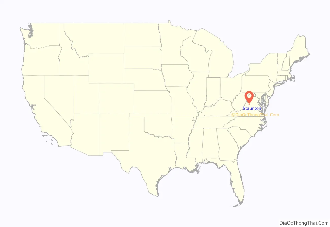
Staunton City location map. Where is Staunton City?
History
The area was first settled in 1732 by John Lewis and family. In 1736, William Beverley, a wealthy planter and merchant from Essex County, was granted by the Crown over 118,000 acres (48,000 hectares) in what would become Augusta County. Surveyor Thomas Lewis in 1746 laid out the first town plat for Beverley of what was originally called Beverley’s Mill Place. Founded in 1747, it was renamed in honor of Lady Rebecca Staunton, wife to Royal Lieutenant-Governor Sir William Gooch. Because the town was located at the geographical center of the colony (which then included West Virginia), Staunton served between 1738 and 1771 as regional capital for much of what was later known as the Northwest Territory, with the westernmost courthouse in British North America prior to the Revolution. By 1760, Staunton was one of the major “remote trading centers in the backcountry” which coordinated the transportation of the vast amounts of grain and tobacco then being produced in response to the change of Britain from a net exporter of produce to an importer. Staunton thus played a crucial role in the mid 18th century expansion of the economies of the American Colonies which, in turn, contributed to the success of the American Revolution. It served as capital of Virginia in June 1781, when state legislators fled Richmond and then Charlottesville to avoid capture by the British.
Like most of colonial Virginia, slavery was present in Staunton. For instance, in 1815, a slave named Henry ran away from John G. Wright’s Staunton plantation. Wright placed an ad in the Daily National Intelligencer in Washington, D.C. seeking Henry’s return. It notes that Henry was an excellent cook and was widely travelled, having been as far as the West Indies.
The Civil War and immediately prior
In August 1855, President Franklin Pierce visited Staunton. He gave a speech at the Virginia Hotel, in which he stated that his “feelings revolted from the idea of a dissolution of the union.” He said that “[i]t would be the Iliad of innumerable woes, from the contemplation of which he shrank.”
Located along the Valley Pike, Staunton developed as a trade, transportation and industrial center, particularly after the Virginia Central Railroad arrived in 1854. Factories made carriages, wagons, boots and shoes, clothing and blankets. In 1860, the Staunton Military Academy was founded. By 1860, Staunton had at least one pro-Union, pro-slavery (the Staunton Spectator) and at least one pro-secession, pro-slavery newspaper (the Staunton Vindicator). The Spectator ran editorials before the war urging its citizens to vote for union, while the Vindicator ran, e.g., stories reporting on “unruly” slaves mutilating themselves to escape being sold.
On May 23, 1861, shortly after the firing on Fort Sumter began the American Civil War, Virginians voted on whether to ratify articles of secession from the Union and join the Confederate States. The articles were overwhelmingly approved throughout the Commonwealth, even in the majority of the counties that would later become West Virginia. The vote in Staunton was 3300 in favor of secession, with only 6 opposed. During the war, the town became an important Shenandoah Valley manufacturing center, a staging area, and a supply depot for the Confederacy.
On June 6, 1864, Union Major General David Hunter arrived with 10,000 troops to cut supply, communication and railway lines useful to the Confederacy. The next day, they destroyed the railroad station, warehouses, houses, factories and mills. Union soldiers looted the stores and warehouses and confiscated supplies.
Post-bellum Staunton
On July 10, 1902, Staunton became an independent city.
In 1908, Staunton adopted the city manager form of government. Charles E. Ashburner was hired by Staunton as the nation’s first city manager.
Western State Hospital
Staunton is also home to the former Western State Asylum, a hospital for the mentally ill, which originally began operations in 1828. The hospital was renamed Western State Hospital in 1894.
In its early days, the facility was a resort-style asylum. It had terraced gardens where patients could plant flowers and take walks, roof walks to provide mountain views, and many architectural details to create an atmosphere that would aid in the healing process. However, by the mid 19th Century, this utopian model of care had vanished, replaced by overcrowding in the facility and the warehousing of patients. Techniques such as “ankle and wrist restraints, physical coercion, and straitjackets” were used. After the passage of the Eugenical Sterilization Act of 1924 in Virginia, patients were forcibly sterilized at Western State until the law authorizing the practice was repealed in the 1970s. Later, electroshock therapy and lobotomies were practiced at the facility.
When Western State vacated the property and moved its adult patients to its present site near Interstate 81, the facility was renamed the Staunton Correctional Center and turned into a medium-security men’s penitentiary. The prison closed in 2003, and the site was left vacant for several years. In 2005, the state of Virginia gave the original property to the Staunton Industrial Authority. It is now a condominium complex called The Villages at Staunton.
A separate complex, The DeJarnette State Sanatoruim, was constructed in 1932 and acted as a location for patients with the ability to pay for their treatment. [1] Dr. DeJarnette was the superintendent of the sanatorium from its opening until his retirement in 1947.
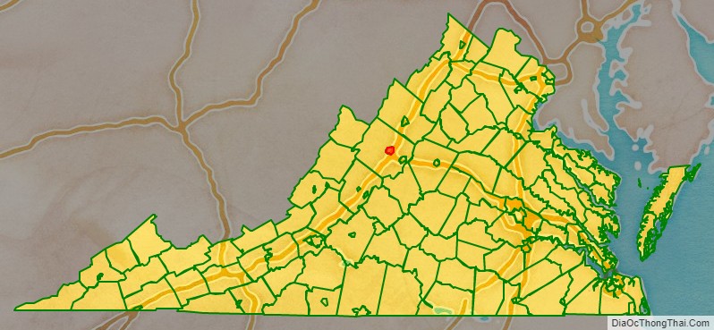
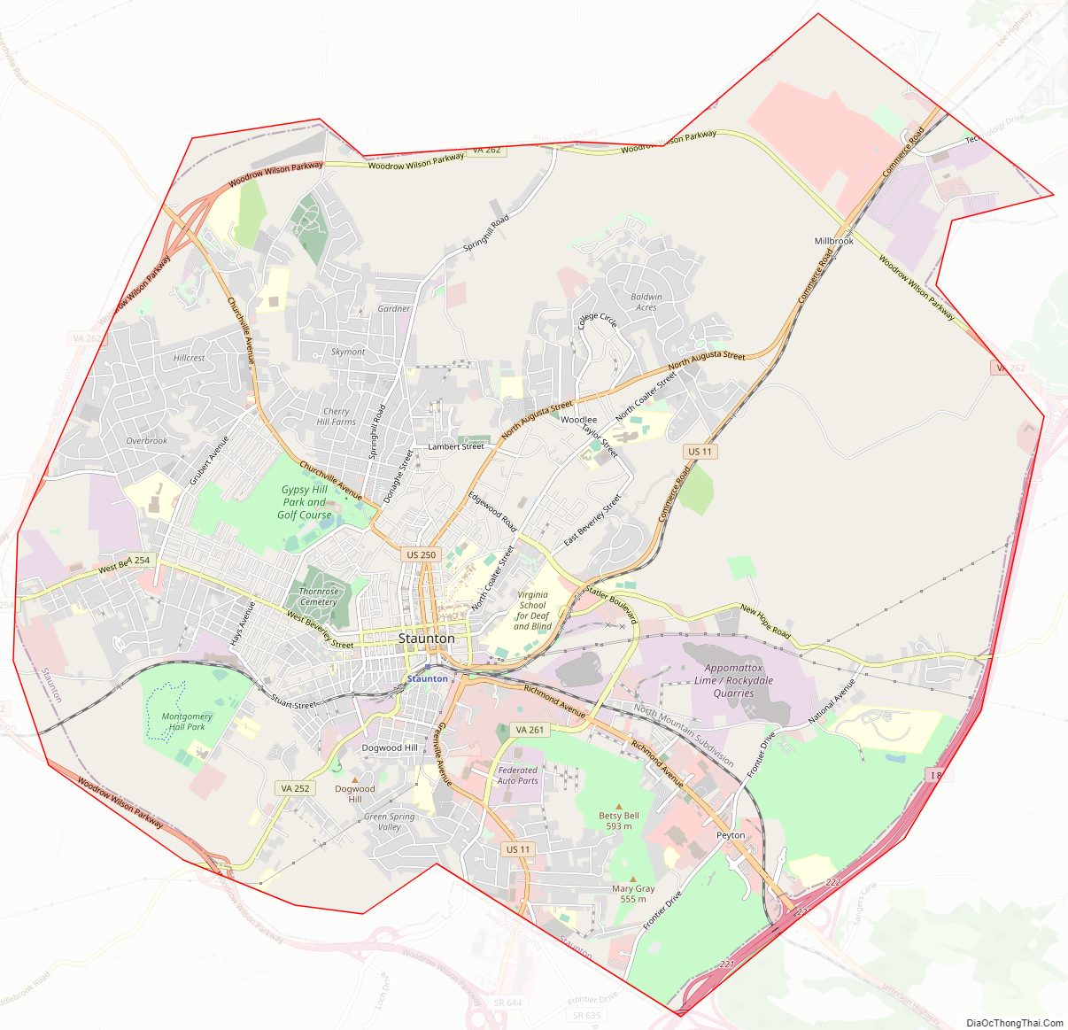
Staunton City Road Map
Geography
According to the United States Census Bureau, the city has a total area of 20 square miles (52 km), virtually all of which is land. Staunton is located in the Shenandoah Valley in between the Blue Ridge and Allegheny Mountains of the Appalachian Mountains. It is drained by Lewis Creek. Lewis Creek flows into the Shenandoah River, which flows into the Potomac, and eventually to the Chesapeake Bay.
Climate
According to the Köppen Climate Classification system, Staunton has a humid subtropical climate, abbreviated “Cfa” on climate maps.
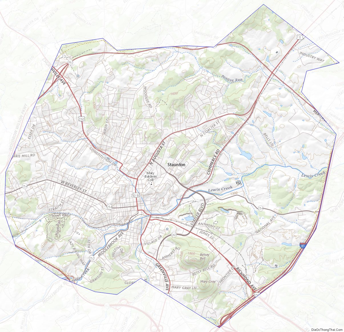
Staunton City Topographic Map
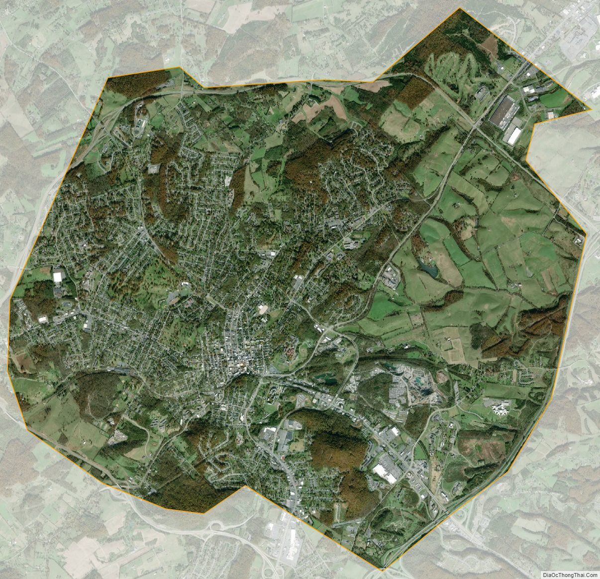
Staunton City Satellite Map
Staunton City Outline Map