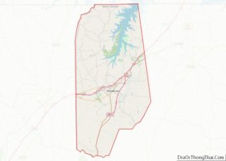
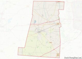
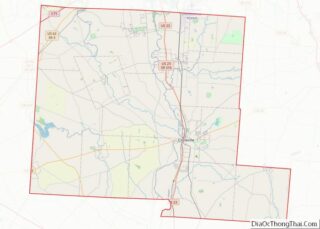
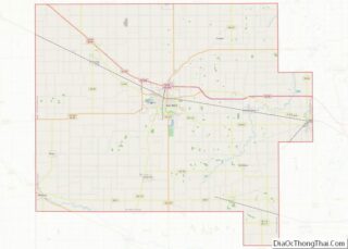
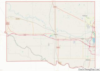
Map of Brown County, Texas
Brown County is a county in west-central Texas. As of the 2020 census, the population was 38,095. Its county seat is Brownwood. The county was founded in 1856 and organized in 1858. It is named for Henry Stevenson Brown, a commander at the Battle of Velasco, an early conflict between Texians and Mexicans. The Brownwood, ... Read more
Map of Brown County, Texas
Map of Coke County, Texas
Coke County is a county located on the Edwards Plateau in the U.S. state of Texas. As of the 2020 census, its population was 3,285. Its county seat is Robert Lee. The county was founded in 1889 and is named for Richard Coke, the 15th governor of Texas. Coke County was one of 46 prohibition, ... Read more
Map of Coke County, Texas
Map of Dallas County, Texas
Dallas County is the second-most populous county in the U.S. state of Texas. As of the 2020 U.S. census, the population was 2,613,539, making it the ninth-most populous county in the country. Dallas County is included in the Dallas-Arlington-Fort Worth metropolitan statistical area—colloquially referred to as the Dallas–Fort Worth metroplex. Municipal expansion within Dallas County ... Read more
Map of Dallas County, Texas
Map of Falls County, Texas
Falls County is a county in the U.S. state of Texas. As of the 2020 census, its population was 16,968. The county seat is Marlin. It is named for the original 10-foot-tall waterfall on the Brazos River, which existed until the river changed course during a storm in 1866. The present falls is two miles ... Read more
Map of Falls County, Texas
Map of Gonzales County, Texas
Gonzales County overview: Name: Gonzales County FIPS code: 48-177 State: Texas Founded: 1837 Named for: City of Gonzales Seat: Gonzales Largest city: Gonzales Total Area: 1,070 sq mi (2,800 km²) Land Area: 1,067 sq mi (2,760 km²) Total Population: 19,653 Population Density: 18/sq mi (7.1/km²) Time zone: UTC−6 (Central) Summer Time Zone (DST): UTC−5 (CDT) Website: www.co.gonzales.tx.us Gonzales County location map. Where ... Read more
Map of Gonzales County, Texas
Map of Hays County, Texas
Hays County overview: Name: Hays County FIPS code: 48-209 State: Texas Founded: 1848 Named for: John Coffee Hays Seat: San Marcos Largest city: San Marcos Total Area: 680 sq mi (1,800 km²) Land Area: 678 sq mi (1,760 km²) Total Population: 241,067 Population Density: 350/sq mi (140/km²) Time zone: UTC−6 (Central) Summer Time Zone (DST): UTC−5 (CDT) Website: hayscountytx.com Hays County location ... Read more
Map of Hays County, Texas
Map of Jasper County, Texas
Jasper County is a county located in the U.S. state of Texas. As of the 2020 census, its population was 32,980. Its county seat is Jasper. The county was created as a municipality in Mexico in 1834, and in 1837 was organized as a county in the Republic of Texas. It is named for William ... Read more
Map of Jasper County, Texas
Map of Kleberg County, Texas
Kleberg County is a county in the U.S. state of Texas. As of the 2020 census, its population was 31,040. The county seat is Kingsville. The county was organized in 1913 and is named for Robert J. Kleberg, an early settler. Kleberg County is part of the Kingsville, TX Micropolitan Statistical Area, which is also ... Read more
Map of Kleberg County, Texas
Map of Lynn County, Texas
Lynn County overview: Name: Lynn County FIPS code: 48-305 State: Texas Founded: 1903 Seat: Tahoka Largest city: Tahoka Total Area: 893 sq mi (2,310 km²) Land Area: 892 sq mi (2,310 km²) Total Population: 5,596 Population Density: 6.3/sq mi (2.4/km²) Time zone: UTC−6 (Central) Summer Time Zone (DST): UTC−5 (CDT) Website: www.co.lynn.tx.us Lynn County location map. Where is Lynn County? History Native ... Read more
Map of Lynn County, Texas
Map of Montague County, Texas
Montague County (/ˈmɒnteɪɡ/ MAHN-tayg) is a county located in the U.S. state of Texas, established in 1857. As of the 2020 census, its population was 19,965. The county seat is Montague. The county was created in 1857 and organized the next year. It is named for Daniel Montague, a surveyor and soldier in the Mexican–American ... Read more
Map of Montague County, Texas
Map of Parmer County, Texas
Parmer County is a county located in the southwestern Texas Panhandle on the High Plains of the Llano Estacado in the U.S. state of Texas. As of the 2020 census, the population was 9,869. The county seat is Farwell. The county was created in 1876 and later organized in 1907. It is named in honor ... Read more
Map of Parmer County, Texas
Map of Rusk County, Texas
Rusk County overview: Name: Rusk County FIPS code: 48-401 State: Texas Founded: 1843 Named for: Thomas Jefferson Rusk Seat: Henderson Largest city: Henderson Total Area: 938 sq mi (2,430 km²) Land Area: 924 sq mi (2,390 km²) Total Population: 52,214 Population Density: 56/sq mi (21/km²) Time zone: UTC−6 (Central) Summer Time Zone (DST): UTC−5 (CDT) Website: www.co.rusk.tx.us Rusk County location map. Where ... Read more
Map of Rusk County, Texas