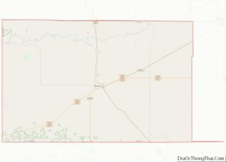
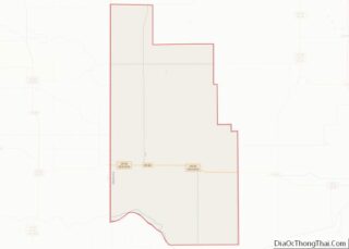
Map of Dundy County, Nebraska
Dundy County is a county in the U.S. state of Nebraska. As of the 2020 United States Census, the population was 1,654. Its county seat is Benkelman. In the Nebraska license plate system, Dundy County is represented by the prefix 76 (it had the seventy-sixth-largest number of vehicles registered in the county when the license ... Read more
Map of Dundy County, Nebraska
Map of Holt County, Nebraska
Holt County overview: Name: Holt County FIPS code: 31-089 State: Nebraska Founded: 1860 Named for: Joseph Holt Seat: O’Neill Largest city: O’Neill Total Area: 2,417 sq mi (6,260 km²) Land Area: 2,412 sq mi (6,250 km²) Total Population: 10,127 Population Density: 4.2/sq mi (1.6/km²) Time zone: UTC−6 (Central) Summer Time Zone (DST): UTC−5 (CDT) Website: www.co.holt.ne.us Holt County location map. Where is ... Read more
Map of Holt County, Nebraska
Map of Merrick County, Nebraska
Merrick County overview: Name: Merrick County FIPS code: 31-121 State: Nebraska Founded: 1858 Named for: Elvira Merrick Seat: Central City Largest city: Central City Total Area: 494 sq mi (1,280 km²) Land Area: 485 sq mi (1,260 km²) Total Population: 7,665 Population Density: 16.3/sq mi (6.3/km²) Time zone: UTC−6 (Central) Summer Time Zone (DST): UTC−5 (CDT) Website: merrickcounty.ne.gov Merrick County location map. ... Read more
Map of Merrick County, Nebraska
Map of Sarpy County, Nebraska
Sarpy County is a county located in the U.S. state of Nebraska. As of the 2020 United States Census, the population was 190,604, making it the third-most populous county in Nebraska. Its county seat is Papillion. Sarpy County is part of the Omaha–Council Bluffs, NE-IA Metropolitan Statistical Area. Sarpy County overview: Name: Sarpy County FIPS ... Read more
Map of Sarpy County, Nebraska
Map of York County, Nebraska
York County is a county in the U.S. state of Nebraska. As of the 2010 United States Census, the population was 13,665. Its county seat is York. In the Nebraska license plate system, York County is represented by the prefix 17 (it had the seventeenth-largest number of vehicles registered in the county when the license ... Read more
Map of York County, Nebraska
Map of Washoe County, Nevada
Washoe County (/ˈwɒʃoʊ/) is a county in the U.S. state of Nevada. As of the 2020 census, the population was 486,492, making it Nevada’s second-most populous county. Its county seat is Reno. Washoe County is included in the Reno, NV Metropolitan Statistical Area. Washoe County overview: Name: Washoe County FIPS code: 32-031 State: Nevada Founded: ... Read more
Map of Washoe County, Nevada
Map of Cape May County, New Jersey
Cape May County overview: Name: Cape May County FIPS code: 34-009 State: New Jersey Founded: 1685 Named for: Cornelius Jacobsen Mey Seat: Cape May Court House Total Area: 620.42 sq mi (1,606.9 km²) Land Area: 251.42 sq mi (651.2 km²) Total Population: 95,263 Population Density: 378.9/sq mi (146.3/km²) Website: capemaycountynj.gov Cape May County location map. Where is Cape May County? History Etymology ... Read more
Map of Cape May County, New Jersey
Map of Warren County, New Jersey
Warren County overview: Name: Warren County FIPS code: 34-041 State: New Jersey Founded: November 20, 1824 Named for: Joseph Warren Seat: Belvidere Largest city: Phillipsburg (population)Hardwick Township (area) Total Area: 362.86 sq mi (939.8 km²) Land Area: 356.92 sq mi (924.4 km²) Total Population: 109,632 Population Density: 307.2/sq mi (118.6/km²) Website: www.warrencountynj.gov Warren County location map. Where is Warren County? History Etymology ... Read more
Map of Warren County, New Jersey
Map of Luna County, New Mexico
Luna County is a county located in the U.S. state of New Mexico. As of the 2010 census, the population was 25,095. Its county seat is Deming. This county abuts the Mexican border. Luna County comprises the Deming, NM Micropolitan Statistical Area. Luna County overview: Name: Luna County FIPS code: 35-029 State: New Mexico Founded: ... Read more
Map of Luna County, New Mexico
Map of Valencia County, New Mexico
Valencia County (Spanish: Condado de Valencia) is a county in the U.S. state of New Mexico. As of the 2010 census, the population was 76,569. The county seat is Los Lunas. Valencia County is included in the Albuquerque, NM Metropolitan Statistical Area. The county was a significant bellwether region that held the longest record for ... Read more
Map of Valencia County, New Mexico
Map of Essex County, New York
Essex County is a county in the U.S. state of New York. As of the 2020 census, the population was 37,381. Its county seat is the hamlet of Elizabethtown. Its name is from the English county of Essex. Essex is one of only 2 counties that are entirely within the Adirondack Park, the other being ... Read more
Map of Essex County, New York
Map of New York County, New York
Manhattan (/mænˈhætən, mən-/) is the most densely populated and geographically smallest of the five boroughs of New York City. The borough is also coextensive with New York County, one of the original counties of the U.S. state of New York. Located near the southern tip of New York State, Manhattan is based in the Eastern ... Read more
Map of New York County, New York