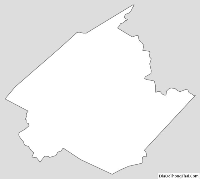
Wirt County is a county in the U.S. state of West Virginia. As of the 2020 census, the population was 5,194, making it the least populous county in West Virginia. Its county seat is Elizabeth. The county was created in 1848 by the Virginia General Assembly and named for U.S. Attorney General and presidential candidate William Wirt. The county is served by one high school, Wirt County High School.
Wirt County is part of the Parkersburg-Vienna, WV Metropolitan Statistical Area.
| Name: | Wirt County |
|---|---|
| FIPS code: | 54-105 |
| State: | West Virginia |
| Founded: | January 19, 1848 |
| Named for: | William Wirt |
| Seat: | Elizabeth |
| Largest town: | Elizabeth |
| Total Area: | 235 sq mi (610 km²) |
| Land Area: | 233 sq mi (600 km²) |
| Total Population: | 5,194 |
| Population Density: | 22/sq mi (8.5/km²) |
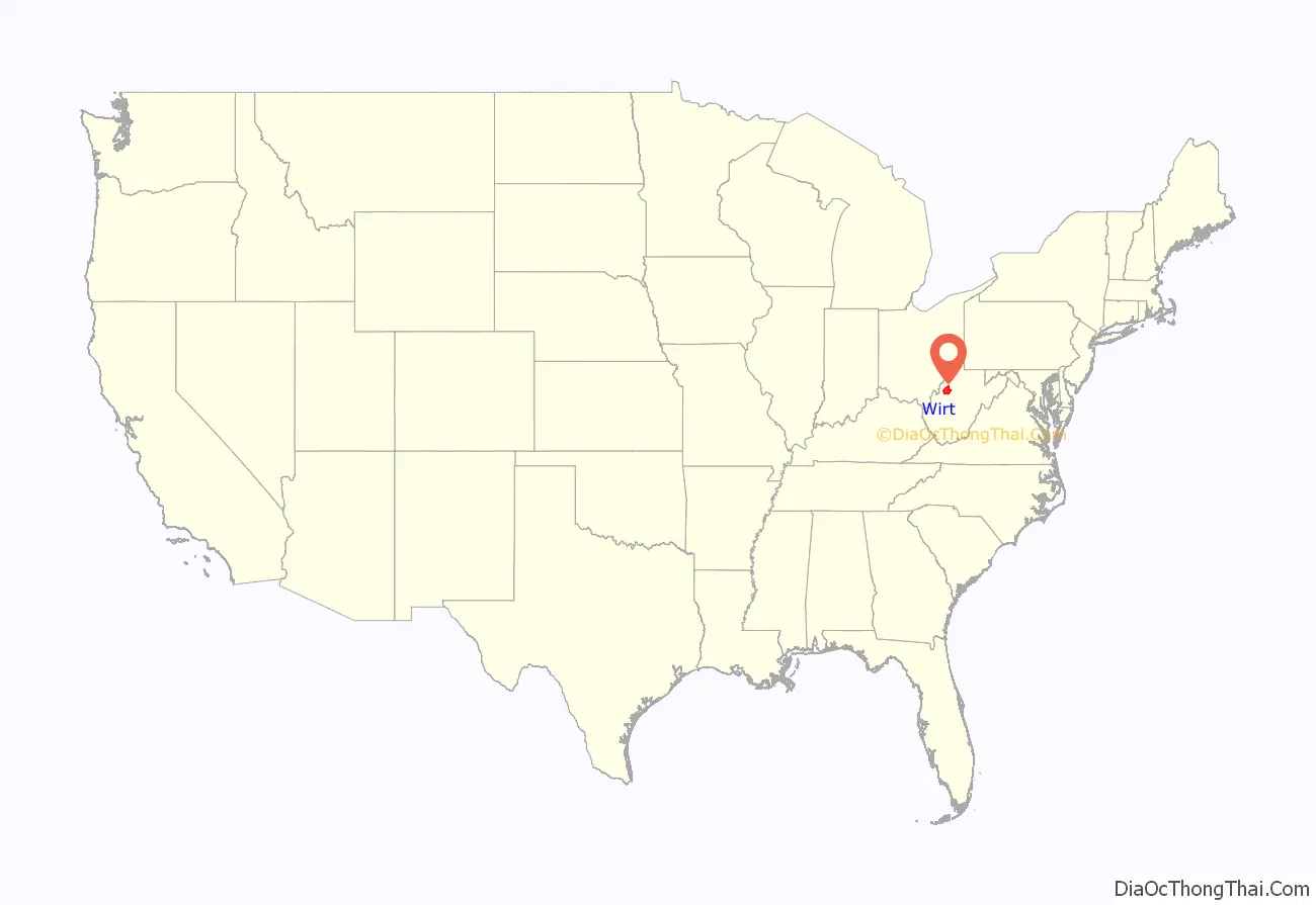
Wirt County location map. Where is Wirt County?
History
Wirt County was created from parts of Jackson and Wood counties on January 19, 1848. The county was named after William Wirt (1772–1834).
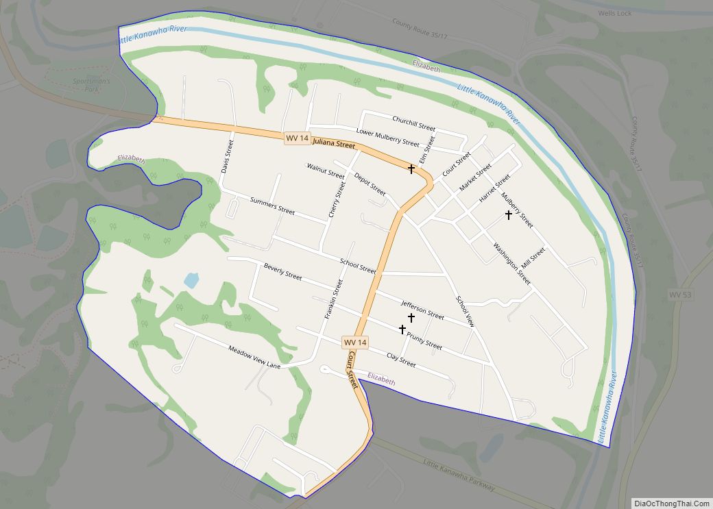
The first European pioneer was William Beauchamp (1743-1808), a veteran of the Continental Navy and a Methodist minister. Beauchamp arrived in 1796 with a claim to 1400 acres on the Little Kanawha River. He farmed, built a mill, and laid out the town of Elizabeth, named after his daughter.
Burning Springs was the site of an oil rush in the 1860s. In 1863 the town was burned, along with 100,000 gallons of oil, by Confederate cavalrymen.
On June 20, 1863, at the height of the Civil War, Wirt County was one of fifty Virginia counties admitted to the Union as the state of West Virginia. Later that year, West Virginia’s counties were divided into civil townships, with the intention of encouraging local government. This proved impractical in the heavily rural state, and in 1872 the townships were converted into magisterial districts. Wirt County was divided into seven districts: Burning Springs, Clay, Elizabeth, Newark, Reedy, Spring Creek, and Tucker. Except for minor adjustments, the seven historic magisterial districts remained largely unchanged for over a century. In the 1980s, they were consolidated into three new districts: Central, Northeast, and Southwest.
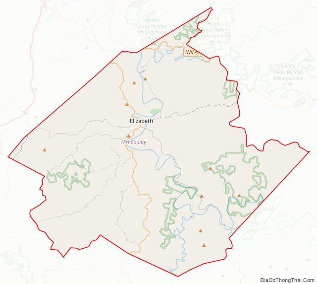
Wirt County Road Map
Geography
According to the United States Census Bureau, the county has a total area of 235 square miles (610 km), of which 233 square miles (600 km) is land and 2.3 square miles (6.0 km) (1.0%) is water.
Major highways
- West Virginia Route 5
- West Virginia Route 14
- West Virginia Route 47
- West Virginia Route 53
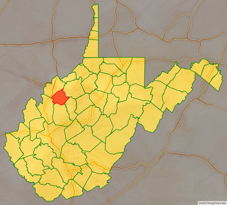
Adjacent counties
- Wood County (northwest)
- Ritchie County (northeast)
- Calhoun County (southeast)
- Roane County (south)
- Jackson County (southwest)
Wirt County Topographic Map
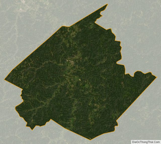
Wirt County Satellite Map
Wirt County Outline Map