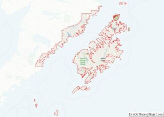
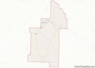
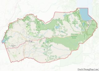
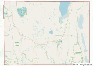
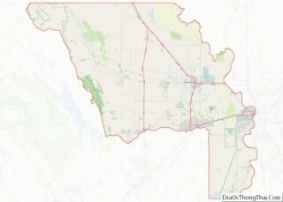
Map of Galveston County

Map of Galveston County, Texas

Galveston County (/ˈɡælvɪstən/ GAL-vis-tən) is a county in the U.S. state of Texas, located along the Gulf Coast adjacent to Galveston Bay. As of the 2020 census, its population was 350,682. The county was founded in 1838. The county seat is the City of Galveston, founded the following year, and located on Galveston Island. The … Read more

Map of Hardin County

Map of Hardin County, Texas

Hardin County is a county located in the U.S. state of Texas, United States. As of the 2020 census, its population was 56,231. The county seat is Kountze. The county is named for the family of William Hardin from Liberty County, Texas. Hardin County is part of the Beaumont–Port Arthur, TX metropolitan statistical area. Hardin … Read more

Map of Hunt County

Map of Hunt County, Texas

Hunt County is a county in the U.S. state of Texas. As of the 2020 census, its population was 99,956. Its county seat is Greenville. The county is named for Memucan Hunt, Jr., the first Republic of Texas Minister to the United States from 1837 to 1838 and the third Texas Secretary of the Navy … Read more

Map of Kent County

Map of Kent County, Texas

Kent County is a county located in the U.S. state of Texas. As of the 2020 census, its population was 753, making it the sixth-least populous county in Texas. Its county seat is Jayton. The county was created in 1876 and later organized in 1892. It is named for Andrew Kent, who died at the … Read more

Map of Lipscomb County

Map of Lipscomb County, Texas

Lipscomb County (/ˈlɪpskəm/ LIP-skəm) is a county located in the U.S. state of Texas. As of the 2020 census, its population was 3,059. Its county seat is Lipscomb. The county was created in 1876 and organized in 1887. It is named for Judge Abner Smith Lipscomb, a secretary of state of the Republic of Texas. … Read more

Map of Menard County

Map of Menard County, Texas

Menard County overview: Name: Menard County FIPS code: 48-327 State: Texas Founded: 1871 Named for: Michel Branamour Menard Seat: Menard Largest city: Menard Total Area: 902 sq mi (2,340 km²) Land Area: 902 sq mi (2,340 km²) Total Population: 1,962 Population Density: 2.2/sq mi (0.84/km²) Time zone: UTC−6 (Central) Summer Time Zone (DST): UTC−5 (CDT) Website: co.menard.tx.us Menard County location map. Where … Read more

Map of Oldham County

Map of Oldham County, Texas

Oldham County is a county located in the U.S. state of Texas. As of the 2020 census, its population was 1,758. Its county seat is Vega. The county was created in 1876 and organized in 1881. Oldham County is included in the Amarillo, TX Metropolitan Statistical Area. Oldham County overview: Name: Oldham County FIPS code: … Read more

Map of Refugio County

Map of Refugio County, Texas

Refugio County (/rɪˈfjʊəriː.oʊ/ rih-FYOOR-ee-oh) is a county located in the U.S. state of Texas. As of the 2020 census, its population was 6,741. Its county seat is Refugio. The county originated as a municipality of Mexico in 1834 and was classified as a county in 1837. Refugio County overview: Name: Refugio County FIPS code: 48-391 … Read more

Map of Smith County

Map of Smith County, Texas

Smith County is a county in the U.S. state of Texas. As of the 2020 census, its population was 233,479. Its county seat is Tyler. Smith County is named for James Smith, a general during the Texas Revolution. Smith County is part of the Tyler metropolitan statistical area and the Tyler–Jacksonville combined statistical area. Smith … Read more

Map of Trinity County

Map of Trinity County, Texas

Trinity County is a county located in the U.S. state of Texas. As of the 2020 census, the population was 13,602. Its county seat is Groveton. The county is named for the Trinity River. Trinity County is included in the Huntsville, TX Micropolitan Statistical Area, which is also included in the Houston-The Woodlands, TX Combined … Read more

Map of Wilbarger County

Map of Wilbarger County, Texas

Wilbarger County overview: Name: Wilbarger County FIPS code: 48-487 State: Texas Founded: 1881 Named for: Josiah Pugh Wilbarger and Mathias Wilbarger Seat: Vernon Largest city: Vernon Total Area: 978 sq mi (2,530 km²) Land Area: 971 sq mi (2,510 km²) Total Population: 12,887 Population Density: 13/sq mi (5.1/km²) Time zone: UTC−6 (Central) Summer Time Zone (DST): UTC−5 (CDT) Website: www.co.wilbarger.tx.us Wilbarger County … Read more

Map of Davis County

Map of Davis County, Utah

Davis County is a county in northern Utah, United States. As of the 2010 United States Census, the population was 306,479, making it Utah’s third-most populous county. Its county seat is Farmington, and its largest city is Layton. Davis County is part of the Ogden–Clearfield, UT Metropolitan Statistical Area as well as the Salt Lake … Read more