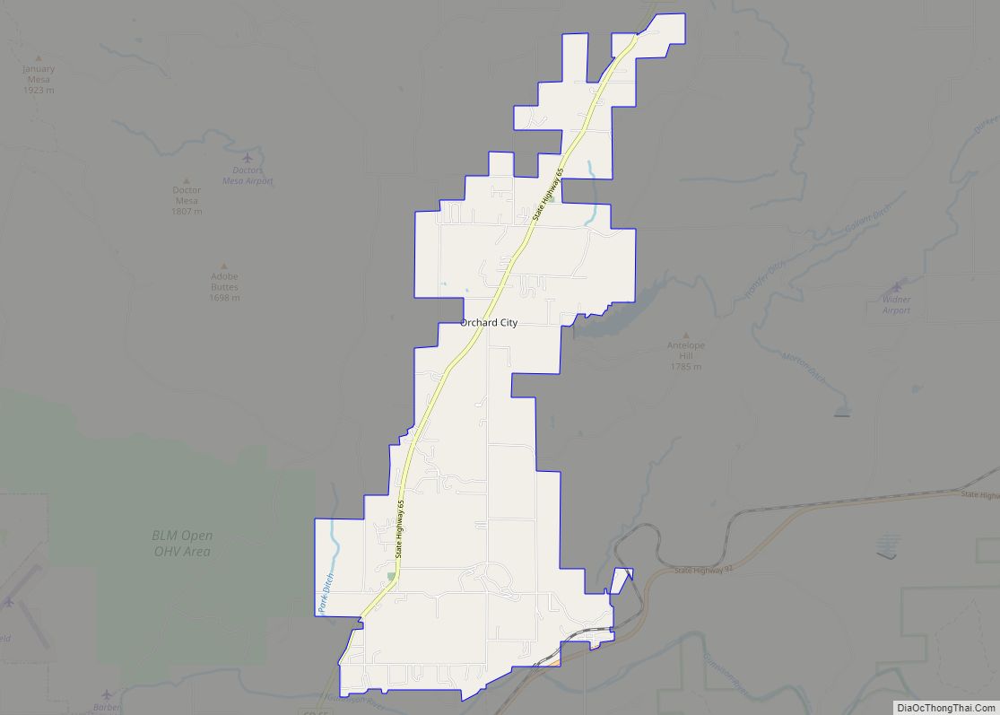
| Name: | Delta County |
|---|---|
| FIPS code: | 08-029 |
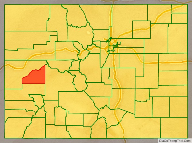
| State: | Colorado |
| Founded: | February 11, 1883 |
| Named for: | City of Delta, Colorado |
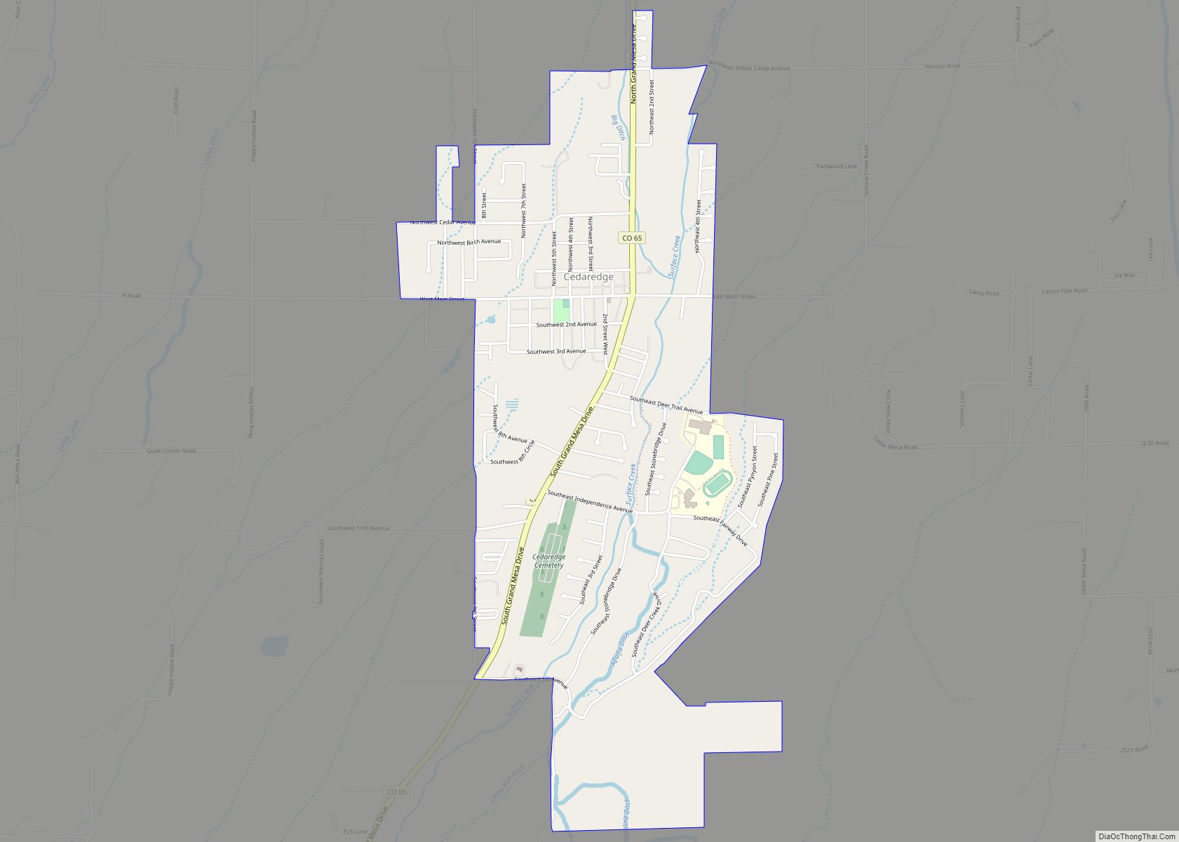
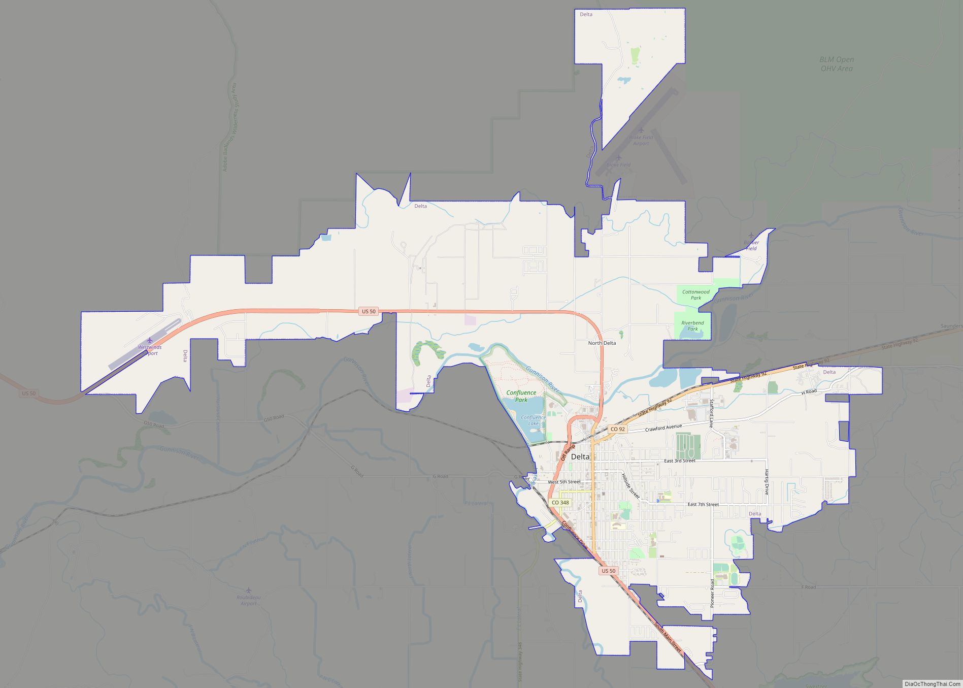
| Seat: | Delta |
| Largest city: | Delta |
| Total Area: | 1,149 sq mi (2,980 km²) |
| Land Area: | 1,142 sq mi (2,960 km²) |
| Total Population: | 31,661 |
| Population Density: | 27/sq mi (10/km²) |
| Time zone: | UTC−7 (Mountain) |
| Summer Time Zone (DST): | UTC−6 (MDT) |
| Website: | www.deltacounty.com |
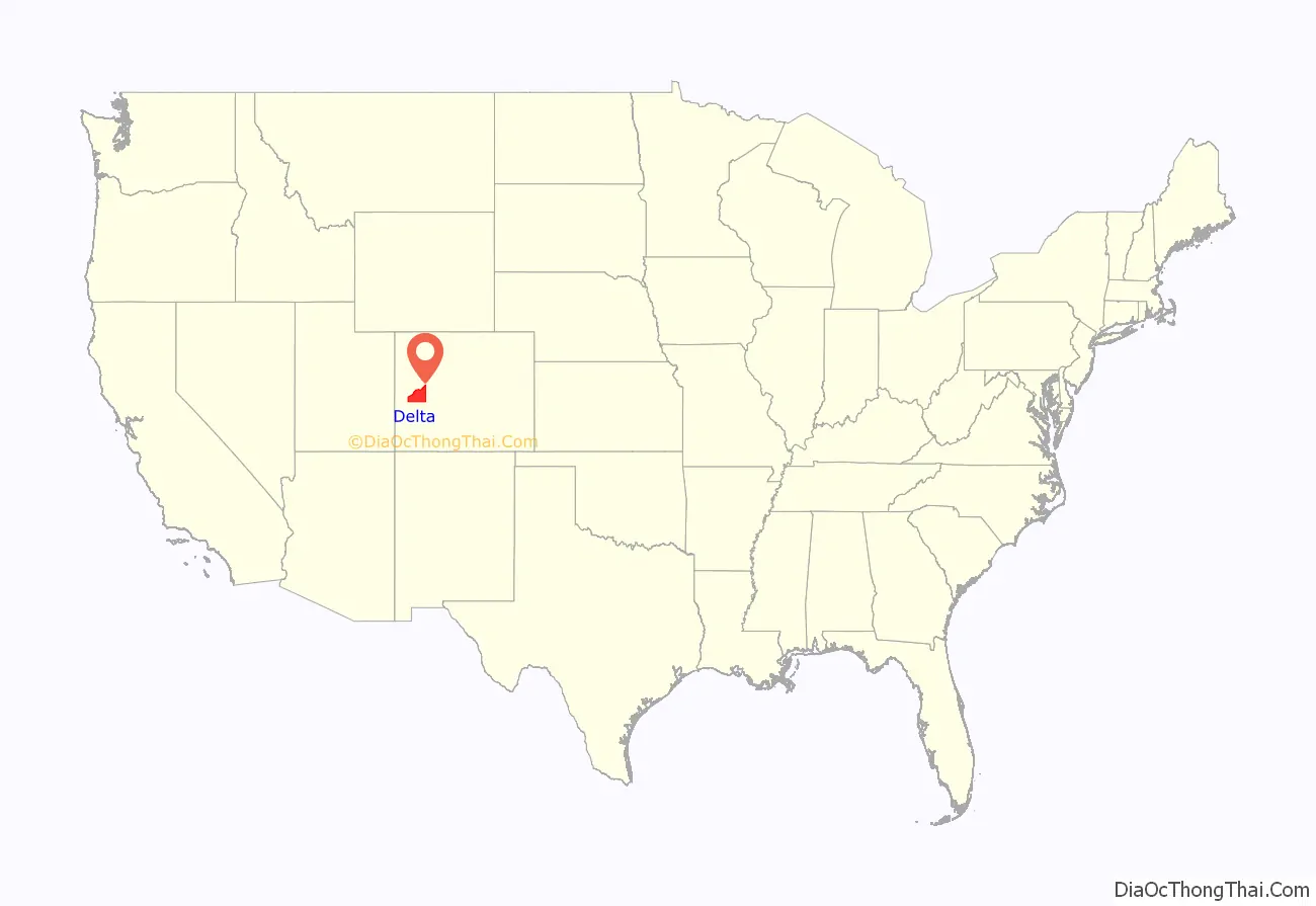
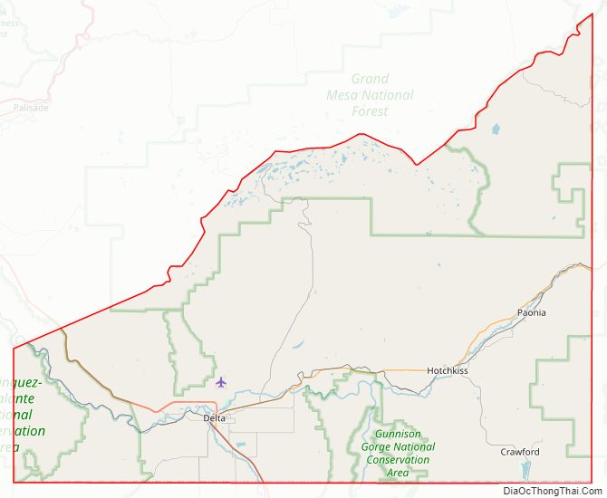
Delta County location map. Where is Delta County?
History
Delta County was created by the Colorado legislature on February 11, 1883, out of portions of central Gunnison County. The county was named from a delta of arable land at the mouth of the Uncompahgre River, where it flows into the Gunnison River.
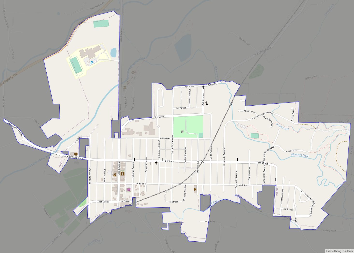
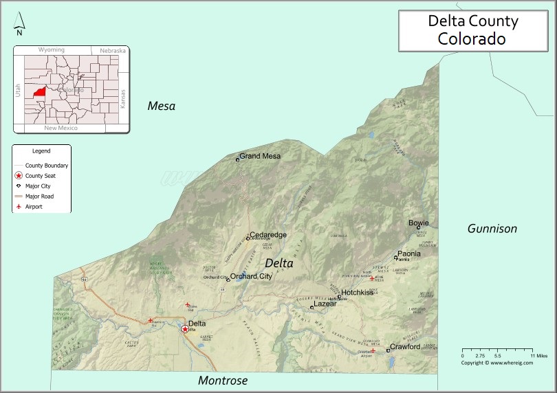
Delta County Road Map
Geography
According to the U.S. Census Bureau, the county has a total area of 1,149 square miles (2,980 km), of which 1,142 square miles (2,960 km) is land and 6.5 square miles (17 km) (0.6%) is water.
Adjacent counties
- Mesa County – northwest
- Gunnison County – east
- Montrose County – south
Major Highways
- U.S. Highway 50
- State Highway 65
- State Highway 92
- State Highway 133
- State Highway 348
National protected areas
- Dominguez Canyon Wilderness
- Dominguez-Escalante National Conservation Area (part)
- Grand Mesa National Forest
- Gunnison Gorge National Conservation Area (part)
- Gunnison Gorge Wilderness
- Gunnison National Forest
State protected areas
- Crawford State Park
- Sweitzer Lake State Park
Trails and byways
- American Discovery Trail
- Crag Crest National Recreation Trail
- Old Spanish National Historic Trail
- Grand Mesa Scenic and Historic Byway
- West Elk Loop Scenic Byway
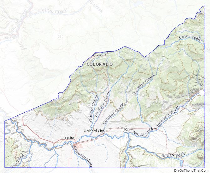
Delta County Topographic Map
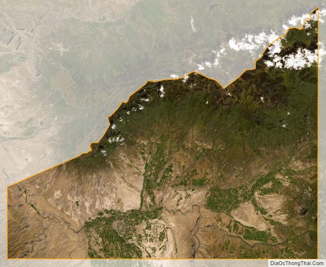
Delta County Satellite Map
Delta County Outline Map