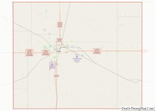
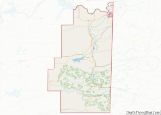
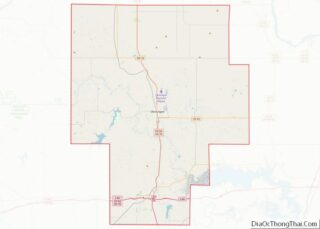
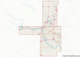
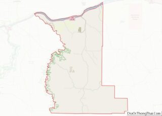
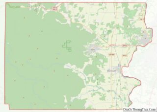
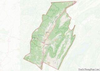
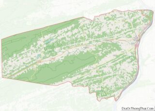
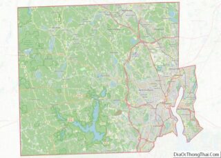
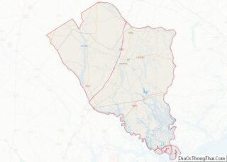
Map of Loving County, Texas
Loving County is a county in the U.S. state of Texas. With a population of 64 per the 2020 census, it is the least-populous county in the United States. Its county seat and only community is Mentone. The county was originally created in 1887, and after being disorganized in 1897, was reorganized in 1931. Loving ... Read more
Map of Loving County, Texas
Map of Mills County, Texas
Mills County is a county located in Central Texas. It was created on March 15, 1887, from parts of four existing counties—Brown, Comanche, Hamilton, and Lampasas. The 2020 census reported a population of 4,456. The county seat is Goldthwaite. Mills County overview: Name: Mills County FIPS code: 48-333 State: Texas Founded: March 15, 1887 Named ... Read more
Map of Mills County, Texas
Map of Panola County, Texas
Panola County is a county located in the U.S. state of Texas. As of the 2020 census, its population was 22,491. The county seat is Carthage. Located in East Texas and originally developed for cotton plantations, the county’s name is derived from a Choctaw word for cotton. Until 2013, Panola County was one of about ... Read more
Map of Panola County, Texas
Map of Rockwall County, Texas
Rockwall County is a county in the U.S. state of Texas. At 149 square miles, Rockwall County has the smallest area of any Texas county. Per the 2020 Census, its population was 107,819. Its county seat is Rockwall. The county and city are named for a wall-like subterranean rock formation that runs throughout the county. ... Read more
Map of Rockwall County, Texas
Map of Stephens County, Texas
Stephens County is a county located in the U.S. state of Texas. As of the 2020 census, its population was 9,101. Its county seat is Breckenridge. The county was created in 1858 and organized in 1876. It was originally named Buchanan County, after U.S. President James Buchanan, but was renamed in 1861 for Alexander H. ... Read more
Map of Stephens County, Texas
Map of Upton County, Texas
Upton County is a county located on the Edwards Plateau in the U.S. state of Texas. As of the 2020 census, its population was 3,308. Its county seat is Rankin. The county was created in 1887 and later organized in 1910. It is named for two brothers: John C. and William F. Upton, both colonels ... Read more
Map of Upton County, Texas
Map of Wilson County, Texas
Wilson County is a county located in the U.S. state of Texas. As of the 2020 census, its population was 49,753. Its county seat is Floresville. The county is named after James Charles Wilson. Wilson County is part of the San Antonio–New Braunfels, Texas, metropolitan statistical area. Wilson County overview: Name: Wilson County FIPS code: ... Read more
Map of Wilson County, Texas
Map of Garfield County, Utah
Garfield County is a county in south central Utah, United States. As of the 2010 United States Census the population was 5,172, making it the fifth-least populous county in Utah; with about 0.98 inhabitants per square mile, it is also the least densely populated county in Utah. Its county seat and largest city is Panguitch. ... Read more
Map of Garfield County, Utah
Map of Utah County, Utah
Utah County is the second-most populous county in the U.S. state of Utah. The county seat and largest city is Provo, which is the state’s fourth-largest city, and the largest outside of Salt Lake County. As of the 2020 United States Census, the population was 665,665. Utah County is one of two counties forming the ... Read more
Map of Utah County, Utah
Map of Washington County, Vermont
Washington County is a county located in the U.S. state of Vermont. Named after George Washington, its county seat is the city of Montpelier (the least populous state capital in the United States) and the most populous municipality is the city of Barre. As of the 2020 census, the population was 59,807, making it the ... Read more
Map of Washington County, Vermont
Map of Botetourt County, Virginia
Botetourt County (/ˈbɒtətɒt/ BOT-ə-tot) is a US county that lies in the Roanoke Region of the Commonwealth of Virginia. Located in the mountainous portion of the state, the county is bordered by two major ranges, the Blue Ridge Mountains and the Appalachian Mountains. Botetourt County was created in 1770 from part of Augusta County and ... Read more
Map of Botetourt County, Virginia
Map of Colonial Heights City, Virginia
Colonial Heights is an independent city in the Commonwealth of Virginia. As of the 2020 census, the population was 18,170. The Bureau of Economic Analysis combines the City of Colonial Heights (along with the City of Petersburg) with Dinwiddie County for statistical purposes. Colonial Heights is located in the Tri-Cities area of the Richmond Metropolitan ... Read more
Map of Colonial Heights City, Virginia