| Name: | Delaware County |
|---|---|
| FIPS code: | 42-045 |
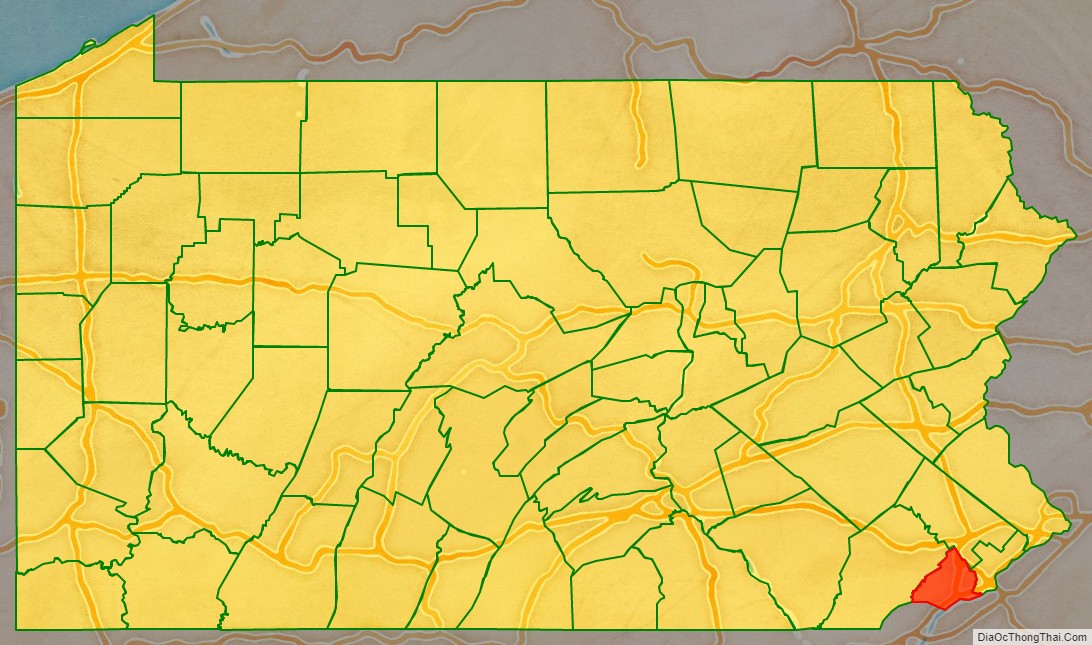
| State: | Pennsylvania |
| Founded: | September 26, 1789 |
| Named for: | Delaware River |
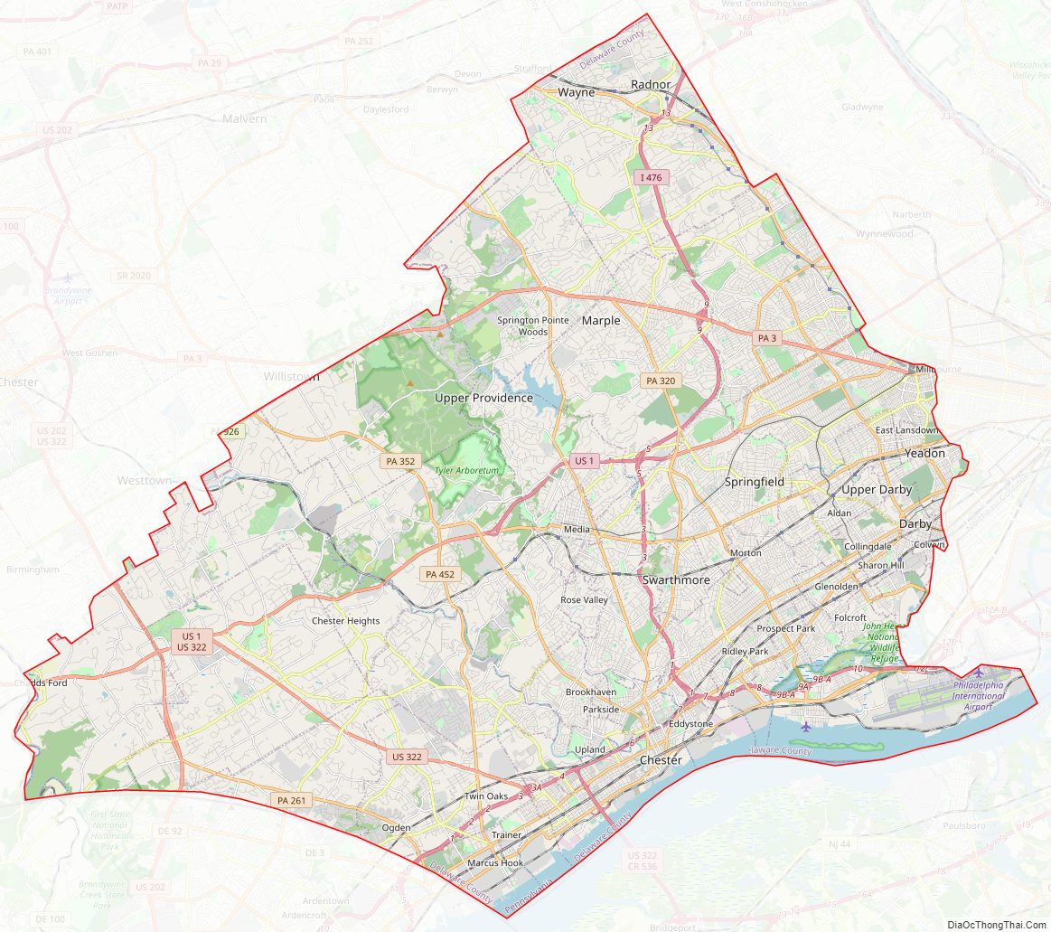
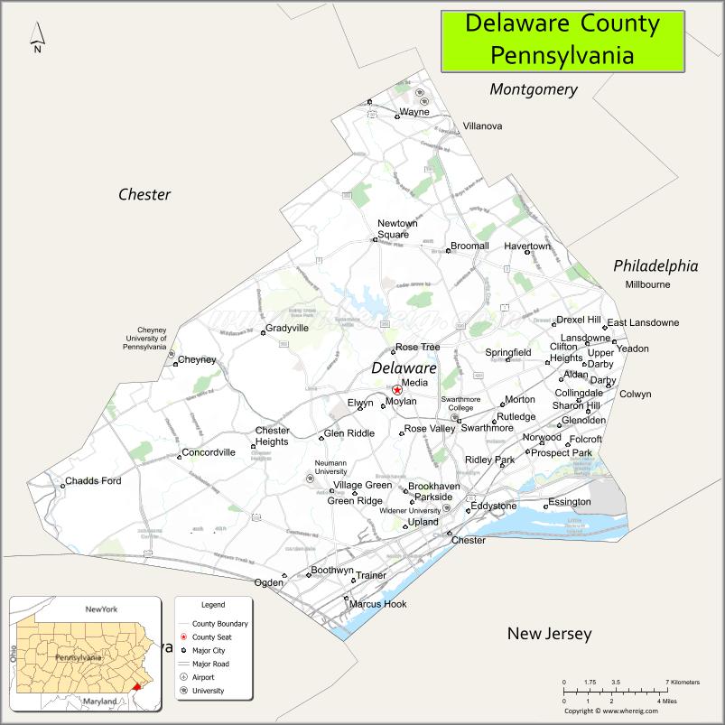
| Seat: | Media |
| Largest town: | Upper Darby |
| Total Area: | 191 sq mi (490 km²) |
| Land Area: | 184 sq mi (480 km²) |
| Total Population: | 576,830 |
| Population Density: | 3,000/sq mi (1,200/km²) |
| Website: | delcopa.gov |
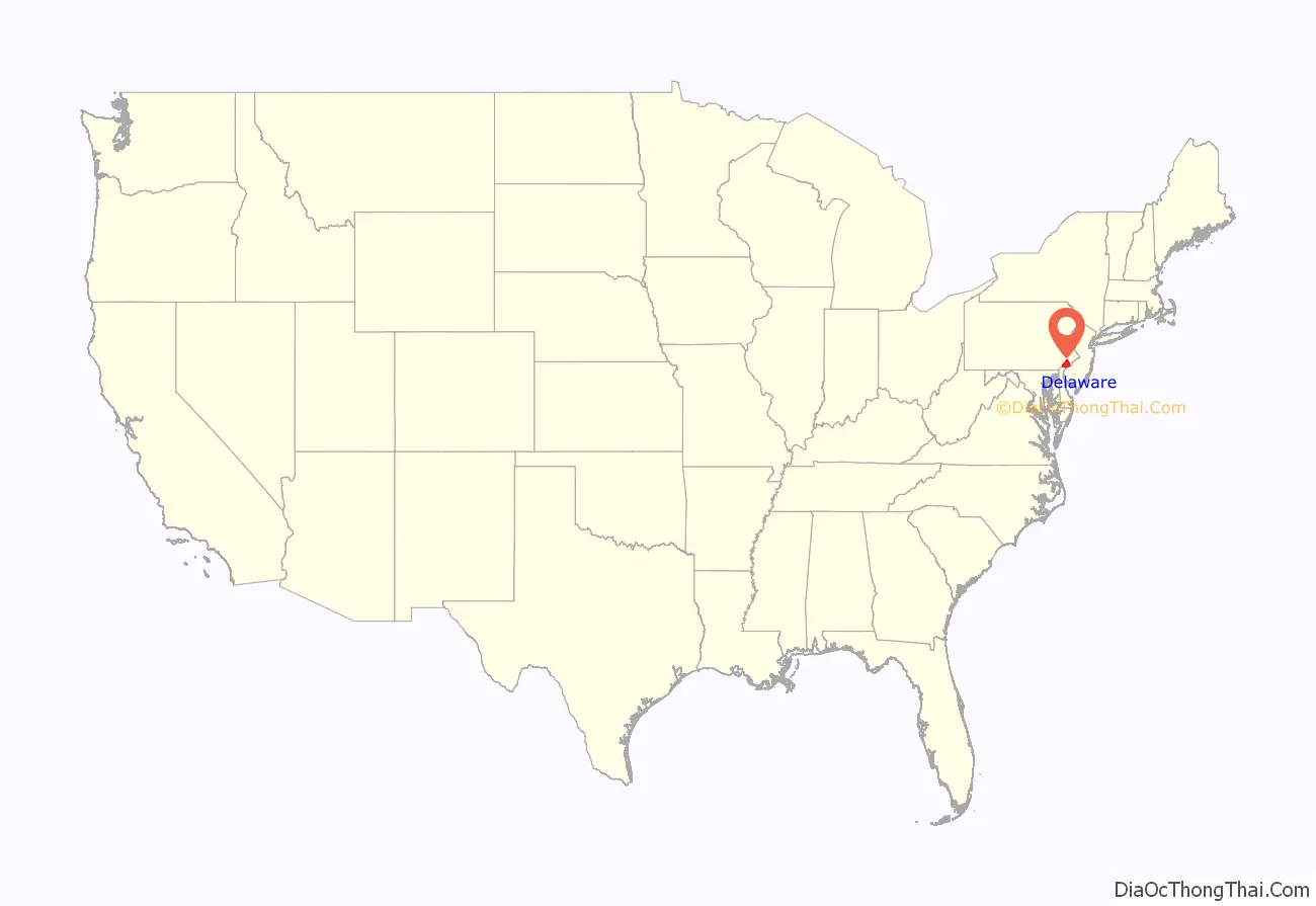
Delaware County location map. Where is Delaware County?
History
Delaware County lies in the river and bay drainage area named “Delaware” in honor of Thomas West, 3rd Baron De La Warr, Governor of the nearby English colony of Virginia. The land was explored by Henry Hudson in 1609, and over the next several decades it was variously claimed and settled by the Swedes, the Dutch, and the English. Its original human inhabitants were the Lenape tribe of American Indians.
Once the Dutch were defeated and the extent of New York was determined, King Charles II of England made his grant to William Penn in order to found the colony which came to be named Pennsylvania. Penn divided his colony into three counties: Bucks, Philadelphia, and Chester. The riverfront land south of Philadelphia, being the most accessible, was quickly granted and settled. In 1789, the southeastern portion of Chester County was divided from the rest and named Delaware County for the Delaware River.
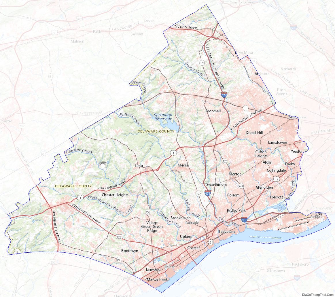
Delaware County Road Map
Geography
According to the U.S. Census Bureau, the county has a total area of 191 square miles (490 km), of which 184 square miles (480 km) is land and 6.8 square miles (18 km) (3.5%) is water. It is the third-smallest county in Pennsylvania by area.
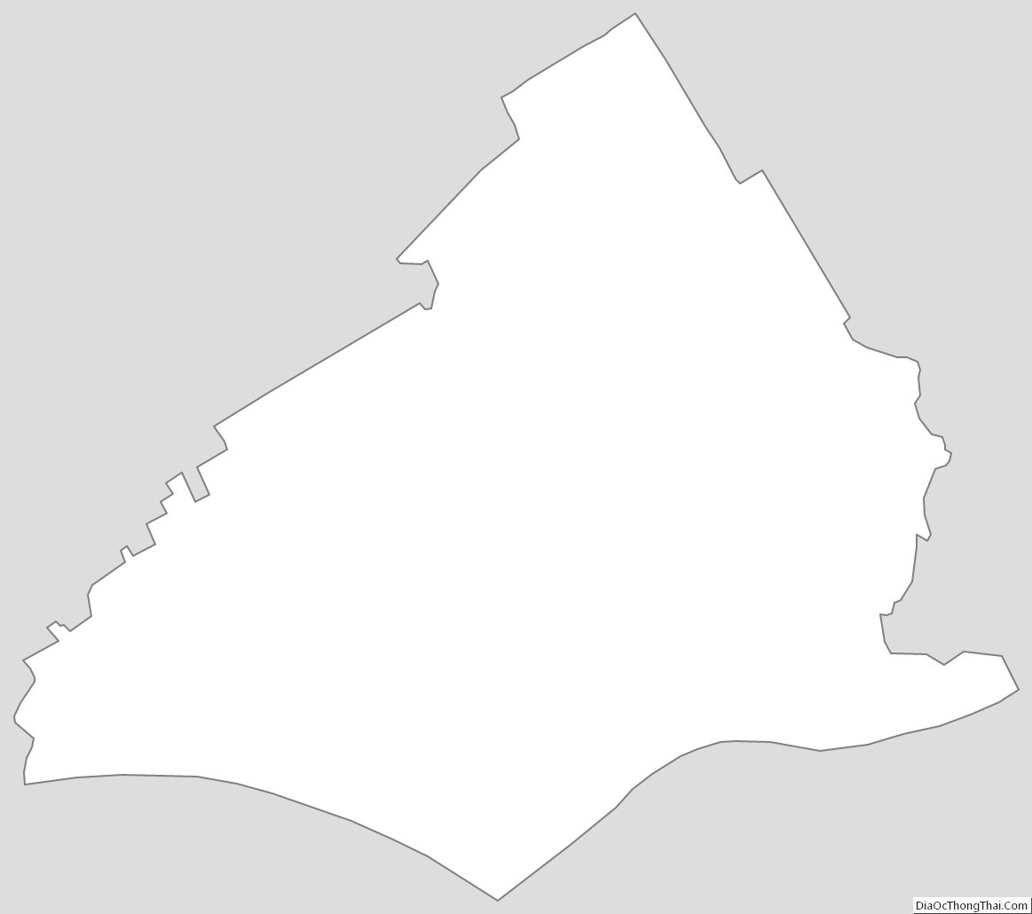
Delaware County is roughly diamond- or kite-shaped, with the four sides formed by the Chester County boundary to the northwest, the boundary with the state of Delaware, a portion of the “Twelve-Mile Circle”) to the southwest, the Delaware River, forming the border with the state of New Jersey) to the southeast, and the city of Philadelphia and Montgomery County to the east and northeast.
The lowest point in the state of Pennsylvania is located on the Delaware River in Marcus Hook in Delaware County, where it flows out of Pennsylvania and into Delaware. The highest point in Delaware County is 500 feet at two points southeast of Wyola in Newtown Township [1].
Waterways in Delaware County generally flow in a southward direction and ultimately drain into the Delaware River. The waterways are, from west to east: the Brandywine River (forming a portion of the county’s western boundary with Chester County), Naaman’s Creek, Stoney Creek, Chester Creek, Ridley Creek, Crum Creek, Muckinipates Creek, Darby Creek and Cobbs Creek (forming a portion of the county’s eastern boundary with Philadelphia). Crum Creek was dammed in 1931 near Pennsylvania Route 252 to fill Springton Lake (also known as Geist Reservoir), an approximately 391-acre (1.58 km) drinking water reservoir maintained by Aqua America, the county’s largest lake.
The Trainer Refinery and the Port of Chester are located along the shores of the Delaware River.
Adjacent counties
- Montgomery County, Pennsylvania (north)
- Philadelphia County, Pennsylvania (northeast)
- Gloucester County, New Jersey (southeast)
- New Castle County, Delaware (southwest)
- Chester County, Pennsylvania (west)
Delaware County is one of four counties in the United States to border a state with which it shares the same name (the other three are Nevada County, California, Texas County, Oklahoma, and Ohio County, West Virginia).
National protected areas
- First State National Historical Park (part)
- John Heinz National Wildlife Refuge (part)
State protected area
2,600 acres (11 km) of the county are occupied by the Ridley Creek State Park.
Delaware County Topographic Map
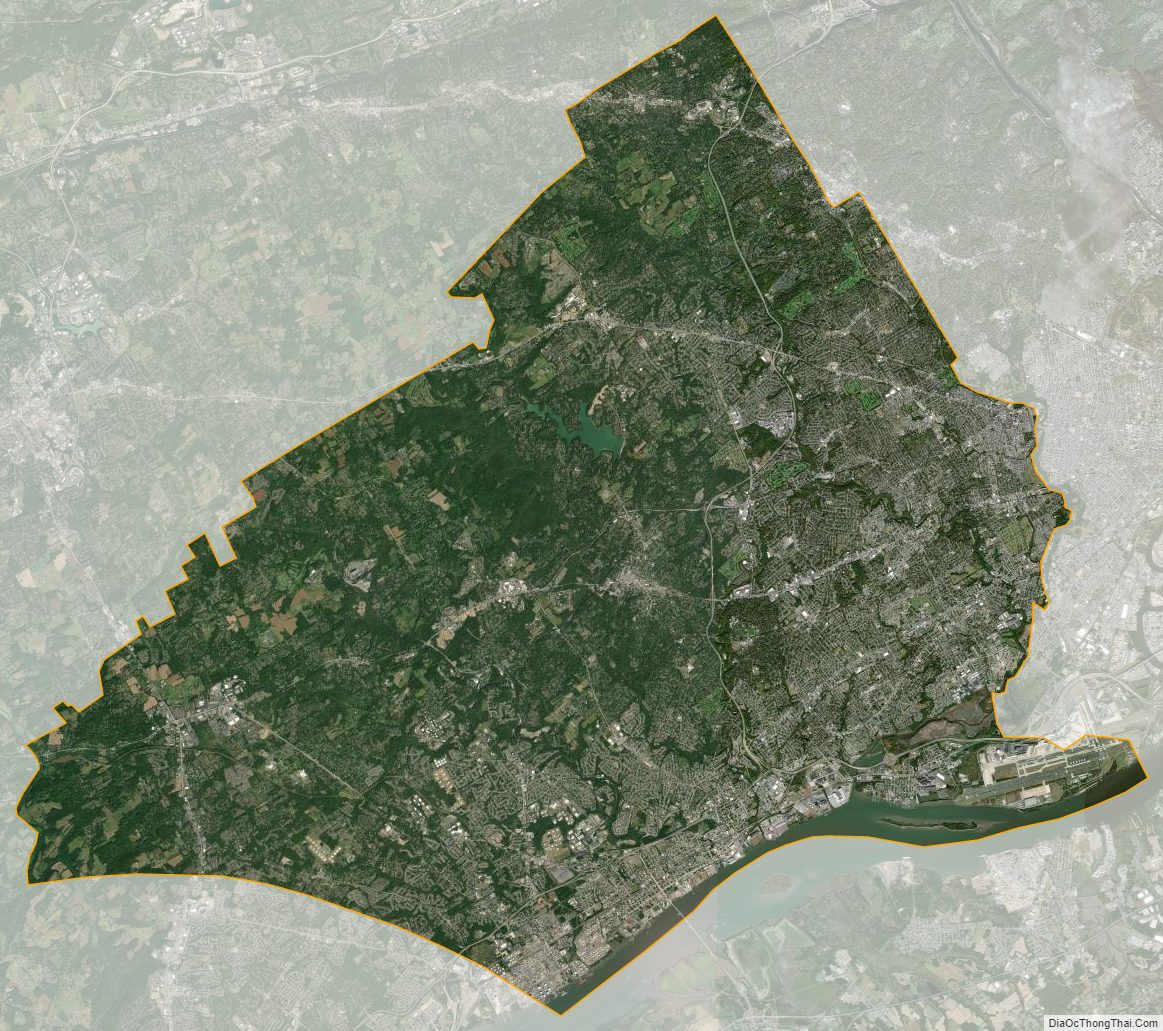
Delaware County Satellite Map
Delaware County Outline Map