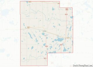
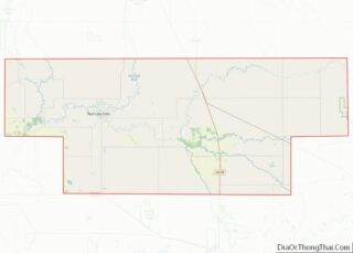
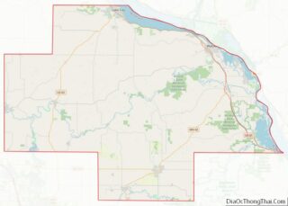
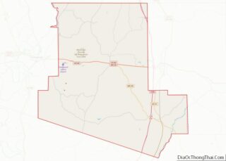
Map of Otsego County

Map of Otsego County, New York

Otsego County is a county in the U.S. state of New York. As of the 2020 census, the population was 58,524. The county seat is Cooperstown. The county’s population center is Oneonta. The name Otsego is from a Mohawk or Oneida word meaning “place of the rock.” Otsego County overview: Name: Otsego County FIPS code: … Read more

Map of Tompkins County

Map of Tompkins County, New York

Tompkins County is a county located in the U.S. state of New York. As of the 2020 census, the population was 105,740. The county seat is Ithaca. The name is in honor of Daniel D. Tompkins, who served as Governor of New York and Vice President of the United States. Tompkins County comprises the Ithaca … Read more

Map of Bladen County

Map of Bladen County, North Carolina

Bladen County (/ˈbleɪdən/) is a county located in the U.S. state of North Carolina. As of the 2020 census, the population was 29,606. Its county seat is Elizabethtown. The county was created in 1734 as Bladen Precinct and gained county status in 1739. Bladen County overview: Name: Bladen County FIPS code: 37-017 State: North Carolina … Read more

Map of Craven County

Map of Craven County, North Carolina

Craven County is located in the U.S. state of North Carolina. As of the 2020 census, the population was 100,720. Its county seat is New Bern. The county was created in 1705 as Archdale Precinct from the now-extinct Bath County. It was renamed Craven Precinct in 1712 and gained county status in 1739. It is … Read more

Map of Guilford County

Map of Guilford County, North Carolina

Guilford County is a county located in the U.S. state of North Carolina. As of the 2020 census, the population is 541,299, making it the third-most populous county in North Carolina. The county seat, and largest municipality, is Greensboro. Since 1938, an additional county court has been located in High Point. The county was formed … Read more

Map of Madison County

Map of Madison County, North Carolina

Madison County overview: Name: Madison County FIPS code: 37-115 State: North Carolina Founded: 1851 Named for: James Madison Seat: Marshall Largest town: Mars Hill Total Area: 451 sq mi (1,170 km²) Land Area: 450 sq mi (1,200 km²) Total Population: 21,193 Population Density: 47.8/sq mi (18.5/km²) Time zone: UTC−5 (Eastern) Summer Time Zone (DST): UTC−4 (EDT) Website: www.madisoncountync.gov Madison County location map. … Read more

Map of Person County

Map of Person County, North Carolina

Person County is a county located in the U.S. state of North Carolina. The population was 39,097 as of the 2020 census. The county seat is Roxboro. Person County is included in the Durham–Chapel Hill Metropolitan Statistical Area, which is also included in the Raleigh-Durham-Chapel Hill Combined Statistical Area, which had an estimated population of … Read more

Map of Tyrrell County

Map of Tyrrell County, North Carolina

Tyrrell County is a county located in the U.S. state of North Carolina. As of the 2020 census, the population was 3,245, making it the least populous county in North Carolina. Its county seat is Columbia. The county was created in 1729 as Tyrrell Precinct and gained county status in 1739. Tyrrell County is included … Read more

Map of Bottineau County

Map of Bottineau County, North Dakota

Bottineau County is a county in the U.S. state of North Dakota. As of the 2020 census, the population was 6,379. Its county seat is Bottineau. The Territorial legislature identified Bottineau as one of the original counties of the territory. on January 4, 1873. Its organization was effected on July 17, 1884. It is named … Read more

Map of Hettinger County

Map of Hettinger County, North Dakota

Hettinger County (/ˈhɛtɪŋɡər/ HET-ing-gər) is a county in the U.S. state of North Dakota. As of the 2020 census, the population was 2,489. Its county seat is Mott. The city of Hettinger, North Dakota, is in nearby Adams County. Hettinger County overview: Name: Hettinger County FIPS code: 38-041 State: North Dakota Founded: 1883 Named for: … Read more

Map of Ransom County

Map of Ransom County, North Dakota

Ransom County is a county in the U.S. state of North Dakota. As of the 2020 census, the population was 5,703. Its county seat is Lisbon. Ransom County overview: Name: Ransom County FIPS code: 38-073 State: North Dakota Founded: 1873 Named for: Fort Ransom Seat: Lisbon Largest city: Lisbon Total Area: 864 sq mi (2,240 km²) Land Area: … Read more

Map of Williams County

Map of Williams County, North Dakota

Williams County is located on the western border of the U.S. state of North Dakota, next to Montana. As of the 2020 census, the population was 40,950. Its county seat is Williston. The Williston Micropolitan Statistical Area includes all of Williams County. It is bordered on the south by the upper Missouri River, whose confluence … Read more