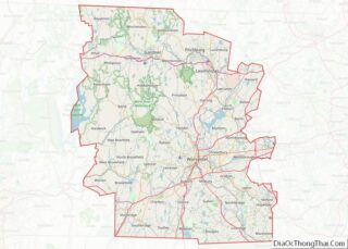
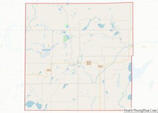
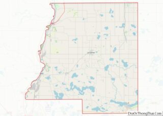
Map of Greene County

Map of Greene County, Missouri

Greene County is located in the U.S. state of Missouri. As of the 2020 census, its population was 298,915. making it the fourth most-populous county in Missouri. Its county seat and most-populous city is Springfield. The county was organized in 1833 and is named after American Revolutionary War General Nathanael Greene. Greene County is included … Read more

Map of Lawrence County

Map of Lawrence County, Missouri

Lawrence County is located in the southwest portion of the U.S. state of Missouri, in the area of the Ozarks. As of the 2010 census, the population was 38,634. Its county seat is Mount Vernon. The county was organized in 1845 and named for James Lawrence, a naval officer from the War of 1812 known … Read more

Map of Morgan County

Map of Morgan County, Missouri

Morgan County is a county located in the central portion of the U.S. state of Missouri. As of the 2010 census, the population was 20,565. Its county seat is Versailles. The county was organized January 5, 1833 and named for General Daniel Morgan of the American Revolutionary War. Morgan County overview: Name: Morgan County FIPS … Read more

Map of Ralls County

Map of Ralls County, Missouri

Ralls County is a county located in the northeastern portion of the U.S. state of Missouri. As of the 2020 census, the population was 10,355. Its county seat is New London. The county was organized November 16, 1820 and named for Daniel Ralls, Missouri state legislator. Ralls County is part of the Hannibal, MO Micropolitan … Read more

Map of Stoddard County

Map of Stoddard County, Missouri

Stoddard County is a county located in the southeastern portion of the U.S. state of Missouri. As of the 2020 census, the population was 28,672. The county seat is Bloomfield. The county was officially organized on January 2, 1835, and is named for Amos Stoddard, the first American commandant (an early term for “governor”) of … Read more

Map of Carbon County

Map of Carbon County, Montana

Carbon County is a county located in the U.S. state of Montana. As of the 2020 census, the population was 10,473. Its county seat is Red Lodge. Carbon County is part of the Billings, MT Metropolitan Statistical Area. Carbon County overview: Name: Carbon County FIPS code: 30-009 State: Montana Founded: March 4, 1895 Seat: Red … Read more

Map of Hill County

Map of Hill County, Montana

Hill County is a county located in the U.S. state of Montana. As of the 2020 census, the population was 16,309. Its county seat is Havre. It lies along the United States border with Canada, abutting Alberta and Saskatchewan. Part of its territory is within the Rocky Boy Indian Reservation, which is held by the … Read more

Map of Pondera County

Map of Pondera County, Montana

Pondera County (/ˌpɒndəˈreɪ/ POND-ə-RAY) is a county in the U.S. state of Montana. As of the 2020 census, the population was 5,898. Its county seat is Conrad. Pondera County overview: Name: Pondera County FIPS code: 30-073 State: Montana Founded: April 1, 1919 Named for: Pend d’Oreilles people Seat: Conrad Largest city: Conrad Total Area: 1,640 sq mi … Read more

Map of Valley County

Map of Valley County, Montana

Valley County is a county in the U.S. state of Montana. Valley County was created in 1893 with area partitioned from Dawson County. As of the 2020 census, the population was 7,578. Its county seat is Glasgow. It is located on the Canada–United States border with Saskatchewan. Valley County overview: Name: Valley County FIPS code: … Read more

Map of Cass County

Map of Cass County, Nebraska

Cass County is a county in the U.S. state of Nebraska. As of the 2010 United States Census, the population was 25,241. Its county seat and largest city is Plattsmouth. The county was formed in 1855, and was named for General Lewis Cass. Cass County is included in the Omaha–Council Bluffs, NE-IA Metropolitan Statistical Area. … Read more

Map of Dundy County

Map of Dundy County, Nebraska

Dundy County is a county in the U.S. state of Nebraska. As of the 2020 United States Census, the population was 1,654. Its county seat is Benkelman. In the Nebraska license plate system, Dundy County is represented by the prefix 76 (it had the seventy-sixth-largest number of vehicles registered in the county when the license … Read more

Map of Holt County

Map of Holt County, Nebraska

Holt County overview: Name: Holt County FIPS code: 31-089 State: Nebraska Founded: 1860 Named for: Joseph Holt Seat: O’Neill Largest city: O’Neill Total Area: 2,417 sq mi (6,260 km²) Land Area: 2,412 sq mi (6,250 km²) Total Population: 10,127 Population Density: 4.2/sq mi (1.6/km²) Time zone: UTC−6 (Central) Summer Time Zone (DST): UTC−5 (CDT) Website: www.co.holt.ne.us Holt County location map. Where is … Read more