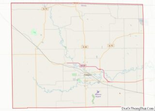
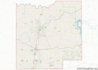
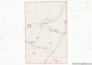
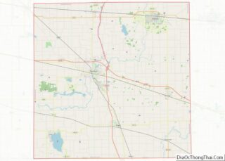
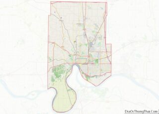
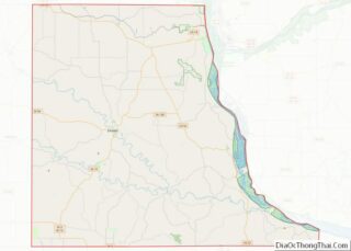
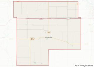
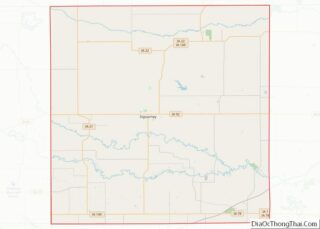
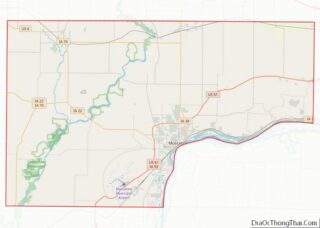
Map of Owyhee County

Map of Owyhee County, Idaho

Owyhee County (/oʊˈwaɪ.hiː/ oh-WYE-hee) is a county in the southwestern corner of the U.S. state of Idaho. As of the 2020 census, the population was 12,133. The county seat is Murphy, and its largest city is Homedale. In area it is the second-largest county in Idaho, behind Idaho County. Owyhee County is part of the … Read more

Map of Cass County

Map of Cass County, Illinois

Cass County is a county located in the U.S. state of Illinois. As of the 2010 United States Census, the population was 13,642. Its county seat is Virginia. It is the home of the Jim Edgar Panther Creek State Fish and Wildlife Area. Cass County overview: Name: Cass County FIPS code: 17-017 State: Illinois Founded: … Read more

Map of Effingham County

Map of Effingham County, Illinois

Effingham County is located in the south central part of the U.S. state Illinois. As of the 2020 census, the population was 34,668. Its county seat and largest city is Effingham. Some other cities in Effingham County, Illinois include Altamont, Teutopolis, Beecher City, Montrose, Dieterich, Shumway, Watson, Mason, and Edgewood. Effingham County comprises the Effingham, … Read more

Map of Jefferson County

Map of Jefferson County, Illinois

Jefferson County is a county located in the southern part of the U.S. state of Illinois. According to the 2020 census, it has a population of 37,113. The county seat is Mount Vernon. Jefferson County contains the Mount Vernon, Illinois micropolitan area. It is located in the southern portion known locally as “Little Egypt”. The … Read more

Map of Macoupin County

Map of Macoupin County, Illinois

Macoupin County is located in the U.S. state of Illinois. According to the 2010 census, it had a population of 47,765. The county seat is Carlinville. The primary industry is agriculture, consisting of crops of corn (maize), soybeans, and some wheat. Macoupin County overview: Name: Macoupin County FIPS code: 17-117 State: Illinois Founded: 1829 Named … Read more

Map of Peoria County

Map of Peoria County, Illinois

Peoria County is located in the U.S. state of Illinois. The 2020 United States Census listed its population at 181,830. Its county seat is Peoria. Peoria County is part of the Peoria, IL Metropolitan Statistical Area. Peoria County overview: Name: Peoria County FIPS code: 17-143 State: Illinois Founded: 1825 Named for: Peoria tribe Seat: Peoria … Read more

Map of Stark County

Map of Stark County, Illinois

Stark County is in Illinois. According to the 2010 census, it had a population of 5,994. Its county seat is Toulon. Stark County is part of the Peoria, IL Metropolitan Statistical Area. Stark County overview: Name: Stark County FIPS code: 17-175 State: Illinois Founded: 1839 Named for: John Stark Seat: Toulon Largest city: Wyoming Total … Read more

Map of Allen County

Map of Allen County, Indiana

Allen County is a county in the U.S. state of Indiana. As of the 2020 Census, the population was 385,410, making it the third-most populous county in Indiana. The county seat and largest city is Fort Wayne, the second largest city in Indiana. Allen County is included in the Fort Wayne Metropolitan Statistical Area and … Read more

Map of Delaware County

Map of Delaware County, Indiana

Delaware County is a county in the east central portion of the U.S. state of Indiana. As of 2020, the population was 111,903. The county seat is Muncie. Delaware County is part of the Muncie, IN metropolitan statistical area, which is part of the larger Indianapolis-Carmel-Muncie CSA. Delaware County overview: Name: Delaware County FIPS code: … Read more

Map of Howard County

Map of Howard County, Indiana

Howard County is one of 92 counties in the U.S. state of Indiana. As of the 2020 census, the population was 83,658. The county seat is Kokomo. Originally named Richardville County, it was renamed in 1844 to commemorate General Tilghman Ashurst Howard. Howard County comprises the Kokomo, Indiana Metropolitan Statistical Area. Howard County overview: Name: … Read more

Map of Marion County

Map of Marion County, Indiana

Marion County is located in the U.S. state of Indiana. The 2020 United States census reported a population of 977,203, making it the largest county in the state and 51st most populated county in the country. Indianapolis is the county seat, the state capital, and largest city. Marion County is consolidated with Indianapolis through an … Read more

Map of Posey County

Map of Posey County, Indiana

Posey County is the southernmost, southwesternmost, and westernmost county in the U.S. state of Indiana. Its southern border is formed by the Ohio River, and its western border by the Wabash River, a tributary to the Ohio. As of 2010, the population was 25,910. The county seat is Mount Vernon. Posey County is part of … Read more