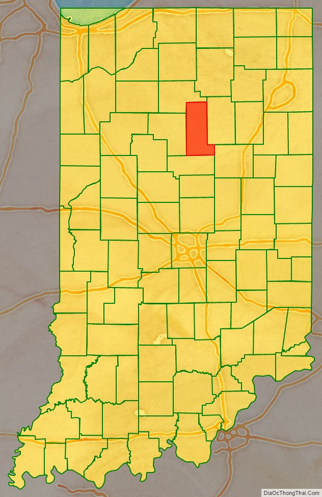
Miami County is a county located in the U.S. state of Indiana. As of 2020, the population was 35,962. The county seat is the City of Peru. Miami County is part of the Kokomo-Peru CSA.
| Name: | Miami County |
|---|---|
| FIPS code: | 18-103 |
| State: | Indiana |
| Founded: | January 30, 1833 |
| Named for: | Miami tribe |
| Seat: | Peru |
| Largest city: | Peru |
| Total Area: | 377.39 sq mi (977.4 km²) |
| Land Area: | 373.84 sq mi (968.2 km²) |
| Population Density: | 98/sq mi (37.93/km²) |
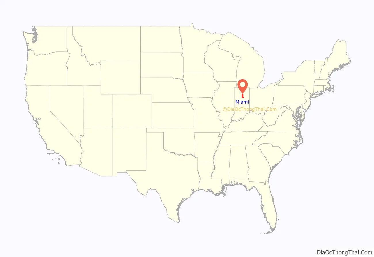
Miami County location map. Where is Miami County?
History
Indiana became a state on December 11, 1816, after being Indiana territory for sixteen years. Originally, Indiana was part of the Northwest Territory, which was made up of land gained by the British after the French and Indian War and organized into a territory after the American Revolution. It was after the revolution that settlement in the area by Europeans really began. Knox territory was created in 1790 and included all of present-day Indiana and areas of Illinois. Ancestry’s Red Book notes that jurisdiction in Knox territory changed due to Indian uprisings in the area from 1790 to 1810. In 1800, Indiana became the name of a territory. Parts Michigan and Illinois both broke away from the territory before it became a state in 1816.
Miami County was formed in 1832 from Cass County and unorganized land. It was named for the Miami, a Native American people, many of whom still live in this area. In 1834, Miami County widened its western border taking some area from Cass County. In 1838 a small portion of unorganized territory was added to the northeastern border, but in 1844 that area was lost to Fulton County. Miami County has been its present shape since 1844.
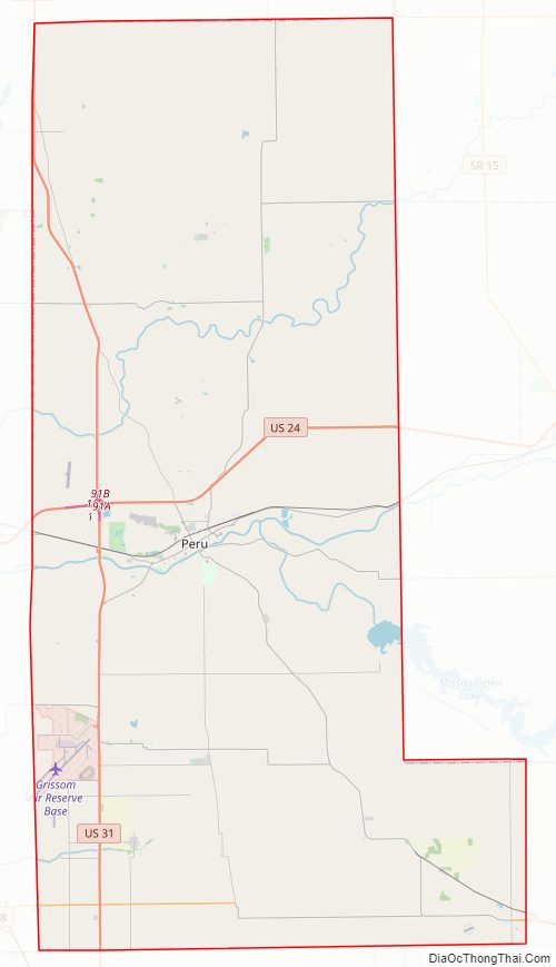
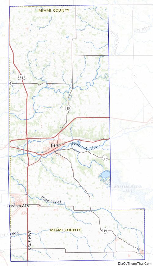
Miami County Road Map
Geography
According to the 2010 census, the county has a total area of 377.39 square miles (977.4 km), of which 373.84 square miles (968.2 km) (or 99.06%) is land and 3.55 square miles (9.2 km) (or 0.94%) is water.
Adjacent counties
- Fulton County (north)
- Wabash County (east)
- Grant County (southeast)
- Howard County (south)
- Cass County (west)
Major highways
- U.S. Route 24
- U.S. Route 31
- State Road 16
- State Road 18
- State Road 19
- State Road 124
- State Road 218
Miami County Topographic Map
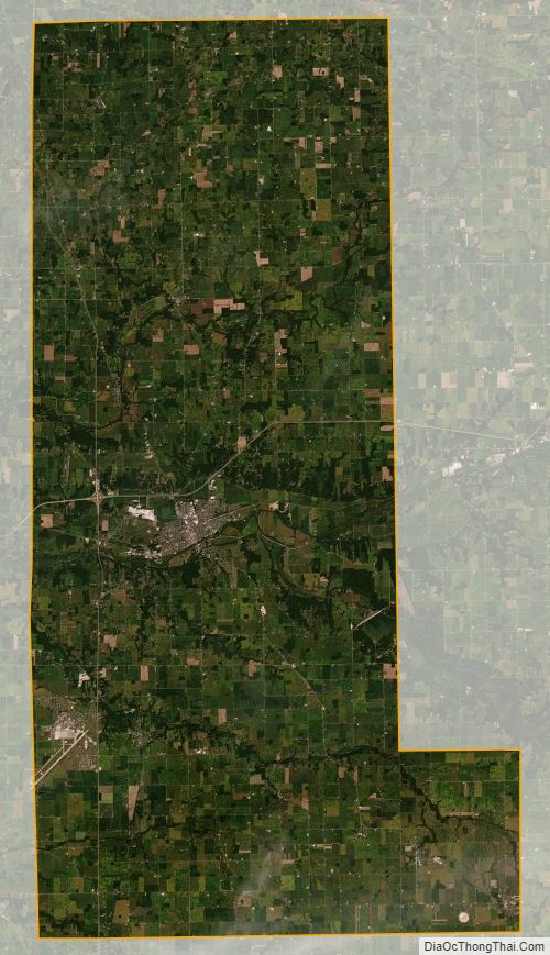
Miami County Satellite Map
Miami County Outline Map