| Name: | Fayette County |
|---|---|
| FIPS code: | 18-041 |
| State: | Indiana |
| Founded: | 1819 |
| Named for: | Marquis de la Fayette |
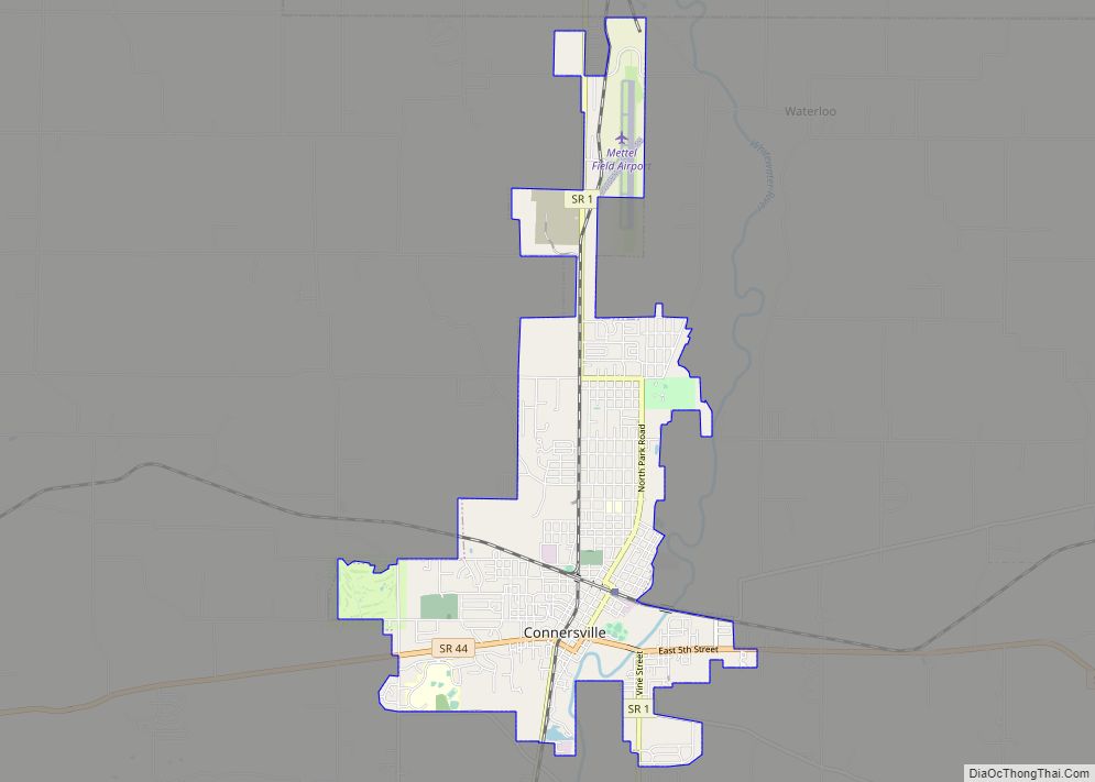
| Seat: | Connersville |
| Largest city: | Connersville |
| Total Area: | 215.16 sq mi (557.3 km²) |
| Land Area: | 215.01 sq mi (556.9 km²) |
| Total Population: | 23,398 |
| Population Density: | 113/sq mi (43.61/km²) |
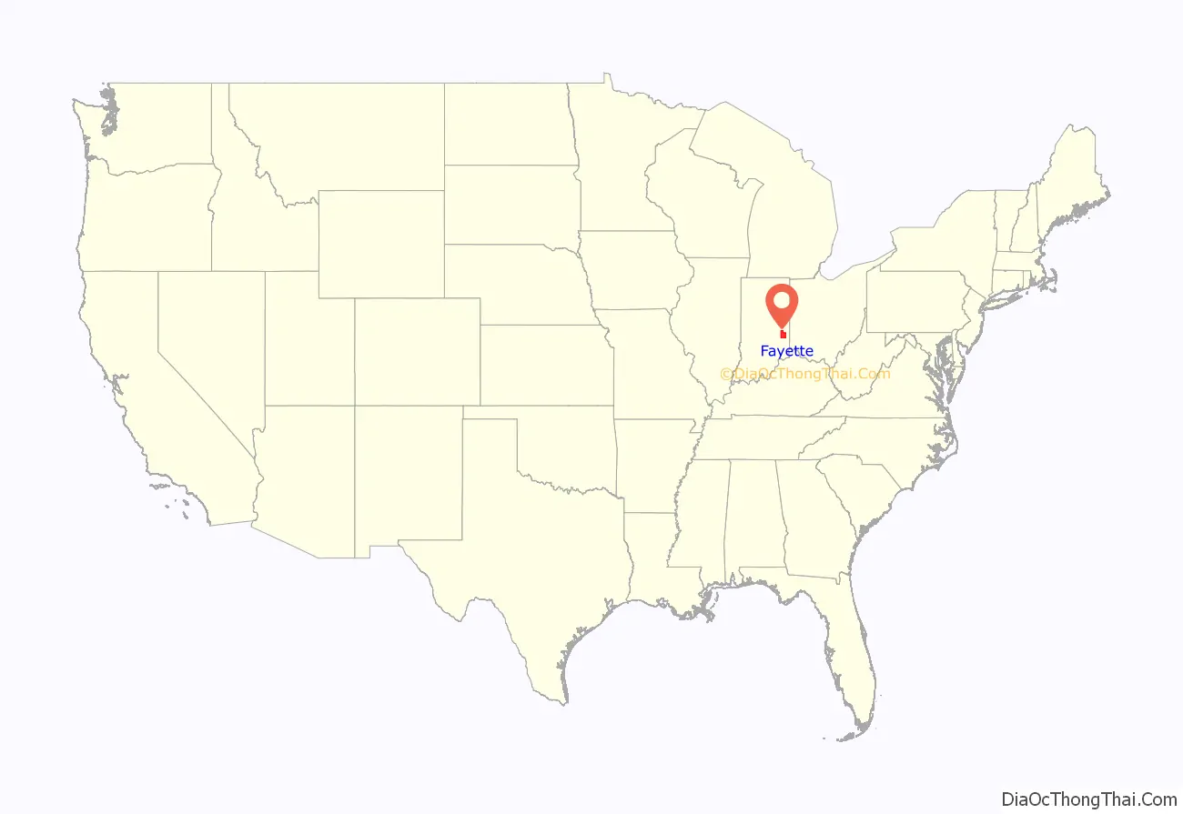
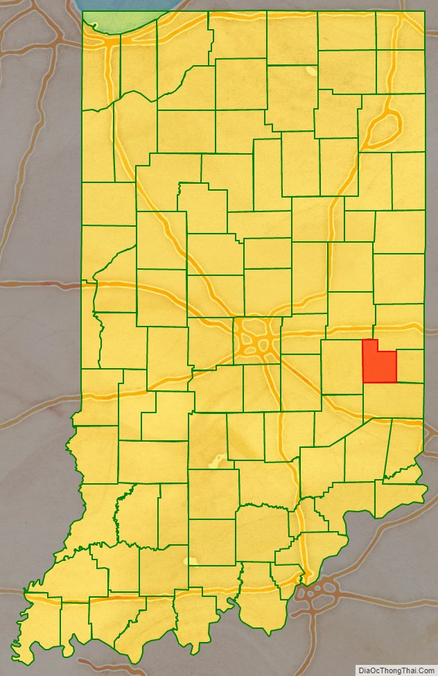
Fayette County location map. Where is Fayette County?
History
The county and its seat Connersville rose from unincorporated territory surrounding an isolated trading post on the Whitewater River to the principal conduit for settlement of northern and central Indiana, Michigan, Wisconsin and Illinois during the early 19th century, to an automotive manufacturing powerhouse in the first half of the 20th century, suffered recession and post-war industrial revival before declining to one of the poorest counties in Indiana and the central midwest. After early settlement, during industrial growth, the county’s population concentrated in the town of Connersville. In 1841, Connersville became the first, and remains the only, incorporated town (chartered as a city in 1869) in the county.
Native American cultures
The oldest civilizations in the Fayette County area, known as Mound Builders, occupied the area between 2,000 and 3,000 years ago. They are known for their distinctive earthen mounds which can be found throughout the area, as well as a variety of metal and pottery artifacts left behind in those mounds across Indiana and Ohio.
Nomadic Miami, Shawnee, and Potawatomi peoples inhabited the area when European explorers arrived and began to form settlements, between the 1670s and early 1800s, and were in the area for at least two hundred years prior to the earliest European explorers. The Delaware Indians, displaced from their ancestral homelands in the east, would later migrate to the Whitewater Valley.
Indiana Territory
At the organization of the Indiana Territory from the Northwest Territory in 1800, the Northwest Territory including present day Indiana was divided between Knox County (seat Vincennes) in the south, and Wayne County, including northern Ohio (seat Detroit) north of Fort Wayne in the north. By the Ohio Enabling Act of 1802 settlers in the Whitewater valley became citizens of the Indiana Territory and residents of Clark county, which had been organized from the eastern part of Knox in 1801, with the county seat at Falls of the Ohio, later called Clarksville.
On Sept. 30, 1809, the United States, on behalf of the Northwest Territory and Governor William Henry Harrison, concluded the Treaty of Fort Wayne, part of whose terms included the purchase from the Indians of a strip of land locally called “The 12 Mile Purchase” parallel to and west of “The Gore”, enclosing the Whitewater Valley and comprising the largest portion of the future county. Conclusion of the treaty essentially ended Indian occupation of the county and cleared the way for settlement.
In southeastern Indiana, a part of the Northwest Territory nicknamed “The Gore” was ceded from Ohio to Indiana in 1803 and became Dearborn County. Wayne and Franklin counties were carved from Dearborn and Clark counties in 1811. At that time much of southeastern Indiana was divided between the two latter counties.
The County
Fayette County was created by act of the Indiana General Assembly in December 1818 from portions of Wayne and Franklin counties and unincorporated (“New Purchase”) territory in the northern portion of the county. It was named for the Marquis de la Fayette, a French hero of the Revolutionary War. Connersville, then a small village of less than a hundred inhabitants, was designated the county seat. The county was divided into five townships (Harrison, Connersville, Jennings, Columbia, and Brownsville) in February 1819, Connersville Township containing the namesake town. In 1821, the organization of Waterloo Township subsumed the portion of Brownsville Township remaining in Fayette County, along with a portion of Harrison Township west of the Whitewater River.
The far eastern part of Fayette lying between the Treaty of Greenville treaty line of 1795 and the present eastern boundary line of Waterloo and Jennings townships was split off into the newly created Union County in 1821. In 1826, a small part in the southeastern portion of Jackson township not included in the limits of the county in 1818, being left a part of Franklin county, was attached to Fayette County.
Four additional townships were created in later years: Posey (1823), Orange (1822), Jackson (1820) and Fairview (1851), corresponding to settlement of the area.
Settlement of the Whitewater Valley
At the time of its organization in 1819, the county had approximately 3,000 residents. Two major events spurred early growth: the completion of the Whitewater Canal in 1847, and the arrival of the Cincinnati, Hamilton and Indianapolis Railroad through Connersville in 1862.
Automotive manufacturing
Economic productivity in the county, except for farming, has been centered almost exclusively in the one town of Connersville.
The automotive era of Connersville began in 1909, when the McFarlan first went into production. The following year, Lexington moved its plant to Connersville from its namesake city in Kentucky. Next came Empire, which built the Little Aristocrat. After Lexington went bankrupt in 1926, Auburn production moved to a factory complex known as Auburn Central. The “Baby Duesenberg” designed in Connersville eventually became the Cord 810 and 812. Connersville also was home to suppliers, including Central Manufacturing, which made bodywork for the 1940 Packard Darrin, along with some 500,000 Jeep bodies during World War II.
Recession
Industrial Revival 1950s & 1960s
Economic decline: labor and industry in the 1980s
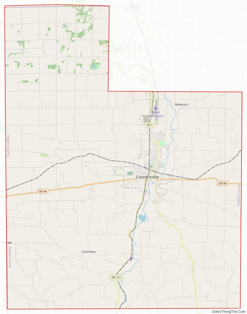
Fayette County Road Map
Geography
According to the 2010 census, the county has a total area of 215.16 square miles (557.3 km), of which 215.01 square miles (556.9 km) (or 99.93%) is land and 0.15 square miles (0.39 km) (or 0.07%) is water. It is almost 14 mi. wide at its widest east–west span, and 19 mi. long (through Posey township). The county is located in the northern portion of the Whitewater River Valley running south and southeasterly from Wayne County to Cincinnati on the Ohio River. The only major waterway in the county is the West Fork of the Whitewater River running north to south through the center of the county. There is only a single tiny (15 acre) lake in the county, Manlove’s Lake in Posey Township. The county is mostly flat with low, rolling hills. The county (and all of Indiana) is part of the Eastern (U.S.) Broadleaf Forest biome dominated by deciduous trees including over 175 native species of oak. Most of the land use is farms (>80%), vacant woodland and pasture. The most common crops are corn and soybeans.
Adjacent counties
- Henry County (north)
- Wayne County (northeast)
- Union County (east)
- Franklin County (south)
- Rush County (west)
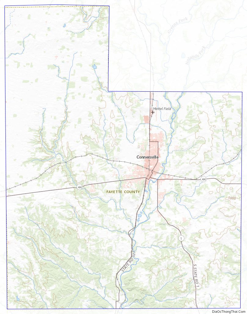
Fayette County Topographic Map
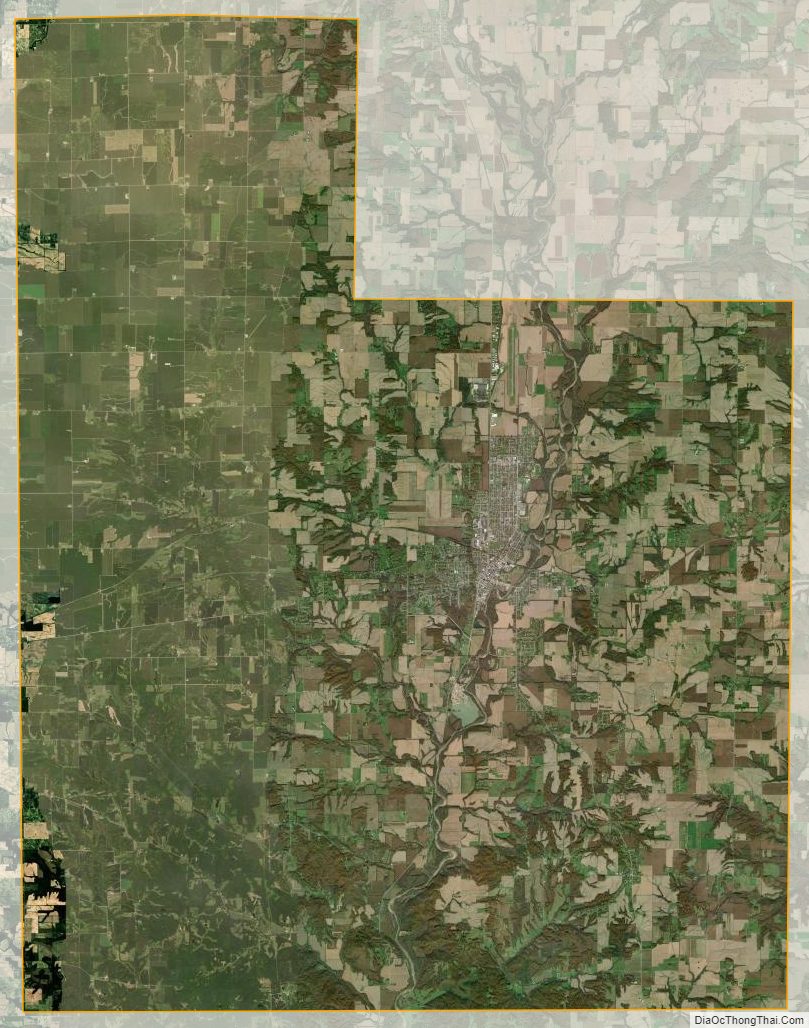
Fayette County Satellite Map
Fayette County Outline Map