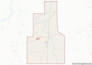
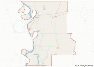
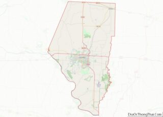
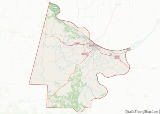
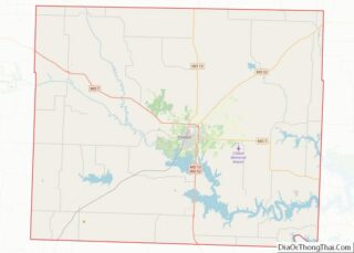
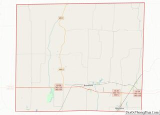
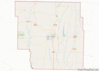
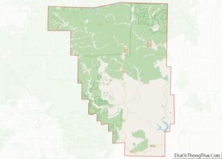
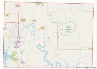
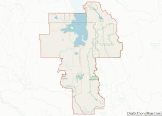
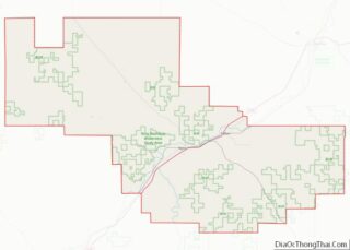
Map of Peoria County, Illinois
Peoria County is located in the U.S. state of Illinois. The 2020 United States Census listed its population at 181,830. Its county seat is Peoria. Peoria County is part of the Peoria, IL Metropolitan Statistical Area. Peoria County overview: Name: Peoria County FIPS code: 17-143 State: Illinois Founded: 1825 Named for: Peoria tribe Seat: Peoria ... Read more
Map of Peoria County, Illinois
Map of Stark County, Illinois
Stark County is in Illinois. According to the 2010 census, it had a population of 5,994. Its county seat is Toulon. Stark County is part of the Peoria, IL Metropolitan Statistical Area. Stark County overview: Name: Stark County FIPS code: 17-175 State: Illinois Founded: 1839 Named for: John Stark Seat: Toulon Largest city: Wyoming Total ... Read more
Map of Stark County, Illinois
Map of Allen County, Indiana
Allen County is a county in the U.S. state of Indiana. As of the 2020 Census, the population was 385,410, making it the third-most populous county in Indiana. The county seat and largest city is Fort Wayne, the second largest city in Indiana. Allen County is included in the Fort Wayne Metropolitan Statistical Area and ... Read more
Map of Allen County, Indiana
Map of Delaware County, Indiana
Delaware County is a county in the east central portion of the U.S. state of Indiana. As of 2020, the population was 111,903. The county seat is Muncie. Delaware County is part of the Muncie, IN metropolitan statistical area, which is part of the larger Indianapolis-Carmel-Muncie CSA. Delaware County overview: Name: Delaware County FIPS code: ... Read more
Map of Delaware County, Indiana
Map of Howard County, Indiana
Howard County is one of 92 counties in the U.S. state of Indiana. As of the 2020 census, the population was 83,658. The county seat is Kokomo. Originally named Richardville County, it was renamed in 1844 to commemorate General Tilghman Ashurst Howard. Howard County comprises the Kokomo, Indiana Metropolitan Statistical Area. Howard County overview: Name: ... Read more
Map of Howard County, Indiana
Map of Marion County, Indiana
Marion County is located in the U.S. state of Indiana. The 2020 United States census reported a population of 977,203, making it the largest county in the state and 51st most populated county in the country. Indianapolis is the county seat, the state capital, and largest city. Marion County is consolidated with Indianapolis through an ... Read more
Map of Marion County, Indiana
Map of Posey County, Indiana
Posey County is the southernmost, southwesternmost, and westernmost county in the U.S. state of Indiana. Its southern border is formed by the Ohio River, and its western border by the Wabash River, a tributary to the Ohio. As of 2010, the population was 25,910. The county seat is Mount Vernon. Posey County is part of ... Read more
Map of Posey County, Indiana
Map of Union County, Indiana
Union County is a county in the U.S. state of Indiana. As of the 2020 United States census, the population was 7,087. The county seat is Liberty. Since 2018, Union County has been included in the Cincinnati-Middletown, OH-KY-IN Metropolitan Statistical Area. It is located on the Indiana-Ohio border. Union County overview: Name: Union County FIPS ... Read more
Map of Union County, Indiana
Map of Audubon County, Iowa
Audubon County is a county in the U.S. state of Iowa. As of the 2020 census, the population was 5,674, making it Iowa’s third-least populous county. Its county seat is Audubon. The county was named after John James Audubon, the naturalist and artist. Audubon County overview: Name: Audubon County FIPS code: 19-009 State: Iowa Founded: ... Read more
Map of Audubon County, Iowa
Map of Clay County, Iowa
Clay County is a county located in the U.S. state of Iowa. As of the 2020 census, the population was 16,384. Its county seat is Spencer. Its name is in honor of Henry Clay Jr., a colonel who died in action in the Mexican–American War, and son of Henry Clay, famous American statesman from Kentucky. ... Read more
Map of Clay County, Iowa
Map of Greene County, Iowa
Greene County is a county located in the U.S. state of Iowa. As of the 2020 census, the population was 8,771. The county seat is Jefferson. The county is named in honor of General Nathanael Greene. Greene County overview: Name: Greene County FIPS code: 19-073 State: Iowa Founded: 1851 Named for: Nathanael Greene Seat: Jefferson ... Read more
Map of Greene County, Iowa
Map of Jones County, Iowa
Jones County is a county in the U.S. state of Iowa. As of the 2020 census the population was 20,646. The county seat is Anamosa. The county was founded in 1837 and named after George Wallace Jones, a United States senator and member of Congress. Jones County is included in the Cedar Rapids Metropolitan Statistical ... Read more
Map of Jones County, Iowa