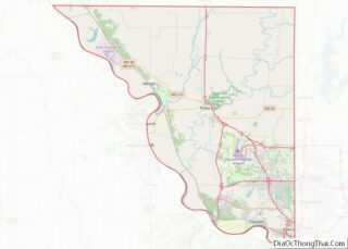
Trego County (standard abbreviation: TR) is a county located in the U.S. state of Kansas. As of the 2020 census, the county population was 2,808. Its county seat and largest city is WaKeeney. Trego County overview: Name: Trego County FIPS code: 20-195 State: Kansas Founded: June 21, 1879 Named for: Edgar Poe Trego Seat: WaKeeney ... Read more
Map of US Counties
Bourbon County is a county located in the U.S. state of Kentucky. As of the 2020 census, the population was 20,252. Its county seat is Paris. Bourbon County is part of the Lexington–Fayette, KY Metropolitan Statistical Area. It is one of Kentucky’s nine original counties, and is best known for its historical association with bourbon ... Read more
Clark County is a county located in the U.S. state of Kentucky. As of the 2020 census, the population was 36,972. Its county seat is Winchester. The county was created in 1792 from Bourbon and Fayette counties and is named for Revolutionary War hero George Rogers Clark. Clark County is part of the Lexington–Fayette, KY ... Read more
Grant County is a county located in the northern part of the U.S. state of Kentucky. As of the 2020 census, the population was 24,941. Its county seat is Williamstown. The county was formed in 1820 and named for Colonel John Grant, who led a party of settlers in 1779 to establish Grant’s Station, in ... Read more
Jessamine County (/ˈdʒɛsəmɪn/) is a county located in the U.S. state of Kentucky. As of the 2020 census, the population was 52,991. Its county seat is Nicholasville. The county was founded in December 1798. Jessamine County is part of the Lexington-Fayette, KY Metropolitan Statistical Area. It is within the Inner Blue Grass region, long a ... Read more
Madison County is a county located in the central part of the U.S. state of Kentucky. At the 2020 census, its population was 92,701. Its county seat is Richmond. The county is named for Virginia statesman James Madison, who later became the fourth President of the United States. The county is part of the Richmond-Berea, ... Read more
Muhlenberg County (/ˈmjuːlənbɜːrɡ/) is a county in the U.S. Commonwealth of Kentucky. As of the 2020 census, the population was 30,928. Its county seat is Greenville and its largest city is Central City. Muhlenberg County overview: Name: Muhlenberg County FIPS code: 21-177 State: Kentucky Founded: 1798 Named for: Peter Muhlenberg Seat: Greenville Largest city: Central ... Read more
Scott County is a county located in the central part of the U.S. state of Kentucky. As of the 2020 census, the population was 57,155. Scott County is part of the Lexington–Fayette, Kentucky Metropolitan Statistical Area. Scott County overview: Name: Scott County FIPS code: 21-209 State: Kentucky Founded: 1792 Named for: General Charles Scott Seat: ... Read more
Acadia Parish (French: Paroisse de l’Acadie) is a parish located in the U.S. state of Louisiana. At the 2020 U.S. census, the population was 57,576. The parish seat is Crowley. The parish was founded from parts of St. Landry Parish in 1886, and later an election was held to determine the parish seat, ending when ... Read more
East Baton Rouge Parish (French: Paroisse de Bâton Rouge Est) is the most populous parish in the U.S. state of Louisiana. Its population was 456,781 at the 2020 census. The parish seat is Baton Rouge, Louisiana’s state capital. East Baton Rouge Parish is located within the Greater Baton Rouge area. East Baton Rouge Parish overview: ... Read more
Madison Parish overview: Name: Madison Parish FIPS code: 22-065 State: Louisiana Founded: 1838 Named for: James Madison Seat: Tallulah Largest city: Tallulah Total Area: 651 sq mi (1,690 km²) Land Area: 624 sq mi (1,620 km²) Total Population: 10,017 Population Density: 15/sq mi (5.9/km²) Time zone: UTC−6 (Central) Summer Time Zone (DST): UTC−5 (CDT) Website: madisonparish.org Madison Parish location map. Where is ... Read more
St. Landry Parish (French: Paroisse de Saint-Landry) is a parish located in the U.S. state of Louisiana. As of the 2020 Census, the population was 82,540. The parish seat is Opelousas. The parish was established in 1807. St. Landry Parish comprises the Opelousas, LA Micropolitan Statistical Area (μSA), which is also included in the Lafayette-Opelousas-Morgan ... Read more