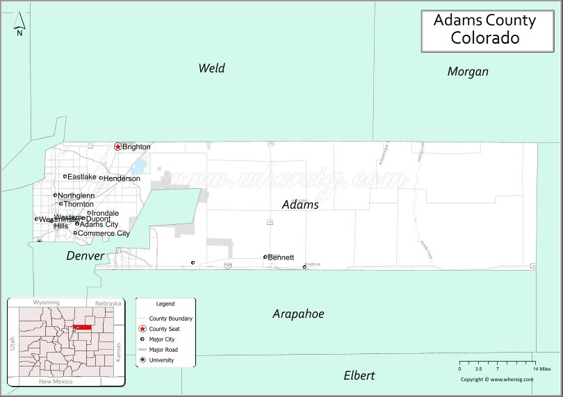
Adams County is a county located in the U.S. state of Colorado. As of the 2020 census, the population was 519,572. The county seat is Brighton. The county is named for Alva Adams, an early Governor of the State of Colorado in 1887–1889. Adams County is part of the Denver–Aurora–Lakewood, CO Metropolitan Statistical Area.
| Name: | Adams County |
|---|---|
| FIPS code: | 08-001 |
| State: | Colorado |
| Founded: | April 15, 1901 |
| Named for: | Alva Adams |
| Seat: | Brighton |
| Largest city: | Thornton |
| Total Area: | 1,184 sq mi (3,070 km²) |
| Land Area: | 1,168 sq mi (3,030 km²) |
| Total Population: | 519,572 |
| Population Density: | 440/sq mi (170/km²) |
| Time zone: | UTC−7 (Mountain) |
| Summer Time Zone (DST): | UTC−6 (MDT) |
| Website: | www.adcogov.org |
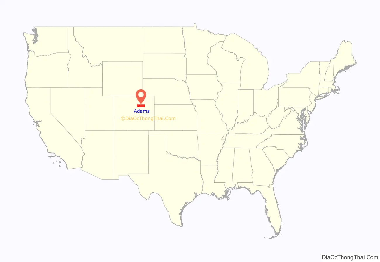
Adams County location map. Where is Adams County?
History
On May 30, 1854, the Kansas–Nebraska Act created the Territory of Nebraska and Territory of Kansas, divided by the Parallel 40° North (168th Avenue in present-day Adams County). The future Adams County, Colorado, occupied a strip of northern Arapahoe County, Kansas Territory, immediately south of the Nebraska Territory.
In 1859, John D. “Colonel Jack” Henderson built a ranch, trading post, and hotel on Henderson Island in the South Platte River in Arapahoe County, Kansas Territory. Jack Henderson was the former editor and proprietor of the Leavenworth (Kansas Territory) Journal and an outspoken pro-slavery politician who had been accused of vote fraud in eastern Kansas. Henderson sold meat and provisions to gold seekers on their way up the South Platte River Trail to the gold fields during the Pike’s Peak Gold Rush. Henderson Island was the first permanent settlement in the South Platte River Valley between Fort Saint Vrain in the Nebraska Territory and the Cherry Creek Diggings in the Kansas Territory. Jack Henderson eventually returned to eastern Kansas and fought for the Union in the American Civil War. Henderson Island is today the site of the Adams County Regional Park and Fairgrounds.
The eastern portion of the Kansas Territory was admitted to the Union as the State of Kansas on January 29, 1861, and on February 28, 1861, the remaining western portion of the territory was made part of the new Colorado Territory. The Colorado Territory created Arapahoe County, on November 1, 1861, and Colorado was admitted to the Union on August 1, 1876.
In 1901, the Colorado General Assembly voted to split Arapahoe County into three parts: a new Adams County, a new consolidated City and County of Denver, and the remainder of the Arapahoe County to be renamed South Arapahoe County. A ruling by the Colorado Supreme Court, subsequent legislation, and a referendum delayed the creation of Adams County until November 15, 1902. Governor James Bradley Orman designated Brighton as the temporary Adams County Seat. Adams County originally stretched 160 miles (260 kilometers) from present-day Sheridan Boulevard to the Kansas state border. On May 12, 1903, the eastern 88 miles (142 kilometers) of Adams County was transferred to the new Washington County and the new Yuma County, reducing the length of Adams County to the present 72 miles (116 kilometers). On November 8, 1904, Adams County voters chose Brighton as the permanent county seat.
A 1989 vote transferred 53 square miles (140 square kilometers) of Adams County to the City and County of Denver for the proposed Denver International Airport, leaving the densely populated western portion of the county as two oddly-shaped peninsulas. Adams County lost the tip of its northwest corner when the consolidated City and County of Broomfield was created on November 15, 2001.
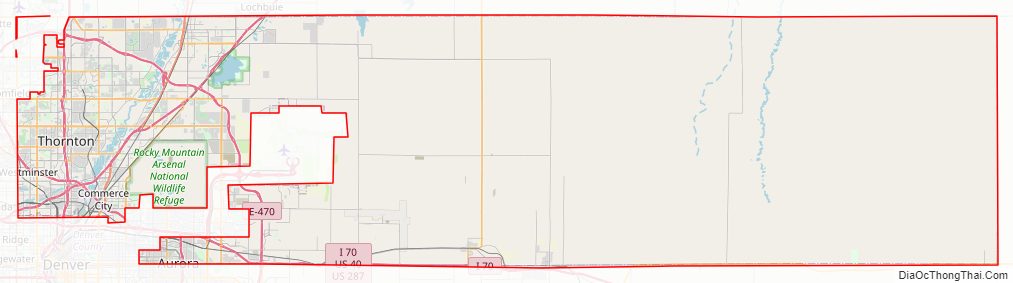
Adams County Road Map
Geography
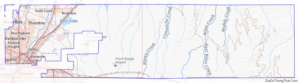
According to the U.S. Census Bureau, the county has a total area of 1,184 square miles (3,070 km), of which 1,168 square miles (3,030 km) is land and 16 square miles (41 km) (1.4%) is water.
Adams County surrounds (and surrendered the land for) most of Denver International Airport which are in the City and County of Denver.
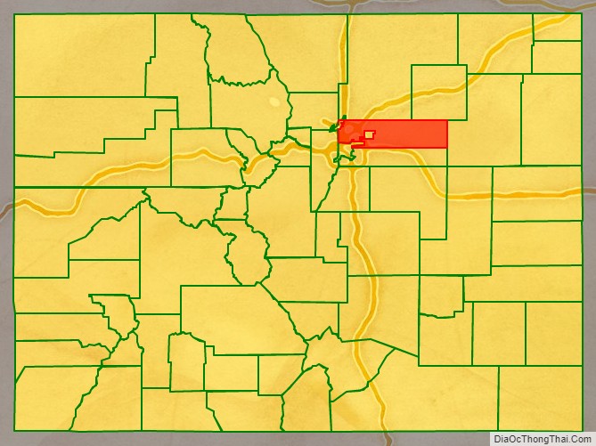
Adjacent counties
- Weld County – north
- Morgan County – northeast
- Washington County – east
- Arapahoe County – south
- City & County of Denver – southeast
- Jefferson County – west
- City & County of Broomfield – northwest
Major Highways
- Interstate 25
- Interstate 70
- Interstate 76
- Interstate 225
- I-70 BS
- U.S. Highway 6
- U.S. Highway 36
- U.S. Highway 40
- U.S. Highway 85
- U.S. Highway 87
- State Highway 2
- State Highway 7
- State Highway 36
- State Highway 40
- State Highway 44
- State Highway 79
- State Highway 128
- State Highway 224
- State Highway 265
- E-470 (tollway)
National protected area
- Rocky Mountain Arsenal National Wildlife Refuge
State park
- Barr Lake State Park
Historic trail
- South Platte Trail
Recreational trails
- American Discovery Trail
- Big Dry Creek National Recreation Trail
- Highline Canal National Recreation Trail
- Platte River Greenway National Recreation Trail
- Rocky Mountain Arsenal National Recreation Trail
Adams County Topographic Map
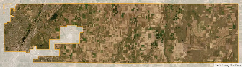
Adams County Satellite Map
Adams County Outline Map