Glenn County is a county located in the U.S. state of California. As of the 2020 census, the population was 28,917. The county seat is Willows. It is located in the Sacramento Valley, in the northern part of the California Central Valley. The Grindstone Rancheria, reservation of the Grindstone Indian Rancheria of Wintun-Wailaki Indians, is located in Glenn County.
| Name: | Glenn County |
|---|---|
| FIPS code: | 06-021 |
| State: | California |
| Founded: | 1891 |
| Named for: | Hugh J. Glenn |
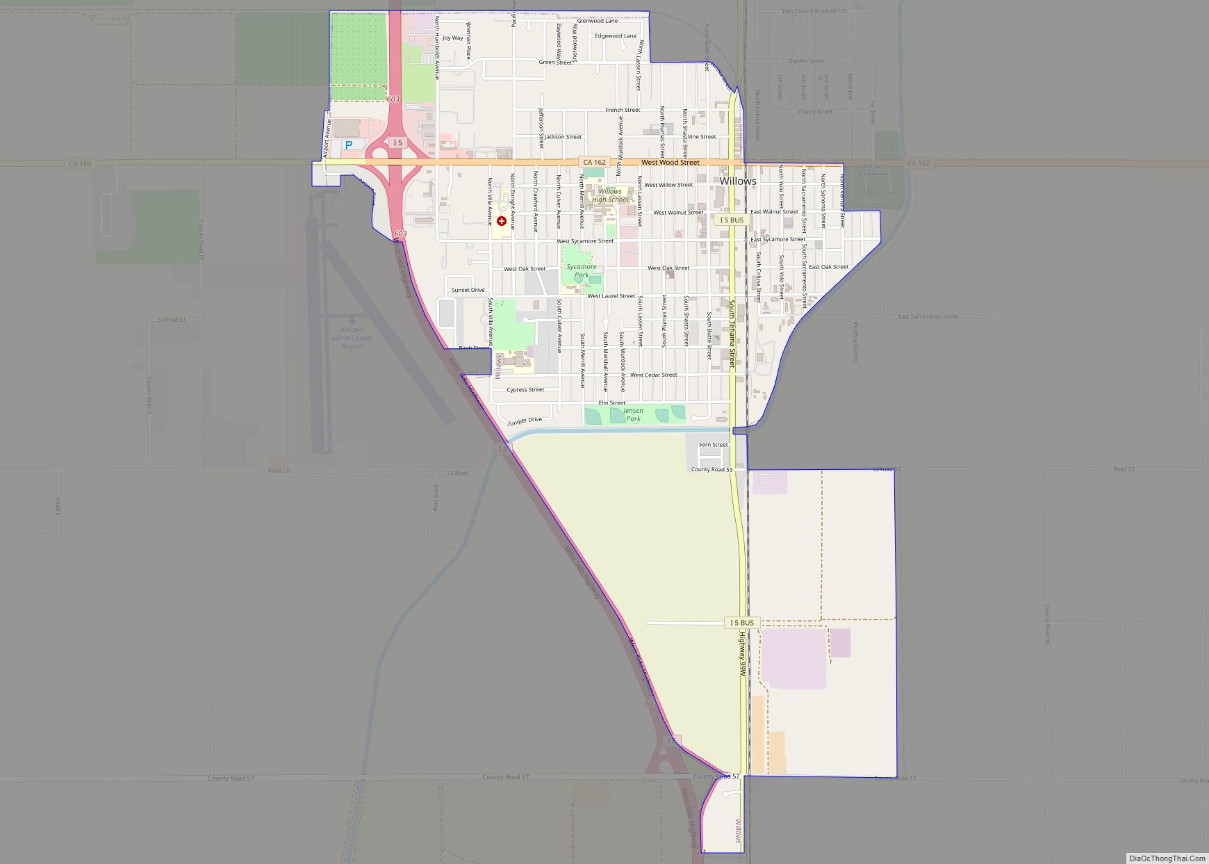
| Seat: | Willows |
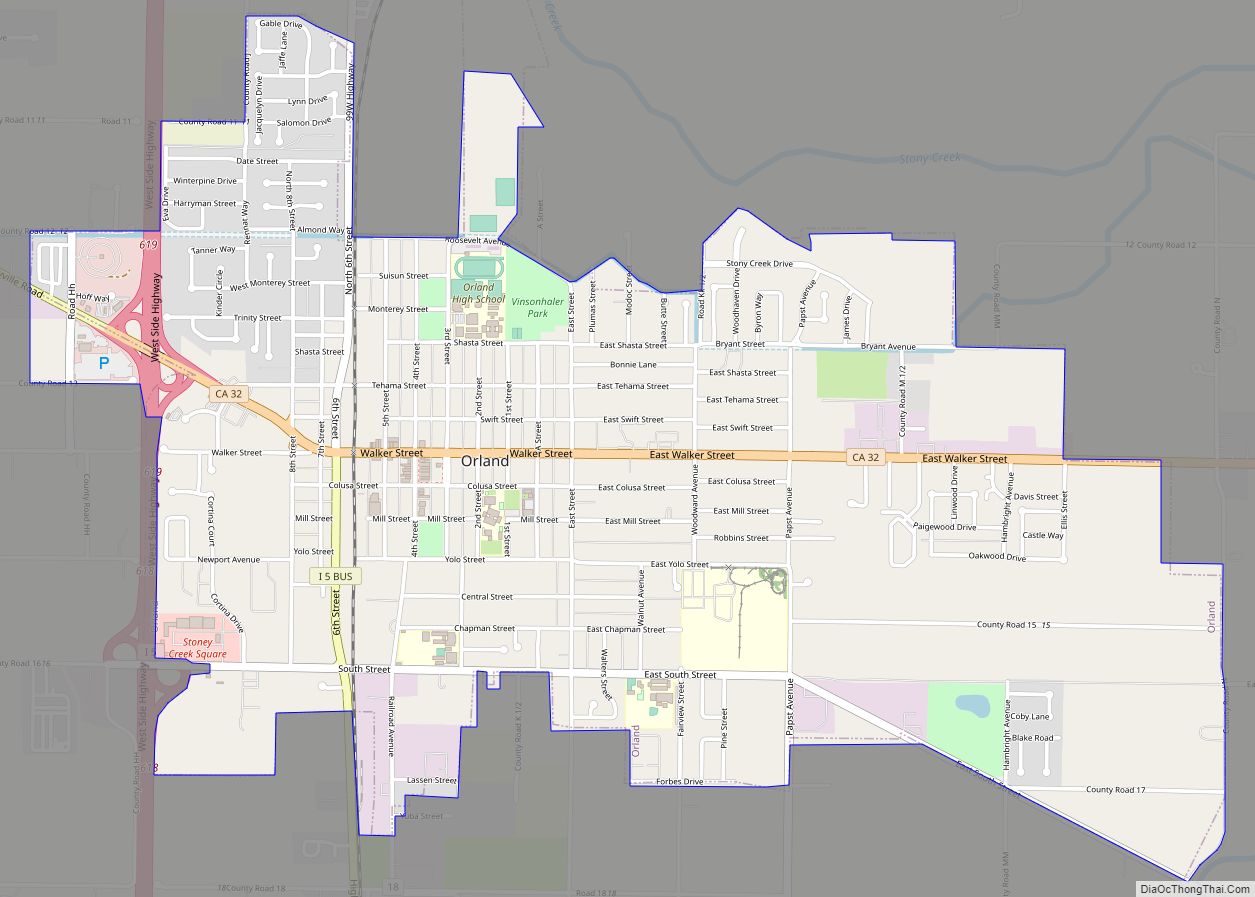
| Largest city: | Orland |
| Total Area: | 1,327 sq mi (3,440 km²) |
| Land Area: | 1,314 sq mi (3,400 km²) |
| Total Population: | 28,917 |
| Population Density: | 22/sq mi (8.4/km²) |
| Time zone: | UTC−8 (Pacific Standard Time) |
| Summer Time Zone (DST): | UTC−7 (Pacific Daylight Time) |
| Website: | Glenn County, California |
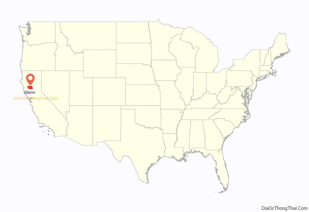
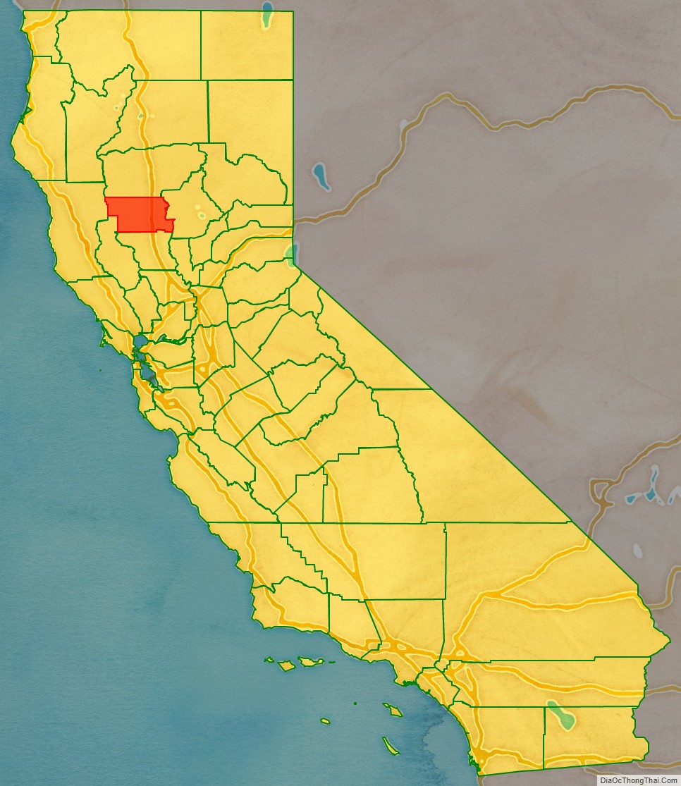
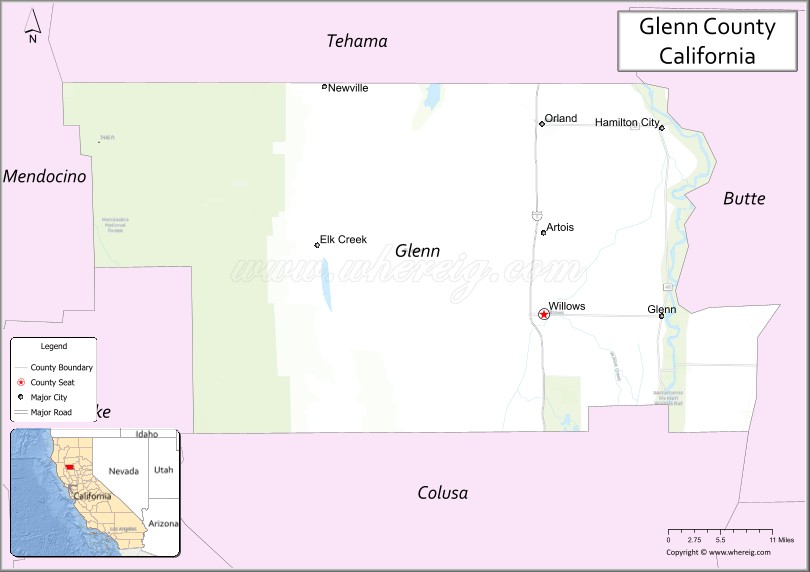
Glenn County location map. Where is Glenn County?
History
Glenn County split from Colusa County in 1891, from parts of Colusa County. It was named for Dr. Hugh J. Glenn, who purchased 8,000 acres (32.4 km) in the northest end of Rancho Jacinto in 1867. He became the largest wheat farmer in the state during his lifetime and a man of great prominence in political and commercial life in California.
Sheriffs
- Peter Herman Clark (1 Mar 1891- 7 Nov 1894)
- William H. Sale (7 Nov 1894- 7 Nov 1900)
- Jack A. Bailey (7 Nov 1900- 7 Nov 1918)
- Newt Collins (7 Nov 1918- 7 Nov 1922)
- Roy D. Heard (7 Nov 1922- 7 Nov 1934)
- Lawrence Atherton Braden (7 Nov 1934- 7 Nov 1940)
- Roy D. Heard (7 Nov 1940- 7 Nov 1946)
- Hal Singleton (7 Nov 1946- 27 Dec 1951)- Killed in Car Crash
- Ben Karanig (27 Dec 1951- 7 Nov 1980)
- Roger Roberts (7 Nov 1980- 7 Nov 1982)
- Richard “Rick” Weaver (7 Nov 1982- 7 Nov 1984)
- Louis K. Donnelley (7 Nov 1984- 7 Nov 1998)
- Robert “Bob” Shadley (7 Nov 1998- 15 Mar 2005) – Resigned
- Larry Jones (15 Mar 2005- 7 Nov 2014)
- Richard L. Warren Jr. (7 Nov 2014- )
Glenn County Road Map
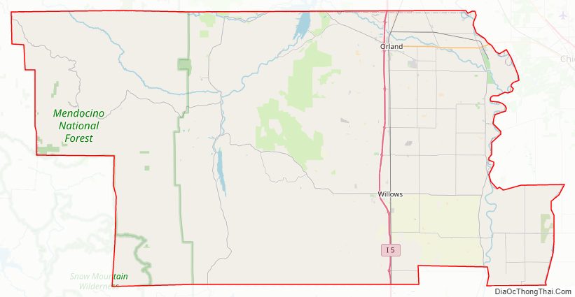
Geography
According to the U.S. Census Bureau, the county has a total area of 1,327 square miles (3,440 km), of which 1,314 square miles (3,400 km) is land and 13 square miles (34 km) (1.0%) is water.
Adjacent counties
- Colusa County – south
- Lake County – southwest
- Mendocino County – west
- Tehama County – north
- Butte County – east
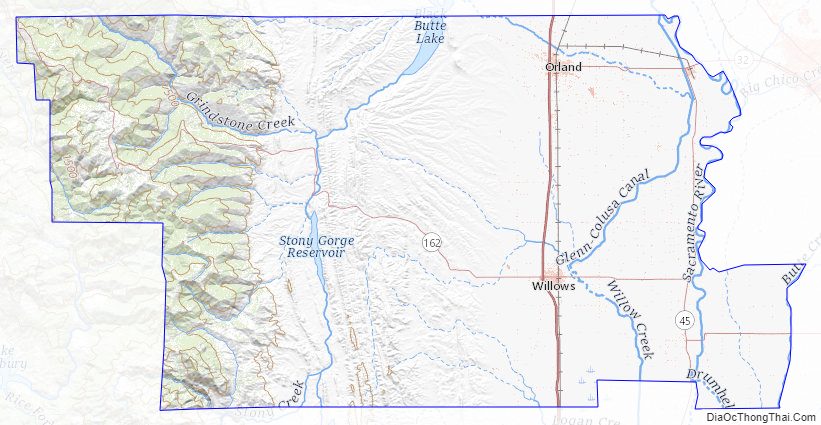
National protected areas
- Mendocino National Forest (part)
- Sacramento National Wildlife Refuge (part)
- Sacramento River National Wildlife Refuge (part)
Glenn County Topographic Map
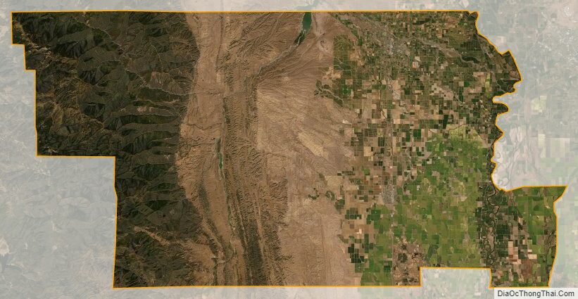
Glenn County Satellite Map
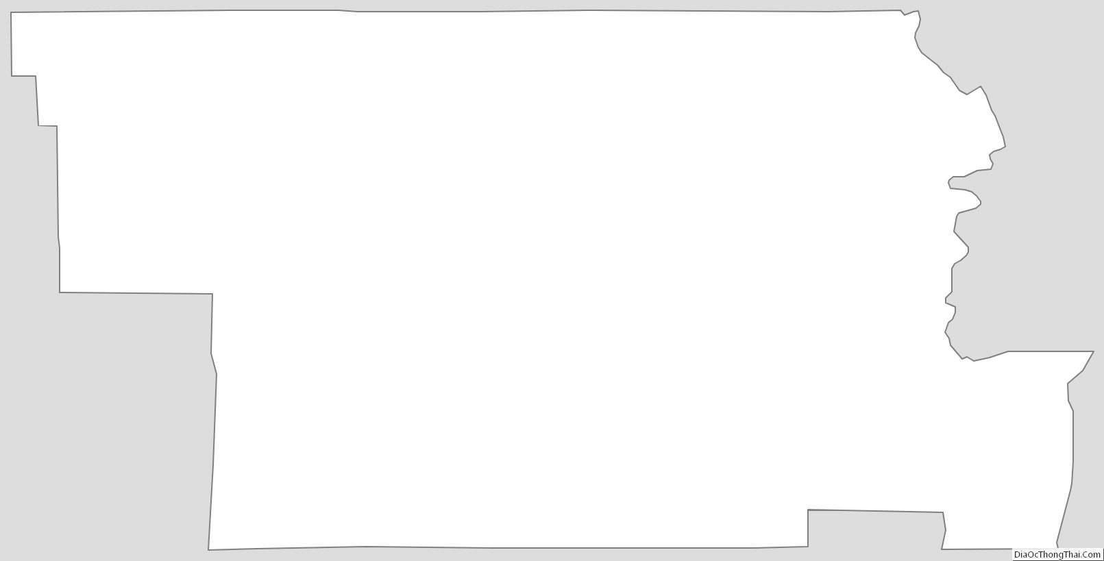
Glenn County Outline Map