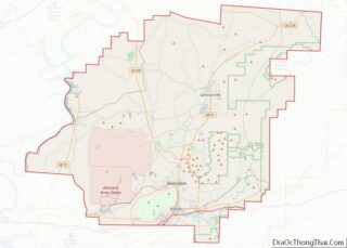
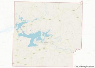
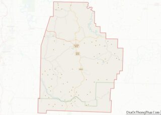
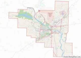
Taney County is a county located in the southwestern portion of the U.S. state of Missouri. As of the 2020 census, the population was 56,066. Its county seat is Forsyth. It is included in the Branson, Missouri, Micropolitan Statistical Area. Taney County was officially organized on January 4, 1837, and named in honor of Roger ... Read more
Map of US Counties
Chouteau County is a county located in the North-Central region of the U.S. state of Montana. As of the 2020 census, the population was 5,895. Its county seat is Fort Benton. The county was established in 1865 as one of the original nine counties of Montana, and named in 1882 after Pierre Chouteau Jr., a ... Read more
Lake County is a county located in the northwest part of the U.S. state of Montana. As of the 2020 census, the population was 31,134. Its county seat is Polson. Lake County overview: Name: Lake County FIPS code: 30-047 State: Montana Founded: 1923 Named for: Flathead Lake Seat: Polson Largest city: Polson Total Area: 1,654 sq mi ... Read more
Prairie County is a county in the U.S. state of Montana. As of the 2020 census, the population was 1,088, making it the fifth-least populous county in Montana. Its county seat is Terry. Prairie County was created by the Montana Legislature in 1915 out of parts of Custer, Dawson, and Fallon Counties. The name was ... Read more
Yellowstone County is the most populous county in the U.S. state of Montana. As of the 2020 census, the population was 164,731. Its county seat is Billings, the state’s most populous city. Yellowstone County is named for the Yellowstone River which roughly bisects the county, flowing southwest to northeast. The river in turn was named ... Read more
Cherry County overview: Name: Cherry County FIPS code: 31-031 State: Nebraska Founded: 1883 Named for: Samuel A. Cherry Seat: Valentine Largest city: Valentine Total Area: 6,009 sq mi (15,560 km²) Land Area: 5,960 sq mi (15,400 km²) Total Population: 5,458 Population Density: 0.98/sq mi (0.38/km²) Website: www.co.cherry.ne.us Cherry County location map. Where is Cherry County? Cherry County Road Map Geography Cherry County ... Read more
Frontier County is a county in the U.S. state of Nebraska. As of the 2010 United States Census, the population was 2,756. Its county seat is Stockville. In the Nebraska license plate system, Frontier County is represented by the prefix 60 (it had the sixtieth-largest number of vehicles registered in the county when the license ... Read more
Jefferson County is a county in the U.S. state of Nebraska. As of the 2020 United States Census, the population was 7,240. Its county seat is Fairbury. The county was named for Thomas Jefferson, third President of the United States of America. In the Nebraska license plate system, Jefferson County is represented by the prefix ... Read more
Nemaha County is a county in the U.S. state of Nebraska. As of the 2020 United States Census, the population was 7,074. Its county seat is Auburn. In the Nebraska license plate system, Nemaha County is represented by the prefix 44 (it had the forty-fourth-largest number of vehicles registered in the county when the license ... Read more
Seward County is a county in the U.S. state of Nebraska. As of the 2010 United States Census, the population was 16,750. Its county seat is Seward. The county was formed in 1855, and was organized in 1867. It was originally called Greene County, and in 1862 it was renamed for William H. Seward, United ... Read more
Clark County is located in the U.S. state of Nevada. As of the 2020 census, the population was 2,265,461. Most of the county population resides in the Las Vegas Census County Divisions, which hold 2,196,623 people as of the 2020 Census, across 435 square miles (1,130 km). It is by far the most populous county in ... Read more
Carroll County is a county in the U.S. state of New Hampshire. As of the 2020 census, the population was 50,107, making it the third-least populous county in New Hampshire. Its county seat is Ossipee. The county was created in 1840 and organized at Ossipee from towns removed from Strafford County. It was named in ... Read more