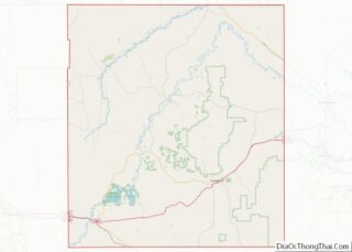
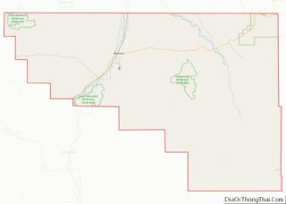
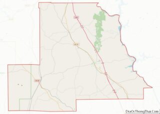
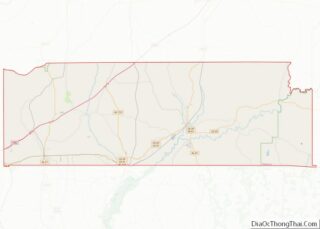
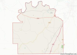
Map of Val Verde County

Map of Val Verde County, Texas

Val Verde County overview: Name: Val Verde County FIPS code: 48-465 State: Texas Founded: 1885 Named for: Battle of Valverde Seat: Del Rio Largest city: Del Rio Total Area: 3,233 sq mi (8,370 km²) Land Area: 3,145 sq mi (8,150 km²) Total Population: 47,586 Population Density: 15/sq mi (5.7/km²) Time zone: UTC−6 (Central) Summer Time Zone (DST): UTC−5 (CDT) Website: www.valverdecounty.texas.gov Val … Read more

Map of Wise County

Map of Wise County, Texas

Wise County is a county in the U.S. state of Texas. As of the 2020 census, its population was 68,632. Its county seat is Decatur. Wise County is part of the Dallas–Fort Worth–Arlington metropolitan statistical area. Its Wise Eyes crime-watch program, eventually adopted by mostly rural counties in several states, was started in 1993 by … Read more

Map of Iron County

Map of Iron County, Utah

Iron County is a county in southwestern Utah, United States. As of the 2010 United States Census, the population was 46,163. Its county seat is Parowan, and the largest city is Cedar City. The Cedar City, UT Micropolitan Statistical Area includes all of Iron County. Iron County overview: Name: Iron County FIPS code: 49-021 State: … Read more

Map of Washington County

Map of Washington County, Utah

Washington County overview: Name: Washington County FIPS code: 49-053 State: Utah Founded: March 3, 1852 Named for: George Washington Seat: St. George Largest city: St. George Total Area: 2,430 sq mi (6,300 km²) Land Area: 2,426 sq mi (6,280 km²) Total Population: 180,279 Population Density: 74/sq mi (29/km²) Time zone: UTC−7 (Mountain) Summer Time Zone (DST): UTC−6 (MDT) Website: www.washco.state.ut.us Washington County … Read more

Map of Windsor County

Map of Windsor County, Vermont

Windsor County is a county located in the U.S. state of Vermont. As of the 2020 census, the population was 57,753. The shire town (county seat) is the town of Woodstock. The county’s largest municipality is the town of Hartford. Windsor County overview: Name: Windsor County FIPS code: 50-027 State: Vermont Founded: 1781 Named for: … Read more

Map of Brunswick County

Map of Brunswick County, Virginia

Brunswick County is a United States county located on the southern border of the Commonwealth of Virginia. This rural county is known as one of the claimants to be the namesake of Brunswick stew. Brunswick County was created in 1720 from parts of Prince George, Surry and Isle of Wight counties. The county was named … Read more

Map of Craig County

Map of Craig County, Virginia

Craig County is a county located in the Commonwealth of Virginia. As of the 2020 census, the population was 4,892. Its county seat is New Castle. Craig County is part of the Roanoke, VA Metropolitan Statistical Area. Craig County overview: Name: Craig County FIPS code: 51-045 State: Virginia Founded: 1851 Named for: Robert Craig Seat: … Read more

Map of Fredericksburg Independent City

Map of Fredericksburg City, Virginia

Fredericksburg is an independent city in Virginia, United States. As of the 2020 census, the population was 27,982. It is 48 miles (77 km) south of Washington, D.C., and 53 miles (85 km) north of Richmond. The Bureau of Economic Analysis of the United States Department of Commerce combines the city of Fredericksburg with neighboring Spotsylvania County … Read more

Map of Isle of Wight County

Map of Isle of Wight County, Virginia

Isle of Wight County is a county located in the Hampton Roads region of the U.S. state of Virginia. It was named after the Isle of Wight, England, south of the Solent, from where many of its early colonists had come. As of the 2020 census, the population was 38,606. Its county seat is Isle … Read more

Map of Mathews County

Map of Mathews County, Virginia

Mathews County overview: Name: Mathews County FIPS code: 51-115 State: Virginia Founded: 1791 Seat: Mathews Total Area: 252 sq mi (650 km²) Land Area: 86 sq mi (220 km²) Total Population: 8,533 Population Density: 34/sq mi (13/km²) Mathews County location map. Where is Mathews County? History During Virginia’s colonial era, the area that later became Mathews County was part of Gloucester County. … Read more

Map of Pittsylvania County

Map of Pittsylvania County, Virginia

Pittsylvania County is a county located in the Commonwealth of Virginia. As of the 2020 United States Census, the population was 60,501. Chatham is the county seat. Pittsylvania County is included in the Danville, VA Micropolitan Statistical Area. The largest undeveloped uranium deposit in the United States (7th largest in the world) is located in … Read more

Map of Salem Independent City

Map of Salem City, Virginia

Salem is an independent city in the U.S. commonwealth of Virginia. As of the 2020 census, the population was 25,346. It is the county seat of Roanoke County, although the two are separate jurisdictions. The Bureau of Economic Analysis combines the city of Salem with Roanoke County, which surrounds both Salem and the neighboring City … Read more