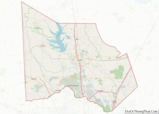
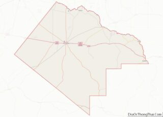
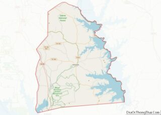
Map of Montgomery County, Virginia
Montgomery County is a county located in the Valley and Ridge area of the U.S. state of Virginia. As population in the area increased, Montgomery County was formed in 1777 from Fincastle County, which in turn had been taken from Botetourt County. As of the 2020 census, the population was 99,721. Its county seat is ... Read more
Map of Montgomery County, Virginia
Map of Powhatan County, Virginia
Powhatan County (/ˈpaʊ.həˈtæn/) is a county located in the Commonwealth of Virginia. As of the 2020 census, the population was 30,033. Its county seat is Powhatan. Powhatan County is included in the Greater Richmond Region. The James River forms the county’s northern border, and the Appomattox River is on the south side. The county is ... Read more
Map of Powhatan County, Virginia
Map of Smyth County, Virginia
Smyth County is a county located in the U.S. state of Virginia. As of the 2020 census, the population was 29,800. Its county seat is Marion. Smyth County overview: Name: Smyth County FIPS code: 51-173 State: Virginia Founded: 1832 Named for: Alexander Smyth Seat: Marion Largest town: Marion Total Area: 452 sq mi (1,170 km²) Land Area: 451 sq mi ... Read more
Map of Smyth County, Virginia
Map of Wise County, Virginia
Wise County is a county located in the U.S. state of Virginia. The county was formed in 1856 from Lee, Scott, and Russell Counties and named for Henry A. Wise, who was the Governor of Virginia at the time. Wise County overview: Name: Wise County FIPS code: 51-195 State: Virginia Founded: 1856 Named for: Henry ... Read more
Map of Wise County, Virginia
Map of Grays Harbor County, Washington
Grays Harbor County overview: Name: Grays Harbor County FIPS code: 53-027 State: Washington Founded: April 14, 1854 Named for: Grays Harbor Seat: Montesano Largest city: Aberdeen Total Area: 2,224 sq mi (5,760 km²) Land Area: 1,902 sq mi (4,930 km²) Total Population: 75,636 Population Density: 38.3/sq mi (14.8/km²) Grays Harbor County location map. Where is Grays Harbor County? History The county is ... Read more
Map of Grays Harbor County, Washington
Map of Skamania County, Washington
Skamania County (/skəˈmeɪniə/) is a county located in the U.S. state of Washington. As of the 2020 census, the population was 12,036. The county seat and largest incorporated city is Stevenson, although the Carson River Valley CDP is more populous. Skamania County is included in the Portland–Vancouver–Hillsboro, OR-WA Metropolitan Statistical Area. Skamania County overview: Name: ... Read more
Map of Skamania County, Washington
Map of Calhoun County, West Virginia
Calhoun County is a county in the U.S. state of West Virginia. As of the 2020 census, the population was 6,229, making it the third-least populous county in West Virginia. Its county seat is Grantsville. The county was founded in 1856 and named for South Carolina politician John C. Calhoun. Calhoun County overview: Name: Calhoun ... Read more
Map of Calhoun County, West Virginia
Map of Logan County, West Virginia
Logan County is a county in the U.S. state of West Virginia. As of the 2020 census, the population was 32,567. Its county seat is Logan. Logan County comprises the Logan, WV Micropolitan Statistical Area, which is also included in the Charleston–Huntington–Ashland, WV–OH–KY Combined Statistical Area. Logan County overview: Name: Logan County FIPS code: 54-045 ... Read more
Map of Logan County, West Virginia
Map of Preston County, West Virginia
Preston County is a county located in the U.S. state of West Virginia. As of the 2020 Census, the population was 34,216. Its county seat is Kingwood. The county was formed from Monongalia County in 1818 and named for Virginia Governor James Patton Preston. Preston County is part of the Morgantown, WV Metropolitan Statistical Area, ... Read more
Map of Preston County, West Virginia
Map of Wyoming County, West Virginia
Wyoming County is a county in the U.S. state of West Virginia. As of the 2020 census, the population was 21,382. Its county seat is Pineville. The county was created in 1850 from Logan County and named for the Lenape word meaning “large plains”. Wyoming County overview: Name: Wyoming County FIPS code: 54-109 State: West ... Read more
Map of Wyoming County, West Virginia
Map of Douglas County, Wisconsin
Douglas County is a county located at the northwest corner of the U.S. state of Wisconsin. As of the 2020 census, the population was 44,295 Its county seat is Superior. Douglas County is included in the Duluth, MN-WI Metropolitan Statistical Area. Douglas County overview: Name: Douglas County FIPS code: 55-031 State: Wisconsin Founded: February 8, ... Read more
Map of Douglas County, Wisconsin
Map of La Crosse County, Wisconsin
La Crosse County is a county located in the U.S. state of Wisconsin. At the 2020 census, the population was 120,784. Its county seat is La Crosse. La Crosse County is included in the La Crosse-Onalaska, WI-MN Metropolitan Statistical Area with a population of 139,627 and is the most populous county on Wisconsin’s western border. ... Read more
Map of La Crosse County, Wisconsin